


 Contact
 Andrea Brookfield,
Department of Earth and Environmental Sciences
Introduction
Baseflow is the portion of surface water flow contributed by groundwater. Human and ecological health depend on baseflow discharge into streams and rivers because it maintains flow between precipitation events and regulates water temperature and quality. Baseflows can be modified in many ways, including changes to climatic conditions or human activities. For example, changes in precipitation volume and timing can alter infiltration and groundwater levels, while changes in temperature can impact evapotranspiration, soil moisture and groundwater storage. Similarly, land use change can affect surface water runoff, recharge rates and groundwater storage.
To effectively manage water resources across Canada it is critical to understand how and why baseflow is changing. Although many site-specific studies have been completed, there are few studies of long-term, Canada-wide baseflow trends. This paper identifies long-term monthly trends in baseflow across the country and relates trends to climate predictors to try to explain changes in the baseflow volume and timing.
Methodology
Daily discharge records were gathered from 1,275 Water Survey of Canada streamflow gauges for the period 1989 to 2019. Monthly baseflow values were calculated as the mean of daily baseflow, estimated using a hydrograph separation technique with a one-parameter digital filter. A subset of 272 gauges were classified as reference stations with minimal human impact. Catchment areas ranged from 626 km2 to 34,850 km2 with mean (median) areas of 7,228 (5335) km2. Monthly basin-averaged values for precipitation and temperature were calculated by averaging daily temperature and averaging the cumulative precipitation for all stations in each basin. Streamflow data was matched to the basin-averaged climate dataset based on the basins in which they were located (Figure 1).
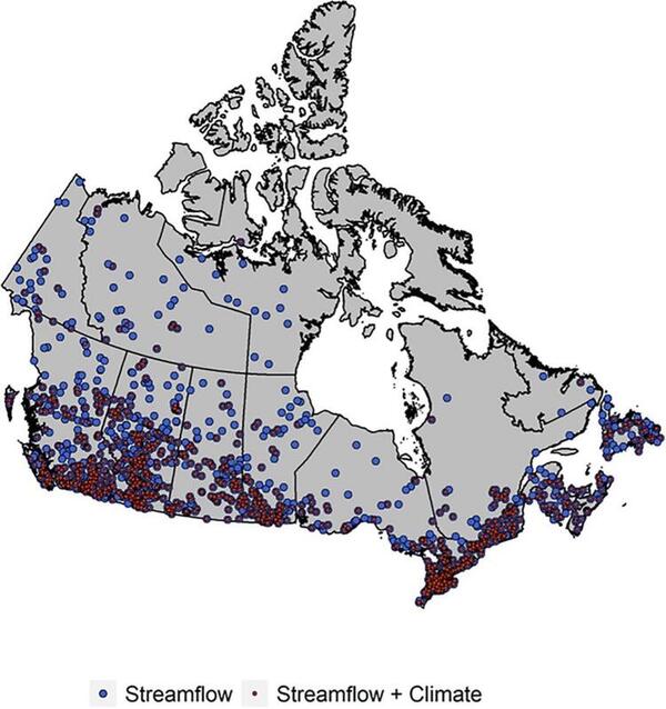
Figure 1: Distribution of streamflow gauges and climate stations.
Monthly baseflow trends were assessed using the Mann-Kendall (MK) trend test and verified using the Theil-Sen trend test. The Generalized Additive Model for Location, Scale and Shape (GAMLSS) distributional regression model was used to model historical baseflow observations to three climate predictors: precipitation, antecedent wetness (cumulative of the previous three month’s precipitation) and temperature. Each combination of climate predictors was evaluated, and the best predictive model was selected at each station and for each month using a stepwise model selection. Antecedent wetness was used to understand how soil moisture and pressure changes within the flow system impacted groundwater discharge.
Outcomes
Results detected no significant trends for almost 86 percent of all stations and months. Notable increasing trends, however, were observed across most of southern Canada during the winter and spring months, while negative trends were detected from June to September in Alberta and British Columbia and in southern Northwest Territories (Figure 2).

Figure 2: Results of Mann-Kendall trend test for every calendar month between years 1989 and 2019. Increasing trends are shown as blue upward arrows and decreasing trends are shown in red downward arrows. A grey circle indicates no statistically significant trend.
Figure 3 shows model selection using precipitation, antecedent wetness and temperature as predictors of baseflow. Antecedent wetness was chosen most often as a predictor, followed by precipitation and temperature. Precipitation and antecedent wetness related positively to increases in baseflow throughout the entire year, but in southern Canada these predictors were selected most often during the coldest months. Results show that warmer temperatures and increased snow cover across much of Canada contributed to increased baseflow likely from shifts in snow melt timing and volumes. During warmer months, results indicate that increases in temperature were related to decreased baseflow, likely through increased evapotranspiration. For about 15 percent of stations and months, no predictors were selected indicating that other factors are playing a role in baseflow variability. Non-reference basins were twice as likely to have no climate predictor, indicating that anthropogenic activities may be causing changes in baseflow.

Figure 3: Seasonal overview of the relationship between monthly baseflow and monthly climate predictors (precipitation, antecedent wetness, and temperature). Blue (red) circles represent sites with a positive (negative) relationship between baseflow and that climate predictor, white circles indicate sites in which model selection was run but the climate predictor was not selected as a covariate in the model formulation.
In the winter and spring months, baseflow trends are predominantly increasing, with trends along the southern coastal and Great Lakes regions positively related to most climate predictors. This is likely related to increased temperature which allows for earlier snow melt events and for rainfall to infiltrate through unfrozen ground. During summer months, increases in temperature and precipitation were observed across much of Canada and baseflow was related positively to both. During the late spring/early summer in central Canada, baseflow and temperature were negatively related, demonstrating that increased temperature and evapotranspiration may be causing decreases in baseflow. Decreasing baseflow trends observed in southwestern Canada and in southern Northwest Territories in the summer detected a positive relationship with precipitation and antecedent wetness and negative relationships with temperature indicating that an arid climate during summer is likely contributing to decreases in baseflow (Figures 2, 3).
Conclusions
The objective of this study was to investigate long-term baseflow trends and identify possible climatic drivers across Canada. Temporally, increasing baseflow trends were observed across Canada for each calendar month, but decreasing trends were concentrated in warmer months. Of the three climate predictors, antecedent wetness was selected most often in the model formulations, which highlights the importance of soil moisture in baseflow response. Precipitation was an important predictor of water availability, while temperature’s relationship to baseflow depended on the season and location. In some regions, including southwest Canada and southern Northwest Territories, baseflow decreased due to an overall drier climate. The results of this work can inform water resources management by identifying the direction of change in groundwater availability across Canada and regions where interventions may be necessary.
Study limitations included a lack of northern streamflow and weather station coverage which prevented a thorough interpretation of trends and climatic drivers in that region. In addition, predictors such as evapotranspiration and snowmelt were only assessed indirectly through temperature due to a lack of data. Future studies might further investigate the impact of human activities on baseflow.
Read more in the Journal of Hydrology
Murray, J., Ayers, J., Brookfield, A. The impact of climate change on monthly baseflow trends across Canada. Journal of Hydrology. March 2023. https://doi.org/10.1016/j.jhydrol.2023.129254
For more information about WaterResearch, contact Julie Grant.
Image by Cousinzeke from Pixabay.


