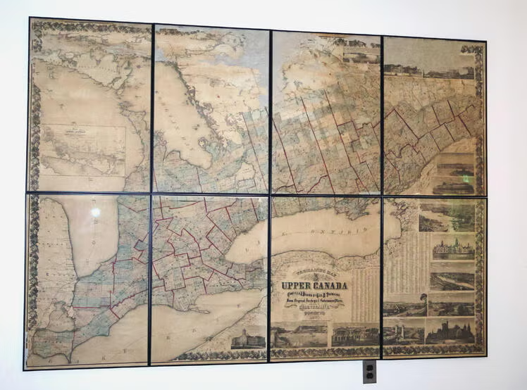
If you’ve been to the Doris Lewis Reading Room in the Special Collections & Archives (SCA) recently, you may have noticed something new. A Tremaine Map of Upper Canada circa 1862 now hangs prominently on one of the walls.
Restoring history
Donated in 2009 by Jon Dellandrea, a former VP of University Development at Waterloo, the map needed extensive restoration work before it could be made available for researchers.
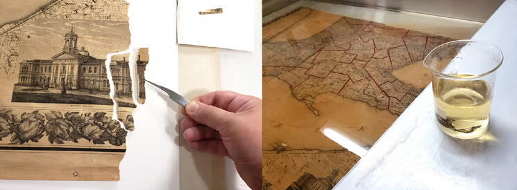
Divided up into eight panels that span approximately four feet by five feet, the map was a large project. SCA works with art conservator Jennifer Robertson for projects of this scale. She put together a treatment proposal for the work that was required and, once funding was in place, began her work in 2018.
"As a conservator of historic artifacts, I strive to preserve the valuable information and context offered by a piece such as this Tremaine Map of Upper Canada. This map was an exciting challenge due to its size and condition, and it was wonderfully satisfying to see it returned to a state where it can be fully appreciated once again,” says Jennifer.
Capturing a moment in time
The “Tremaine” map gets its name from the surveyor behind its creation. George Tremaine operated a family map publishing business in Kingston and Toronto, actively surveying the 54 counties of Canada in the 1850-60s to produce dozens of maps.
The Tremaine maps are also a bit of a time capsule. Working on a subscription model, businesses, townships and even farmers could be featured on Tremaine maps. For an additional cost, a vignette of your business or home could be added around the edges of the map, giving us glimpse into the architectural styles of the day.
A glimpse of the past
The Tremaine Map of Upper Canada, along with another of Waterloo region, are valuable primary sources available from SCA for researchers. Providing a glimpse into the past, maps such as these are helpful in urban planning and local history.
“The map provides an opportunity to understand the colonization of Upper Canada, learn more about who the settlers were, and how townships and municipalities were laid out. It’s exciting to have the conservation work complete and the map on display allowing it to finally be accessible for students and researchers,” says Jessie Blackwell, Special Collections & Archives librarian.
For a closer look or to see if the map would be helpful in your research, contact SCA to set up an appointment.