GeoSafe empowers communities to plan for a changing climate
Waterloo PhD candidate develops a platform that turns complex climate and natural hazard data into actionable insights for informed decision-making
When University of Waterloo PhD candidate Hasti Shwan looks at a piece of land, he sees more than its development potential. He sees flood histories; hidden hazards and the ways climate change could reshape its future.
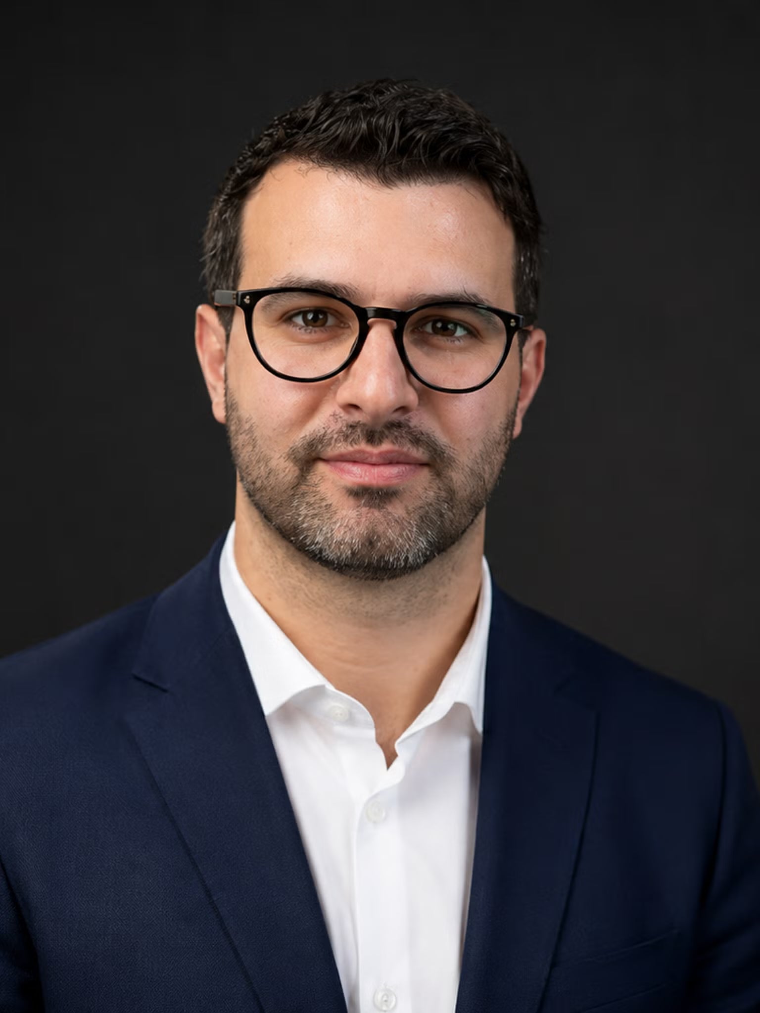
Drawing on more than 18 years of experience in civil and environmental engineering, geospatial technologies and infrastructure resilience, Shwan developed GeoSafe, a user-friendly platform that helps property owners, municipalities, engineers, planners, insurers and developers better understand climate-related risks early and make more informed decisions about the land they own, develop and manage.
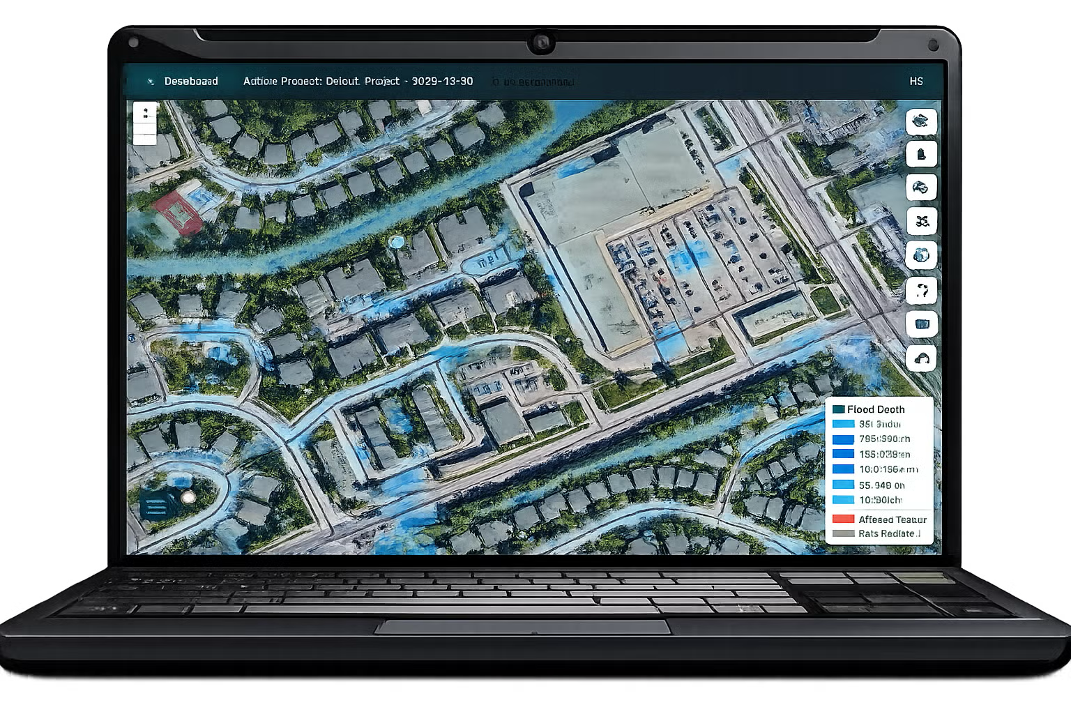
GeoSafe combines artificial intelligence, geospatial analytics and high-resolution environmental modelling to help users evaluate climate risks, natural hazards and infrastructure vulnerability at the property scale.
“One of the issues I saw in the industry is that many decision-makers, including property owners, municipalities, planners and infrastructure professionals, lack access to clear, understandable information about climate and environmental risks,” Shwan says. “Although relevant information is available from governments, conservation authorities and other organizations, it is often highly technical, scattered across multiple sources and difficult to interpret."
Despite much of the underlying rainfall, topography and environmental data is publicly available, it is often scattered across multiple sources and challenging to translate. GeoSafe brings that information together into a single customizable platform, transforming complex datasets into accessible insights that help users understand risks related to flooding, drainage and extreme weather before making critical decisions.
Turning research into real-world climate resilience
In 2020, Shwan co-founded Geomount Inc., a Vancouver-based geospatial consulting firm specializing in civil engineering design, geospatial analysis and 3D infrastructure modelling. Through his work with municipalities, planners, engineering firms and universities, he recognized a growing need for accessible tools to help people better understand climate and land-development risks. Those experiences ultimately became the foundation for GeoSafe.

After returning to school to pursue a PhD in civil and environmental engineering at Waterloo, Shwan continued developing the platform through his research at the Centre for Pavement and Transportation Technology (CPATT) under the supervision of Dr. Pejoohan Tavassoti. Using deep learning and geospatial modelling, he examines how coastal, fluvial and pluvial flooding affect infrastructure performance.
“Most hydrology software on the market is designed for regional, municipal or even provincial scale,” Shwan explains. “GeoSafe brings climate risk assessment down to the property level. We can identify where water may pond on a road, building site or parcel of land. Instead of looking at an entire city floodplain, we're analyzing localized flood behaviour using very high-resolution terrain models, allowing property-scale assessments.”
In addition to assessing flood susceptibility and integrating historical, current and forecast precipitation information, GeoSafe generates reports on a range of natural hazards identified by the Government of Canada, including wildfires, earthquakes and projected climate conditions. The goal is to give users a clearer picture of the risks that may affect a property today and in the future.

Leveraging Waterloo’s entrepreneurial resources
As a Fellow in the Master of Business, Entrepreneurship and Technology (MBET) program at Waterloo’s Conrad School for Entrepreneurship and Business, Shwan has worked with mentors, instructors and classmates to refine GeoSafe and expand its applications beyond pavement and transportation infrastructure.
Many of those lessons came from conversations with prospective users. During one interview, Shwan spoke with a property owner in Mississauga who discovered after purchasing a property that part of it fell within a flood-prone area and was excluded from insurance coverage.
“The insurance company already knew that information, but the property owner didn’t,” Shwan says. “People aren’t always aware of the climate and environmental risks associated with their property.”
The experience reinforced the importance of making climate-risk information more accessible before critical decisions are made. Today, GeoSafe helps both professionals and non-expert users assess flood exposure, identify potential hazards and better understand a property’s environmental profile before purchasing, developing or investing.
“Sometimes you work on an idea, and you think it’s perfect, but for people it may be too advanced,” Shwan says. “Through the MBET program, I learned how to make GeoSafe more user-friendly and how to listen to feedback about what clients actually need.”
While GeoSafe is designed as an early decision-support tool rather than a replacement for professional engineering assessments, it provides a fast, accessible starting point for understanding climate-related risks and evaluating future scenarios. By helping homeowners, communities and organizations make more informed decisions earlier in the planning process, the platform supports a more proactive approach to climate resilience.
For Shwan, increasing access to this information is essential as communities across Canada face more frequent and severe weather events. By helping people understand risks before they make critical decisions, GeoSafe is supporting a more informed, proactive and resilient future — one property at a time.