How should coastal communities in Nova Scotia cope with increased sea level rise and extreme flooding? This question motivated community members, property owners, Indigenous communities and governments to realign a section of Nova Scotia's North Onslow dyke in order to strengthen resilience to natural hazards and mitigate future flood risks.
Nova Scotia’s coasts have long been sites of human occupation and industry development, which have resulted in a loss of nearly 85% of tidal wetlands (Hanson and Calkins, 1996). In recent years, changing climate conditions in the Town of Truro have had an adverse effect on the local economy and landscape ecology. The North Onslow Marsh in Truro is located on a floodplain of the Salmon River that flows into the Bay of Fundy, which is heavily dyked to protect vital agricultural, residential, commercial and transportation infrastructure (Sherren, Bowron, Graham, Rahman & van Proosdij, 2019). Truro has long faced frequent flooding from rainwater accumulation, high tides and ice gridlocks that have exposed communities to inundation risk.

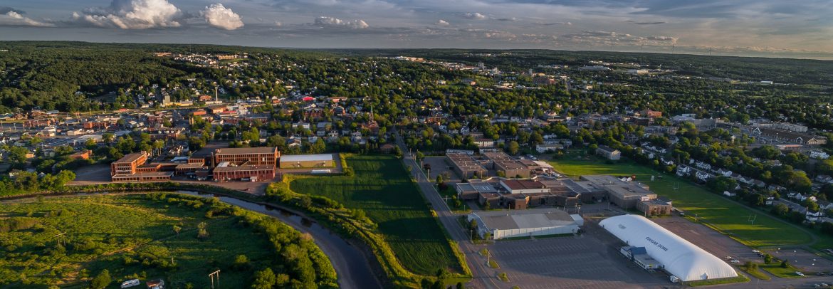
Truro, Nova Scotia: A community that implemented climate adaptation strategies to reduce flood risks (Photo Credit: Business View Magazine, 2018)
After the 2012 floods, local residents concerned about several dyke breaches that had allowed severe damage to homes and businesses pleaded for repairs and infrastructure reinforcements to the dyke system. To protect against further damage, the province performed emergency repairs on the dyke but the responsibility for ongoing maintenance was left undecided.
Following the floods, a Joint Flood Advisory Committee was commissioned to:
- Reduce ongoing dyke maintenance costs for the government by reducing the length of dykes and aboiteauxs;
- Enhance the protection of public and private infrastructure and farmland;
- Reduce flood risk;
- Enhance flood resiliency through the restoration of floodplains (Sherren et al., 2019).
The following solutions were recommended to prevent further damage in the area:
-
Raise and strengthen dykes;
-
Construct runoff storage dams;
-
Build tidal dams to cordon off the Bay of Fundy;
-
Install ice control berms;
-
Improve drainage infrastructure (Sherren et al., 2019).
These structural options were extremely costly, however, and did not guarantee the protection of more than 20% of the exposed zones. Instead, stakeholders unanimously opted for managed retreat, which would allow for the realignment and restoration of the land to its original marsh state. Managed retreat was more cost-effective and better aligned with provincial policy. Extensive public engagement, consultation and round tables allowed for collaboration among stakeholders through the restoration design process. Although the project remains under development, a 5-year post restoration-monitoring program is in place to assess the outcomes and governance strategies for similar projects in the future.
Faced with increasing flood-related expenses, governments, communities and insurers will have weaker capacity to repair or rebuild homes, which suggests managed retreat will be an increasingly important climate adaption strategy. Truro is a great example of how a coastal community can integrate nature-based solutions (i.e. restoration & infrastructure realignment) to increase coastal resilience to climate change.
The case study of Truro, Nova Scotia was highlighted by the OECD in their report that focused on adaptation approaches that tackled coastal risks. Read the full report.
Academic References:
Hanson, A. & L. Calkins (1996), Wetlands of the Maritime Provinces: revised documentation for the wetlands inventory, Environment Canada, Canadian Wildlife Service, Atlantic Region.
Sherren, K., Bowron, T., Graham, J. M., Rahman, H. M. T., and van Proosdij, D. 2019. Coastal infrastructure realignment and salt marsh restoration in Nova Scotia, Canada. Chapter 5 in Responding to Rising Seas: OECD Country Approaches to Tackling Coastal Risks, p. 111-135. OECD Publishing: Paris, France.