RISE graduate student Thiruni Thirimanne, a member of co-Principal Investigator Bruce MacVicar’s River Hydraulics Research Group, presented the group’s research at the Natural Channels Conference on June 28, 2023 on the significance of using powerful GIS-based tools to effectively tackle growing erosion risk in urban watersheds and mitigating erosion impacts on infrastructure and river systems through a watershed-based approach.
The Stream Power Index for Networks (SPIN) is a GIS-based toolbox that calculates the total and specific stream power along a river network. Stream power, which represents the energy expenditure of flowing water per unit length, plays a crucial role in river erosion, channel stability, and morphological changes. The tool is currently being used to support decision-making processes by conservation authorities and municipalities in Ontario.
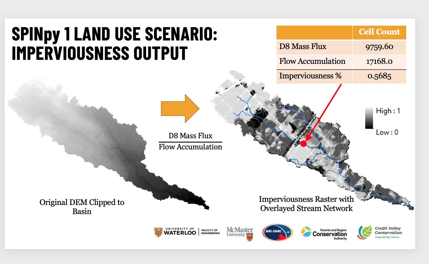
The presentation highlighted the recent improvements and expanded capabilities of SPIN, known as SPINpy 1, developed by the research group. SPINpy 1 offers an enhanced toolbox that is fully open-source in Python, resulting in faster processing and greater flexibility. The group validated the reliability of SPIN through case studies in southern Ontario, where modelled channel slope and threshold substrate sizes closely matched those measured in the field, and stream power metrics strongly correlated with urban development and infrastructure erosion.
SPIN has been successfully integrated into Credit Valley Conservation's Risk and Return on Investment Tool (RROIT) to help estimate the costs of erosion-related damages. It is a valuable resource for updating Official Watershed Plans for two watersheds under the Toronto and Region Conservation Authority's jurisdiction. The group’s aim is for SPINpy 1 to make a valuable contribution to efforts aimed at addressing erosion risk in urban areas for creating sustainable and resilient communities.
Looking ahead, the group plans to continue to validate SPINpy 1's accuracy by comparing its results with field measurements of river morphology and erosion indices, and improve the discharge estimation algorithms to better account for natural and engineered green infrastructure. These initiatives will contribute to the development of nature-based solutions for river management and restoration, an essential aspect of ongoing efforts in land-use and climate scenario testing.
The research will contribute to Bruce’s RISE research on understanding the different components of the urban water landscape in residential developments for improving the design of stormwater systems that reduce greenhouse gas emissions.