Grand Canyon geological trails

Saturday, December 24, 2011

What on Earth Volume 7 2011

Peter Russell
diagram of the Cross-section along Bright Angel Creek.

Figure 1. Cross-section along Bright Angel Creek.

I have been very fortunate to be able to visit the Grand Canyon many times since 1975 when I first visited with groups of students from the University of Waterloo on an after Christmas two week, 16,000 km tour of the Southwestern USA. We hiked down the Kaibab Trail and up the Bright Angel Trail, with an overnight at the Phantom Ranch. During our early trips the geology was easy to decipher as there were plaques along the route. These have since been removed. Today you may pick up a guide to the trails at a National Park bookstore or a cloth neckerchief printed cross-section of the geology. Recently, I have enjoyed more time to explore other trails in the park.

Ribbon Falls Hike

In 2010 together with family members from Australia we spent two nights at the Phantom Ranch, to relax and hike to Ribbon Falls, 18 km (12 miles) return along the Bright Angel Creek to the north of Phantom Ranch. The North Kaibab Trail gently climbs following the Bright Angel Creek. The hike is deceptively easy, the kicker comes just before the Ribbon Falls turnoff when a 90 m (300 foot) climb is required over a mound of Quaternary alluvium.

Archean - Granite Gorge Metamorphic Suite 2 Billion Years Ago

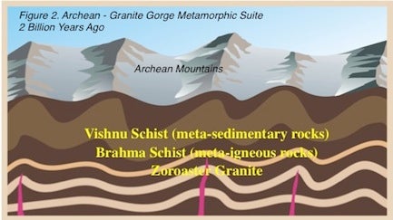
Figure 2. Archean - Granite Gorge Metamorphic Suite 2 Billion Years Ago
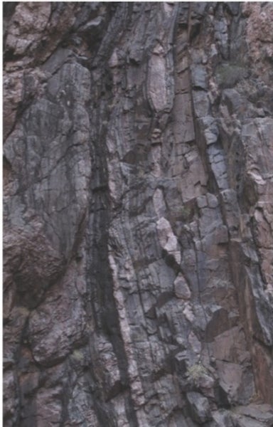
The legs were complaining by now! We enjoyed the views of the tufa mound deposited by the waterfall. The most interesting part for me was walking through rocks of the oldest section of Grand Canyon Series, which is called the Unkar Group. The rocks were deposited about one billion years ago and injected with diabase. Here follows a description and photographs of the rocks along the trail to Ribbon Falls. The Unkar rocks continue 6.5 km (4 miles) along the trail.
A couple of kilometres along the trail from the Phantom Ranch, some of the oldest rocks in the Grand Canyon, the gray Vishnu Schists and pink Zoroaster Granites form the vertical stripes and folded layers which surround you along the narrowest part of the trail. Occasional interesting outcrops including garnet mica schist and boudinaged rocks (torn apart into sausage shapes) as the gneiss was stretched beneath a mountain range.
Boudinage

Figure 3. Boudinage

Vishnu Schists and Zoroaster Granites.

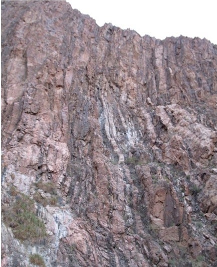
Figure 4. Vishnu Schists and Zoroaster Granites.

Towards the end of a period of erosion the Grand Canyon Group, was deposited in sedimentary basins. These rocks were then intruded by diabase. The rocks were then tilted at about 45 degree angle to the north and faulted. 500 million years of erosion leveled the land leaving fragments of the 12,000 foot (3,600 metres) thick Grand Canyon Group.
Algonkian Grand Canyon Group - 1 billion to 740 million years ago

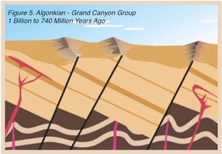
The oldest rocks of the Grand Canyon Group are a basal conglomerate called the Hotauta Conglomerate.

Hotauta conglomerate formed at the base of the Grand Canyon Group.

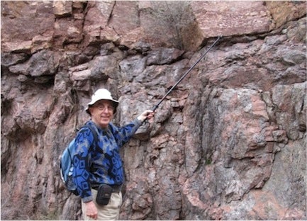
Figure 6a. Hotauta conglomerate formed at the base of the Grand Canyon Group.

Hotauta Conglomerate

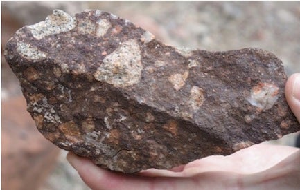
Figure 6b. Hotauta Conglomerate

These rocks are overlain by the Bass Limestone, which in some places in the Canyon, host stromatolite fossils. Here you will find stylolites in the limestone and calcium rich springs chalking the rock face.
Bass limestone
Disbase
The red Haitaki Shale follows and is intruded by greenish gray diabase sills and dikes. 
Haitaki shale intruded by a diabase dike.

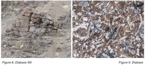
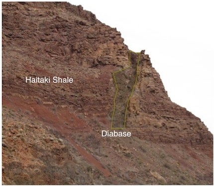
Figure 10. Haitaki shale intruded by a diabase dike.

Across Bright Angel Creek the entrance to Ribbon Creek and Ribbon Falls may be seen. The valley formed along a fault. After a scramble across the creek the trail to Ribbon Falls and the tufa dome is found. Ribbon Falls used to be known as Altar Falls. Calcium carbonate as tufa is deposited among the moss gradually building the dome.
View towards ribbon falls
The Altar at Ribbon Fall

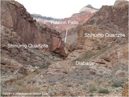
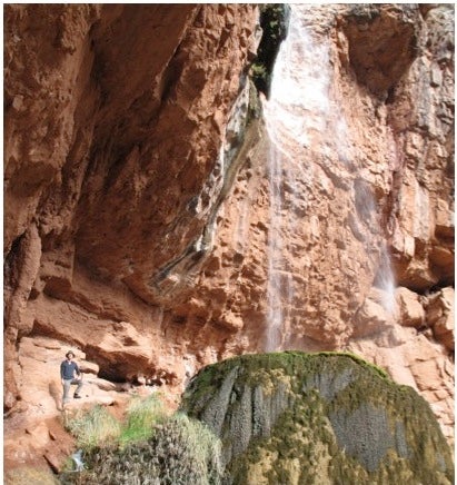
Figure 12. The Altar at Ribbon Fall

Ribbon Falls

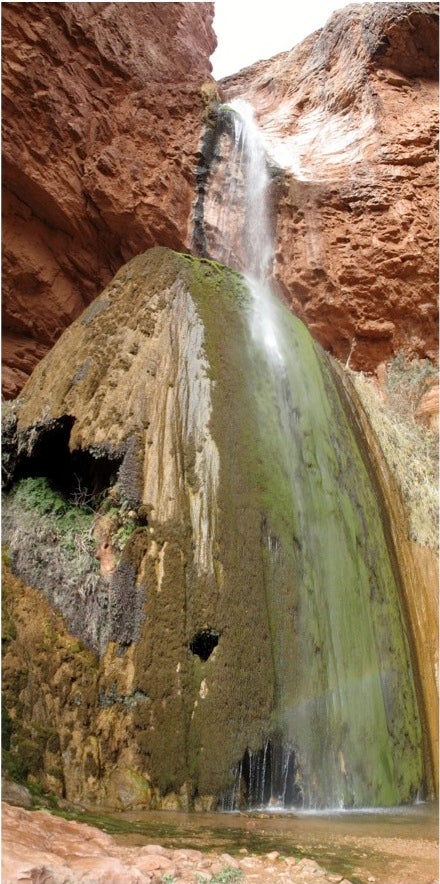
Figure 13. Ribbon Falls


​Clear Creek Trail and the Great Unconformity

Phantom Ranch

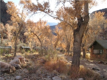
Figure 14. Phantom Ranch

A second hike from Phantom Ranch is a hike along the Clear Creek Trail with great views of Granite Gorge and the deeply weathered schist and granite on which the Cambrian Tapeats Sandstone was deposited.
Granite Gorge

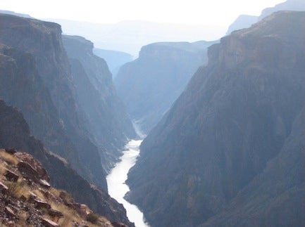
Figure 15. Granite Gorge

Folded schist

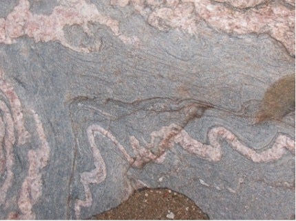
Figure 16. Folded schist

Follow the trail along the unconformity into the valley with a great view of Zoroaster Temple. As you cross the dry stream bed, follow it down to and study the polished surface of the folded schist and the place where rocks are forced into the bedding during flash floods. This is as far as we ventured on our visit.

Clear Creek Trail near Zoroaster Temple.

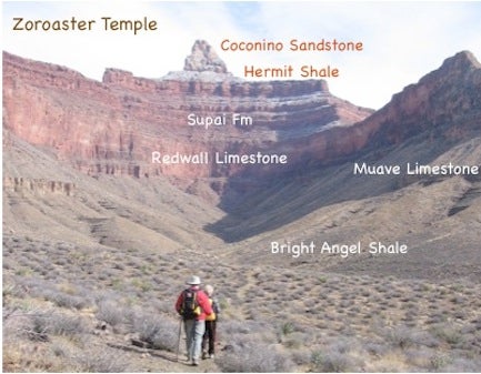
Figure 17. Clear Creek Trail near Zoroaster Temple.

Great Unconformity

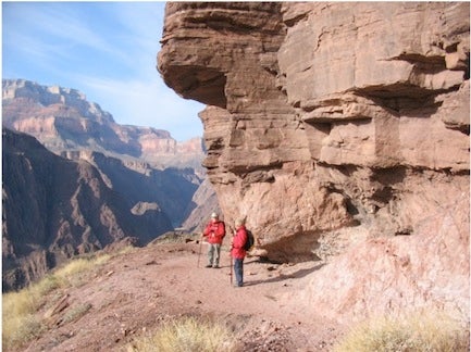
Figure 18. Great Unconformity 

Rocks forced into bedding during flash floods.​

Figure 19. Rocks forced into bedding during flash floods.​


​Hermit Trail to the Coconino Critters.

A short hike on the Hermit Trail to the west of Grand Canyon Village rewards you with a hike on a trail which has not been pounded by mule teams. An hour of hiking will take you to where the trail is steep (about a 45 degree angle) and made of pieces of the Permian Coconino sandstone. Watch out for critter footprints (tetrapod tracks) to the left of the trail and you will find large footprints with a slither of tail as the creature walked across the sand dunes. At this spot you may explore a few metres to the left of the trail and find more tracks and a place where a large slab of tracks was excavated for a museum. The return hike takes at least one and a half hours. More energetic hikers may continue down the trail to Santa Maria Springs and beyond. Remember it takes twice as long to hike out as hiking in and bring lots of water and salty snacks to stay hydrated.
Tetrapod tracks in the Coconino Sandstone.
Tetrapod tracks in the Coconino Sandstone closer.
Tetrapod tracks in the Coconino Sandstone with penny for scale.

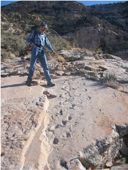
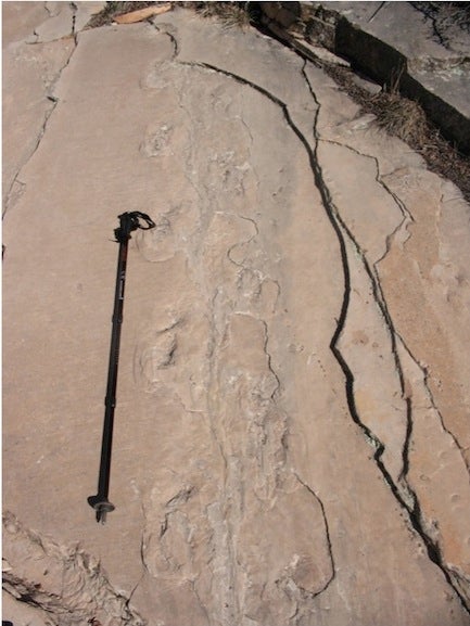
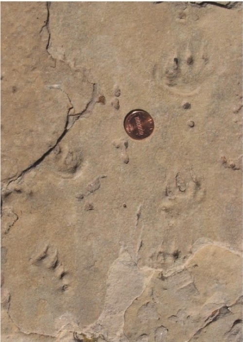
Figure 20 - 22 Tetrapod tracks in the Coconino Sandstone.

Reference:

Story of the Grand Canyon, How it was made. By N.H. Darton, Geologist, U.S. Geological Survey. 24th revised edition. 1950. Published by Fred Harvey, Grand Canyon, Arizona.