Contact the Geospatial Centre
Dana Porter Library, Room 328
University of Waterloo Library
Waterloo, Ontario N2L 3G1
Email: librarygeo@library.uwaterloo.ca
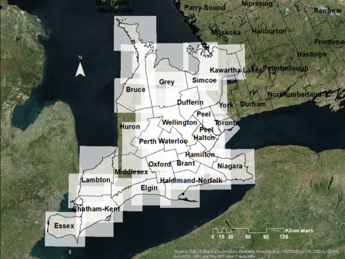
This metamap, represents work completed by Peter Findlay (1973) at the Ministry of Culture, Tourism and Recreation. Peter was a summer student hired by Archaeologist William Fox, who was assessing archaeological potential through vegetation coverage. Anecdotal accounts of interactions with first nations peoples also exist within survey log books and Peter made note of these contacts in his accompanying records. Original maps are housed at the London, Ontario archaeology division under the care of resident archaeologist, Sherry Prowse.
Access map coverage index in Google Earth by opening this (KMZ) file.
Contact:
Ministry of Culture Recreation and Tourism,
London, Ontario.
Shari Prowse, Senior Archaeologist


