Markus Moos and Anna Kramer
School of Planning, University of Waterloo
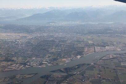
It is well known that Canada is an urban nation. Most people now live in cities. But most growth is occurring in the suburbs of large metropolitan areas and in nearby towns and cities. Yet academic research has often focused on our central cities. Better understanding of suburbs as places, and suburbanization as a process, have less frequently been explicit aims of research.
The research of the suburbs that is conducted is all too commonly broad-brush, looking from the seemingly dense and diverse inner city outward to supposedly low-density, uniform suburbs.
But what if we mapped characteristics commonly believed to be telling of suburbs just to see where they actually occur? What if we went to the suburbs, figuratively and literately, and conducted research as if looking from one suburb to the other, or as if looking from a suburb toward the central city? The likely result is an understanding of suburbanism, and our cities more generally, that is richer and more diverse; an understanding that does not take for granted the political or historic development of cities as drawing concrete lines between what we believe is the suburban and the urban.
The Atlas of Suburbanisms aims to provide information that can help us move toward such an understanding. The information contained here is inherently ‘incomplete’ in that it relies heavily on one data source, particularly the Statistics Canada census, and quantitative methods. But it provides a starting point for helping us think about suburbs in new ways. It provides analysis and graphics that reveal socio-economic and built form characteristics for metropolitan areas as a whole as well as in relation to traditional measures of suburbanism, such as distance from the central city. It allows us to see characteristics of places in the context of metropolitan wide trends.
We invite you to consult the maps, tables, analysis and links contained in our Atlas.
The resources will keep growing as we continue our research. Hopefully the Atlas will provide useful information that you can use in your own research or teaching, or simply to expand your own understanding of our cities. You are free to use the information on these pages for non-commercial purposes only—we are asking you to adhere to standard practices of citation when using any content from the Atlas (Moos, M. & Kramer, A. (2012). Atlas of Suburbanisms. https://uwaterloo.ca/atlas-of-suburbanisms/). When citing individual postings, data, maps/figures or linked content, please ensure to provide attribution to the appropriate authors/creators/owners of the work. Most of the data analyzed to create Atlas content come from the Statistics Canada census. Links to other blogs, videos and websites are included in the Atlas as a means of creating a resource on Canadian suburbanism. We are not responsible for linked content as sites do change.
The Atlas project is led by Markus Moos at the University of Waterloo. It is an output from the Global Suburbanisms research project: A Social Sciences and Humanities Research Council of Canada (SSHRC) funded Major Collaborative Research Initiative (MCRI), led by Roger Keil at the City Institute, York University. Foundational research for this project consists of a collaborative socio-spatial analysis by Pierre Filion (University of Waterloo), Richard Harris (McMaster University), Ute Lehrer (York University), Pablo Mendez (University of British Columbia), Markus Moos (University of Waterloo), Alan Walks (University of Toronto) and Elvin Wyly (University of British Columbia). A large share of the maps, analysis, graphics and web design currently included in the Atlas were created by our research assistant Anna Kramer (University of Waterloo). Michael Seasons (University of Waterloo) also played a key role in finalizing the web design of the Atlas. The works of students Liam McGuire (University of British Columbia) and Robert Walter-Joseph (University of Waterloo) have also informed the analysis and content of the Atlas in important ways.
To follow updates on the project, follow Markus Moos on Twitter.