Thursday, July 11, 2013
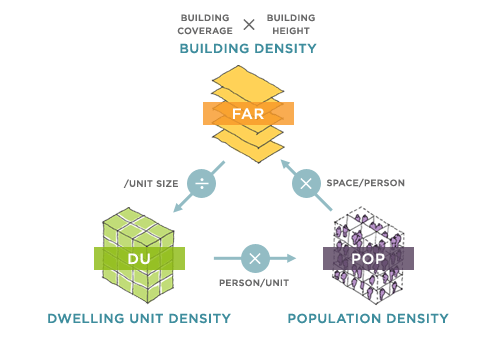
The Density Atlas is a web-based platform developed by MIT architecture and planning faculty and students designed to compare city blocks and neighbourhoods using the three most common measurements of density: dwelling units per hectare/acre, people per hectare/acre, and floor area ratio.
In the context of an increasingly urban world, the Density Atlas contributes to our understanding of what density actually looks like in the real world. More importantly, it examines what density looks like across the world: case studies areas include examples in Brazil, China, France, India, Japan, Mexico, the Netherlands, Spain, Pakistan, the U.K., and the U.S.
See the Density Atlas website to explore more.