TERRITORIAL ACKNOWLEDGMENT
We acknowledges that much of our work takes place on the traditional territory of the Neutral, Anishinaabeg and Haudenosaunee peoples. Our main campus is situated on the Haldimand Tract, the land granted to the Six Nations that includes six miles on each side of the Grand River. Our active work toward reconciliation takes place across our campuses through research, learning, teaching, and community building, and is co-ordinated within the Office of Indigenous Relations.
CAPSTONE DESIGN PARTICIPANTS
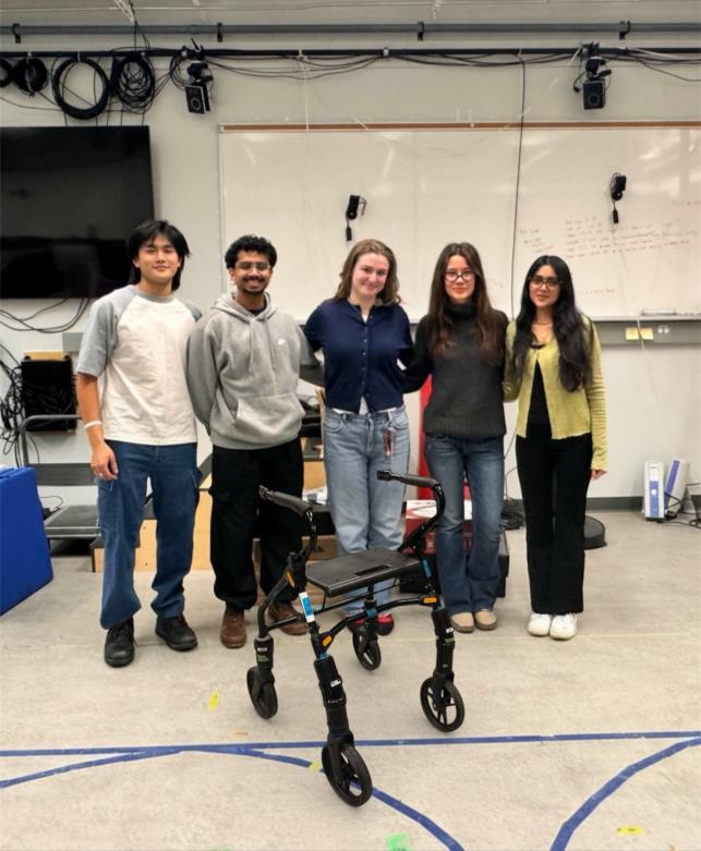
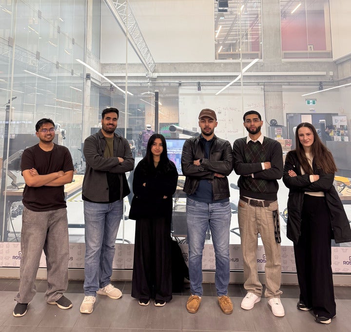
SMART Walker
Marco Li, Karthik Nambiar, Julia Empey, Emilia Malec, Supneet Bisla
Every year, one in three adults aged 65+ will fall—accounting for 89% of all injury-related hospitalizations in Canada. Despite falls being a leading cause of injury and death among older adults, gradual changes in posture and stability often go unnoticed, while other health metrics like sleep and heart rate are routinely tracked.
Currently, physiotherapists play a critical role in helping patients monitor and improve mobility. However, gait assessments heavily rely on observation and clinical judgement—a framework built on checklists to validate a diagnosis rather than concrete data. Without quantitative feedback, progress is estimated rather than measured, making it difficult to detect gradual mobility decline until it’s already had an impact.
This project aims to develop STRIDE, a smart walker that provides real-time gait feedback to help older adults and clinicians detect mobility decline. STRIDE integrates eight embedded force sensors in the walker frame to measure reaction force at each leg. A heatmap will also display where force is applied and highlight any asymmetry in walking posture. By capturing subtle changes in weight distribution and balance over time, STRIDE detects early signs of decline—before you fall.
A functional prototype of STRIDE has been developed, informed by feedback from physiotherapists, to help quantify patient mobility. STRIDE is the smart walker designed to support your every step. It empowers older adults to walk independently, giving families peace of mind through remote monitoring, and equipping clinicians with the quantifiable, objective gait data needed to make more informed care decisions.
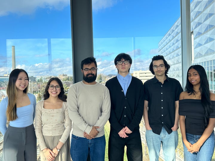
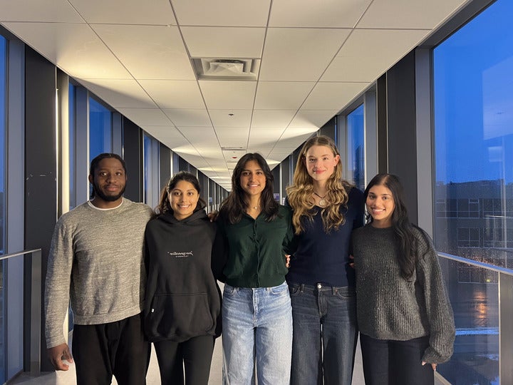
We Dream in Voxels
Nena Le, Khushleen Bawa, Shaharyar Badar, Seung-woo Kim, Saptarshi Bhattacherya, Ranmali Attapattu
Tumours rely on abnormal blood vessels to support their rapid growth. Unlike healthy vessels, tumour blood vessels are often disorganized and leaky, leading to uneven blood flow and poor drug distribution. This makes it difficult for treatments such as chemotherapy to reach all areas of a tumour, reducing effectiveness and contributing to treatment resistance. As a result, accurately visualizing and modelling how drugs move through tumours is critical for improving cancer care.
The Cross-Voxel Exchange Model (CVXM) was developed at Princess Margaret Cancer Centre to address limitations in simpler models by capturing how substances move between blood vessels and surrounding tissue using MRI data. While CVXM provides valuable insight into tumour transport, its current implementation models a tumour as a set of 2D slices. A proper 3D approach would provide even better spatial fidelity.
This project expands CVXM to 3D, creating a more realistic representation of drug transport within tumours. The goal of this project is to evaluate the 3D version of the model against its 2D counterpart. The new implementation is written in Python, to leverage high-performance computing libraries such as PyTorch, and also includes a graphical user interface. Initial model outputs on mouse xenograft MRI images have been obtained and compared with corresponding outputs from the 2D version of the model; accuracy and model runtime are the primary factors considered.
This work lays the foundation for improved predictions of treatment effectiveness and supports the development of more personalized cancer therapies, helping bridge the gap between research tools and clinical applications.
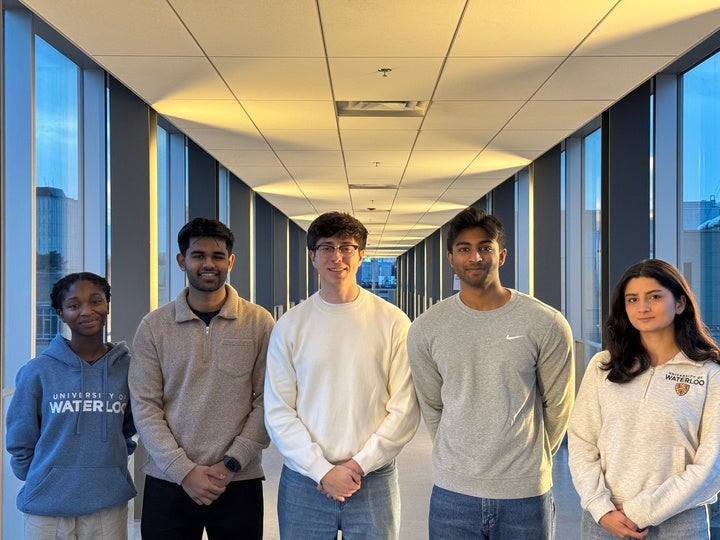
CT Optimizers
Elizabeth Agyei, Heet Shah, Adrian Gri, Chris Abey, Labkhand Maghamianzadeh
Princess Margaret Cancer Centre (PM) performs a high volume of CT scans, but growing patient demand has pushed the system beyond its capacity. As a result, many patients receive scan appointments later than their doctor intended. To help manage this backlog, the hospital occasionally opens extra evening scan slots. When this happens, staff must quickly decide which delayed patients should be moved into these openings. Today, this process relies heavily on doctors keeping personal lists of delayed patients and manually communicating this information, which leads to inefficiency and inconsistency.
The goal of this project is to make CT scheduling more fair, more accurate, and easier for both patients and hospital staff. We propose a classification tool that reviews information in the CT requisition form combined with other data in the hospital’s electronic medical record system, Epic, and recommends which patients should be prioritized for available evening slots.
To support extra evening shifts, our system will also include a dashboard that displays which patients are the most overdue and most in need of earlier appointments. When evening slots open, staff can choose to follow the model’s recommended priorities instead of relying on handwritten lists or spreadsheets.
Compared with the current process, this solution reduces delays, removes the need for personal tracking systems, considers patient equity and fairness holistically, and gives staff a clear view of who should be moved into the evening shift slots. Ultimately, it supports better patient care and a smoother, more organized scheduling workflow for the hospital.

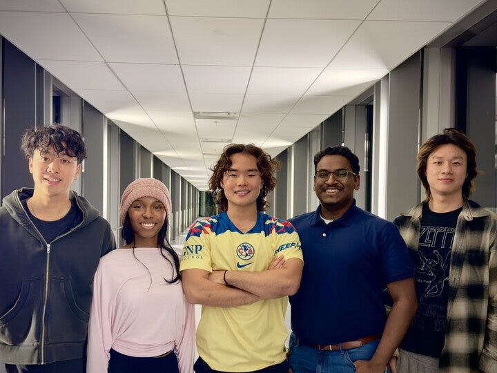
CareCreatives
Kathy Chen, Clara Liu, Afra Parvez, Mya Hansen,Thipisaha Yatheeswaran
Dementia currently affects over 770,000 Canadians, creating a global healthcare crisis that places an unsustainable burden on informal caregivers. Approximately 45% of these caregivers report symptoms of distress, a figure expected to rise as care requirements reach 1.4 billion hours annually by 2050.
The objective of this project is to develop an adaptable, AI-driven companion platform that provides non-clinical emotional support for people living with mild to moderate dementia. The system aims to foster a collaborative care management approach that enhances the emotional well-being of the patient while measurably reducing caregiver distress. To achieve this, the proposed design centres on an conversational AI patient chatbot, paired with a caregiver portal to configure safe conversational boundaries and an analytical dashboard that summarizes engagement and communication patterns from patient conversations, enabling low-effort monitoring for caregivers. The main advantage of this design over existing alternatives is its caregiver-centric focus. By providing patients with a safe companion with strict conversational guardrails, the platform aims to reduce the caregiver’s need for constant physical supervision. Furthermore, the system’s automated cognitive summaries reduce the reliance on handwritten notes and memory.
Initial testing confirms that target demographics are engaging positively with Nura Care. Follow-up evaluations conducted with three caregivers successfully validated the project’s primary objectives. These sessions showed. caregivers found the platform to be a valuable toolfor monitoring patient well-being,and utilzing the anaytics dashboard to track engagement and communication patterns. Ultimately, these findings prove the tools’s ability to support informal caregivers with tracking real-time insights on the emotional and mental well-being of their loved ones.
FerbAI
Ivan Lim, Oreoluwa Oni, Sebastian Tia, Kenneth Francis, David Wu
FerbAI is an assistive AI system designed to empower seniors to age independently while simultaneously alleviating the mounting pressure on caregivers and healthcare systems. By placing users at the center of its design, the system addresses the distinct, evolving needs of both elderly individuals and those who support them. It serves as a practical example of how clinically informed AI and human-centered design can deliver meaningful interventions in modern eldercare.
The solution integrates two primary components to provide a holistic care experience. First, an Individual Companion facilitates empathetic and engaging dialogue to combat social isolation and bolster emotional health. Second, a Predictive Monitoring module utilizes advanced natural language processing and predictive analytics to evaluate speech patterns passively. This allows the system to detect early markers of cognitive decline and issue hands-free alerts when necessary, ensuring timely and low-intrusion interventions.
Foundational to the project are the principles of privacy, accessibility, and ethical data usage. To ensure reliability, robust safeguards are in place to minimize false positives and account for environmental factors like background noise and voice variability. This transparency in decision-making preserves user autonomy while providing caregivers with objective, real-time insights into subtle health changes without the need for constant, active oversight.
Ultimately, FerbAI delivers a scalable solution for aging in place by merging high-empathy conversational AI with continuous, passive cognitive assessment. By providing actionable early warnings and improving quality of life, the system effectively reduces the long-term strain on formal healthcare infrastructures.
CNL Research
Dante Maggiotto, Ibraheem Azhar, Mikaela Moyer, Mohammad Yehya Qureshi, Zizi Fahlefi, Rida Sayed
During radiation emergencies, it is important for emergency responders and healthcare providers to quickly assess an individual’s radiation exposure so they can prioritize treatment and reduce fatalities. Despite this, the current gold standard, the γH2AX flow cytometry assay requires over 24 hours and specialized laboratory equipment, limiting its effectiveness for rapid field triage. γH2AX is a biomarker that signifies radiation-induced DNA damage and is used to estimate an individual’s absorbed dose.
This project aims to develop a portable, field-deployable γH2AX biodosimetry device that can estimate radiation dose from a finger-prick blood sample for rapid emergency triage. The design involves a compact cartridge that magnetically captures lymphocytes, prepares and stains cells, and detects γH2AX fluorescence using LEDs, allowing for rapid dose estimation outside a traditional laboratory. The resulting signal is compared to a calibration threshold to produce a simple Green/Amber/Red triage output, supporting fast decision-making in the field. Compared to conventional γH2AX flow cytometry, the proposed device removes the need for centrifugation, microscopy, and manual foci counting. This reduces the assay time from over 24 hours to approximately one hour, enabling efficient decision-making, and improving patient outcomes during the critical early stages of a radiation event.
The design of this project is broken into four phases. Phase 0: Research and Framing, Phase 1: Lab Validation, Phase 2: Cartridge and Optical Integration, and Phase 3: Prototype Development. Phase 0 has been fully completed, and for Phase 1 and 2, standard operating procedures have been established. All chemical reagents and hardware components have been ordered, and BSL-2 lab access has been secured at the Velocity Innovation Arena. Experimental validation of the biological workflow and developments on the LED-based fluorescence detection system has been started simultaneously. The full system will be integrated in Phase 3 upon completion of Phase 1 and 2.
Augmenta
Chiadikobi Ifesinachi, Harleen Chatrath, Jena Ravindran, Michelle Steen, Simrat Puar
Medical students receive minimal pre-clinical suturing practice, often only a few hours before performing on real patients. Limited repetition and inconsistent feedback contribute to low confidence, higher error rates, and variability in technique. To address this training gap, our project proposes an AR/VR-Enhanced Suture Practice platform that delivers real-time, wound-specific guidance to help learners build proficiency before clinical exposure.
Our solution evolved from an initial VR haptic concept to a more practical and scalable augmented reality (AR) system. AR enables students to practice on physical media such as suture pads or kits, while receiving immediate visual feedback on needle placement, alignment, spacing, and tension control. The system integrates machine learning and computer vision to classify user-traced wounds and recommend appropriate suturing techniques. AR overlays then provide alignment lines, bite-size guidance, and spacing cues directly within the learner’s field of view using Meta Quest 3 hardware.
For our MVP, we have narrowed the scope to a single wound length, depth, and material. All participating physicians will suture the same wound, allowing us to average their suture paths to define a gold standard and calculate a standard deviation. This establishes an objective threshold for grading and feedback. Once validated, this baseline workflow can be expanded to support additional wound types, materials, and suturing techniques.
By combining objective benchmarking with real-time AR guidance, this project aims to bridge the gap between introductory practice and clinical readiness.
Phantom Force
Lillian Yukhtman, Wanyi Olivia Li, David Szczecina, Vladimir Bjelica
Dental Cone Beam CT (CBCT) imaging is widely used in modern dentistry, yet the absence of universal Quality Assurance (QA) standards presents a challenge for maintaining consistent image quality and patient safety. Currently, clinics rely on fragmented, manufacturer- specific testing protocols, making cross-device comparison unreliable and limiting the ability to detect gradual performance degradation. This inconsistency can lead to variability in image quality and challenges in maintaining compliance with the ALARA (As Low As Reasonably Achievable) principle for radiation exposure.
We develop a vendor-agnostic QA system that enables standardized performance monitoring across CBCT devices. Rather than attempting to evaluate every possible imaging metric, our system focuses on a set of critical indicators (such as noise, contrast modulation, and distortions) that are most relevant for routine performance verification. By emphasizing these key measurements, the system enables more frequent and practical QA testing, helping clinics identify performance drift early while maintaining safe imaging practices for both patients and practitioners.
Our solution, the Phantom Force system, integrates both hardware and software components centred around a standardized Phantom Puck. The puck incorporates stainless-steel ball bearings for sub-millimetre geometric verification and blocks of 6061-aluminum for radiometric (density) calibration. Modular, 3D-printed adapters ensure a secure, motion-free fit on a range of chin rests, accommodating multiple device models such as Sirona and Planmeca.
The accompanying software uses OpenCV (Open Source Computer Vision Library) to automatically detect key structures in the phantom. In addition to evaluating the aforementioned imaging quality metrics, it will also evaluate pixel consistency and geometric distances. The program performs individual scan analysis while also tracking changes over time, enabling comparison with baseline benchmarks to identify deviations that may indicate system degradation or calibration issues. With CAD design and adapter interfaces finalized, we are preparing prototypes for field testing at partner clinics to further validate performance and durability.
Northern Links
Mona Sahota, Charles Tianle Cheng, Allen Lu, Banujah Theivendrarajah, Sai Wai Yan Lin, Yuhao Chen
The City of Iqaluit currently receives municipal service requests through email, phone, website forms, and Facebook, leading to delayed responses, misrouted issues, and inconsistent tracking. These fragmented channels increase administrative workload for City staff and slow response times for residents, which lead to reduced transparency and trust in municipal services. The unique range of requests—from snow clearing to recreation facility bookings and business permits—complicates the City’s ability to provide an intuitive experience for its residents.
To solve this, our team is developing a mobile app prototype that manages the full lifecycle of municipal service requests between residents and City of Iqaluit staff. Residents can submit issues with photos, descriptions, and mapped locations, while the system automatically triages requests and routes them to the appropriate departments for staff. Municipal case studies demonstrate the value of such systems: Toronto’s 311 app handled 1.29 million service interactions in 2024, with a standard of answering 80% of calls within 75 seconds. We anticipate similar benefits upon deployment of our tool.
Our design approach uses a human-centred process, including interviews and iterative feedback from City staff and Inuit stakeholders at the University of Waterloo, supported by ongoing usability testing. The app will support universal accessibility for residents and staff, multilingual support (English, Inuktitut, and French), and intuitive, familiar UI patterns. It’s architecture uses an open-source backend for request routing and GIS software integration, enabling workflow fit with existing city processes.
Compared to existing tools, such as generic third-party platforms or web forms, the prototype supports multilingual functionality, direct integration with existing city software, and reduced duplicate data entry. By consolidated service into a single platform, the system will help with planning and reporting reoccurring maintenance issues, track KPI’s, and improve the City’s request responsiveness and transparency. In-person engagement sessions planned in Iqaluit for June will support user testing and alignment for municipal service delivery.
Civic Compass
Kanykei Nurmambetova, Christian Florea
The City of Burlington’s Recreation, Culture, and Community (RCC) Department faces a key challenge: making timely, data-informed decisions while dealing with fragmented data systems. Critical information resides across Snowflake data lakes, Workday financial systems, and Excel files, creating delays in extracting actionable insights and bottlenecks in the reporting pipeline. Although senior managers receive quarterly reports, producing up-to-date reports requires substantial manual effort from RCC staff, the IT department, and data scientists. As a result, opportunities to act quickly on data-driven insights are missed until the following reporting cycle.
Civic Compass creates an automated analytics system providing RCC with near-real-time KPIs to improve reporting efficiency and strategic decision-making. The team shifted from a custom Microsoft Azure solution to the City’s existing Microsoft Fabric platform which reduces future technical debt and ensures a smooth IT handover.
Fabric tools such as Pipelines, Lakehouses, Notebooks, Semantic Models, and Power BI reports enable aggregation of over 200 tables into five core tables. A key design challenge is optimizing refresh frequency while maintaining responsive dashboards across Lakehouses with heterogeneous data rates and quality.
Civic Compass’s solution enables the City of Burlington to monitor facility usage, optimize programs, and forecast future needs, identifying opportunities for program growth and resource reallocation. The MVP focuses on critical RCC metrics and provides a reusable framework for the City’s IT team in future projects and has been shared with RCC stakeholders for preliminary feedback.
LoPIN
Pakalavan Logan, Renée Hinton
LoPIN is a web-based tool, developed as a case study for the City of Kitchener, that identifies and evaluates plots of land for affordable, sustainable housing development. LoPIN intends to bridge the gap between policy makers and municipal government, co-op and non-profit developers and financiers, to provide clear identification and evaluation of development sites. The tool has been developed to focus specifically on underutilized community or public owned land for affordable, sustainable housing development opportunities.
Through engagement with the intended end users, LoPIN has been designed to meet the needs of the industry. The tool was designed specifically with non-profit housing development in mind, supporting a model in which affordable housing projects are delivered through coordinated partnerships, often combining donated or low-cost land, government grants, or collaboration with community landowners.
The tool uses HTML, CSS, and JavaScript, and integrates an open-source mapping library with open-source municipal data that is pre-processed to display the requested information. Users can (1) use an interactive map with layered data; (2) input an address and retrieve property attributes and (3) filter potential sites by key attributes identified by the intended end users. Users can identify sites based on ownership, the neighborhood, current use, sidewalks, roadways, buildings, parks and more. Once a site of interest has been identified, users can generate a report to evaluate the site, providing details such a existing structures, previous development, zoning and more.
In comparison to navigating through various portals to gather the required information about a property, the tool consolidates relevant spatial and attribute information into a single interface, and reduces the time and skill required to screen potential sites for affordable, sustainable housing development.
Mappybara
Jonathan Cheng, Emily Cai, Fred Yang, Emma Song, Sophie Yang, Avril Chen
Engineering programs across Canada are required to demonstrate that their curricula meaningfully develop the CEAB Graduate Attributes (GAs), a set of competencies ranging from technical knowledge and problem analysis. At the same time, instructors independently create Intended Learning Outcomes (ILOs) that describe what students should achieve in a course. While both ILOs and GAs aim to capture student learning goals, they are often written in different styles and at different levels of specificity. As a result, aligning course outcomes with accreditation requirements becomes a highly manual, time-consuming, and error-prone task.
Our project introduces an AI-assisted ILO-to-GA mapping system designed to streamline how the university connects course-level learning outcomes to CEAB’s program-level attributes. The tool analyzes instructor-written ILOs using natural-language processing and recommends relevant CEAB GA categories along with some short justification. Instructors can review and approve mappings, and request alternate suggestions. The platform integrates with the university’s course outline API to pull course data seamlessly and generate program-wide GA coverage reports for accreditation teams. By reducing manual mapping effort, increasing consistency, and offering meaningful explanations, our system supports evidence-based curriculum design while making the accreditation process more transparent and efficient.
To support this system, we deployed a large language model on the Velocity AI server, providing access to GPU resources within a controlled environment for experimentation. The system has now been integrated with the university’s existing course outline tool, allowing instructors to directly generate and review GA mappings while preparing their course outlines. Moving forward, we plan to incorporate feedback from instructors and administrators to refine the mapping recommendations and improve usability. We also aim to transition model hosting from the Velocity AI infrastructure to an internal ECE server, enabling more stable long-term deployment and tighter integration with university systems.
Midnight Sun Power Point Trackers
Akma Pranenda, Forest Zhou, Theodoro Barreira, Patrick Rosenau, Juan Carlos Segovia Garza, Joshua Leveck
This capstone project aims to create a Maximum Power Point Tracker (MPPT) for solar- powered cars that achieves high efficiency with fast response rates, to maximize driving range under variable weather and shading conditions. MPPTs are components in solar systems that control voltage and current to maximize power transfer from solar panels to loads. Because solar cars emphasize minimal weight and compact designs, MPPTs must be lightweight, small, energy-dense, and highly efficient in power conversion.
Solar car panels experience much faster changes in sunlight than stationary systems. These can range from driving under overhead objects to the car changing directions, which changes solar exposure to all panels at the same time. For efficient power conversion, regulating algorithms on solar car MPPTs must be able to adapt to changing conditions faster than traditional MPPTs do while remaining accurate and stable.
No existing MPPTs meet these performance and adaptation requirements. The proposed solution includes a DC-DC converter to maximize the power from the solar panels to charge the battery as efficiently as possible, a microcontroller running a fast-tracking Perturb & Observe algorithm, and a sealed enclosure that dissipates power and protects from water exposure. Prototype testing evaluated design efficiency and algorithm performance across typical irradiance fluctuations faced by solar vehicles.
We have successfully designed, developed and built an MPPT that meets Midnight Sun’s requirements, including class-leading efficiency, high power throughput, a small physical footprint, and most importantly, low development costs. Besides enabling the Midnight Sun team to reduce the development costs of their current solar car, it also allows for an increased operating efficiency of their car, helping student teams like Midnight Sun enhance their designs and possibly influence future electric vehicles.
Hermes
Kate Young Sim, Francesca Evans, Lucas Shumaker, Martina Bubeqi
The ocean is often called Earth’s final frontier; roughly 80% remains unexplored and only 5% of the sea floor has ever been observed by humans. A new generation of self-driving submarines are stepping in to push those boundaries with improved capacity for deep sea exploration. Our partner, Orpheus Ocean is contributing to this effort through its autonomous submersible, to venture depths where human exploration is difficult. Inaccurate calibration in navigation systems can be unreliable for deep sea missions. The objective of this project is to determine if it is necessary to conduct 3D calibration inside the Orpheus vehicle, which would inform the development of a full-scale rig for the vehicle.
The navigation system that Orpheus Ocean uses in their vehicles is manufactured by Impact Subsea. In collaboration with Orpheus Ocean and Impact Subsea the required calibration tests were developed. There are two different kinds of tests that are conducted to test the calibration. One test is a distance test where the navigation unit is taken on a trip to determine if there is drift. The second test is a heading calibration test where a magnet and iron block is used to see if there are differences in the headings when the navigation system is in close proximity to magnetic fields. The tests that are conducted provide valuable feedback on the necessity of 3D calibration over the 2D calibration that is currently conducted by rotating the vehicle on a single axis while it is in the ocean. Based on the results, it can be determined if a full-scale rig should be designed and manufactured. Preliminary designs for this rig have been developed as a part phase 1 of the project.
Jam Squad
Martin Groenewald, Bilal Ali, Jasper Calder, Cal McArthur, Sebastian Mendoza
The rapid integration of AI into daily life presents a unique challenge for the music industry: preserving human creativity while ensuring accessibility to these emerging tools. While 60% of independent artists use AI tools, a significant gap remains: 47% desire AI for songwriting, yet 28% are deterred by inaccessible tools. A lack of collaborative products limits musician’s ability to develop human-led AI workflows and learn from these tools.
The objective of CoJam is to develop a system that serves as a collaborative partner for solo musicians. The system aims to enhance music creation with instant ideas and simulates ensemble play to teach collaborative dynamics. This fosters growth across the entire musical journey, from practice to performance.
CoJam is a hardware interface bringing collaborative software under the musician’s feet. When toggling listening mode, the device analyzes live playing features such as key, BPM (beats per minute), and emotion to generate context-aware backing tracks that sync in real-time. Key design challenges include minimizing audio syncing latency, accurate emotion classification with ML (machine learning), and creating an intuitive pedal interface.
The primary advantage of CoJam over loop pedals or static backing tracks is its generative versatility. Unlike loopers that simply repeat input, CoJam contributes new material and enables varied ensemble and educational scenarios. Housing the technology in a stompbox instead of a Digital Audio Workstation (DAW) reduces the entry barrier by removing the need to learn new interfaces or manage computer peripherals.
The prototype successfully integrates a hardware interface with a backend for pop and rock guitar-to-drum generation. Evaluation targets include sub-10ms syncing latency, sub-one-second musical feature extraction, and three-second track generation. These metrics address solo musicians’ primary need for a responsive collaborator that facilitates creativity without the cognitive load of a DAW. Final validation will confirm these performance benchmarks and assess user satisfaction through hands-on demonstrations with musicians.

Sparse RL Finders
Pavan Jayasinha, Hao Peng (UIUC), Lifan Yuan (UIUC), Sagnik Mukherjee (UIUC)
Recent advances in reinforcement learning (RL) fine-tuning have enabled large language models (LLMs) to achieve remarkable improvements in reasoning and alignment. However, the computational costs of training these models remain substantial, with billions of dollars invested in AI training infrastructure globally. Understanding the fundamental dynamics of how RL modifies pretrained model weights could unlock significant efficiency gains.
This project investigates a phenomenon we term "update sparsity" — the observation that during RL fine-tuning, only a small fraction of model weights receive meaningful updates. Our objective is to characterize this sparsity across different RL algorithms, optimizers, and model architectures, and to explore its implications for more efficient training methods.
Our approach involves systematic ablation studies across multiple RL algorithms (PPO, GRPO, DPO, PRIME, KTO) and LLM architectures (Llama-3, Qwen, DeepSeek Math). We analyze weight update distributions using metrics including sparsity percentages, layer-wise update patterns, and effective rank of update matrices. Experiments are conducted on UIUC’s Delta AI cluster using H200/GH200 GPUs.
Preliminary results reveal striking sparsity patterns: stochastic gradient descent (SGD) optimizer achieves extreme sparsity rates exceeding 99%, compared to approximately 81% for AdamW, while maintaining comparable validation accuracy. SGD concentrates updates heavily on input embeddings, whereas AdamW distributes updates more uniformly across layers. These findings suggest that RL fine-tuning naturally operates within small intrinsic subnetworks of the pretrained model.
The implications are significant: if update sparsity can be predicted and exploited, it may enable 50-100x training speedups and substantial inference improvements. This work contributes both theoretical understanding of why RL fine-tuning succeeds where traditional deep RL struggles, and practical pathways toward more efficient LLM training.
Secur-A-Bot
Kushal Mujral, Rohan Jagtap, Ginny Wang, Dina Orucevic, Francis Martin Okezie
Secur-A-Bot addresses an operational gap in hotels, event venues, and other large indoor facilities where limited staffing, especially during overnight or high-traffic periods, can slow guest support and leave some areas insufficiently monitored. The project objective is to design and prototype an autonomous indoor robot that augments, rather than replaces, human personnel by handling repetitive, low-risk tasks such as wayfinding, answering common guest questions, and supporting routine crowd monitoring, while being privacy compliant.
To achieve this, the project follows an iterative, stakeholder-informed design approach that combines consultations with SELEST Security, hardware evaluation, and subsystem prototyping on the Kinova Movo platform. The proposed design integrates a touchscreen-first user interface, ROS (Robot Operating System)-based indoor navigation and mapping, and a modular privacy-compliant perception system that performs on-device people counting without storing or transmitting personally identifiable video data.
Compared with existing alternatives, Secur-A-Bot is expected to provide broader dual-purpose functionality, lower implementation overhead than custom or imported single-purpose systems, and stronger social acceptability through its tool-like, “assist not replace” positioning. The current prototype is being assessed against engineering performance targets of at least 90% crowd-count accuracy within a 5m radius, 20m indoor navigation in 30 seconds or less, and 98% operational uptime during a standard event shift.
Preliminary results show that the project has established a functional autonomous navigation pipeline for standard indoor paths, a real-time anonymous headcount system that publishes live occupancy data, and an accessible touchscreen interface selected over voice interaction for reliability in noisy environments. These subsystems are now being evaluated against the stated performance targets in representative indoor scenarios.
Project Sunshine
Malik Dahel, Amir Hamadache, Araad Shams
Municipal zoning bylaws are highly complex and subject to frequent amendments, creating a translation gap between regulatory frameworks and actionable development plans. The manual interpretation of these dense documents is a primary bottleneck in urban planning and housing development, routinely leading to weeks-long and even months-long permit review cycles and costly development delays. To address this, we developed an AI-powered Zoning Bylaw Parsing Engine and a standardized zoning API to make municipal regulations machine-accessible and directly integrable into digital planning tools.
By utilizing a series of agentic nodes—making use of structural parsing, natural language processing, and large language models to extract critical zoning attributes (such as height limits, setbacks, and density)—the engine systematically structures unstructured regulatory text into a standardized schema. Unlike existing static zoning maps or manual PDF search tools, this dynamic API continuously accommodates new amendments and exposes structured data for downstream applications.
To date, the system has successfully parsed all zoning sections of the City of Waterloo zoning bylaw into standardized attributes, achieving an extraction accuracy of over 90% against manually curated ground truth.
Furthermore, a prototype Accessory Dwelling Unit (ADU) feasibility checker built on this foundational layer returns property-specific eligibility assessments in just a few seconds.
Beyond single-use applications, this infrastructure accelerates development timelines and reduces administrative bottlenecks. Most importantly, by successfully unlocking and democratizing previously siloed regulatory data, the API establishes a foundational layer capable of powering a vast ecosystem of future innovations, from automated compliance validation to interactive zoning platforms.
Climate Guard
Muad Abdinur, Kavya Srinivasan, Ryan Gosal, Stephen Bassilios, Saaranga Balakumar
Approximately 1.5 million Canadian families’ homes are vulnerable to climate-related risks. Most homeowners are unaware of the options available to make their homes more climate-resilient, which prevents them from taking actionable next steps. For banks, non-resilient homes weaken mortgage portfolio collateral and increase the probability of homeowners defaulting, exposing our industry partner to large losses. This creates an opportunity to leverage GenAI to generate property-specific resilience plans.
To address this gap, we developed Tera Shield, a multi-agentic model that assesses property-level flood risk and generates personalized resilience plans for homeowners. Tera Shield assesses a home’s flood risk by evaluating its proximity to flood zones and classifying the home’s building archetype to formulate a resilience plan that’s custom to the property. The resilience plan features applicable rebate programs and retrofit options.
Tera Shield is trained on historical climate data, the Toronto Region Conservation Authority flood zone map, government grants, retrofit programs, and other home resilience options. The tailored agentic AI model determines a home’s proximity to high flood-risk zones and outputs the best flood resilience measures personalized to that house. The user can simply enter their location, and the model returns the resilience plan. The homeowner is then given tailored advice to make their home more resilient to flooding.
Currently, there is no unified platform that aggregates flooding data, rebate programs, and potential retrofits to formulate a custom resilience plan for homeowners. Homeowners are expected to search for these resources individually across multiple sites, leading to low adoption of resilience measures. Our solution mitigates this problem by providing personalized advice based on the homeowner’s specific circumstances. Industry partners, such as banks, can also calculate the risk for the house they are providing insurance for.
REV
Marcel Lui, Amira Ali, Kabir Sathe, Shangeeth Umashanker
Rising student enrolment, limited land availability, and aging building stock are increasing pressure on the University of Waterloo to deliver student housing that is scalable, energy-efficient, and supportive of student well-being. While new builds can address capacity and performance targets, many existing student residences on campus present a significant opportunity for retrofit and repurposing. Upgrading these buildings with targeted envelope, electrical, and building technology improvements can reduce energy use and emissions without the cost, disruption, and embodied carbon impacts associated with demolition and full reconstruction. However, retrofit pathways that integrate energy performance, on-site generation, and student-centered functionality are not often packaged into a clear, repeatable framework.
The objective of this capstone project is to develop a retrofit design and feasibility framework for Ron Eydt Village (REV) that improves operational energy performance, reduces emissions, and better aligns residence functionality with evolving student needs. REV is used as a representative case study for similarly aged residence buildings in Ontario, with the intent that the retrofit approach and evaluation methodology can be transferred to other campus housing portfolios facing similar constraints.
The design approach is structured into coordinated workstreams. One workstream focuses on architectural and planning upgrades, including targeted building retrofit measures to improve enclosure energy performance and selective floor plan redesign to reflect current student preferences and usage patterns. A second workstream uses residence submetering data to model and compare solar PV scenarios that generate and locally consume green electricity. This workstream also evaluates sensor-controlled lighting and EV chargers for REV.
Key results include a detailed retrofit report for REV that quantifies expected reductions in energy use (kWh) and emissions (eCO2), and presents a cost-benefit analysis including estimated payback periods for enclosure upgrades, solar PV design, sensor-based lighting impacts, and EV charging considerations.

Hadati Road
Omar El Maraghy
This project presents a structural and energy optimization redesign of the roof system for a proposed three-storey, 24-unit residential building at 140 Hadati Road in Guelph, Ontario. The primary objective of the redesign is to maximize solar photovoltaic (PV) efficiency while maintaining compliance with Ontario Building Code (OBC) climatic loads, zoning height restrictions, and structural performance requirements.
The proposed roof configuration consists of a 35∘ monopitch profile that truncates to a flat section at the municipal height limit. This geometry was selected to balance optimal solar tilt angles for Southern Ontario and to stay within planning constraints. Based on the building footprint (approximately 38.5 m by 14.2 m), the available roof plan area is approximately 547 m2, with an estimated 65–80% usable for PV installation after access and setback requirements. Using modern module efficiencies ( 210 W/m2), the system capacity is projected at approximately 75–92 kWDC, producing an estimated 85,000–105,000 kWh annually under typical Guelph solar irradiance conditions.
The structural analysis included detailed evaluation of dead loads, snow loads (ground snow load Ss = 1.9 kPa), rain load, and wind uplift pressures for Guelph climatic conditions. Special attention was given to snow drift accumulation at the slope-to-flat transition, which considered truss design forces and bracing requirements. A 14.2 m truss span system at 600 mm spacing was evaluated, with ultimate load simulations demonstrating the need for reinforced top chord compression control and coordinated permanent bracing design.
The redesign demonstrates that a properly engineered monopitch roof can simultaneously satisfy structural safety, energy generation optimization, and zoning constraints. The project highlights the integration of renewable energy systems into mid-rise residential design while maintaining economic feasibility and long-term operational performance.
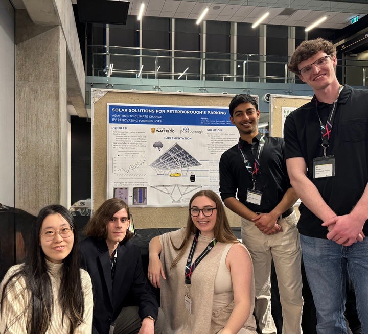
Peterborough Parking Posse
Sarah Zafar, Ruiyang Li, Varun Sen, Bill Moran, Carol Liberty, Grant Bermonte
The City of Peterborough is exploring strategies to retrofit municipal parking lots with solar canopies and rainwater retention systems to support its climate change mitigation and adaptation goals. Located along the Otonabee River, Peterborough is particularly vulnerable to flooding due to its low-lying downtown core. As precipitation intensity and storm frequency is expected to increase under anthropogenic climate change, the risk of flooding and stormwater overflow is expected to worsen.
This project evaluates the feasibility of integrating solar canopies and rainwater retention systems into existing municipal parking lots. The primary objectives are to capture and delay stormwater runoff during peak storm events and to harness solar radiation for renewable electricity generation while reducing surface temperatures. Conceptual retrofit designs have been developed for six municipal parking lots while maintaining regular parking operations.
Baseline site conditions have been compared with proposed retrofit designs using hydrologic modelling to estimate stormwater capture and controlled release during representative design storms. Photovoltaic (PV) performance modelling has been used to estimate installed generation capacity, annual energy production, cost savings, and associated greenhouse gas emission reductions.
In addition to these primary outcomes, qualitatively assessments have been made to incorporate electric vehicle charging infrastructure and pollinator-friendly planting bioswales. Finally, life-cycle cost analysis and high-level constructability considerations have been used to evaluate the overall feasibility of the proposed systems.
By transforming municipal parking lots, which currently accelerate runoff and contribute to the urban heat island effect, this project aims to provide the City of Peterborough with a practical framework for implementing climate-resilient and sustainable urban infrastructure.
Climate Calculators
Sirjan Kathuria, Aathithan Chandrabalan, Bruno Bustos Alegria, Sophie Smith, Maija Hooyer, Colette Jiang
Halton Region has committed to ambitious climate action, including a 2045 net-zero target outlined in its 2023 Corporate Climate Action Plan. The plan acknowledges the urgency of climate change impacts on infrastructure, programs, and services, a commitment that followed the Region’s climate emergency declaration in 2019. To meet these goals, the Region must make strategic decisions about which projects to pursue to best align with its economic, environmental and social objectives. However, Halton currently lacks a reliable way to assess the full range of benefits these investments can generate. Without a tool that brings together financial outcomes, environmental impacts (such as GHG reductions), and social value (such as public health improvements), it is challenging to compare initiatives or determine which options offer the greatest long-term return.
This project develops a decision-support tool designed to fill that gap by evaluating the integrated return on investment (ROI) of potential projects. The tool combines tangible metrics (such as financial costs, operational performance, and technical feasibility) with broader environmental and social indicators. By bringing these factors together into a single, easy-to-use platform, the tool provides a clearer picture of each project’s overall value and helps decision-makers choose investments that deliver meaningful, multi-dimensional benefits.
The project involves the creation of evaluation metrics and the development and testing of the ROI calculator. The resulting tool offers Halton Region a practical and evidence-based way to integrate climate-lens and ESG (Environmental, Social, and Governance) thinking into its asset management and capital planning processes. Ultimately, this solution supports more informed and strategic decision-making as the Region works toward its long-term climate and sustainability objectives, for a more resilient future.
EnvEngBus Netzero
Azzam Asim, Soumyajit Karforma, Sameer Passi, Madison Szeryk, Olivia Orlic
Halton Region has committed to achieving net-zero emissions by 2045 through its Corporate Climate Action Plan. However, the Region currently lacks a unified way to compare potential net-zero pathways across emissions reductions, financial costs, and social impacts. Where climate data typically lives in spreadsheets, reports, and siloed departmental analyses, this fragmentation makes it hard for staff to assess trade-offs and justify investments.
This project’s objective is to design and prototype an interactive decision-support dashboard that enables Halton Region’s Climate Change Response and Sustainability Team to compare alternative net-zero pathways across environmental, social, and economic metrics. The dashboard will allow its users to explore the potential implications of different net-zero pathways, including decisions concerning fleet decarbonization.
This visual dashboard will include complex GHG emissions data and risk matrices, alongside qualitative social metrics. By synthesizing these complex considerations into a unified platform, it will enable the Region to compare its potential decisions, identify trade-offs, and understand consequences that could arise from specific decisions. The project’s focus is to integrate relevant data, frameworks, and user testing to guarantee usability, drawing on key regional planning and operational documents such as the Corporate Climate Action Plan and Progress Report. Unlike static reports or disconnected spreadsheets currently used in planning processes, the dashboard centralizes climate, financial, and operational metrics into a single interactive interface.
The final prototype will incorporate any pilot feedback, and ensure the Region is properly equipped to navigate complex challenges in its transition to reach net-zero emissions by 2045.
The tool will ensure that Halton Region’s chosen path to net-zero is minimizing risks, maximizing opportunities, and positioning itself as a sustainability leader through long-term regional resilience.
Iqaluit Organics
Danielle Raskin, Isabella Ristic, Ava Luzzi, Kyle Foster, Albert Wood, Veronica Green
Iqaluit, the capital city of Nunavut, currently relies on landfill disposal for solid waste management. Due to limited landfill capacity and logistical challenges associated with the remote Arctic community, the City of Iqaluit is seeking waste management strategies to reduce waste volume. This project explores the feasibility of thermal waste management strategies based on cost, energy requirements, operational complexity, and emissions constraints.
A cost and performance comparison was conducted between a custom-designed gasification system, a commercial incineration system, and the baseline landfilling case. The gasification system includes pretreatment, to remove water content and transform the waste into uniform pellets; a heat exchanger, to generate steam for the gasification reactions; and emissions controls through the flaring of gases. The gasification system was designed to process organic waste and paper products which account for approximately 55% of the total waste stream by mass. This system was modeled using Aspen software to estimate energy consumption and volume reduction. These results were then used to estimate the capital, maintenance, and operational costs of the system.
The objective for the City of Iqaluit is to minimize the total waste volume without a major increase in expenditure. For this reason, the custom gasification solution is not suitable due to significant limitations with respect to acceptable inlet waste streams and increased expenses. In contrast, the commercial incineration system can process a greater percentage of waste streams at a comparable cost to the landfilling method. Incineration systems have also demonstrated reliability in other Arctic communities and require minimal pre-treatment and emissions control. Based on these findings, an incineration-based system is recommended as a practical and cost-effective option for reducing landfill volumes and promoting sustainability in Iqaluit.
FUTURE CAPSTONE DESIGN PROJECTS
We hope you will engage with us with your complex and challenging multi-dimensional needs and expertise. Please contact me here:
Derek Rayside
drayside@uwaterloo.ca
Share this page on social media:


