I’d like to take a moment to highlight some of the recent work that our team at McGill has been involved with as part of the Geoweb for Community Development in Rural Quebec project. One of our partners, the Corporation de développement de la Rivière Noire (CDRN) has become very involved with developing Geoweb sites. The first, Géoweb Junior, was developed during summer 2011 by Andréane and Pierre, two undergraduate research assistants at McGill University. Géoweb Junior was a test case for a more detailed Geoweb tool on forest management that is currently being rolled out by CDRN with McGill support. Géoweb Junior provided students (approx. age 10) at a summer day camp organized by CDRN with info sheets to go and gather information on the local environment.

Students collected all manner of observations, from environmental problems, to species of wildlife. Many of them even drew pictures. This information was plotted on a paper map attached to the observation sheet. Students then input this information onto a Google Maps-based Geoweb site and observations were categorized.
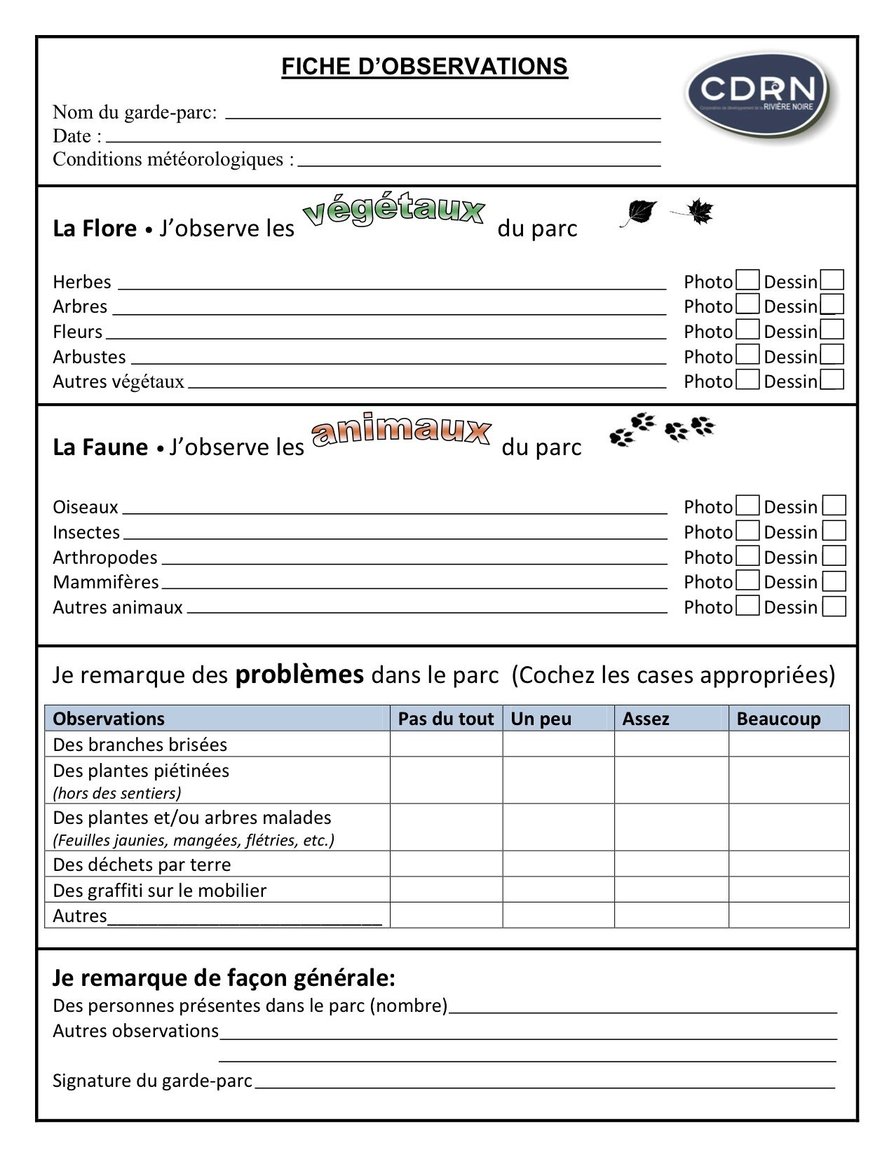
In this way, students were able to participate in the data gathering aspect of environmental science, demonstrating how their local information could be georeferenced, and shared publicly via the Geoweb. You can take a look at their observations on the CDRN web page devoted to the project. This type of project, though fairly simple, demonstrates the ability of the Geoweb as a tool for a variety of community-based organization tasks. These could include data collection, participation, discussions, information and data sharing, and many others.
Technical details: This Geoweb implementation uses a Google Maps API tool (version 2). This is hosted on a separate server and integrated into the WordPress content management system (rivierenoire.org) using an iFrame tag. Points that are added via double clicking on the map are saved in the database and can be edited or deleted by the user with an appropriate password. We plan to make this system available as an open-source template for anyone to use.