What is EcoMap? | How did we make this map? | Access map data | Example of use
What is EcoMap?
EcoMap is a visual reference of natural, semi-natural, and landscaped areas on the University of Waterloo campus. To get started, visit the navigate EcoMap page for tips on how to interact with the EcoMap before proceeding to view the EcoMap.
How did we make this map?
The resources used to create the EcoMap include the Campus Master Plan (2009) (.pdf) and the Northwest Campus Development Guidelines (2012) (.pdf), resources from the Geospatial Centre, Teranet land use parcel data, consultations with stakeholders, Google maps and imagery, and other resources from the UW website.
Access map data
Environmental Stewardship is excited to share the GIS and shapefiles for the EcoMap. Uses can include, but are not limited to, geospatial data analysis, planning on-campus research, or data management/archiving.
The Campus EcoMap GIS and Shapefiles were created by Melissa Greco, in collaboration with Sara Bohnert, Shefaza Esmail and Tim Alamenciak. All materials are licensed under the Creative Commons Attribution-ShareAlike 4.0 International (CC BY-SA 4.0) license. Please feel free to use these materials in your own work, with attribution.
Example of use
Here is an example of how on-campus species richness was visualized using iNaturalist data overlaid on the EcoMap using the shortcodes to index the data entries. Once the entries are coded, it's possible to analyze the iNaturalist observations based on the parcel. Please note, these images are for demonstration purposes only.
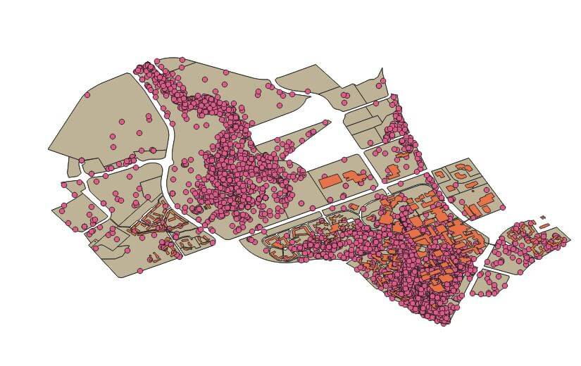
The above (messy) image is from QGIS and demonstrates the process of coding iNaturalist entries based on our GIS data. That data can then be analyzed using statistical software like R to derive measurements like the Shannon Biodiversity Index:
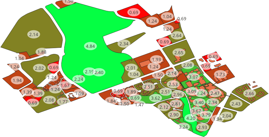
This is just an example of the kind of analysis capable with the EcoMap GIS files. We hope that you will build on this work and use these files to inform your own research and ecological data synthesis.
For information or updates on the EcoMap, contact project co-leads Shefaza Esmail and Tim Alamenciak.