Our team of Canadian researchers affiliated with the Global Suburbanisms project has been busy investigating the evolving and highly variegated links between the metropolitan built environment, suburbanisms as ways of life, and the socio-demographic characteristics of residents in Canada’s largest metropolitan areas.
In the latest addition to the Atlas Maps and Data section, Pablo Mendez (University of British Columbia) presents a written analysis of the latest mapping outputs added to the project. Project lead Markus Moos, with the assistance of graduate researchers Anna Kramer and Robert Walter-Joseph, offer a series of compelling mapping visualizations of socioeconomic data across 23 cities and 3 dimensions of suburbanism. A few sample maps from Toronto offer an example of what has been mapped for the entire list of cities:
Built-form/commute-mode dimension
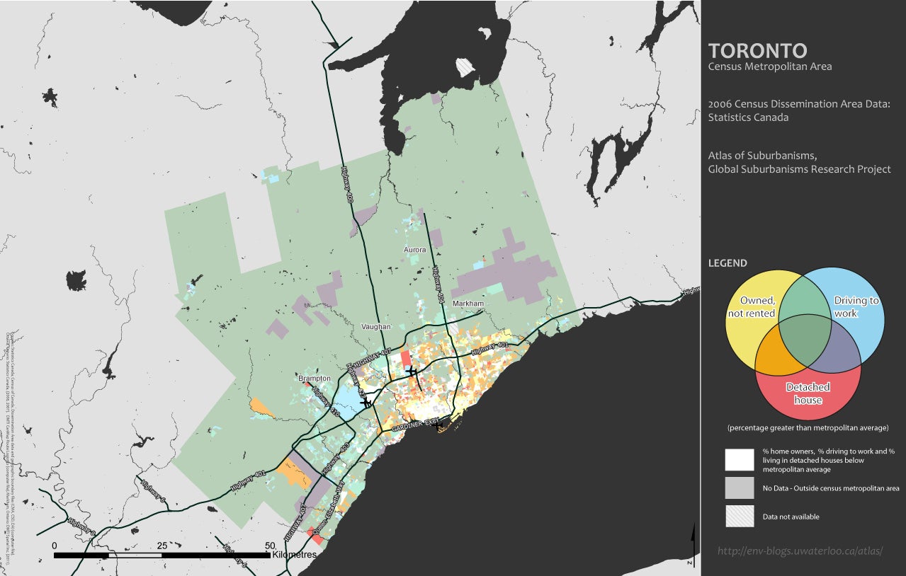
homeownership, occupancy of detached single-family housing, and reliance on the private automobile
Domesticity dimension
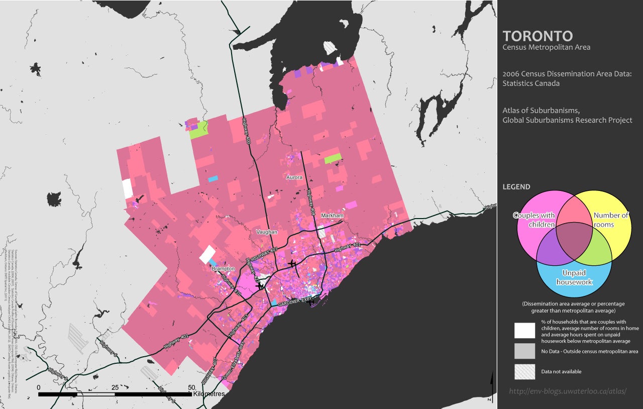
incidence of couples with children at home, average house size expressed in number of rooms per dwelling, and time spent doing unpaid housework
Social status dimension
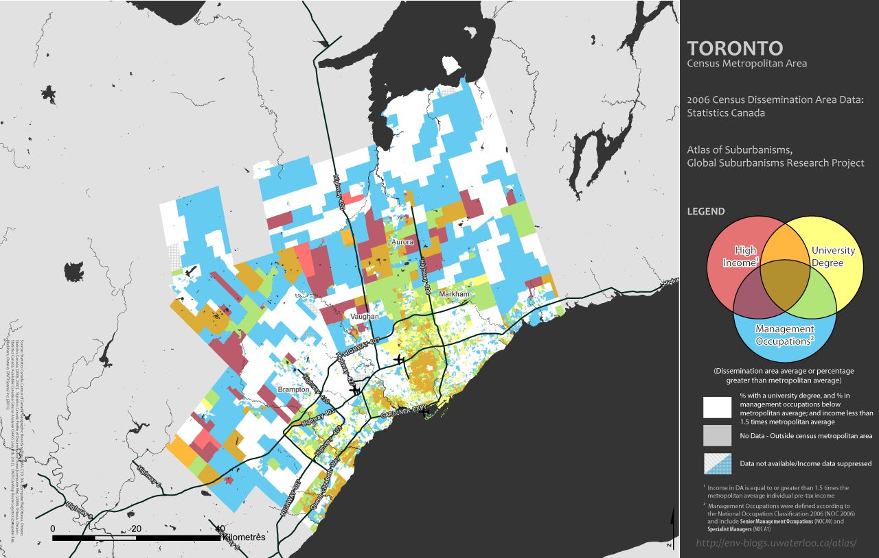
incidence of high income, high levels of formal education, and employment in high-level managerial occupations
The complete set of analysis and maps can be found at the “Mapping the dimensions of suburbanism” page, under the “Maps and data” menu.