News

Filter by:

Limit to news where the title matches:
Limit to items where the date of the news item:
Date range
Limit to items where the date of the news item:
Limit to news items tagged with one or more of:
Limit to news items where the audience is one or more of:

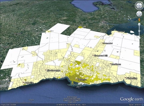
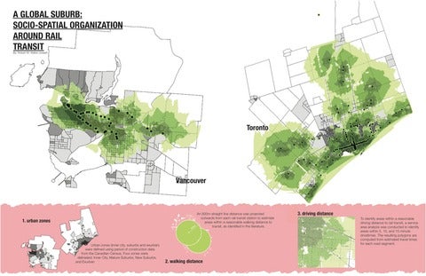
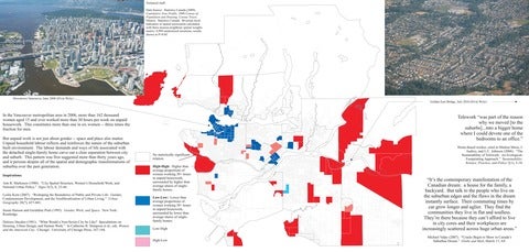
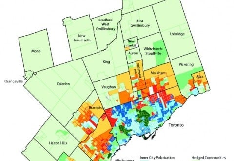
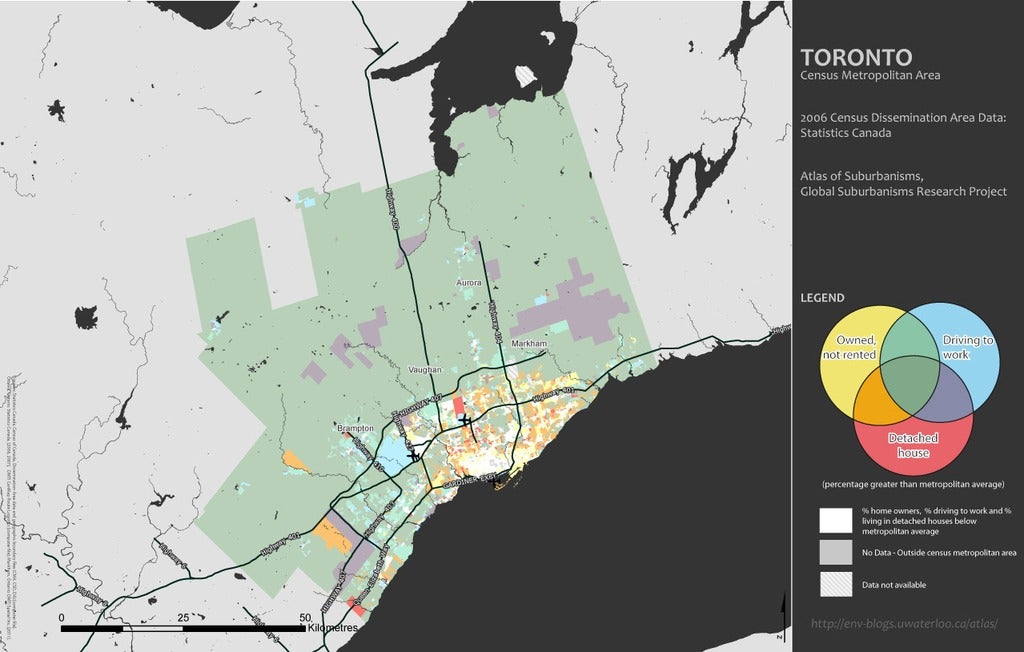
Pablo Mendez (University of British Columbia) offers an analytical writeup to accompany the most recent contribution to the Atlas data: a series of 69 maps covering 23 cities visualizing 3 sets of socioeconomic data themes. The result: a compelling set of data-rich maps showing interesting and surprising patterns of suburbanism across Canada.

A team led by Professor David Gordon at Queen’s University estimates that up to two-thirds of Canadians may be living in suburban areas. They use Statistics Canada data to designate neighbourhoods as suburban or urban based on density and commuting patterns. Findings are presented in visually intriguing ways using a combination of census maps and Google Earth.