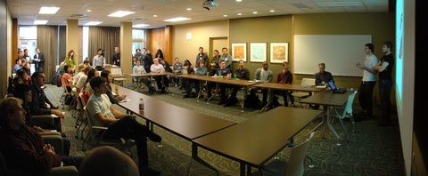
Lightning talks
- Tanya Christidis: Using GIS to determine health effects of living near a wind turbine
- Anna Kramer: Mapping affordability and accessibility
- Ryan Ahola: Investigating the X-band radar response from snow covered terrain in Churchill, Manitoba
- Que Ren (Lucy): Terrain analysis and soil inference using GIS
- Josh MacKenzie and Ben Teichman: 3D campus in UDK
- Mona Khaleghy: Spatial analysis of earthquake fatalities in the Middle East
- Andrei Balulescu and Peter Chu Su: The creation of a digital elevation model (DEM) using pixel-correlation
- Yuanming Shu: Marine oil spill monitoring by satellite-borne synthetic aperture radar (SAR)
- Michael Luubert and Erica Frey: UW Navigator - campus wayfinding web application
- Qian Che: Snow depth/cover
- Robert Walter-Joseph: Network analysis
- Zahra Abedi: Investigating the role of consumer amenities in the location of IT firms
- Kyrylo Rewa: Region of Waterloo cycling study
- Dongrong Li: Using remote sensing and GIS technologies for soil carbon management
- Niina Luus and Mike Lackner: Classifying snow cover area at a low Arctic site using ArcGIS, ENVI and IDL
- Homa Kheyrollah Pour and Claude Duguay: Remote sensing observations of lake surface temperature in regional climate modeling and weather forecasting
- Kevin Kang: Arctic reports card
- Roberto Tapia: Conducting satellite data classification using Support Vector Machines (SVM) and fuzzy methods for crop inventory
- Grace Cai: An automated cost surface generator
- Matt Newman: Modeling wetland vegetation
- James McCarthy: Mobile campus map demonstration
- Eva Dodsworth: Introducing the Scholars Geoportal
Map gallery exhibits
- Ian Dunlop: 20 years of Dun-Map Inc. - the successful run of a UWaterloo co-op start-up
- Alex Brenning: Integrating GIS and statistical software for spatial analysis and prediction
- Roberto Tapia: Monitoring program in Ottawa for Sirex noctilio
- Jacqueline Ho: Comparisons of environmental impacts between salt water swimming pools and road salt in the City of Mississauga
- James Lockyer: An examination of the resources and tools provided through ArcGIS Online
- Melanie Langlois: Evaluating public transit success: A comparative study of route 301 and 305, Calgary, Alberta
- Soliman, A.; Duguay, C. R.; Hachem, S.; Saunders, W.; Luus, K. A.: Pan-Arctic land surface temperature from moderate-resolution imaging spectroradiometer (MODIS) and Advanced Along Track Scanning Radiometer (AATSR): Product development and comparison with multi-source data
- K.A. Luus and R.E.J. Kelly: Pan-Arctic trends (1982-2006) in temperature and bioclimatological indicators
- Andrei Balulescu and Peter Chu Su: Investigating pixel correlation for the development of high accuracy digital elevation models
- Laura Brown and Claude Duguay: Examining sub-grid cell variability of modelled lake ice phenology using gridded climate data
- Matt Newman: Mapping wetland vegetation
- Morgan Lamprey, Nafis Karim and Cam Wheelan: Identifying food deserts in Kitchener and Waterloo, Ontario
- Brian Lyn and Eliot Wand: Analyzing crime incidence clustering using Ripley's K, ArcGIS and R
- Michael Tjendra, Yiou Gao, and Junyi Wang: Watershed delineation in ArcGIS - Grand River Watershed
- Di Wu, Yefan Wei and Chen Chen: Reservoir site selection in Shivapuri, Nepal by ArcGIS
- Nicolas A. Svacina and Claude Duguay: Analyzing RADARSAT-1 imagery to determine variability and trends in ice cover on shallow lakes near Churchill, Manitoba
- Shuhratchon Ochilov, Nicolas A. Svacina, Claude R. Duguay, and David A.: Towards an automated lake ice monitoring system for SAR imagery
- University Map Library: Speak with staff from the University Map Library about Geospatial Data Services that they provide
- MAD: Learn more about MAD's services
