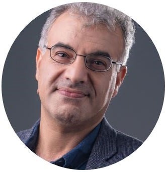
Biography
Dr. Saeid Pirasteh, Professor, Ph.D., IEEE Senior Member, T-PGO, UN-GGIM Academic Network Expert and Advisory Board Member, ISPRS ICWG IVa Chair, GeoIME Founder and Inventor
Dr. Saeid Pirasteh is a Visiting Professor with the Geospatial Intelligence and Mapping (GIM) Lab at the University of Waterloo. He is also a Professor of Geospatial Artificial Intelligence (GeoAI) and Environmental Disasters and Sustainability, Associate Dean at the Institute of Artificial Intelligence, Shaoxing University, China, and an Academician of the Asian Academy of Sciences (AASc.), Fellow of the IET, and IEEE Senior Member. With over 26 years of international experience across academia, industry, and the United Nations geospatial community, he has made significant contributions to GeoAI, remote sensing, disaster management, environment, and sustainable development through research, innovation, leadership, and capacity building. He is the inventor and co-founder of Geospatial Infrastructure Management Ecosystem (GeoIME) (www.geoime.ca).
He has authored more than 300 scientific publications, received over 9,200 citations, and serves in several international leadership roles, including Executive Committee (Secretary) and Advisory Board Member of the UN-GGIM Academic Network, Chair of the ISPRS ICWG III/IVa on Disaster Management, Overseas CIG Chair, and GRSS Disaster Management and Early Warning Co-Chair.
His work focuses on advancing geospatial data science, artificial intelligence, GeoAI Plus, GeoIME-GPT/GeoGPT, and Earth observation technologies to address global challenges related to climate resilience, environmental monitoring, sustainable environment, and disaster risk reduction (e.g., earthquakes, floods, landslides).
He has supervised and co-supervised nearly 100 master/Ph.D. students, postdoc fellows and visiting scholars from various countries. He has been honoured with numerous local and international projects and prestigious awards, including recognition from organizations such as the CIG, IEEE, ISPRS, FIG, and the Science Father Awards. Notably, he was also bestowed with the Life Saving Solution of The Year award at the 2022 Expo in Miami, USA, and the Innovation City Commemorative Medal (2025), Shaoxing City, Zhejiang Province. For instance, Saied's recent accomplishment includes securing a grant from the ISPRS Capacity Building Education Initiative.
Teaching Interests
He has taught a number of core courses in geomatics and geography programs, including remote sensing, GIS Intelligence, spatial analysis, photogrammetry and remote sensing, computer vision, basics of computer, geospatial data science, geospatial artificial intelligence, multivariate statistics, applied machine learning, surveying, cartography and geovisuzalization, and applications beyond like natural hazards, disaster risk reduction and management, geological mapping.
Research Interests
Geospatial Data Science & GeoAI, Remote Sensing, GeoAI Plus, GeoIME-GPT/GeoGPT, Computer Vision (satellite, drone, LiDAR), data processing, GIS and Geospatial Information analysis and modelling, and developing algorithms for novel applications in hazards & disasters beyond. Saied focuses on advancing scientific practices and innovations for sustainable, climate-smart operations, particularly in environmental monitoring and disaster management and risk reduction.
Education
- Ph.D., Geography – Geoanalytics and LiDAR, University of Waterloo, 2018
- Ph.D., Geology - Remote Sensing and GIS, Aligarh Muslim University, Uttar Pradesh, India, 2004
- M.Sc., Applied Geology - Remote Sensing, Aligarh Muslim University, Uttar Pradesh, India, 2000
- B.Sc., Geology, Aligarh Muslim University, Uttar Pradesh, India, 1998
Recent Publications
- Qin J., Zevenbergen C., Qian L., Zhong Y., Zhou S., Pirasteh S. (2026). Impact of extreme climate events on community planning and flood risk management in Giant Panda National Park. Land. 15, 1201, https://doi.org/10.3390/land15071201.
- Fu X., Safari H.O., Wang J., Li H., Wei X., Pirasteh S., Rizvi S.M.A. (2026). An Integrated InSAR and Structural Investigation of Crustal Deformation from the 2017 Alghur Earthquake. Earth Systems and Environment. 2026, 1-24. https://doi.org/10.1007/s41748-026-01152-0.
- Pirasteh S., Bazvand Z., Miri N., Zhaoxi F., Asmat A. (2026). Assessing carbon and economic loss from oak decline in Iran’s Zagros forests using Sentinel-2 and machine learning. Geo-spatial Information Science. 1-21. 10.1080/10095020.2026.2682739.
- Isazadeh V., Shirmohammadi M., Pirasteh S., Akhavan M. (2026). Flood mapping and modeling: Progress, challenges and future directions. Habitable Planet. 2(2), 285–302. https://doi.org/10.63335/j.hp.2026.0039.
- Shirmohammadi M., Pirasteh S., Li H., Akhavan M., Isazadeh V., Ji J., Chen C., Muhammad Y. (2026). Challenges and opportunities in flood mapping and modeling of next-generation geospatial intelligence: A review. Geomatics, Natural Hazards and Risk. 17 (1): 2660866. https://doi.org/10.1080/19475705.2026.2660866.
- Li H., Isazade V., Pirasteh S., Serwa A., Abdehvand Z.Z., Rezaei D., Isazade E., Fang Z., Shirmohammadi M. (2026). Spatiotemporal Dynamics of Hydrological and Environmental Change in Lake Urmia (2000-2024) Using Remote Sensing Big Data on Google Earth Engine. Earth Science Informatics. 19:41. DOI: 10.1007/s12145-026-02089-8.
- Liu X., Abulibdeh A., Pirasteh S., Zhang S., Fang Z. (2026). Environmental impact of stadiums and urban greening in the FIFA World Cup 2022 in Qatar. Urban Ecosystem. 29, 71. https://doi.org/10.1007/s11252-025-01859-4.
- Razavi-Termeh S.V., Sadeghi-Niaraki A., Pirasteh S., Liu L., Choi S.M., Bao S. (2026). Optimizing Spatial Prediction of Land Subsidence through Synergized Nonparametric Machine Learning and Swarm-Based Metaheuristic Algorithms. Environmental and Ecological Statistics. 33, 273–305. https://doi.org/10.1007/s10651-026-00704-x.
- Shirmohammadi M., Pirasteh S., Li J., Sharifikia M. (2026). A novel CNN-LSTM-Attention model to forecast flood susceptibility under global climate scenarios. Gondwana Research. 154: 82-102. https://doi.org/10.1016/j.gr.2025.12.020.
- Pirasteh S., Isazade E., Isazade V., Mostafaei, F., Bakhshayesh S.A., Forouzanfar S., Salimi Z. (2026). Impact of housing price increases on depression and stress in urban Iran: A case study from district 18 of Tehran. International Journal of Mental Health Systems. 20:6. DOI: 10.1186/s13033-026-00695-z.
- Wang X., Pirasteh S., Varshosaz M., Zhaoxi F. (2026). A hybrid algorithm for human interaction recognition from drone videos: Experimental analysis to enhance disaster response and rescue. Geomatics, Natural Hazards and Risk. VOL. 17, NO. 1, 2621550. DOI: 10.1080/19475705.2026.2621550.
- Meng S., Shi Z., Nex F., Pirasteh S., Ghorbanzadeh O., Glade T. (2026). Lightweight Semantic Segmentation for Co-seismic Landslide Identification Using Adaptive Transfer Learning. Engineering Applications of Artificial Intelligence. Volume 166, Part B, 113683. https://doi.org/10.1016/j.engappai.2025.113683
- Yasir M., Liu S., Xu M., Aguilar F.J., Wan J., Wei S., Pirasteh S., Fan H., Ul Islam Q. (2026). TFST: Two-frame ship tracking for SAR using YOLOv12 and feature-based matching. IEEE Journal of Selected Topics in Applied Earth Observations and Remote Sensing. 19: 3175-3198. DOI: 10.1109/JSTARS.2025.3647680.
- Feng S., Zhao L., Ying C., Shen S., Wang W. Gao X.Z., Pirasteh S. (2025). Fuzzy comprehensive three-level evaluation for deep learning classification targeting high-dimensional data. Applied Soft Computing. 188:114443. https://doi.org/10.1016/j.asoc.2025.114443.
- Razavi-Termeh S.V., Sadeghi-Niaraki A., Ali F., Pirasteh S., Shirmohammadi M., Soo-Mi Choi. (2025). Spatially explicit and interpretable GeoAI models for understanding factors controlling groundwater availability. Journal of Hydrology. 665:134683. https://doi.org/10.1016/j.jhydrol.2025.134683.
- Pirasteh S., Mohamed Ghouse Z.S., Gartner G., Chauhan L., Shirmohammadi M., Khonsari N. (2025). Towards Responsible GeoAI Frameworks for Ethical Governance and Global Sustainability. Earth System, Resources and Sustainability. 2026: 1(1), 18–30.
- Erfanifard Y., Hosingholizade Ali, Griess V.C., Garcia Millan V.E., Pirasteh S. (2025). Estimating tree diameter at breast height (DBH) from UAV data: A comparison of oblique–vertical imagery fusion and allometric modeling. 12:100331. Science of Remote Sensing. https://doi.org/10.1016/j.srs.2025.100331.
- Razavi-Termeh S.V., Sadeghi-Niaraki A., Ali F., Pirasteh S., Soo-Mi Choi, (2025). Particulate Matter Pollution Prone-Areas Mapping Using an Enhanced Explainable Ensemble Meta-Algorithm. International Journal of Digital Earth. 18(2):2557511. https://doi.org/10.1080/17538947.2025.2557511.
- Woodbridge K.P., Pirasteh S., Parsons D.R. (2025). Improved Scheme Using Remotely Sensed Geomorphological Characteristics to Investigate Fold-River Interactions for Major Rivers. Journal of Water Research. 3(2):1-38. https://dx.doi.org/10.33140/JWR.03.02.01.
- Shirmohammadi M., Pirasteh S., Mafi-Gholami D., Isazadeh V. (2025). Spatiotemporal assessment and projection of social vulnerability of cities in Iran. Sustainable Cities and Society. 131:106757. https://doi.org/10.1016/j.scs.2025.106757.
- Mohamadi B., Balz T., Pirasteh S., Li H. (2025). Unsupervised Learning-Based Model for Mapping Development Projects in Big Cities Using InSAR Coherence. Geo-spatial information Science. https://doi.org/10.1080/10095020.2025.2542976.
- Razavi-Termeh S.V., Sadeghi-Niaraki A., Ali F., Pirasteh, S., Choi Soo-M. (2025). Enhancing land subsidence susceptibility mapping using deep tabular learning optimization with metaheuristic algorithms, Gondwana Research, 148: 53-76. https://doi.org/10.1016/j.gr.2025.07.002.
- Wang X., Pirasteh S., Husain H.J., Chauhan B., Sivakumar V.L., Shirmohammadi M., Mafi-Gholami D. (2025). Leveraging Machine Learning for Monitoring Afforestation in Mining Areas: Evaluating Tata Steel’s Restoration Efforts in Noamundi, India. Environmental Monitoring and Assessment. 197:816. https://doi.org/10.1007/s10661-025-14294-x.
- Zhang M., Qi C., Yang F., Wang R., Pirasteh S. (2025). Enhancing water depth inversion accuracy via SAR and variable window sliding segmentation. Frontier Marine Science, Volume 12, https://doi.org/10.3389/fmars.2025.1509503.
- Moghimi A., Celik T., Mohammadzadeh A., Pirasteh S., Li J. (2025). Optimizing Relative Radiometric Normalization: Minimizing Residual Distortions in Multispectral Bitemporal Images Using Trust-Region Reflective and Laplacian Pyramid Fusion.IEEE Geoscience and Remote Sensing Letters. vol. 22, pp. 1-5, 2025, Art no. 5001305, doi: 10.1109/LGRS.2025.3562276.
- Pirasteh S., Yasir M., Fan H., Aguilar F.J., Hossain M.S., Li H. (2025). Enhanced landslide detection using a swin transformer with multi-scale feature fusion and local information aggregation.IEEE Geoscience and Remote Sensing Letters. vol. 22, pp. 1-5, 2025, Art no. 5001505, doi: 10.1109/LGRS.2025.3560990. [IF: 3.7]
- Pirasteh S., Samad A., Ahmad R., Thakural L.N, Khan H.H., Chauhan P. (2025). Geospatial and AHP based identification of potential zones for groundwater recharge in Haridwar District of India. Frontier in Environmental Science. 13:1421918, doi: 10.3389/fenvs.2025.1421918.
- Hong S., Shen J., Yang H., Pirasteh S., Liu S., Ishi K. (2025). Enhancing flexibility and efficiency for urban waterlogging response scenarios simulation: an open-ended approach involving user participation. International Journal of Digital Earth. 18 (1): 2468420, https://doi.org/10.1080/17538947.2025.2468420.
- Meng S., Shi Z., Pirasteh S., Liberata Ullo S., Peng M., Zhou C., Zhang L., Gonçalves W.N. (2025). Enhancing Earthquake-Induced Landslide Detection in Remote Sensing Images Using TLSTMF-YOLO with C3-Swin Transformer and Multiscale Feature Fusion. IEEE Transactions on Geoscience and Remote Sensing. 63: 1-12. DOI: 10.1109/TGRS.2025.3541171.
- Pirasteh S., Mafi-Gholami D., Li H., Wang T., Chen F., Zenner E.K., Frazier T.G., Ghaffarian S., Nouri-Kamari A. (2025). Social vulnerability: a driving force in amplifying the overall vulnerability of protected areas to natural hazards. Heliyon. 11: e42617, https://doi.org/10.1016/j.heliyon.2025.e42617.
- Hosingholizade A., Erfanifard Y., Alavipanah S.K., Garcia Millan V.E., Mielcarek M., Pirasteh S., Stereńczak K. (2025). Assessment of pine tree crown delineation algorithms on UAV data: From K-means clustering to CNN segmentation. Forests. 16:228, https://doi.org/10.3390/f16020228.
- Parto Dezfooli F., Valadan Zoej M.J., Mansourian A., Alatab S., Youssefi F., Pirasteh S. (2025). GEE-Based Environmental Monitoring and Phenology Correlation Investigation Using Support Vector Regression.Remote Sensing Applications: Society and Environment. 37:101445, https://doi.org/10.1016/j.rsase.2024.101445.
- Hashemi F.S., Li H., Valadan Zoej M.J., Youssefi F., Shafian S., Farnaghi M., Pirasteh S. (2025). Integrating Remote Sensing Data with Fuzzy Decision Systems for Innovative Crop Water Needs Assessment. International Journal of Applied Earth Observation and Geoinformation. Volume 136:104338, https://doi.org/10.1016/j.jag.2024.104338.
- Abulibdeh, A., Pirasteh, S., Mafi-Gholami, D., Kucukvar M., Onat N.C., Zaidan E. (2024). Unveiling the Nexus Between Land Use, Land Surface Temperature, and Carbon Footprint: A Multi-Scale Analysis of Building Energy Consumption in Arid Urban Areas. Earth Systems and Environment. https://doi.org/10.1007/s41748-024-00550-6.
- Mao W., Shen J., Su Q., Yang H., Pirasteh S., Ishii K. (2024). A method for constructing an urban waterlogging emergency knowledge graph based on spatio-temporal processes. ISPRS International Journal of Geo-Information.13 (10): 349. https://doi.org/10.3390/ijgi13100349.
- Guneet Singh B., Azhar M., Pirasteh S., Satinder, S., Moin H. (2024). Enhancing Emergency Response: A Smart Ambulance System using Game-Building Theory and Real-Time Optimization. International Journal of Advanced Computer Science and Applications. 15(9):363-370.
- Bashir K., Pirasteh S., Abdelrhman H., Mosadag M., Mohammed A. (2024). An Enhanced Feature Selection Method for Breast Cancer Prediction Using a Hybrid Framework Based on Logistic Regression with Noise Filtering and Data Balance. Journal of Karary University for Engineering and Science. 3(2):1-11.
- Khankeshizadeh E., Mohammadzadeh A., Mohsenifar A., Moghimi A., Pirasteh S., Feng S., Hu K., Li J. (2024). Building Detection in VHR Remote Sensing Images Using a Novel Dual Attention Residual-based U-Net (DAttResU-Net): An Application to Generating Change Maps. Remote Sensing Applications: Society and Environment. 36:101336. https://doi.org/10.1016/j.rsase.2024.101336.
- Yasir M., Shanwei L., Pirasteh S., Mingming X., Jianhua W., de Figueiredo F.L.P., Fernando J A., Li J. (2024). YOLOShipTracker: Tracking ship in SAR images using lightweight YOLOv8. International Journal of Applied Earth Observation and Geoinformation. 134:104137. https://doi.org/10.1016/j.jag.2024.104137.
- Cao S., Feng D., Liu S., Xu W., Chen H., Xie Y., Zhang H., Pirasteh S., Zhu J. (2024). BEMRF-Net: Boundary Enhancement and Multi-Scale Refinement Fusion for Building Extraction from Remote Sensing. IEEE Journal of Selected Topics in Applied Earth Observations and Remote Sensing. 17: 16342-16358. DOI: 10.1109/JSTARS.2024.3447788.
- Wang X., Mafi-Gholami D., Pirasteh S., Wang T., Li H., Chen F., Frazier T.G., Nouri-Kamari A., Jaafari A., Abulibdeh A. (2024). Assessing Spatial-Temporal Dynamics of Vulnerability of Protected Areas in Iran to Multiple Environmental Hazards. International Journal of Applied Earth Observation and Geoinformation. 132:104053. https://doi.org/10.1016/j.jag.2024.104053.
- Razavi-Termeh S.V., Sadeghi-Niaraki A., Farhangi F., Khiadani M., Pirasteh S., Soo-Mi Choi. (2024). Solving Water Scarcity Challenges in Arid Regions: A Novel Approach Employing Human-Based Meta-Heuristics and Machine Learning Algorithm for Groundwater Potential Mapping. Chemosphere. 363:142859. https://doi.org/10.1016/j.chemosphere.2024.142859.
- Hong S., Liu Z., Shen J., Pirasteh S., Han Z. (2024). Construction of user-adaptive urban waterlogging emergency scenarios considering mapping concerns. International Journal of Applied Earth Observation and Geoinformation. 131:103953. https://doi.org/10.1016/j.jag.2024.103953.
- Yépez-Rincón F.D., Ferriño Fierro A., Escobedo Tamez A.N., Guerra Cobián V.H., Pinedo Sandoval O.E., Alatorre Cejudo L.C., Pirasteh S. (2024). Mapping longitudinal and transverse displacements of a dam crest based on the synergy of high-precision remote sensing. Advances in Civil Engineering. 6220245: 13. https://doi.org/10.1155/2024/6220245.
- Pirasteh S., Fang Y., Mafi-Gholami D., Abulibdeh A., Nouri-Kamari A., Khonsari N. (2024). Enhancing Vulnerability Assessment through Spatially Explicit Modeling of Mountain Social-Ecological Systems Exposed to Multiple Environmental Hazards. Science of the Total Environment. 630: 172744. doi.org/10.1016/j.scitotenv.2024.172744.
- Moghimi A., Singha C., Fathi M., Pirasteh S., Mohammadzadeh A., Varshosaz M., Huang J., Li H. (2024). Hybridizing Genetic Random Forest and Self-Attention Based CNN-LSTM Algorithms for Landslide Susceptibility Mapping in Darjiling and Kurseong, India. Quaternary Science Advances. 14: 100187, https://doi.org/10.1016/j.qsa.2024.100187.
- Husain H.J., Wang X., Pirasteh S., Chouhan B., Mafi-Gholami D., Latif Khan M., (2024). Review and assessment of the potential restoration of ecosystem services through the implementation of the biodiversity management plans for SDG-15 localization. Heliyon. 10: e29877, DOI:10.1016/j.heliyon.2024.e29877.
- Pirasteh S., Varshosaz M., Badrloo S., Li J. (2024). Developing an expansion-based obstacle detection using panoptic segmentation. Journal of Field Robotics. 1-24. DOI: 10.1002/rob.22319.
- Li W., Zhu J., Pirasteh S., Guo Y., Luo L., Dehbi Y. (2024). A 3D virtual geographic environment for flood representation towards risk communication. International Journal of Applied Earth Observation and Geoinformation. 128:103757. doi:10.1016/j.jag.2024.103757.
- Pirasteh S., Mafi-Gholami D., Li H., Fang Z., Nouri-Kamari A., Khorrami B. (2024). Precision in Mapping and Assessing Mangrove Biomass: Insights from the Persian Gulf Coasts. International Journal of Applied Earth Observation and Geoinformation. 128: 103769. doi:10.1016/j.jag.2024.103769.
- Varshosaz M., Sajadian M., Pirasteh S., Moghimi A. (2024). Automated two-step seamline detection for generating large-scale orthophoto mosaics from drone images. Remote Sensing. 16:903. doi:10.3390/rs16050903.
- Cai Y., Hu B., He H., Gao K., Xu H., Zhang Y., Pirasteh S., Wang X., Chen W., Li H. (2024). Automatic error correction: Improving annotation quality for model optimization in oil-exploration related land disturbances mapping. Egyptian Journal of Remote Sensing and Space Sciences. 27:108-119. doi: 10.1016/j.ejrs.2024.01.001.
- Liang R., Dai K., Xu Q., Pirasteh S., Li Z., Wen N., Deng J., Fan X. (2024). Utilizing a single-temporal full polarimetric Gaofen-3 SAR image to map coseismic landslide inventory following the 2017 Mw 7.0 Jiuzhaigou earthquake (China). International Journal of Applied Earth Observation and Geoinformation. 127: 103657, https://doi.org/10.1016/j.jag.2024.103657.
- Khankeshizadeh E., Mohammadzadeh A., Arefi H., Mohsenifar A., Pirasteh S., Fan E., Li H. (2024). A Novel Weighted Ensemble Transferred U-Net based Model (WETUM) for Post-Earthquake Building Damage Assessment from UAV Data: A Comparison of Deep Learning- and Machine Learning-based Approaches. IEEE Transactions on Geoscience and Remote Sensing. 62: 4701317. DOI: 10.1109/TGRS.2024.3354737.
- Yasir M., Liu S., Mingming X., Wan J., Pirasteh S., Dang K.B. (2024). ShipGeoNet: SAR Image-Based Geometric Feature Extraction of Ships Using Convolutional Neural Networks. IEEE Transactions on Geoscience and Remote Sensing. 62: 1-13. doi: 10.1109/TGRS.2024.3352150.