When the tide moves ice: How radar reveals a glacier’s hidden pulse

A WaterLeadership Snapshot
WaterLeadership Snapshots feature articles written by graduate students participating in the Water Institute’s WaterLeadership training series. Students describe the value of their research and its potential for real world impact.
By Jae Hun Kim
Twice a day, the ocean lifts a glacier. The movement is small, sometimes only a few centimeters. It happens quietly, far from cities and coastlines. But along the edges of glaciers, these subtle tidal pulses help control how quickly ice flows into the sea.
Working with Dr. Wesley Van Wychen, Dr. Jae Hun Kim studies how glaciers in Greenland and the Canadian Arctic respond to the rhythm of the tides. Using radar, he tracks the grounding line, the place where a glacier lifts off bedrock and begins to float. This narrow boundary plays a crucial role in glacier mass loss.
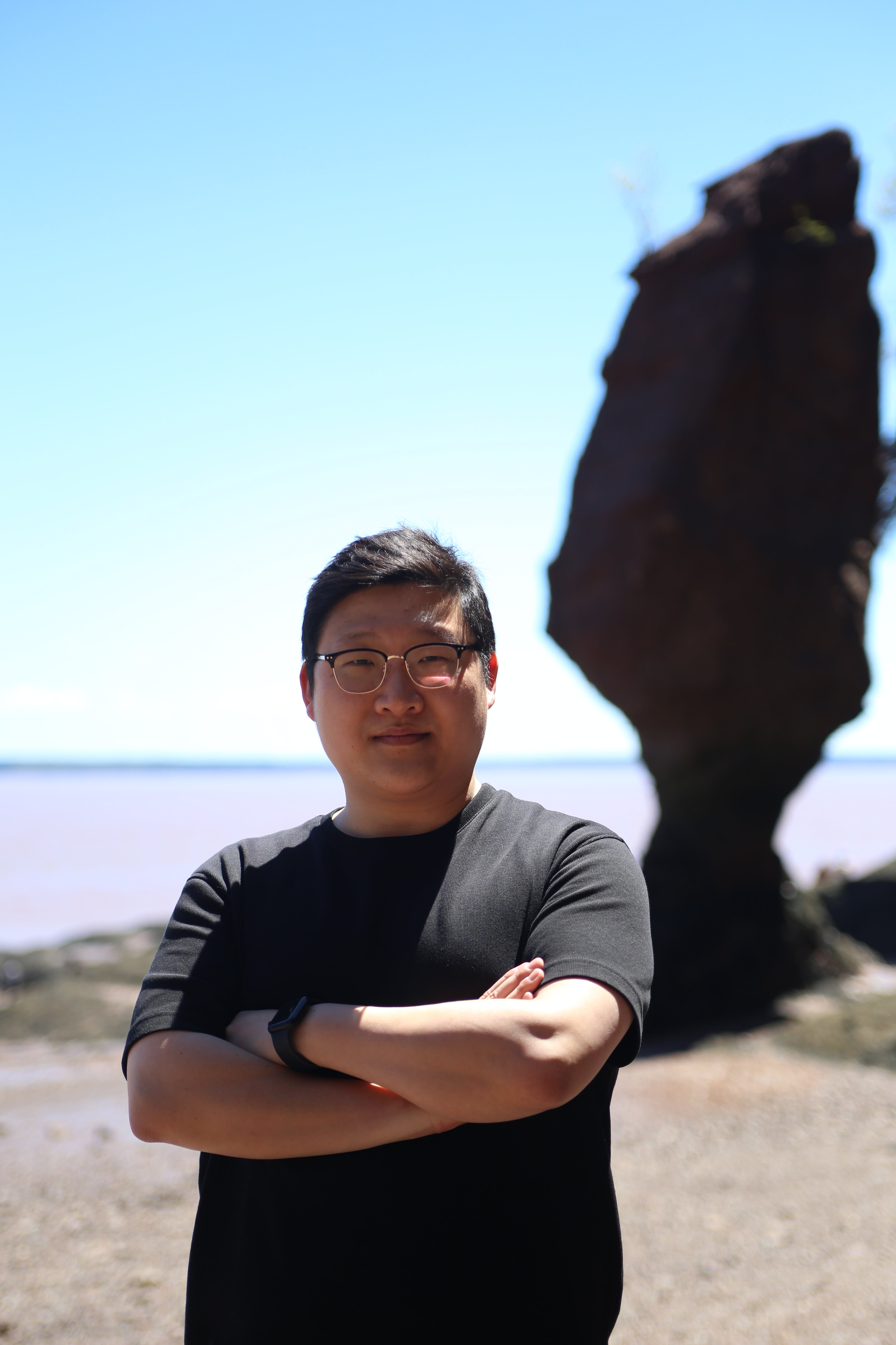
Photo: Dr. Jae Hun Kim, Postdoctoral Scholar, Department of Geography and Environmental Management.
Over the past two decades, glaciers have been retreating at an alarming pace. Between 2000 and 2020, 85 percent of marine-terminating glaciers in the Northern Hemisphere pulled back. More than half of those were in Greenland. These glaciers lose ice through melting at the surface and below the waterline, but most of their mass disappears when towering blocks of ice break off into the ocean. This process, called calving, drives much of Greenland’s contribution to sea level rise.
To understand calving, scientists must understand what happens where ice meets ocean. Warm seawater flows toward the glacier front. It melts the ice from below and carves out hidden cavities, weakening the ice and making it more likely to fracture. But the Arctic is remote and difficult to study. Field data are scarce, and the most important changes often occur beneath the surface. This is where radar becomes essential.
Kim uses Synthetic Aperture Radar (SAR), a type of satellite radar that works through clouds and in complete darkness. By comparing radar images taken at different times using radar interferometry (InSAR), he measures tiny changes in the glacier’s surface. As the tides rise and fall, the glacier lifts and settles. These small vertical movements reveal the position of the grounding line.
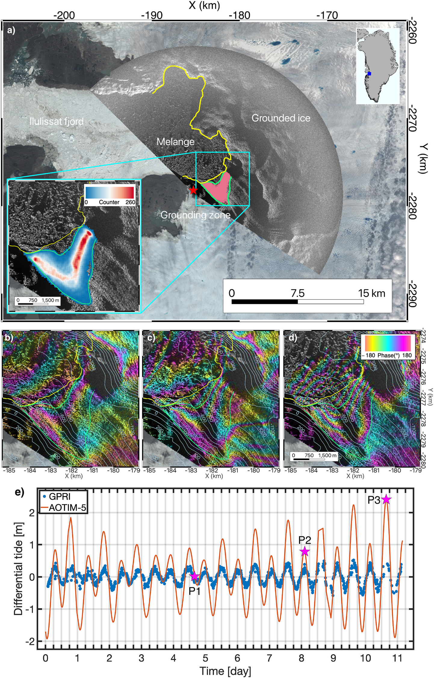
Figure1: Survey of Jakobshavn Isbræ, Greenland, using a terrestrial radar interferometer (TRI) in June 2016. (a) Radar intensity image overlaid on a Landsat-8 satellite image acquired on 13 June 2016, showing the radar location (red star), the glacier front (yellow), and the grounding zone (green), where the glacier begins to float. The pink lines mark the observed grounding-line positions, with the inset showing their distribution. (b–d) Radar interferograms captured under different tidal conditions, illustrating how tidal motion changes the position of the grounding line. Each color cycle represents 9 mm of ice-surface motion. (e) Measured vertical motion of the glacier (blue dots) compared with the modeled tidal changes in Ilulissat Fjord (red curve). The labeled points (P1–P3) correspond to the tidal conditions shown in panels (b–d), from little tidal change to the largest tidal difference.
In Greenland, Kim focused on two of the most dynamic glaciers: Jakobshavn Isbræ and Helheim Glacier. Both move at remarkable speeds and discharge enormous amounts of ice each year. By combining satellite radar with ground-based radar instruments, Kim observed that seawater travels far inland beneath these glaciers. At Jakobshavn, ocean water intrudes up to 2.8 kilometers from the ice front. At Helheim, the glacier’s front rises and falls with the tide, pivoting around a central ridge like a teeter-totter. These motions show a strong link between ocean forcing and calving events.
His work also suggests that parts of the glacier bed are deeper than previously known. A deeper bed allows more warm water to circulate beneath the ice, increasing the glacier’s sensitivity to ocean warming.
Why does this matter?
If the grounding line retreats inland, glaciers can accelerate and thin. Even small shifts at this boundary can amplify sea level rise over time. By mapping grounding lines with high precision, Kim’s research helps improve glacier models and reduce uncertainty in future sea level projections.
He is now applying these radar techniques to glaciers in the Canadian Arctic, where similar processes are unfolding. With better measurements of grounding line migration and seawater intrusion, scientists can better estimate how much ice these regions may contribute to sea level rise.
The tides continue to rise and fall each day. With radar from above, we can now see how glaciers respond and how those quiet movements may shape coastlines around the world.
Banner photo: Fieldwork in Greenland 2021, courtesy of Jae Hun Kim and team.