Description
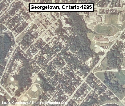
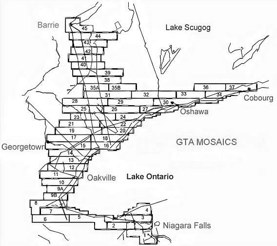
These digital orthophotos provide a full-colour view of the Greater Toronto Area, as well as the Golden Horseshoe. These images were provided by Triathlon Mapping Corporation. The georeferenced orthoimages have the same accuracy as a 1:20,000 scale map. The resolution of these photos is 1 meter. For coverage areas please see the index below. To find the individual TIFF images, please consult the TIFF index.
Index showing coverage for MrSID images
Links to imagery thumbnails
[Note from Rose (July): the parent menu item for the mosaic files below has not been changed to City of Toronto until we decide whether we are keeping these.]
Spatial reference and data type
These data sets are available in Universal Transverse Mercator (UTM) co-ordinates; horizontal datum is North American Datum (NAD) 27. These data are stored as MrSID image files, and are also available as geo referenced TIFF images. Other data formats can be accommodated, as the Geospatial Centre has access to a number of conversion utilities.
Data access
To request this data, please fill out the Ask-Us form and include which layers (shapefiles) you are interested in obtaining. The dataset will be shared with you via OneDrive upon completion of the data release agreement form. You may also make an in-person appointment using the same form.
Use restrictions/licensing/copyright
This material is provided for academic, research, teaching, and personal use only. A data release agreement must be agreed to before the data is delivered. Triathlon Mapping Corporation should be acknowledged on any derivative product, such as a map or an image.
Citation
Colour digital orthophotos of the Greater Toronto and Golden Horseshoe Areas 1995 [computer file]. Burnaby, British Columbia: Triathlon Mapping Corporation, [1995].
Sample view of the data