Data access
Full access to our resources is available to current students, faculty, and staff of the University of Waterloo. To request access, please complete the Ask-Us form indicating the specific layers (shapefiles) you require. Upon completion of the data release agreement form, the dataset will be provided to you via OneDrive.
In-person consultations may also be requested through the Ask-Us form.
Description
This collection of data products provides topographic and municipal planning information for the area encompassed by the City of Toronto. This data were provided to the Geospatial Centre by the City of Toronto, Geospatial Competency Centre between 2003 -2025. The City of Toronto also has current open data available from their website.
Data resources for the City of Toronto
- Aboriginal Services
- Accessible Stalls
- Address Point
- Affordable Rental Housing Pipeline
- Air Conditioned and Cool Spaces
- Ambulance Station Locations
- Arechaelogical Potential
- Areas
- Automated Speed Enforcement Locations
- Basement Flooding Study Areas
- Basic incidents Details from 2023 onward
- Buildings with Heights (2023)
- Bicycle and Micromobility Cordon Count 2022
- Bicycle Parking
- Bicycle Shops
- Bicycle Thefts
- Bicycle Thefts
- Bikeways
- BLT Active Surveillance Results
- Bodysafe
- Bridges Structure
- Building Outlines
- Building Asset Inventory
- Business Improvement Areas
- Café TO Locations
- Centreline
- Centreline Intersection
- Centreline Streets (includes streets, rivers, creeks, ramps, hydro lines, laneways, railways, shorelines, trails, walkways) (data type: shapefiles)
- Childcare Centres
- Childcare Safe Inspection Results
- City of Toronto Free Public Wifi
- City Operated Electric Vehicle Charging Station Map
- City Wards
- Clothing Drop-Box Locations
- Community Centres
- Community Council Boundaries
- Community Housing
- Contours (data type: shapefiles)
- Contributing Areas
- COVID-19 Immunization Clinics
- COVID-19 Testing Sites
- CREM Public Washrooms
- Cultural Hotspot Point of Interest
- Cycling network
- Distribution Watermain
- Downsview (Watermain, Community Recreation Centre, Districts, Major Streets and Green Spine, Parks)
- EarlyON Child and Family Centres Locations
- Edge of Road
- Edge of Roadway
- Environmentally Significant Areas
- Fire Hydrants
- Fire Station Locations
- Former Municipal Boundary
- Generalized Digital Terrain Model (DTM) (data type: AutoCAD DWG and ASCII)
- Green Spaces
- Green Streets Map
- Health Services
- Historical Bike Trails
- Homicides
- Indoor Ice Rinks
- Inspection Results
- Litter Bin Collection Frequency
- Locations
- Long Term Care Locations
- Major Crime Indicators
- Motor Vehicle Collisions with KSI Data
- Municipality boundaries
- Music Locations
- Neighbourhood Improvement Areas
- Neighbourhood Crime Rates
- Neighbourhoods
- Off Leash Areas
- On-Street Permit Parking Area Map
- Outdoor Artificial Ice Rinks
- Park and Recreation Facility Projects
- Park and Recreation Facility Study Areas
- Parking Lot
- Parking Zone Overlay
- Parks and Recreation Facilities
- Parks Drinking Fountains
- Patrol Zones
- Pedestrian Crossover
- Pedestrian Network
- Places of Interest and Attractions
- Places of Worship
- Points of Interest
- Poles
- Police Boundaries Data
- Police Facility Locaitons
- PollinateTO Primary Project Garden Locaitons
- Poster Board
- Poster Structure
- Presto Card Access
- Properties Requiring a Cultural Heritage Evaluation Report Under OPA 720
- Property Boundaries
- Property Data Maps (PDM) 2011 - 2018 (data type: AutoCAD DWG)
- Property Parcels (data type: shapefile)
- Public Art
- Public Washrooms
- Publicaiton Structure
- Railway
- Red light cameras
- Renewable Energy Installations
- Retirement Homes
- River Locations
- Road Reconstruction Program
- Road Resurfacing Program
- School Locations
- School Safety Zone Watch Your Speed Program
- Secondary Plans
- Sewer (Inlets, Junctions, Manholes, Outfalls, Pressurized Main)
- Shooting Firearm Discharges
- Sidewalk Construction Program
- Sidewalks
- Sign Bylaw Districts
- Site and Area Specific Policies
- SolarTO Map
- Stationary Sign Locations
- Stations
- Street bicycle parking
- Street Furniture (Bench, Bicycle parking, Information pillar, Litter receptacle)
- Street Trees
- StrollTO POI Details
- StrollTO Starting Points
- Swimsafe
- TCDSB - Schools
- Temporary Extension and Special Occasion Permit Endorsement for Liquor Licences
- Tennis Court Facilities
- Theft From Motor Vehicles
- Topographic Maping Poles
- Topographic Sidewalk
- Toronto Signature Sites
- Toronto Beaches Water Quality
- Toronto Fire Services Run Areas
- Toronto Public Library (TPL) Branch General Information
- Traffic (Beacon, Calming, Cameras, Collitions, Control Devices)
- Transit Shelter
- Transmission Watermain
- Voting Locations (2023)
- Voting Subdivisons (2010, 2014, 2018, 2022, 2023)
- Ward and Elected Councillor
- Washroom Facilities
- Water (Fitting, Hydrant, Line, Pressure District Boundaries, Valve)
- Zoning (Area, Building Setback, Height, Lot Coverage, Policy Area, Policy Road, Priority Retail Street, Queen St W Eat Community, Rooming Housing)
Spatial reference and data type
These data sets are available in Universal Transverse Mercator (UTM) co-ordinates; horizontal datum is North American Datum (NAD) 83. Centre line streets are also available in Modified Transverse Mercator (MTM) zone 10, (NAD) 27. Other data formats can be accommodated, as the Geospatial Centre has access to a number of conversion utilities.
Use restrictions/licensing/copyright
These data are provided for personal use for academic, research, and/or teaching purposes. A data release agreement must be agreed to before these licensed data can be released. The City of Toronto Geospatial Competency Centre must be acknowledged on any derivative product, whether printed or electronic, including for example, a printed map, a raster or vector graphic, a web-based application, etc. Patrons are advised to fully respect the provisions of Canada's Copyright Act as well as terms and conditions imposed by the data provider.
Citation
City of Toronto Municipal Data [computer file]. Toronto, Ontario: City of Toronto, Geospatial Competency Centre. [2018].
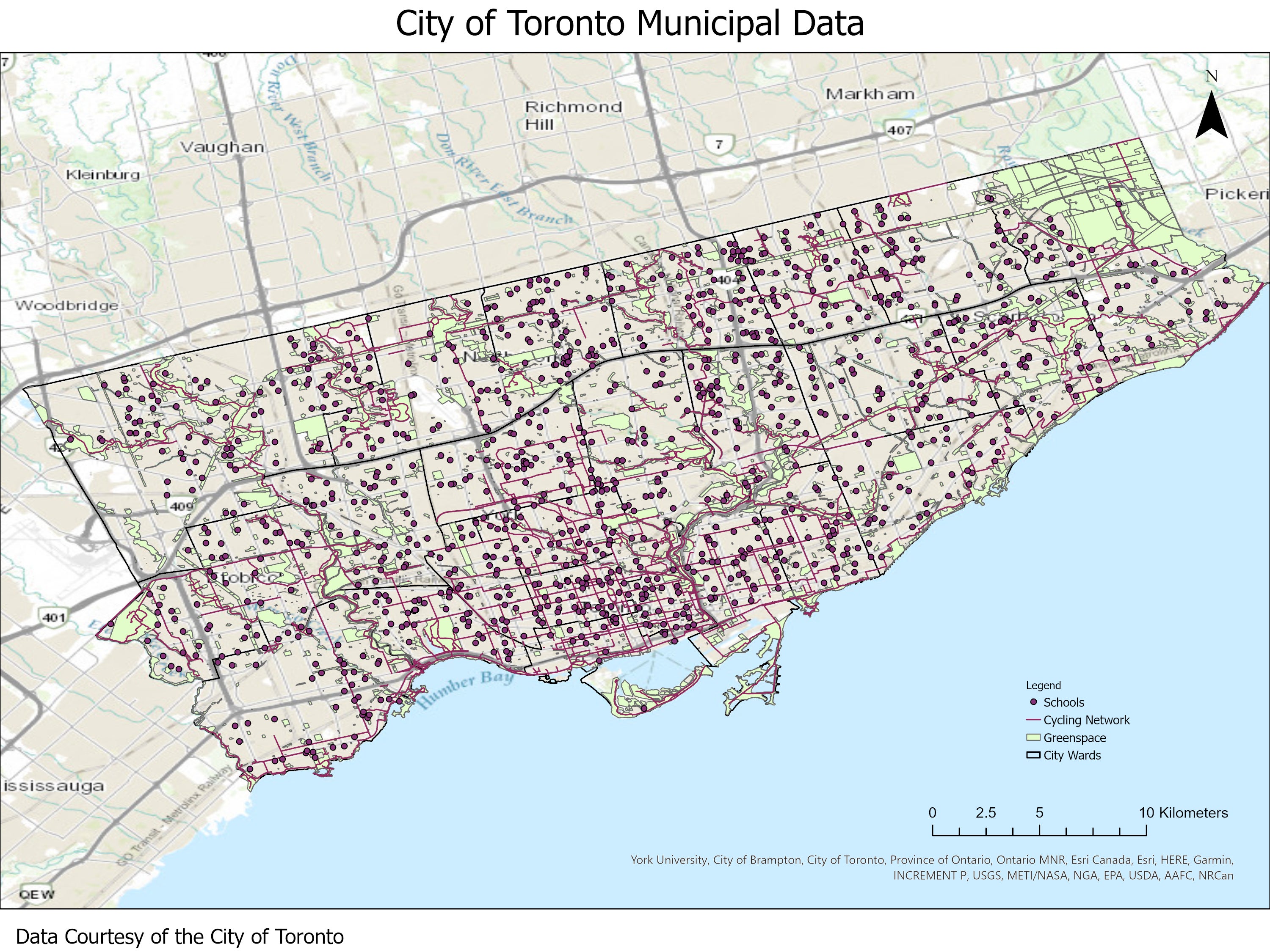
Sample views of the data