Description
2013 orthoimagery was received February 2014 from the Geospatial Competency Centre, Mapping Services, City of Toronto. Imagery covers the entire City of Toronto and consists of 3,018 tiles each covering an area of 0.5 km2, with an image resolution of 6 cm ground pixel.
Extent of orthoimagery
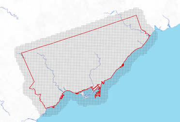
A detailed index (PDF) provides the four digit identifying number for each .5 km tile.
Spatial reference and data type
Coordinate system for these georeferenced tiled orthos is Modified Transfer Mercator (MTM) zone 10, North American Datum (NAD) 27. They are stored as compressed MrSID data files, with accompanying Sid World (SDW) files. Average file size for each tile is 52 MB, and the entire set is 102 GB.
Data access
To request this data, please fill out the Ask-Us form and include which layers (shapefiles) you are interested in obtaining. The dataset will be shared with you via OneDrive upon completion of the data release agreement form. You may also make an in-person appointment using the same form.
Use restrictions/licensing/copyright
These data are provided for personal use for academic, research, and/or teaching purposes. A data release agreement must be agreed to before these licensed data can be released. The City of Toronto Geospatial Competency Centre must be acknowledged on any derivative product, whether printed or electronic, including for example, a printed map, a raster or vector graphic, a web-based application, etc. Patrons are advised to fully respect the provisions of Canada's Copyright Act as well as terms and conditions imposed by the data provider.
Citation
2013 orthoimagery [computer file], Geospatial Competency Centre, Mapping Services, City of Toronto, Ontario 2013
Sample image: 6cm resolution
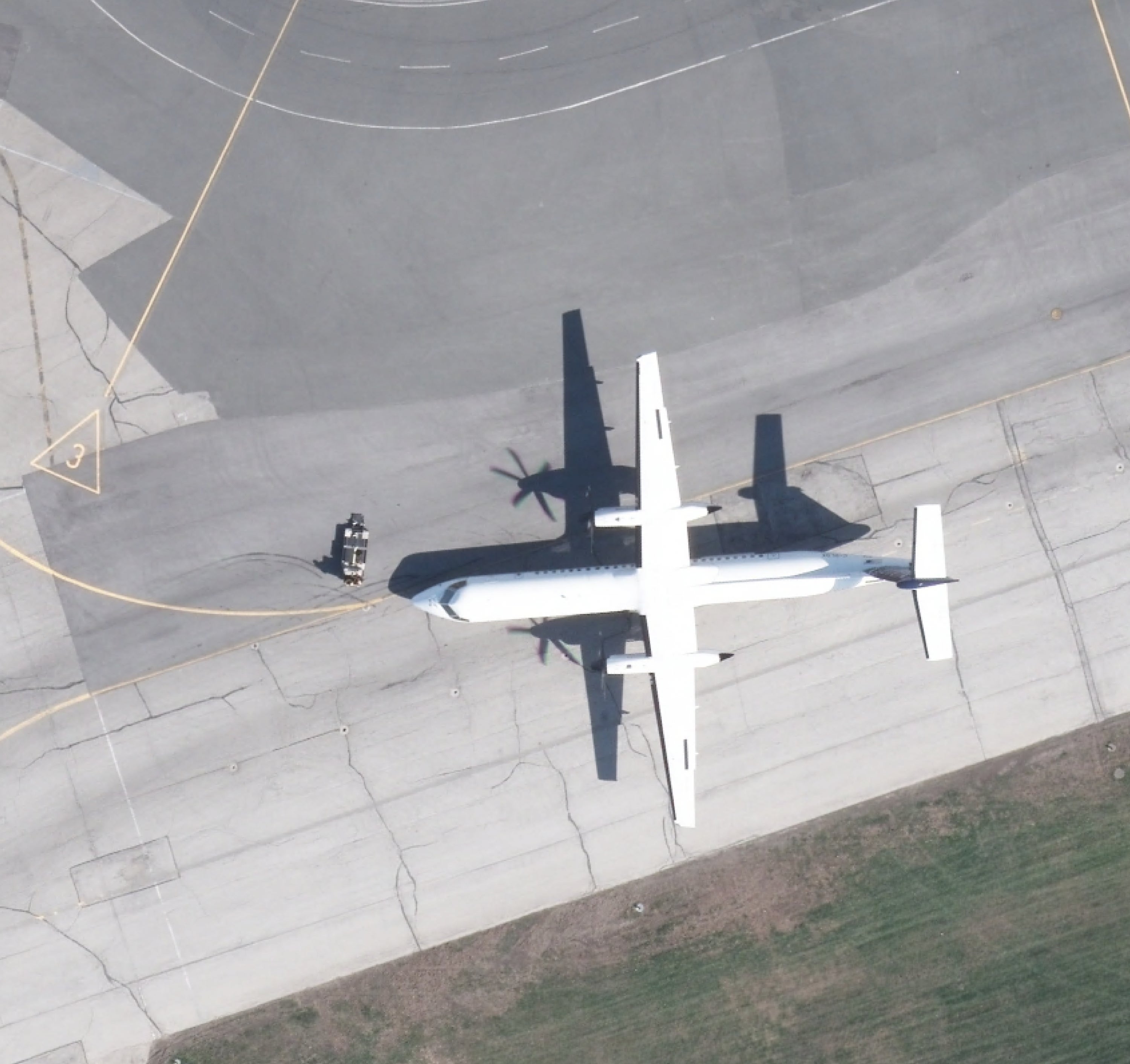
Data courtesy of the Geospatial Competency Centre, City of Toronto