Description
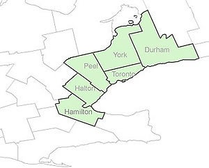
These digital orthoimages provide full-colour aerial coverage of the Regions of Durham, York, Peel and Halton, the City of Toronto and the City of Hamilton. These images were flown in April 2005 by First Base Solutions. The resolution of these images is 20 cm.
Spatial reference and data type
These georeferenced images are available in Universal Transverse Mercator (UTM) coordinates; horizontal datum is North American Datum (NAD) 83. They are stored as compressed MrSID data files, with accompanying Sid World (SDW) files. MrSID mosaics are available for each of the lower tier municipalities in the regions of Durham, Halton, York and Peel. The cities of Toronto and Hamilton are both divided into three sectional areas; MrSID mosaics are available for each sectional area.
Data access
To request this data, please fill out the Ask-Us form and include which layers (shapefiles) you are interested in obtaining. The dataset will be shared with you via OneDrive upon completion of the data release agreement form. You may also make an in-person appointment using the same form.
Use restrictions/licensing/copyright
These data are provided for personal use for academic, research, and/or teaching purposes. A data release agreement must be agreed to before these licensed data can be released. The Ministry of Natural Resources must be acknowledged on any derivative product, whether printed or electronic, including, for example, a printed map, a raster or vector graphic, a web-based application, etc. Patrons are advised to fully respect the provisions of Canada's Copyright Act as well as the terms and conditions imposed by the data provider.
Citation
Greater Toronto Area: orthoimagery 2005 [computer file]. Toronto, Ontario: The Ontario Ministry of Natural Resources, [2005].
Sample view of the data
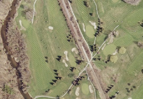
Data courtesy of Ontario Ministry of Natural Resources