Data access
Full access to our resources is available to current students, faculty, and staff of the University of Waterloo. To request access, please complete the Ask-Us form indicating the specific layers (shapefiles) you require. Upon completion of the data release agreement form, the dataset will be provided to you via OneDrive.
In-person consultations may also be requested through the Ask-Us form.
Description
This data resource is provided by the Ontario Geological Survey and shows general bedrock (iron formations, kimberlites, dikes, etc.) and quaternary geology (dunes, hummocky terrain, etc.) for all of Ontario. This represents data collected from 1950-2020. A more in-depth level of data is provided for select 1:50,000 NTS map sheet areas; 40p1, 40p2, and 40p7-10. This level of data contains information on specific primary material, secondary material, veneer, carbon content, age, provenance, and formation.
This physiography data covers Southern Ontario and is based on the Chapman and Putnam survey of the 1950s, with minor revisions in 1984. For more information please consult the book entitled: The Physiography of Southern Ontario by L J Chapman and D F Putnam, 3rd edition (Toronto, 1984) located in the Geospatial Centre, G3461.C5 svar P7x no. P-2715).
- Specific Gravity 2018
- Quaternary Geology 2005
- Lake Geochemistry of Ontario (compilation) 2020
- Geochronology Inventory of Ontario (compilation) 2019
- Karst of Southern Ontario 2008
- Index to Aggregate Resources 2021
- Bedrock Geology 2021
- Aggregate Resources of Ontario (compilation) 2021
- Mineral Deposits (MDI) 2021
- Mining Claims 2021
- Geophysical Dataset Index 2021
- Abandoned Mines 2018
- Surficial Geology 2020
- Physiography 2007
Spatial reference and data type
These data sets are available in Universal Transverse Mercator (UTM) co-ordinates; horizontal datum is North American Datum (NAD) 83. These data are stored as Esri shapefiles. Other data formats can be accommodated, as the Geospatial Centre has access to a number of conversion utilities.
Use restrictions/licensing/copyright
This material is provided for academic, research, teaching, and personal use only. A data release agreement must be agreed to before the data is delivered. The Ontario Geologic Survey should be acknowledged on any derivative product, such as a map or an image.
Citation
Ontario Geologic Survey [computer file]. Toronto, Ontario: Ontario Geologic Survey, [1997].
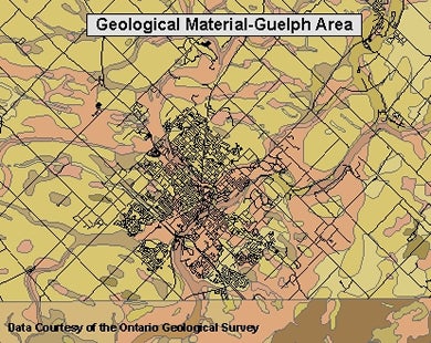
Sample view of the data