Data access
Full access to our resources is available to current students, faculty, and staff of the University of Waterloo. To request access, please complete the Ask-Us form indicating the specific layers (shapefiles) you require. Upon completion of the data release agreement form, the dataset will be provided to you via OneDrive.
In-person consultations may also be requested through the Ask-Us form.
Description
This data resource is provided by the Ontario Ministry of Agriculture, Food, and Rural Affairs. This data was provided by Agriculture Canada, and covers the areas of Brant, Oxford, Perth, Waterloo, Wellington, and Wentworth counties. The attribute table shows soil type, drainage (well drained, poorly drained), and Canada Land Inventory code. An online map is available to view more recent layers: https://www.lioapplications.lrc.gov.on.ca/AgMaps/Index.html?viewer=AgMaps.AgMaps&locale=en-CA
Spatial reference and data type
These data sets are available in Universal Transverse Mercator (UTM) co-ordinates; horizontal datum is North American Datum (NAD) 27. These data are stored as Esri shapefiles. Other data formats can be accommodated, as the Geospatial Centre has access to a number of conversion utilities.
Use restrictions/licensing/copyright
This material is provided for academic, research, teaching, and personal use only. A data release agreement must be agreed to before the data is delivered. The Ontario Ministry of Agriculture, Food, and Rural Affairs should be acknowledged on any derivative product, such as a map or an image.
Citation
Soil types of Ontario [computer file]. Guelph, Ontario: Ontario Ministry of Agriculture, Food, and Rural Affairs, [2003].
Sample view of the data
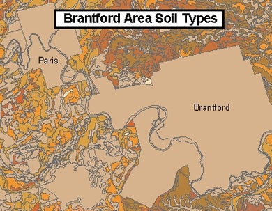
Data courtesy of the Ontario Ministry of Agriculture, Food, and Rural Affairs