Data access
Full access to our resources is available to current students, faculty, and staff of the University of Waterloo. To request access, please complete the Ask-Us form indicating the specific layers (shapefiles) you require. Upon completion of the data release agreement form, the dataset will be provided to you via OneDrive.
In-person consultations may also be requested through the Ask-Us form.
Description
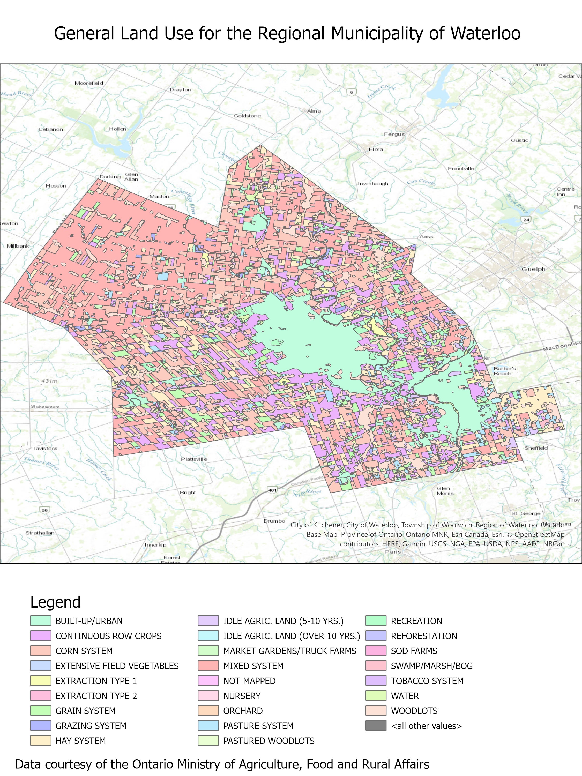
This data resource, provided by the Ontario Ministry of Agriculture, Food, and Rural Affairs (OMAFRA) provides agricultural-type land use. Classifications include agricultural farming such as field vegetables, corn, grain, tobacco, sod, as well as other uses such as recreation, nursery, pastured woodlots and more. The data set was originally received in 2006 and consisted of one shape file that covered most of Southern Ontario.
On April 5, 2010 the Geospatial Centre received the same data set that is expanded to cover all of Southern Ontario. Agricultural Land Use file that Land Information Ontario that covers all of Southern Ontario.
Land use systems in this data set are defined as:
Field crop system: continuous row crops, corn system, mixed system (rotation of grain, corn or beans, and hay), grain system, hay system, pasture system, and grazing system
Fruit and grape system: orchard
Speciality agriculture: extensive field vegetables, market gardens/truck farms, tobacco system, nursery
Non-System land uses: idle agricultural land (5-10 years), idle agricultural land (over 10 years), woodland/lots, pastured woodland/lots, reforestation, built-up/urban, swamp/marsh/bog, extraction1 (pits and quarries), extraction2 (topsoil removal), sod farms, recreation, water
The resource includes the following land use data:
- Built up/urban
- Continuous row crops
- Corn system
- Extensive field vegetables
- Extraction type 1 and 2
- Grain system
- Grazing system
- Hay system
- Idle agriculture land (5-10 years)
- Idle agriculture land (over 10 years)
- Market gardens/ truck farms
- Mixed system
- Nursery
- Orchard
- Pasture system
- Pastured woodlots
- Recreation
- Reforestation
- Sod farms
- Swamp/marsh/bog
- Tobacco system
- Water
- Woodlots
Spatial reference and data type
These data sets are available in geographic (lat/long) coordinates; horizontal datum is North American Datum (NAD) 83, zone 17. These data are stored as Esri shapefiles. Other data formats can be accommodated, as the Geospatial Centre has access to a number of conversion utilities.
Use restrictions/licensing/copyright
This material is provided for academic, research, teaching, and personal use only. A data release agreement must be agreed to before the data is delivered. The Ontario Ministry of Agriculture, Food, and Rural Affairs should be acknowledged on any derivative product, such as a map or an image.
Citation
OMAFRA: Land Use [computer file]. Ontario Ministry of Agriculture, Food, and Rural Affairs, [1983].
Sample view of the data