Data access
Full access to our resources is available to current students, faculty, and staff of the University of Waterloo. To request access, please complete the Ask-Us form indicating the specific layers (shapefiles) you require. Upon completion of the data release agreement form, the dataset will be provided to you via OneDrive.
In-person consultations may also be requested through the Ask-Us form.
Description
This vector data resource provides topographic and planning information for the area encompassed by the City of Guelph. This information was provided to the Geospatial Centre by the City of Guelph in October 2006, 2011, 2014 and 2018. More recent data is available from the Guelph Open Data site. For your convenience, 2024 and 2026 has already been downloaded.
Included are the following coverages:
- Address points
- Bike facilities
- Building footprints
- Bus routes and stops
- Child care
- City Boundary
- City facilities
- Community Gardens
- Contours (5 metre interval)
- Donation Bins
- Double line street network
- EMS locations
- Fire hydrants
- Fire stations
- Guelph areas
- Guelph Lake
- Health services
- Hydrants
- Hydrology
- Landmarks: educational, recreational, municipal services
- Parking lot points
- Parks and park names
- Places of worship
- Police station
- Program locations
- Property lines
- Registered plans
- Restrooms
- Schools
- Sidewalks
- Single line street network with street names
- Solid waste collection days
- Sports fields
- Stormwater management pond
- Street centrelines
- Street intersections
- Streets
- Termite data
- Trails
- Tree inventory
- Wards
- Watercourse polygons
- Zoning 1995 & 2023
Spatial reference and data type
These data sets are available in Universal Transverse Mercator (UTM) co-ordinates; horizontal datum is North American Datum (NAD) 83. These data are stored as Esri shapefiles. Other data formats can be accommodated, as the Geospatial Centre has access to a number of conversion utilities.
Use restrictions/licensing/copyright
These data are provided for personal use for academic, research, and/or teaching purposes. A data release agreement must be agreed to before these licensed data can be released. The City of Guelph must be acknowledged on any derivative product, whether printed or electronic, including for example, a printed map, a raster or vector graphic, a web-based application, etc. Patrons are advised to fully respect the provisions of Canada's Copyright Act as well as terms and conditions imposed by the data provider.
Citation
The City of Guelph Municipal Data [computer file]. Guelph, Ontario: The City of Guelph Department of Information and Technology Services, [2014].
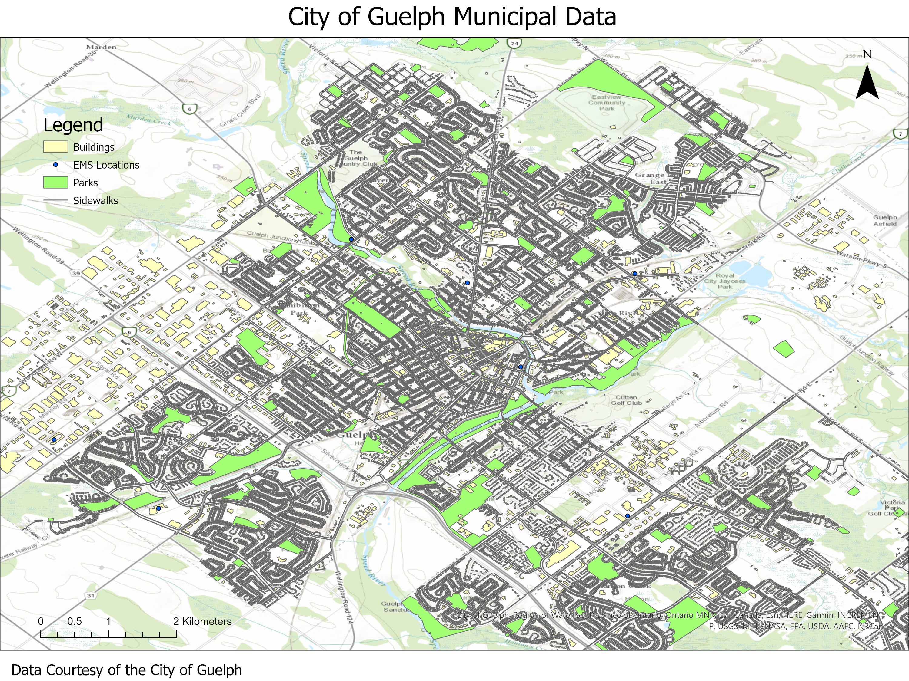
Sample view of the data