Data access
Full access to our resources is available to current students, faculty, and staff of the University of Waterloo. To request access, please complete the Ask-Us form indicating the specific layers (shapefiles) you require. Upon completion of the data release agreement form, the dataset will be provided to you via OneDrive.
In-person consultations may also be requested through the Ask-Us form.
Description
This vector data resource provides topographic and planning information for the City of London, Ontario. This data was delivered to the Library by the City of London in 2003 with updates and additional features received thereafter up until 2024.
Further municipal data updates for the City of London are available on-line through Scholars GeoPortal:http://geo2.scholarsportal.info/ as well as the City of London Open Data Site.
This resource includes the following vector coverages:
- access way
- addresses
- assessment parcels
- airports
- bicycle routes
- billboards (freestanding)
- bridges
- buildings
- catch basins
- city boundary
- contours (1 metre interval)
- contours (5 metre interval)
- culverts
- dock/wharf
- double line/ street network (2003)
- electrical substation
- electrical tower
- emergency services
- falls
- fences
- flow arrows
- golf courses
- hedge rows
- heritage parcels
- manholes
- marsh/ fens
- mast
- overhead walkway
- Parcels
- Parks
- pipeline (above ground)
- property parcels
- parking lots
- petroleum tank
- piles
- pits
- public swimming pools
- racetrack
- railway line
- rapids
- retaining walls
- rivers/ streams
- roads
- runway (airport)
- settling basins
- sewer pipes
- shoreline
- sidewalks
- speed limits
- steps
- single line street network
- spot heights
- street names
- tanks
- towers (hydro)
- trails
- transmission lines
- trees/ wooded areas/ vegetation
- utility poles
- vacant land
- walkways
- walls
- water
- zoning areas
Spatial reference and data type
This data set is available in Universal Transverse Mercator (UTM) co-ordinates; horizontal datum is North American Datum (NAD) 83 UTM zone 17. Data are stored as Esri shapefiles. Other data formats can be accommodated, as the Geospatial Centre has access to a number of conversion utilities.
Use restrictions/licensing/copyright
These data are provided for personal use for academic, research, and/or teaching purposes. A data release agreement must be agreed to before these licensed data can be released. The City of London must be acknowledged on any derivative product, whether printed or electronic, including for example, a printed map, a raster or vector graphic, a web-based application, etc. Patrons are advised to fully respect the provisions of Canada's Copyright Act as well as terms and conditions imposed by the data provider.
Citation
The City of London Municipal Data [computer file]. London, Ontario: The City of London, [2013].
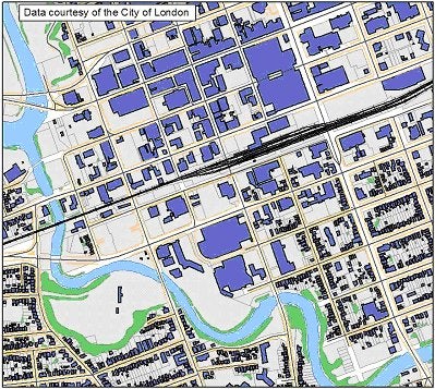
Sample view of the data