Data access
Full access to our resources is available to current students, faculty, and staff of the University of Waterloo. To request access, please complete the Ask-Us form indicating the specific layers (shapefiles) you require. Upon completion of the data release agreement form, the dataset will be provided to you via OneDrive.
In-person consultations may also be requested through the Ask-Us form.
Description
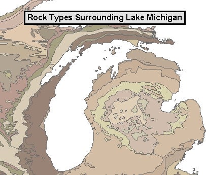
This data resource, the "Geology of the Conterminous United States at 1:2,500,000 Scale--A Digital Representation of the 1974 P.B. King and H.M. Beikman Map" is provided by the USGS. This information focuses on rock and soil type, as well as glaciation period and other geological features. Interactive mapping and other soil related datasets are available from:https://websoilsurvey.sc.egov.usda.gov/App/HomePage.htm,
Spatial reference and data type
These data sets are available in geographic co-ordinates; horizontal datum is North American Datum (NAD) 27. These data are stored as Architects Data File (ADF) and PDF files. Other data formats can be accommodated, as the Geospatial Centre has access to a number of conversion utilities.
Use restrictions/licensing/copyright
This material is provided for academic, research, teaching, and personal use only. A data release agreement must be signed before the data is delivered. USGS should be acknowledged on any derivative product, such as a map or an image.
Citation
Geology of the Conterminous United States [computer file]. Denver, CO.: The United States Geological Survey, 1974.
Sample view of the data