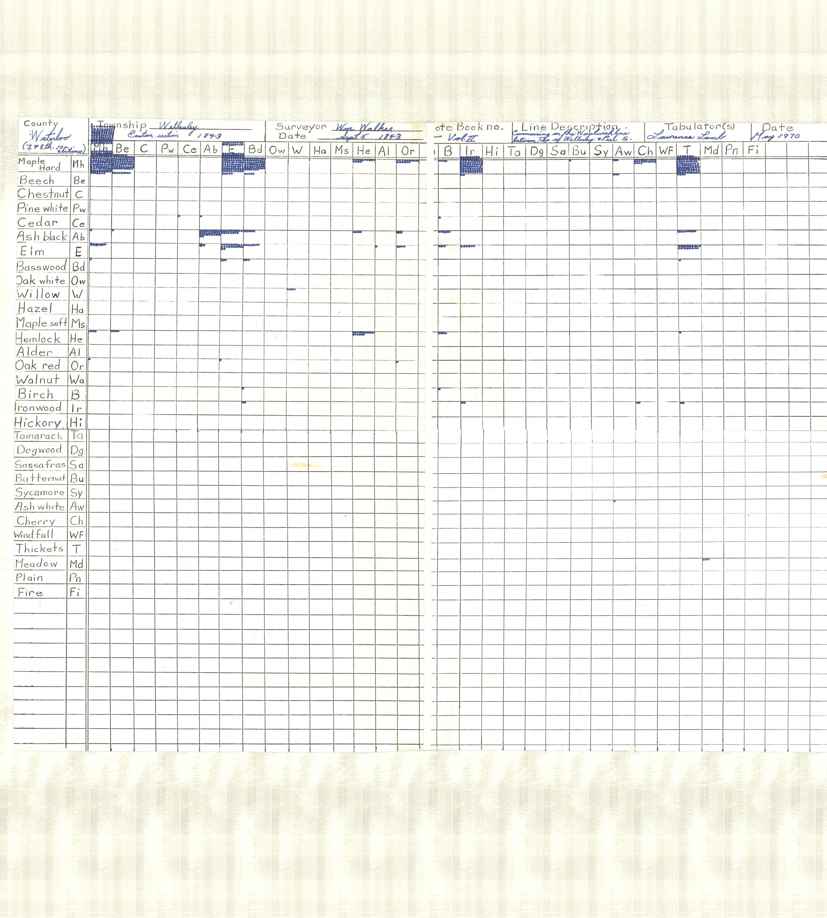
Description
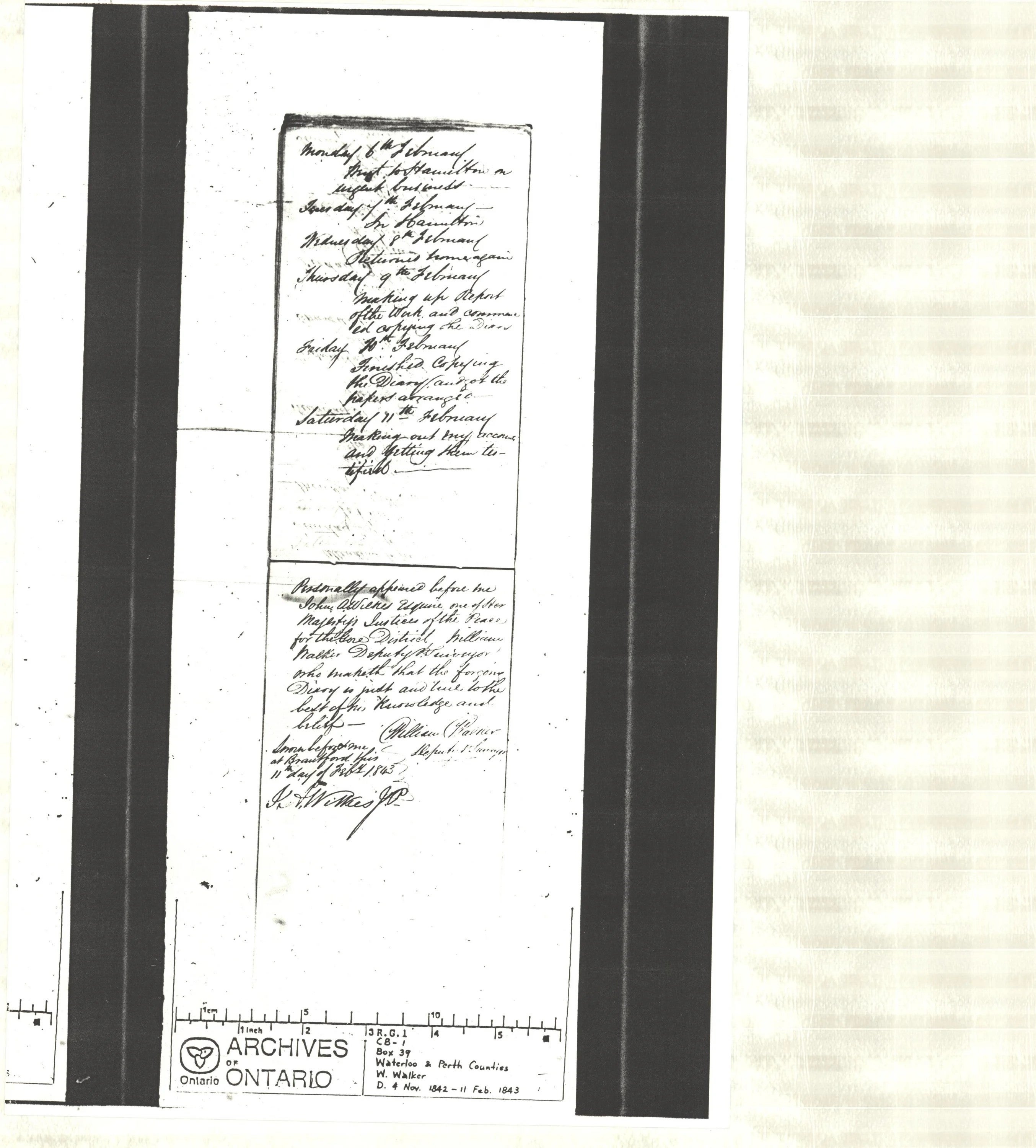
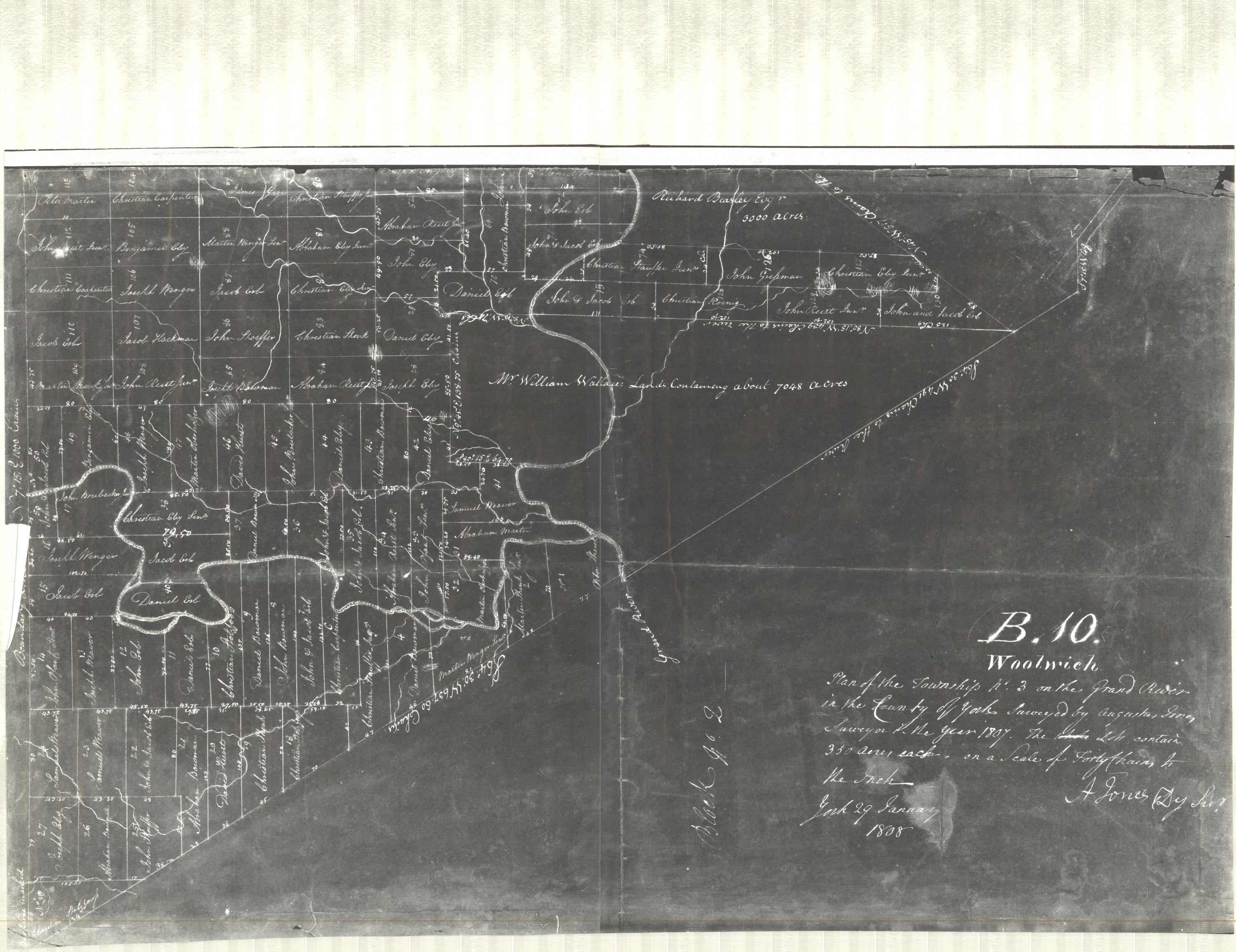
During settlement of Upper Canada (now Southern Ontario) from 1784 to 1859, land surveys were conducted along transects at one mile intervals. These hand-written notes and a few maps are housed in various locations in Ontario and have been used only sparsely in modern research. This information is applicable as a pre-European settlement baseline in such fields as, land-use and heritage planning, forestry, archaeology, and agriculture. Though early survey data (ESD) exhibit deficiencies and surveyor bias, they comprise a unique source of spatial environmental data that is best suited to large-scale resolution studies. Only a few researchers have generated pre-settlement vegetation maps from ESD, each using independent methodologies.
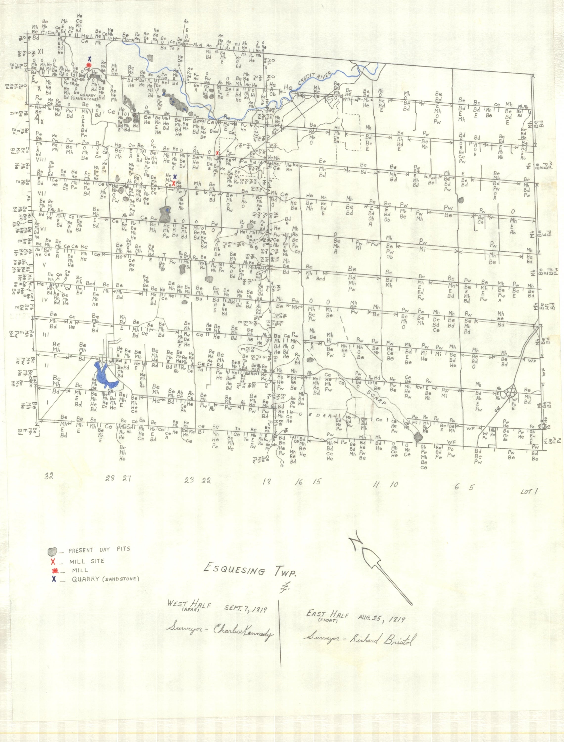
Pre-settlement vegetation map: Esquesing township:
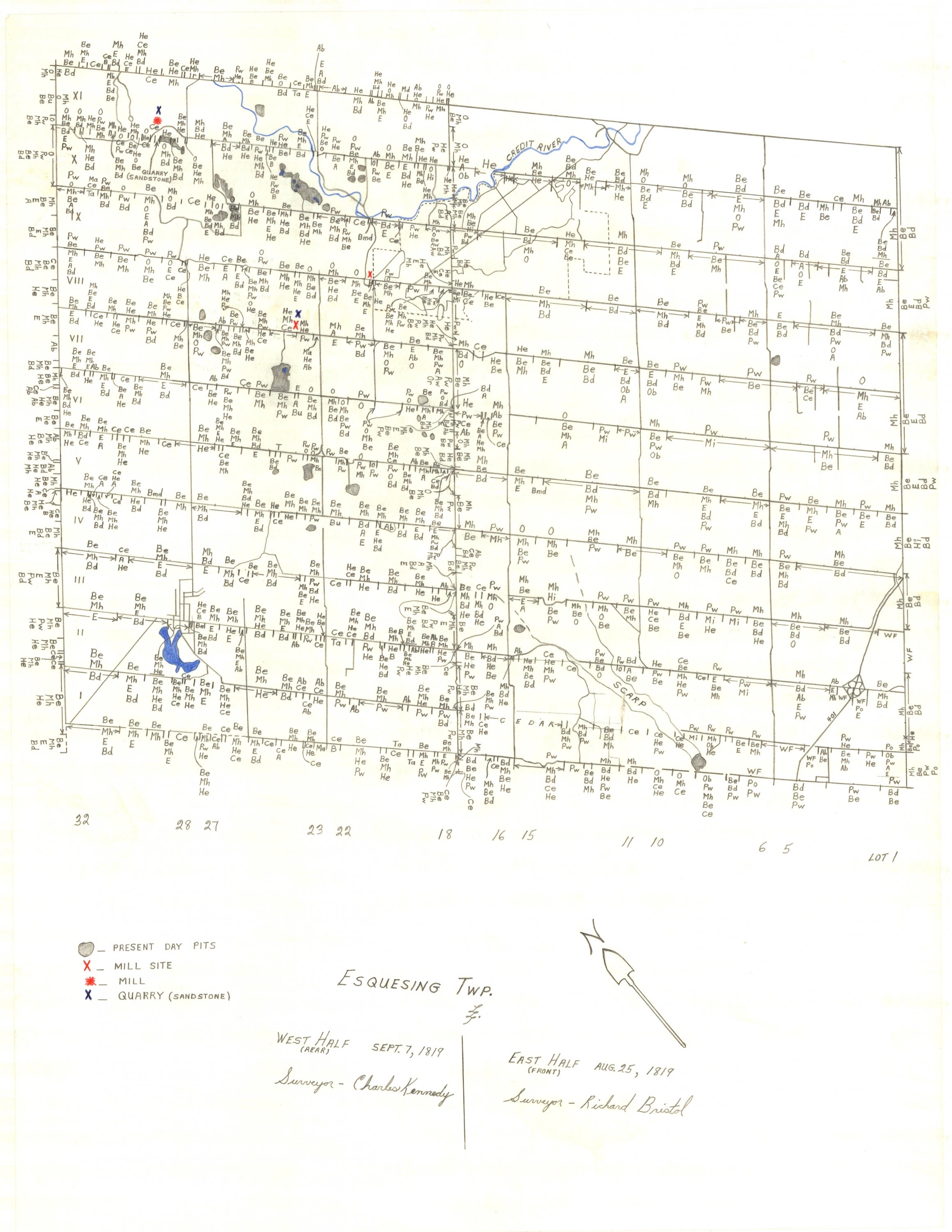
| acronym/ full name | acronym/ full name | acronym/ full name | acronym/ full name |
|---|---|---|---|
| Ab: Ash Black | Ce: Cedar | Mh: Maple Hard | T: Thickets |
| Al: Alder | Ch: Cherry | Ms: Maple Soft | Ta: Tamarack |
| Aw: Ash White | Dg: Dogwood | Md: Meadow | Th:Thorn |
| B: Birch | E: Elm | Ms: Maple Soft | W: Willow |
| Bd: Basswood | Ha: Hazel | Ow: Oak White | Wa: Walnut |
| Be: Beech | He: Hemlock | Pw: Pine White | Wf: Windfall |
| Bu: Butternut | Hi: Hickory | Sa: Sassafras | |
| C: Chestnut | Ir: Ironwood | Sy: Sycamore |
Data access
As listed on this master_inventory list (PDF) the Geospatial Centre's historical vegetation collection contains surveyor notes (JPG), pre-settlement vegetation maps (JPG), photo negatives of surveyor maps (JPG) and tabulation tables (JPG) .
The historical vegetation collection is freely available for researchers to view or copy during regular business hours.
Citation
Seneca township vegetation: James Kirkpatrick (surveyor) 1842.
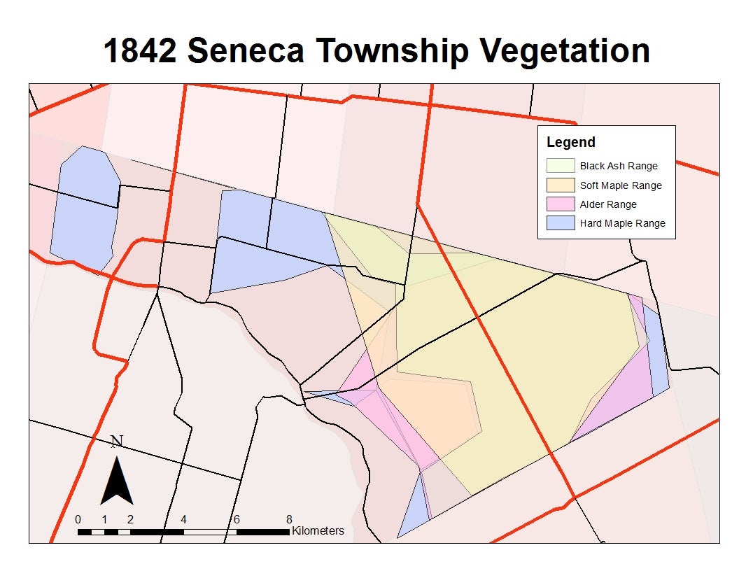
Data courtesy of James Kirkpatrick {surveyor}