Data access
Access to interactive map and files can be accessed by registering online through the LandScan website.
Full access to our resources is available to current students, faculty, and staff of the University of Waterloo. To request access, please complete the Ask-Us form indicating the specific layers (shapefiles) you require. Upon completion of the data release agreement form, the dataset will be provided to you via OneDrive.
In-person consultations may also be requested through the Ask-Us form.
Description
The LandScan global population database features the highest-accuracy population data available on the market and was developed at the United States Department of Energy’s Oak Ridge National Laboratory. The population data is broken down into three levels:
- countries
- first-level administrative boundaries (i.e. provinces, states)
- square-kilometre cells
This dataset has a wide range of applications across numerous fields, including business, planning, health and humanitarianism, and more. Currently, available population data ranges from 2000 to 2019.
Spatial reference and data type
Data projection coordinates are Geographic, World Geodetic System (WGS) 84. The LandScan products include raw data files in raster format as well as a cloud-based web mapping service (WMS). Both the raw data files as well as the cloud-based web mapping service (WMS) can be used with Geographic Information System (GIS) software.
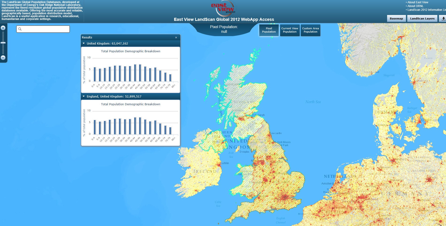
Sample data from web mapping service (WMS):
Use restrictions/licensing/copyright
These data are provided for personal use for academic, research, and/or teaching purposes. A data release agreement must be agreed to before these licensed data can be released. The United States Department of Energy's Oak Ridge National Laboratory must be acknowledged on any derivative product, whether printed or electronic, including for example, a printed map, a raster or vector graphic, a web-based application, etc. Patrons are advised to fully respect the provisions of Canada's Copyright Act as well as terms and conditions imposed by the data provider.
Citation
LandScan global population database [computer file]: United States Department of Energy's Oak Ridge Laboratory, [2014].
Sample view of the data:
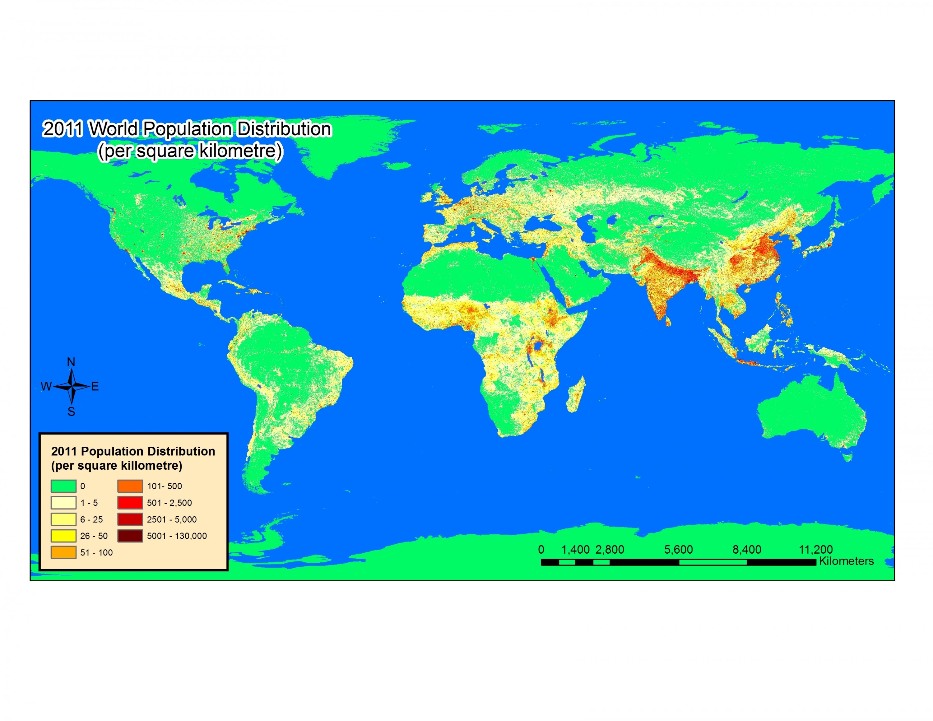
Data courtesy of the United States Department of Energy's Oak Ridge Laboratory