Description
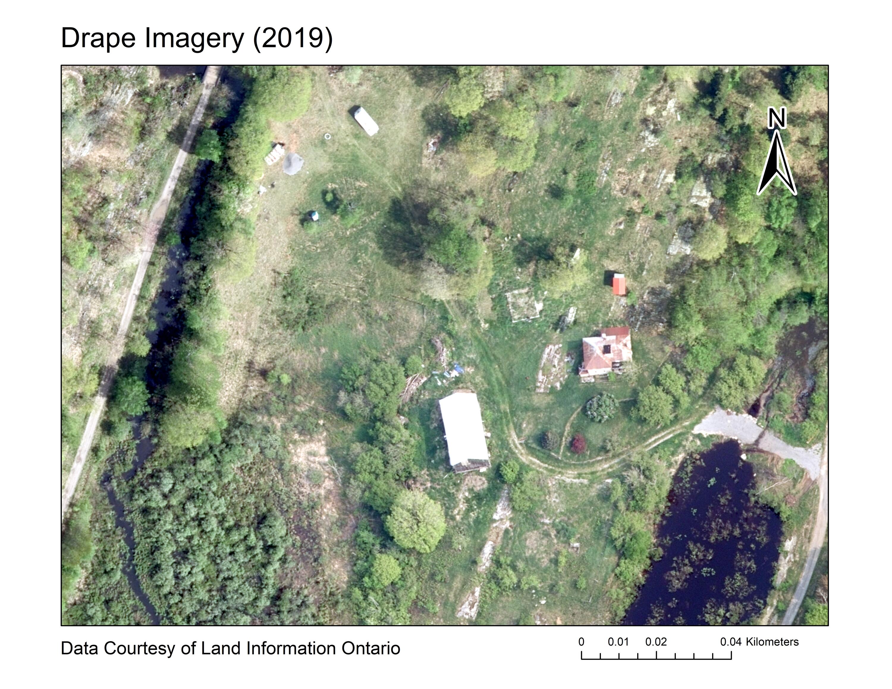
Received from Land Information Ontario (LIO), 2019 imagery for the Digital Raster Acquisition Project for the East (DRAPE). These orthorectified images have been captured from aircraft because of the ability to obtain high-resolution products over a large area. Orthophotos are captured during spring under the best conditions possible to achieve cloud free, snow-free, ice-free, smoke-free, and leaf-off conditions. Using the ADS80 Leica digital camera, these true colour orthophotos have a pixel resolution of 16cm and are accurate to 45 cm at 95% confidence level.
When the entire data set has been received from LIO, Scholars GeoPortal will also make DRAPE 2019 available via the GeoPortal.
Spatial reference and data type
These georeference images are available in Universal Transverse Mercator (UTM) coordinates; horizontal datum is North American Datum (NAD). Data is stored as 16 cm true colour 1km x 1km Tiff tiles. The average file size for 1km tiles is 152 mb.
Data access
In order to access these data sets, please visit the Geospatial Centre Reference Desk during reference hours. Library reference staff are available to provide further information about these data sets and to deliver data upon request. Under the terms of the Library's license agreement, these data sets are for use by students, faculty, and staff at the University of Waterloo only.
Data manipulation and storage
There are public workstations in the Geospatial Centre that provide access to ArcGIS and software programs, program extensions and data manipulation utilities. Patrons may use the Geographic Information System (GIS) and image processing software in the library to view and manipulate the data. UWaterloo faculty, students and staff may copy these data to other media (for example: CD, DVD or Zip disc) for use elsewhere.
Data output
These images may be exported from ArcGIS in a choice of bitmapped formats (also known as raster graphics) including JPG, TIFF, GIF, and BMP or in a choice of vector graphics formats including Adobe Illustrator (AI), Encapsulated Postscript (EPS), and Scalable Vector Graphics (SVG). Yet another option is PDF. The user defines the output resolution.
Use restrictions/licensing/copyright
These data are provided for personal use for academic, research, and/or teaching purposes. Library staff will ask patrons to read and sign a data release agreement before these licensed data can be released. Land Information Ontario must be acknowledged on any derivative product, whether printed or electronic, including, for example, a printed map, a raster or vector graphic, a web-based application, etc. Patrons are advised to fully respect the provisions of Canada's Copyright Act as well as the terms and conditions imposed by the data provider.
Citation
DRAPE : Orthoimagery 2019 [computer file]. Land Information Ontario.
Sample view of the data