Data access
Full access to our resources is available to current students, faculty, and staff of the University of Waterloo. To request access, please complete the Ask-Us form indicating the specific layers (shapefiles) you require. Upon completion of the data release agreement form, the dataset will be provided to you via OneDrive.
In-person consultations may also be requested through the Ask-Us form.
Description
This data resource provides hydrologic and water management information for the Grand River watershed. The watershed extends from the headwaters of the Grand River near Luther Marsh Reservoir to the mouth of the Grand River at Port Maitland on Lake Erie. This information is provided to the Library by the Grand River Conservation Authority (GRCA), however many of these layers are also available for download from the Grand River Information Network. The resource includes the following vector and raster grid data sets.
GRCA vector data
- 2 m contours
- Aquifers
- Cross sections
- Dams
- Dynamic Beach Lake Erie
- Ecoregions
- Erosion Hazards
- Flood Hazards
- Flood Zones
- Floodplain Mapping
- Floodplains
- Flow Gauges
- Forest Management Compartments
- GRCA Parks
- GW (Depth Water Table, Discharge Area, Potentiometric Surface, Vertical Head Difference, Water Table Observed)
- Hydrologic Response Unit
- Lake Erie Flood Hazard
- Lake Erie Shoreline Erosion Hazard
- Land Cover 1999
- Land Cover 2017
- Municipal Boundaries
- Nature Centres
- Official watershed boundaries
- Conservation lands
- Parks
- Poorly-drained Soils
- Properties
- Rail Trail
- Rain Gauges
- Recharge
- Registered Schedule Areas
- Regulation Limit
- Regulatory Limit
- River Slopes
- River Slopes Erosion Allowance
- River Valley Slopes
- River Watch Sites
- Sewage Treatment Plants
- Shoreline Reach
- Slope Erosion Hazard
- Snow Course Sample Sites
- Subcatchments Basins
- Virtual drainage
- Water Flow Gauges
- Water Quality Gauges
- Water Quality Site
- Waterbody
- Watercourse
- Watershed Boundary Jurisdiction
- Wells
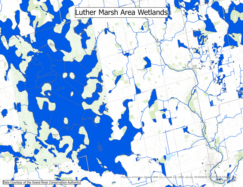
- Wetlands
Source Water Protection (SWP)
- Event Based Area
- Event Cross Tab
- Highly Vulnerable Aquifer
- Impervious Surface Area
- Intake IPZ (Intake Protection Zones) CrossTab
- Intake Water Quantity Zone
- Intrinsic Vulnerability Refined
- Intrinsic Vulnerability Regional
- IPZ (Intake Protection Zones) Vulnerability Scoring
- Issue ICS (Incident Command System) Table
- Issue Contributing Area
- Managed Lands Livestock Density
- Significant Groundwater Recharge Area
- Surface Water IPZ (Intake Protection Zones)
- Surface Water Intake
- Transport Pathway
- Watersheds
- Well
- Well ICA (Intrinsic Susceptibility Assessment) CrossTab
- Wellhead Protection Area Zone
- Wellhead Water Quantity Zone
- WHPA (Wellhead Protection Area) GUDI (Groundwater Under the Direct Influence) Vulnerability Scoring
- WHPA (Wellhead Protection Area) Vulnerability Scoring
- WHPA (Wellhead Protection Area) Well CrossTab
GRCA raster grid data
- Depth to bedrock
- Ground surface
- Overburden thickness
- Sand and gravel thickness
- Water table
- Potentiometric surface
- Vertical hydraulic gradient
- Depth to water table
- Depth to first aquifer
- Registered schedule areas
- Vulnerability to contamination
- Discharge area
- Land cover (data from 1999)
Spatial reference and data type
These data sets are available in Universal Transverse Mercator (UTM) co-ordinates; horizontal datum is North American Datum (NAD) 83. These data are stored as Esri shapefiles.
Use restrictions/licensing/copyright
These data are provided for personal use for academic, research, and/or teaching purposes. A data release agreement must be agreed to before these licensed data can be released. The Grand River Conservation Authority must be acknowledged on any derivative product, whether printed or electronic, including for example, a printed map, a raster or vector graphic, a web-based application, etc. Patrons are advised to fully respect the provisions of Canada's Copyright Act as well as terms and conditions imposed by the data provider.
Citation
Grand River Watershed data [computer file]. Cambridge, Ontario: Grand River Conservation Authority, 2021.
Sample view of the data