Data access
Full access to our resources is available to current students, faculty, and staff of the University of Waterloo. To request access, please complete the Ask-Us form indicating the specific layers (shapefiles) you require. Upon completion of the data release agreement form, the dataset will be provided to you via OneDrive.
In-person consultations may also be requested through the Ask-Us form.
Description
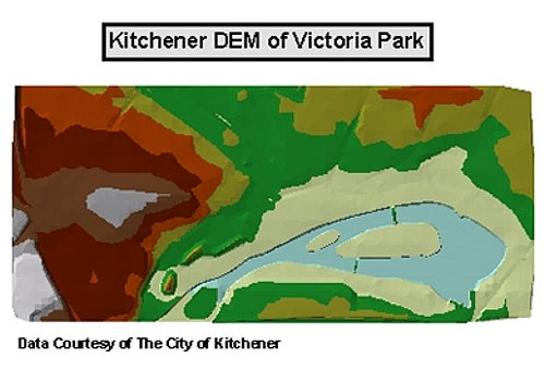
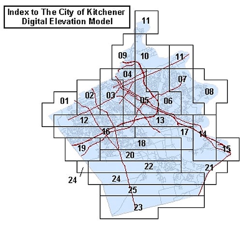
This data resource consists of irregularly-spaced elevation points for the City of Kitchener. This data can be used to create 3 dimensional surfaces for use in elevation and ground surface studies. This data is provided by the City of Kitchener as a series of tiles. An index to these tiles is provided below. Available years: 2011, 2013, and from Ministry of Natural Resources, 2015.
Spatial reference and data type
This data set is available in Universal Transverse Mercator (UTM) co-ordinates; horizontal datum is North American Datum (NAD) 83. These data are stored as Esri shapefiles. Other data formats can be accommodated, as the Geospatial Centre has access to a number of conversion utilities.
Use restrictions/licensing/copyright
These data are provided for personal use for academic, research, and/or teaching purposes. A data release agreement must be agreed to before these licensed data can be released. The City of Kitchener must be acknowledged on any derivative product, whether printed or electronic, including for example, a printed map, a raster or vector graphic, a web-based application, etc. Patrons are advised to fully respect the provisions of Canada's Copyright Act as well as terms and conditions imposed by the data provider.
Citation
The City of Kitchener Digital Elevation Model [computer file]. Kitchener, Ontario: City of Kitchener Department of Information Services, [2015].
Sample view of the data