Data access
Full access to our resources is available to current students, faculty, and staff of the University of Waterloo. To request access, please complete the Ask-Us form indicating the specific layers (shapefiles) you require. Upon completion of the data release agreement form, the dataset will be provided to you via OneDrive.
In-person consultations may also be requested through the Ask-Us form.
Description
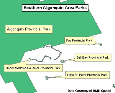
CanMap Parks is a geospatial database of 1,500 national, provincial and territorial parks across Canada. This resource is provided by DMTI Spatial. The data is current to 20235 Included in this data resource are attributes such as boundaries, park names, classifications, and types. Please visit the DMTI Spatial web resource for more information.A file name index (PDF) and data dictionary (PDF) have been prepared to aid users in navigating through DMTI folders and products.
Spatial reference and data type
This data set is available in geographic (lat/long) co-ordinates; horizontal datum is North American Datum (NAD) 83. These data are stored as Esri shapefiles. Other data formats can be accommodated, as the Geospatial Centre has access to a number of conversion utilities.
Use restrictions/licensing/copyright
These data are provided for personal use for academic, research, and/or teaching purposes. A data release agreement must be agreed to before these licensed data can be released. DMTI Spatial must be acknowledged on any derivative product, whether printed or electronic, including for example, a printed map, a raster or vector graphic, a web-based application, etc. Patrons are advised to fully respect the provisions of Canada's Copyright Act as well as terms and conditions imposed by the data provider.
Citation
DMTI CanMap Parks v1.1[computer file]. Markham, Ontario: DMTI Spatial Inc. , [2020].
Sample view of the data