Data access
Full access to our resources is available to current students, faculty, and staff of the University of Waterloo. To request access, please complete the Ask-Us form indicating the specific layers (shapefiles) you require. Upon completion of the data release agreement form, the dataset will be provided to you via OneDrive.
In-person consultations may also be requested through the Ask-Us form.
Description
The DMTI Postal Code data includes six-digit postal codes for all of Canada. There are two types of postal codes provided, Unique Enhanced Postal Codes (UEP), and Multiple Enhanced Postal Codes (MEP). UEP is used more frequently because it provides a 1:1 relationship between postal codes and Statistics Canada's standard census geography. MEP takes into account that in some newer subdivisions, many streets will share the same postal code. We also have boundary files for Forward Sortation Areas (FSA) - three digit postal codes and Local Delivery Units (LDU) - six digit postal codes for all of Canada. The data is current to 2025.
Spatial reference and data type
These data sets are available in geographic (lat/long) co-ordinates; horizontal datum is North American Datum (NAD) 83. These data are stored as Esri shapefiles. Other data formats can be accommodated, as the Geospatial Centre has access to a number of conversion utilities.
Use restrictions/licensing/copyright
These data are provided for personal use for academic, research, and/or teaching purposes. Geospatial Centre staff will ask patrons to read and sign a data release agreement before these licensed data can be released. The City of Waterloo must be acknowledged on any derivative product, whether printed or electronic, including for example, a printed map, a raster or vector graphic, a web-based application, etc. Patrons are advised to fully respect the provisions of Canada's Copyright Act as well as terms and conditions imposed by the data provider.
Citation
DMTI Postal Code Geography [computer file]. Markham, Ontario: DMTI Spatial Inc., [2018].
Sample view of the data
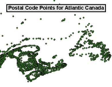
Data courtesy of DMTI Spatial Incorporated