Data access
Full access to our resources is available to current students, faculty, and staff of the University of Waterloo. To request access, please complete the Ask-Us form indicating the specific layers (shapefiles) you require. Upon completion of the data release agreement form, the dataset will be provided to you via OneDrive.
In-person consultations may also be requested through the Ask-Us form.
Description
This data resource shows all Canadian census boundaries for the years 1996, 2001, 2006, 2011, 2016 and 2021. These coverages are provided by Statistics Canada, and are available for Canada, Ontario, and the Region of Waterloo/local area. Census boundaries are available (in decreasing geographic size); Federal electoral district, Census metropolitan area, Census division, Census subdivision, Census tract, Census dissemination area and Census dissemination block.
Dissemination Block Census Boundaries are only available for 2006, 2011, 2016 and 2021
Spatial reference and data type
These data sets are available in geographic (lat/long) co-ordinates; horizontal datum is North American Datum (NAD) 83. These data are stored as Esri shapefiles. Other data formats can be accommodated, as the Geospatial Centre has access to a number of conversion utilities.
Use restrictions/licensing/copyright
This material is provided for academic, research, teaching, and personal use only. A data release agreement must be signed before the data is delivered. Statistics Canada should be acknowledged on any derivative product, such as a map or an image.
Citation
Statistics Canada Census Boundaries [computer file]. Ottawa, Ontario: Statistics Canada, [2021].
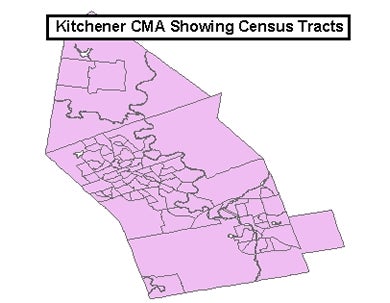
Sample view of the data
Data courtesy of Statistics Canada