Data access
Full access to our resources is available to current students, faculty, and staff of the University of Waterloo. To request access, please complete the Ask-Us form indicating the specific layers (shapefiles) you require. Upon completion of the data release agreement form, the dataset will be provided to you via OneDrive. Data access is also available through https://climatedata.ca/.
In-person consultations may also be requested through the Ask-Us form.
Description
This dataset was received from the National Land and Water Information Service, Agriculture and Agri-Food, Canada.
For current downloadable datasets, please visit: https://climatedata.ca/.
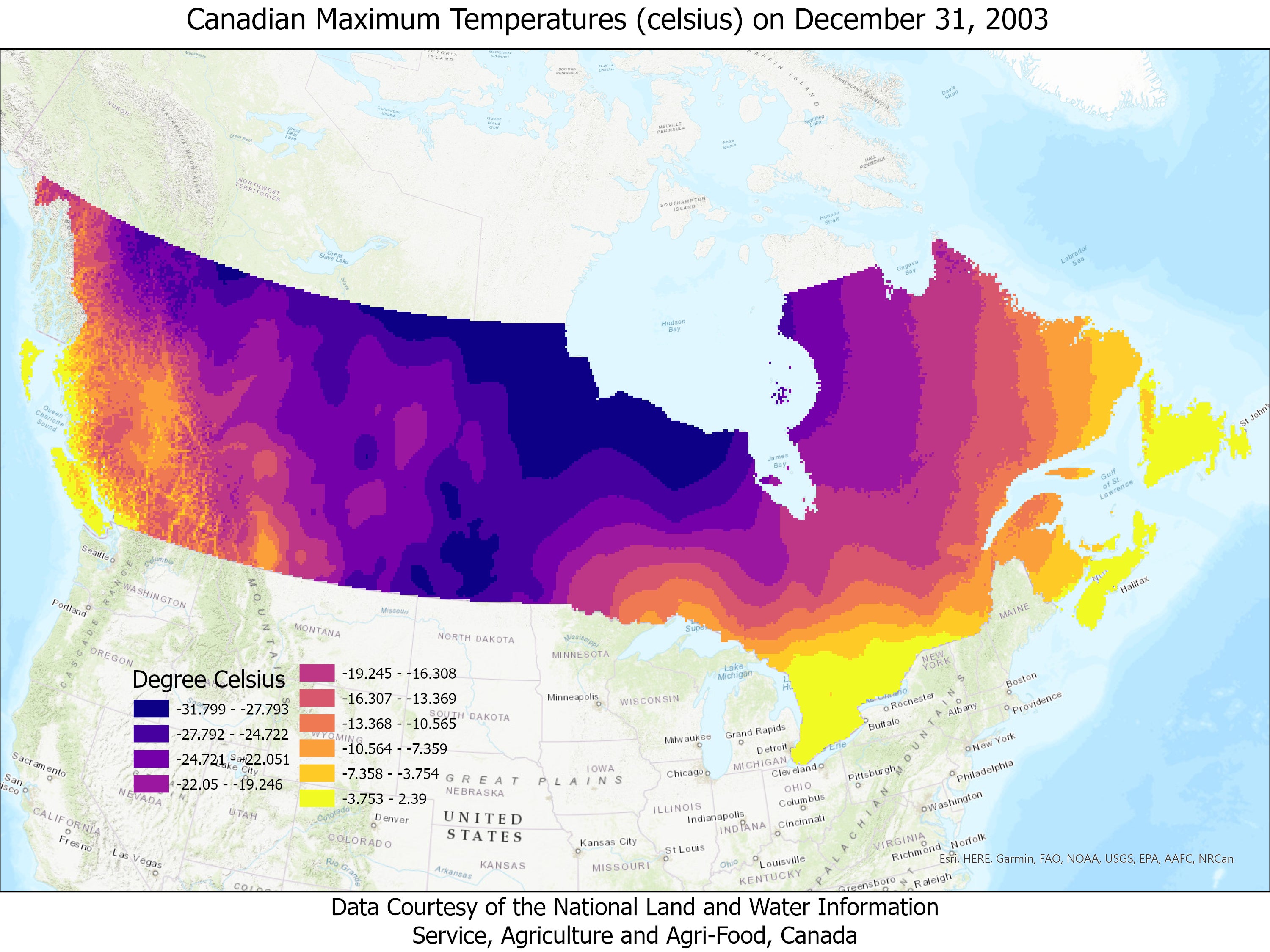
The Daily 10 km Gridded Historial Climate Dataset for Canada 1961-2003 (ANUSPLIN Point Grid) contains gridded point locations of daily maximum temperature (°C), minimum temperature (°C), and precipitation (mm) for the Canadian landmass south of 60°N . Each daily grid contains interpolated point estimates arranged in a regular grid with a spacing of 10 km. Grids were interpolated from daily Environment Canada climate station observations using a thin plate smoothing spline surface fitting method implemented by ANUSPLIN V4.3.
The data are georeferenced TIF images, one image for each day of the year.
Spatial reference and data type
These data sets are available in Geographic Coordinate System, Horizontal Datum: North American Datum (NAD) 83. Map projection name: Albers Conical Equal Area. Other data formats can be accommodated, as the Geospatial Centre has access to a number of conversion utilities.
Use restrictions/licensing/copyright
This material is provided for academic, research, teaching, and personal use only. National Land and Water Information Service, Agriculture and Agri-Food, Canada should be acknowledged on any derivative product, such as a map or an image.
Citation
Daily Maximum Temperatures (celsius) for Canada. [Computer File]. National Land and Water Information Service, Agriculture and Agri-Food, Canada, 2020.
Sample view of the data