Data access
Full access to our resources is available to current students, faculty, and staff of the University of Waterloo. In order to access this data set, please request an appointment through the Ask-Us form. Geospatial Centre staff are available to provide further information about these data sets and to deliver data upon request.
Under the terms of the library's license agreement, these data sets are for use by students, faculty, and staff at the University of Waterloo only.
Description
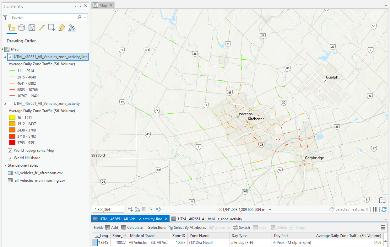
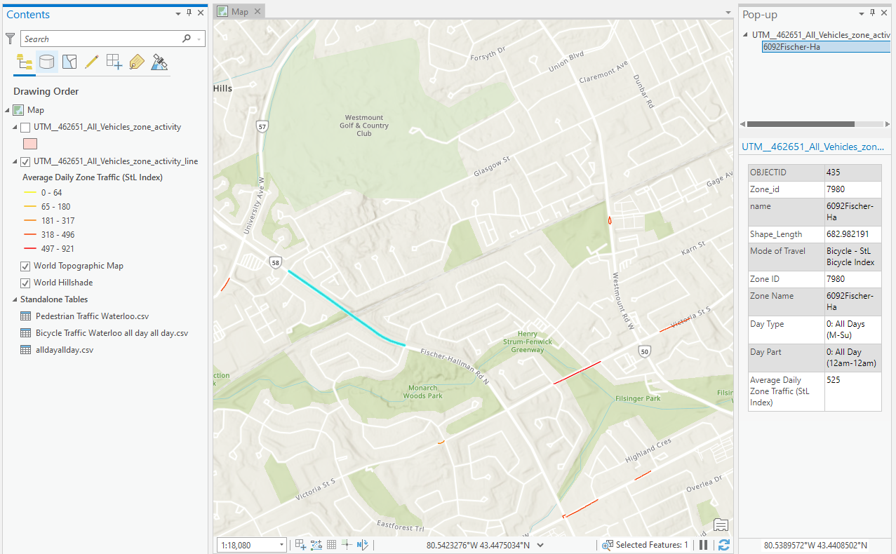
This vector data resource provides traffic data from 2019, courtesy of StreetLight. This dataset is based on mobile device location tracking and covers specific streets within the Region of Waterloo. The main purpose of using this data is to analyze the traffic volume or relative trip activity in the Region of Waterloo. This traffic data can be used to analyze vehicle traffic volume and activity for specific weekdays and times (i.e. Monday-Friday during rush hour). Data are available for vehicles, bicycles, and pedestrians, and are calculated based on traffic zones or street segments. For each traffic zone, traffic volume or index is calculated for each day of the week. The average daily traffic volume or index for a week is also calculated. For each day of the week, the traffic volume or index is calculated for each part of the day. The data consist of three csv files and two shapefiles. The attributes and their explanation of the csv files are presented in the following:
- Mode of Travel: The mode of transport.
- Zone ID: ID assigned by StreetLight Data to uniquely identify each traffic zone.
- Zone Name: The name of the traffic zone.
- Day Type: Specific day of the week. If a cell value includes ‘All Days’, that row indicates an average daily traffic volume or index for a week.
- Day Part: Specific part of the day. If a cell value includes ‘All Day’, that row indicates the sum of the traffic volume or index for all parts of the day.
- Average Daily Zone Traffic (StL Volume or Index): The traffic volume or index.
Spatial reference and data type
These data sets are available in Universal Transverse Mercator (UTM) co-ordinates; horizontal datum is North American Datum (NAD) 83. These data are stored as Esri shapefiles. Other data formats can be accommodated, as the Geospatial Centre has access to a number of conversion utilities.
Data manipulation
There are public workstations in the Geospatial Centre that provide access to both ArcGIS software programs, program extensions and data manipulation utilities. Patrons may use the Geographic Information System (GIS) and image processing software in the library to view and manipulate the data. Waterloo faculty, students and staff may copy these data for use elsewhere.
Data output
This image may be exported from ArcGIS in a choice of bitmapped formats (also known as raster graphics) including JPG, TIFF, GIF, and BMP or in a choice of vector graphics formats including Adobe Illustrator (AI), Encapsulated Postscript (EPS), and Scalable Vector Graphics (SVG). Yet another option is PDF.
Use restrictions/licensing/copyright
These data are provided for personal use for academic, research, and/or teaching purposes. A data release agreement must be agreed to before these licensed data can be released. StreetLight must be acknowledged on any derivative product, whether printed or electronic, including for example, a printed map, a raster or vector graphic, a web-based application, etc. Patrons are advised to fully respect the provisions of Canada's Copyright Act as well as terms and conditions imposed by the data provider.
Citation
StreetLight Data [computer file]. San Francisco: California, [2019].
Sample views of the data