Description
Available
through
GeoGratis,
the
National
Topographic
Data
Base
(NTDB)
comprises
digital
vector
data
sets
that
cover
the
entire
Canadian
landmass.
Geomatics
Canada
has
digitized
and
structured
thousands
of
topographic
maps,
creating
a
complete
and
uniform
product
that
can
be
highly
useful
in
a
broad
range
of
industries.
The
organizational
unit
for
the
NTDB
is
the
National
Topographic
System
(NTS),
based
on
the
North
American
Datum
(NAD)
83.
Each
file
(data
set)
consists
of
one
NTS
unit
at
either
the
1:50,000
or
1:250,000
scale.
Furthermore,
the
data
is
now
available
by
themes
within
a
file.
The
ground
data
is
depicted
through
points,
lines,
and
areas.
Coverages are organized into one of the following 13 themes: hydrography, hypsography (contours), vegetation, the road network, roads, the rail network, the electric power network, designated areas, landform and relief, water saturated soils, toponymy and manmade features.
Many of the coverages or individual data sets are listed in the following list.
- Aerial cableways
- Auto wreckers
- Barriers/ gates
- Breakwaters
- Bridges
- Buildings
- Built up areas
- Cemetaries
- Chimneys
- Contours (10 metre for 1:50,000 scale, 50 metre for 1:250,000 metre scale)
- Conveyors
- Cranes
- Cut areas/ lines
- Disappearing streams
- Elevation points
- Embarkments
- Ferry routes
- Footbridges
- Fortifications
- Golf courses
- Hazards to navigation
- Historic sites/ points of interest
- Highway exits
- Liquids: depots/ dumps
- Limited use roads
- Marinas
- Mining areas
- Navigation aids
- National Topographic System (N.T.S.) limits
- Parks
- Picnic sites
- Ponds
- Railways
- Roads
- Runways
- Sandy area
- Seawalls
- Silos
- Sports tracks/ race tracks
- Stadiums
- Tanks
- Toponyms
- Towers
- Trails
- Transmission lines
- Tunnels
- Underground reservoirs
- Vegetation
- Walls/ fences
- Water disturbance (rapids, discharge, etc.)
- Waterbodies
- Watercourses
- Wetlands
- Wharfs
- Zoos
Spatial reference and data type
These data sets are available in geographic (lat/long) and co-ordinates; horizontal datum is NAD 83. These data are available in Esri Shapefile format.
Data manipulation and storage
There are public workstations in the Geospatial Centre that provide access to ArcGIS software programs, program extensions and data manipulation utilities. Patrons may use the Geographic Information System (GIS) and image processing software in the library to view and manipulate the data. UWaterloo faculty, students and staff may copy these data to other media (for example: CD, DVD or Zip disc) for use elsewhere.
Data output
These images may be exported from ArcGIS in a choice of bitmapped formats (also known as raster graphics) including JPG, TIFF, GIF, and BMP or in a choice of vector graphics formats including Adobe Illustrator (AI), Encapsulated Postscript (EPS), and Scalable Vector Graphics (SVG). Yet another option is PDF. The user defines the output resolution.
Citation
National Topographic Data Base (3rd Edition) [computer file]. Ministry of Natural Resources Canada Centre for Topographic Information (1998).
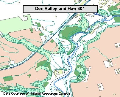
Sample view of the data