Data access
Full access to our resources is available to current students, faculty, and staff of the University of Waterloo. To request access, please complete the Ask-Us form indicating the specific layers (shapefiles) you require. Upon completion of the data release agreement form, the dataset will be provided to you via OneDrive.
In-person consultations may also be requested through the Ask-Us form.
Description
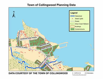
This vector data resource provides topographic and planning information for the Town of Collingwood, Ontario. This information was delivered to the Geospatial Centre by the Town of Collingwood in April 2014. Current datasets are available from Grey County GIS website. The resource includes the following vector coverages:
- Address points
- Bridges
- Building footprints
- Bus stops/ routes
- Condominiums
- Contours (2 metre)
- Emergency planning
- Hospital
- Points of interest
- Pumping station
- Railroad
- Roads
- Road barriers
- Sanitary network (junctions, mains, services, manholes, force main)
- Schools
- Signs
- Street lights
- Street network
- Town owned land
- Traffic signals
- Trails (2010)
- Transit bus shelters (current and proposed)
- Water bodies and shoreline
- Watershed
- Wetland
- Zoning
Spatial reference and data type
This data set is available in Universal Transverse Mercator (UTM) zone 17 co-ordinates; horizontal datum is North American Datum (NAD) 83. These data are stored as Esri shapefiles. Other data formats can be accommodated, as the Geospatial Centre has access to a number of conversion utilities.
Use restrictions/licensing/copyright
These data are provided for personal use for academic, research, and/or teaching purposes. A data release agreement must be agreed to before these licensed data can be released. The Town of Collingwood must be acknowledged on any derivative product, whether printed or electronic, including for example, a printed map, a raster or vector graphic, a web-based application, etc. Patrons are advised to fully respect the provisions of Canada's Copyright Act as well as terms and conditions imposed by the data provider.
Citation
The Town of Collingwood Planning Data [computer file]. Collingwood, Ontario. [2014].
Sample view of the data