Description
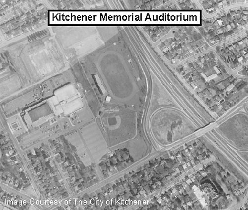
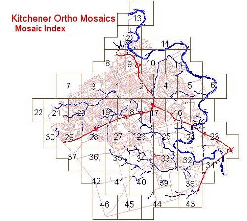
This resource includes black and white digital orthoimages of the City of Kitchener taken in 1997. These images were provided by the City of Kitchener. For coverage, see the index of ortho mosaics below (numbered 1-46). This photography was flown on April 11, 1997. Photo scale is 1:8,000. Resolution is 12 cm; accuracy is +/- 70 cm.
Spatial reference and data type
This data set is available in Universal Transverse Mercator (UTM) co-ordinates; horizontal datum is North American Datum (NAD) 27. These data are stored as MrSID image files. Other data formats can be accommodated, as the Geospatial Centre has access to a number of conversion utilities.
Data access
To request this data, please fill out the Ask-Us form and include which layers (shapefiles) you are interested in obtaining. The dataset will be shared with you via OneDrive upon completion of the data release agreement form. You may also make an in-person appointment using the same form.
Use restrictions/licensing/copyright
These data are provided for personal use for academic, research, and/or teaching purposes. A data release agreement must be agreed to before these licensed data can be released. The City of Kitchener must be acknowledged on any derivative product, whether printed or electronic, including for example, a printed map, a raster or vector graphic, a web-based application, etc. Patrons are advised to fully respect the provisions of Canada's Copyright Act as well as terms and conditions imposed by the data provider.
Citation
The City of Kitchener Digital Orthophotos 1997 [computer file]. Kitchener, Ontario: City of Kitchener Department of Information Services, [1997].
Sample view of the data