Description
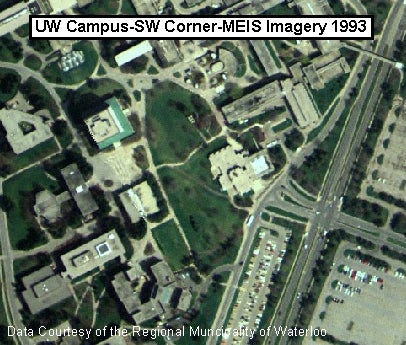
These are colour images with 1-metre ground resolution. Flown in April, 1993, they provide complete geographic coverage of the Region of Waterloo. This set of 262 georeferenced Multispectral Electro-Optical Image Sensor (MEIS) images was acquired by the library from the Regional Municipality of Waterloo in 2000.
View the image index to the northern half of the Region (Woolwich, Wellesley, and Waterloo). View the image index to the southern half of the Region (Wilmot, North Dumfries, Kitchener, and Cambridge).
Spatial reference and data type
These images are available in Universal Transverse Mercator (UTM) zone 17, North American Datum (NAD) 83 co-ordinate system. These data are stored in TIF format with average file size is 23 MB. Other data formats can be accommodated, as the Geospatial Centre has access to a number of conversion utilities.
Data access
To request this data, please fill out the Ask-Us form and include which layers (shapefiles) you are interested in obtaining. The dataset will be shared with you via OneDrive upon completion of the data release agreement form. You may also make an in-person appointment using the same form.
Use restrictions/licensing/copyright
These data are provided for personal use for academic, research, and/or teaching purposes. A data release agreement must be agreed to before these licensed data can be released. The Region of Waterloo must be acknowledged on any derivative product, whether printed or electronic, including for example, a printed map, a raster or vector graphic, a web-based application, etc. Patrons are advised to fully respect the provisions of Canada's Copyright Act as well as terms and conditions imposed by the data provider.
Citation
The Regional Municipality of Waterloo MEIS Imagery [computer file]. Kitchener, Ontario: The Regional Municipality of Waterloo, [1993].
Sample view of the data