Archival maps sorted by county/district name
| Year | Publisher | Scale | County |
|---|---|---|---|
|
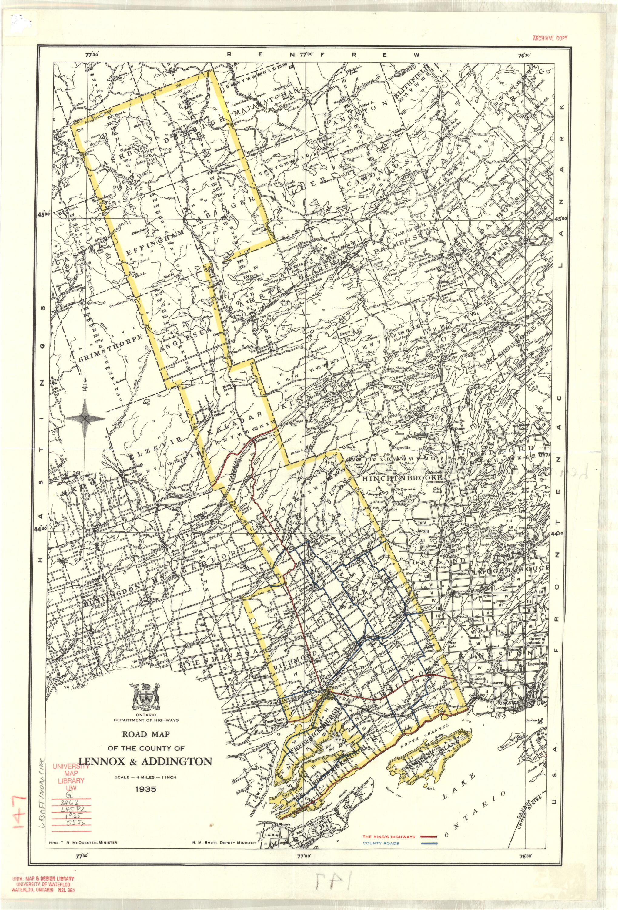
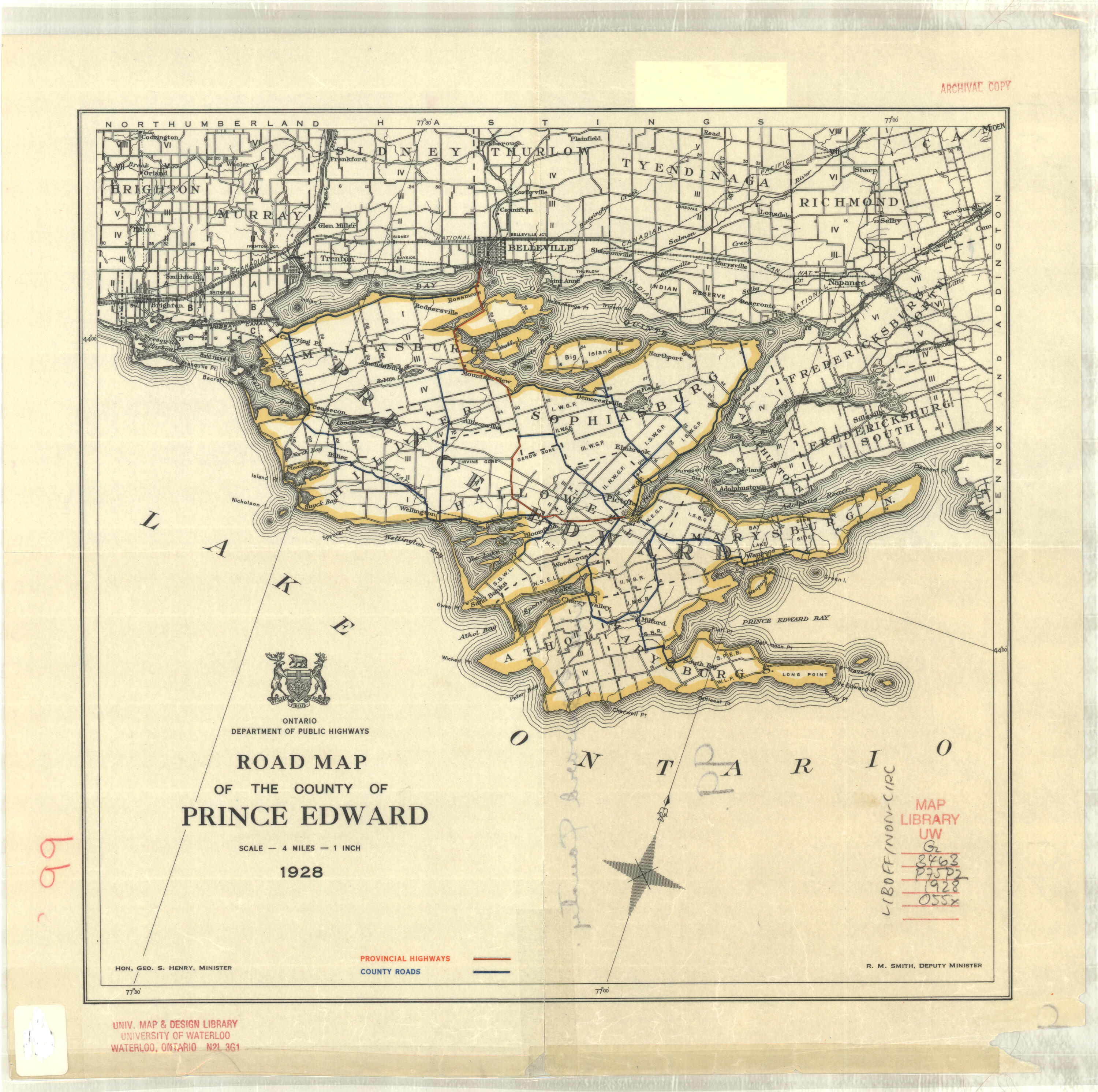
Addington SEE Lennox and Addington |
|||
|
1961 |
Dept. of Highways Ontario |
1”: 4 miles |
|
|
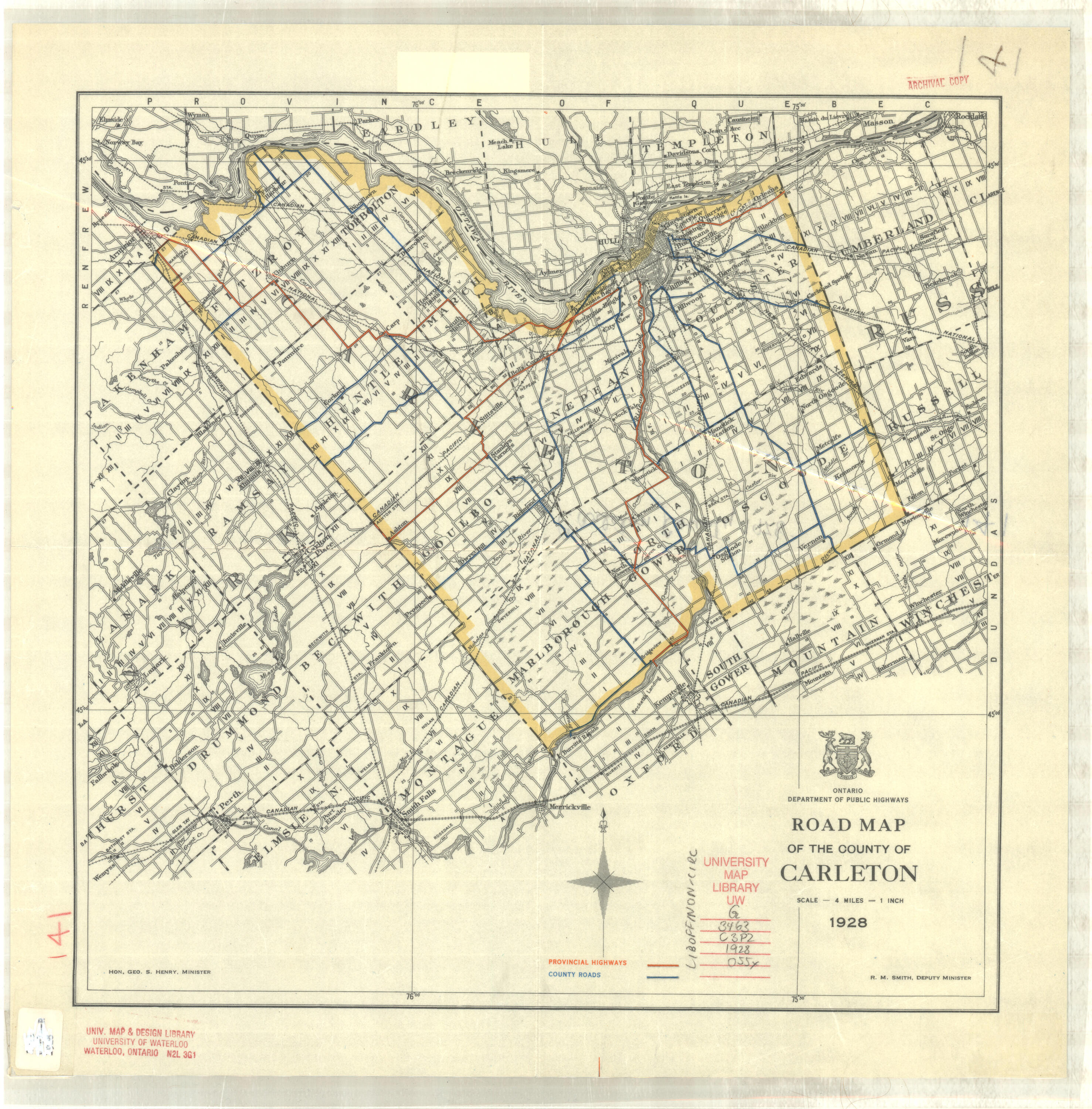
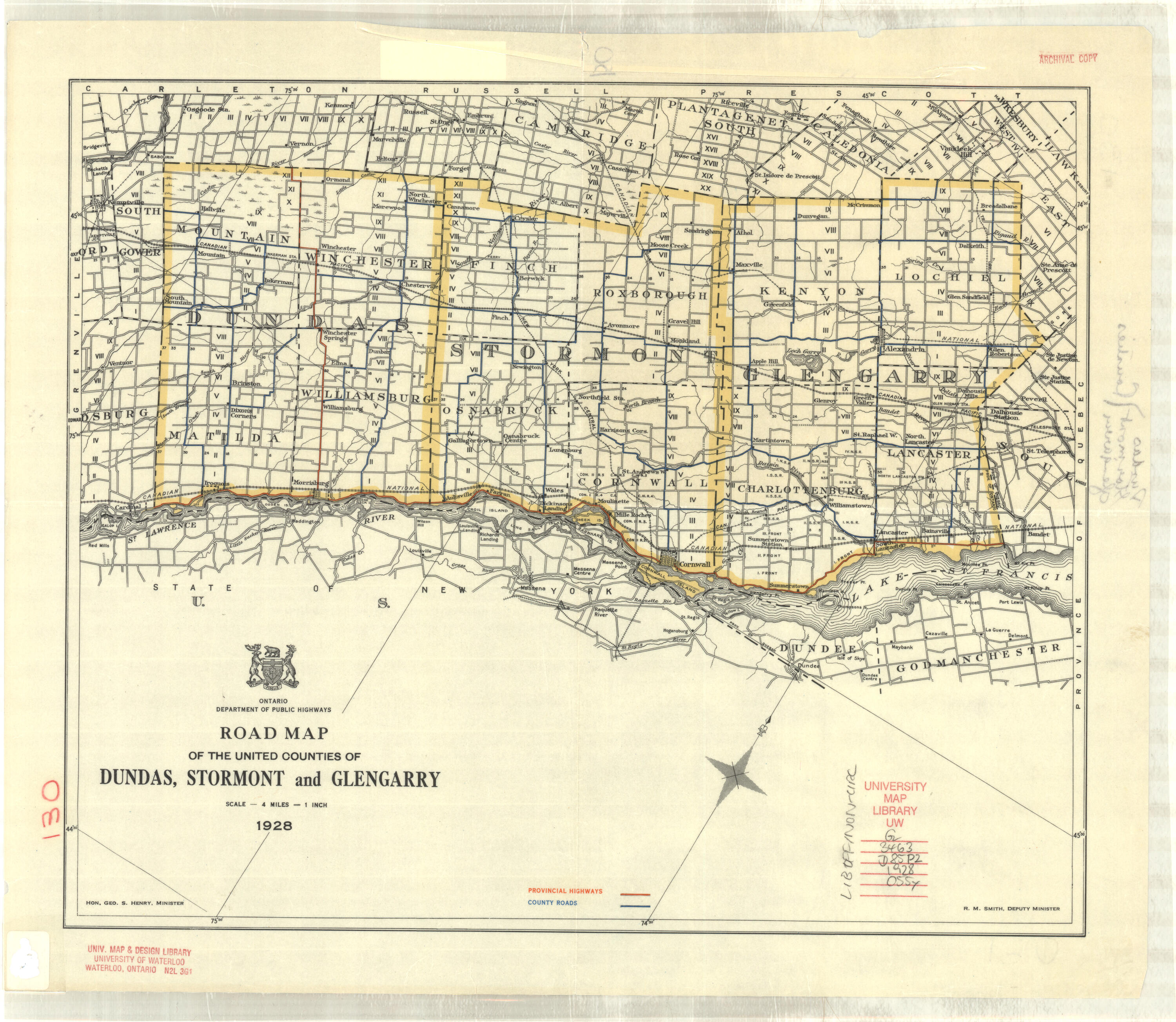
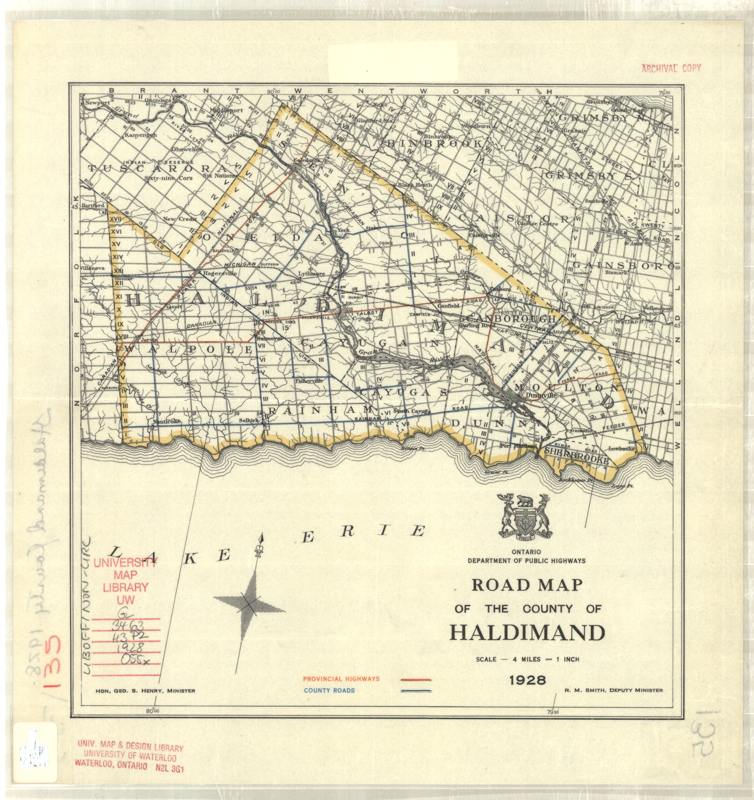
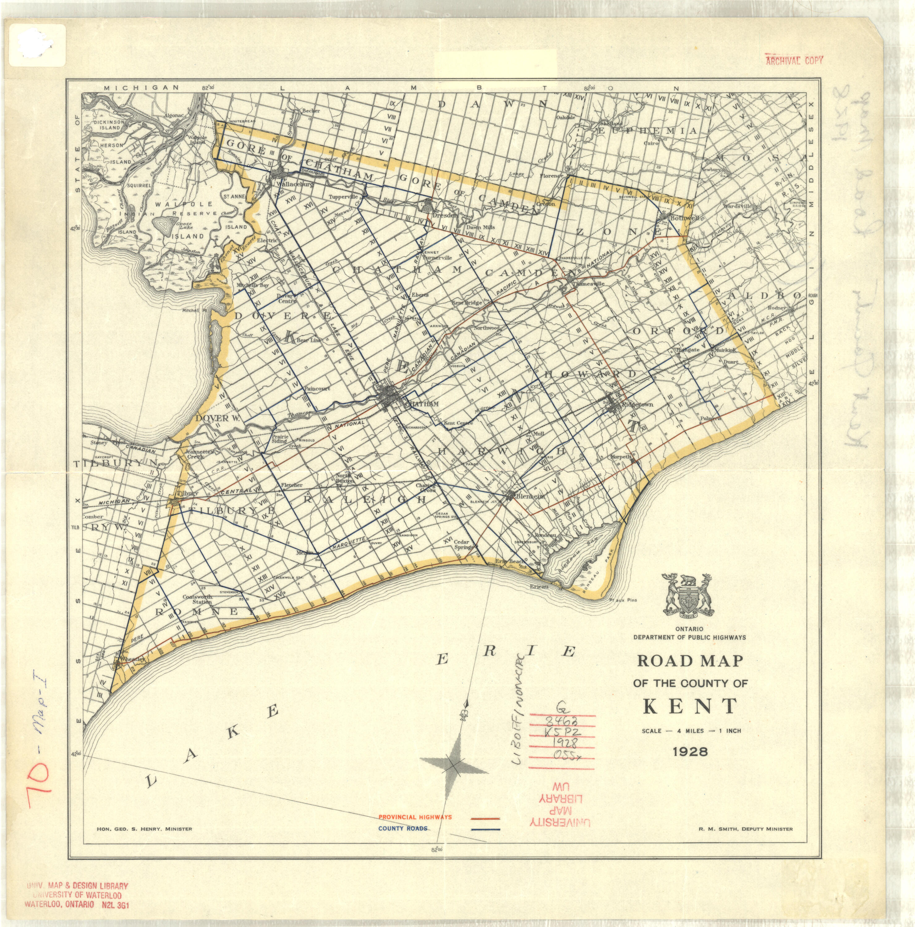
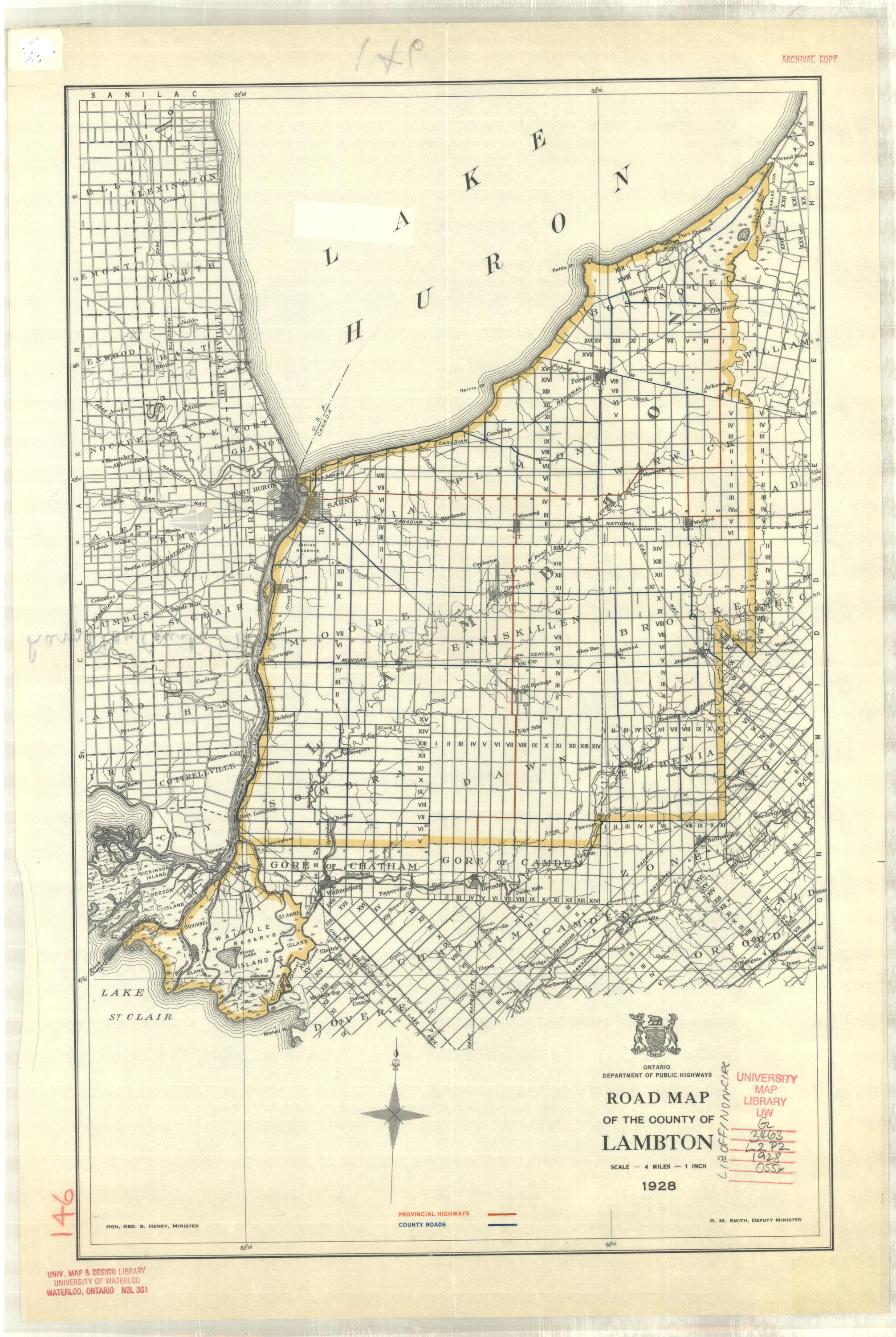
1928 |
Ontario Dept. of Public Highways |
1”: 4 miles |
|
|
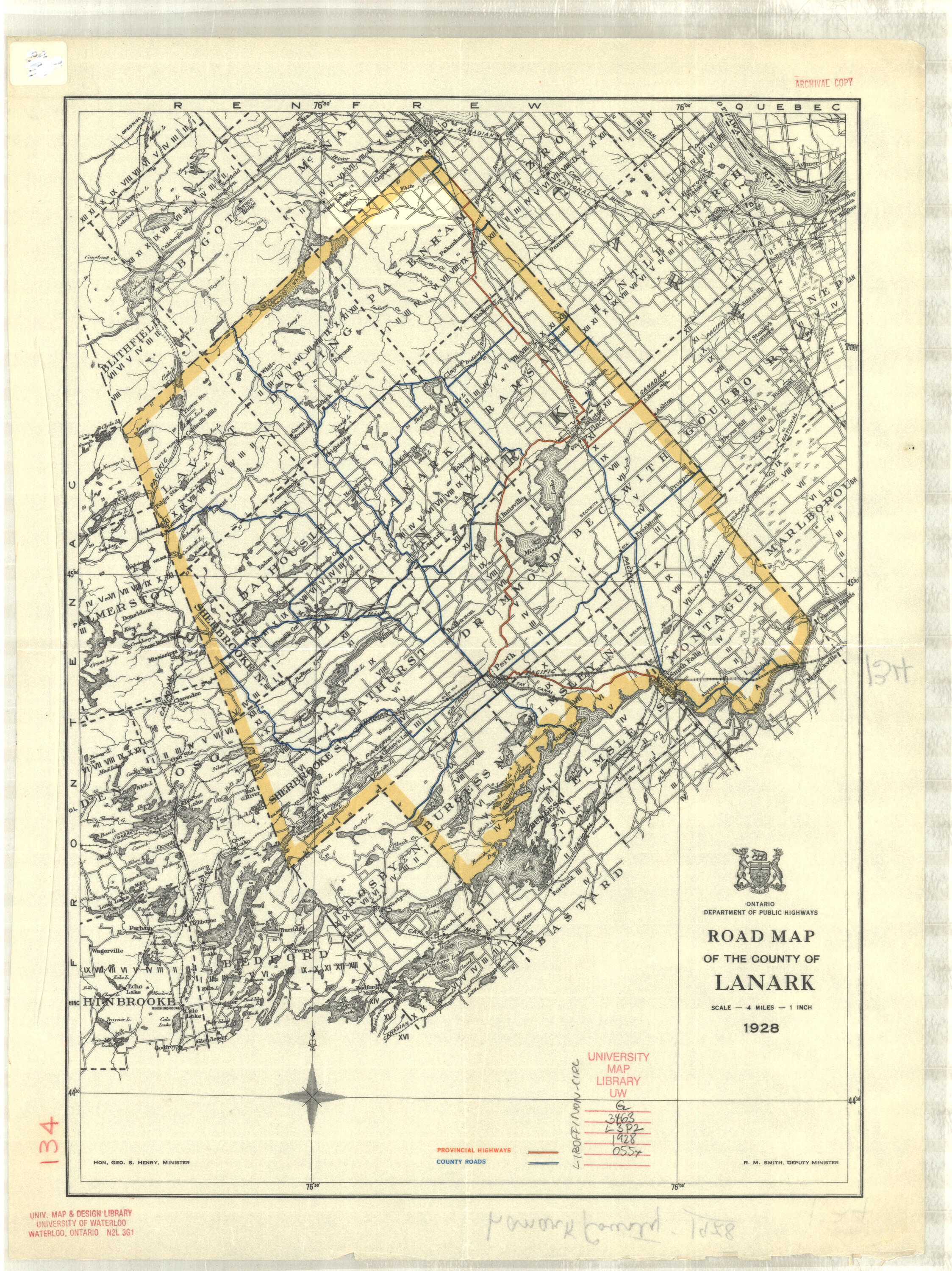
1928 |
Ontario Dept. of Public Highways |
1”: 4 miles |
|
|
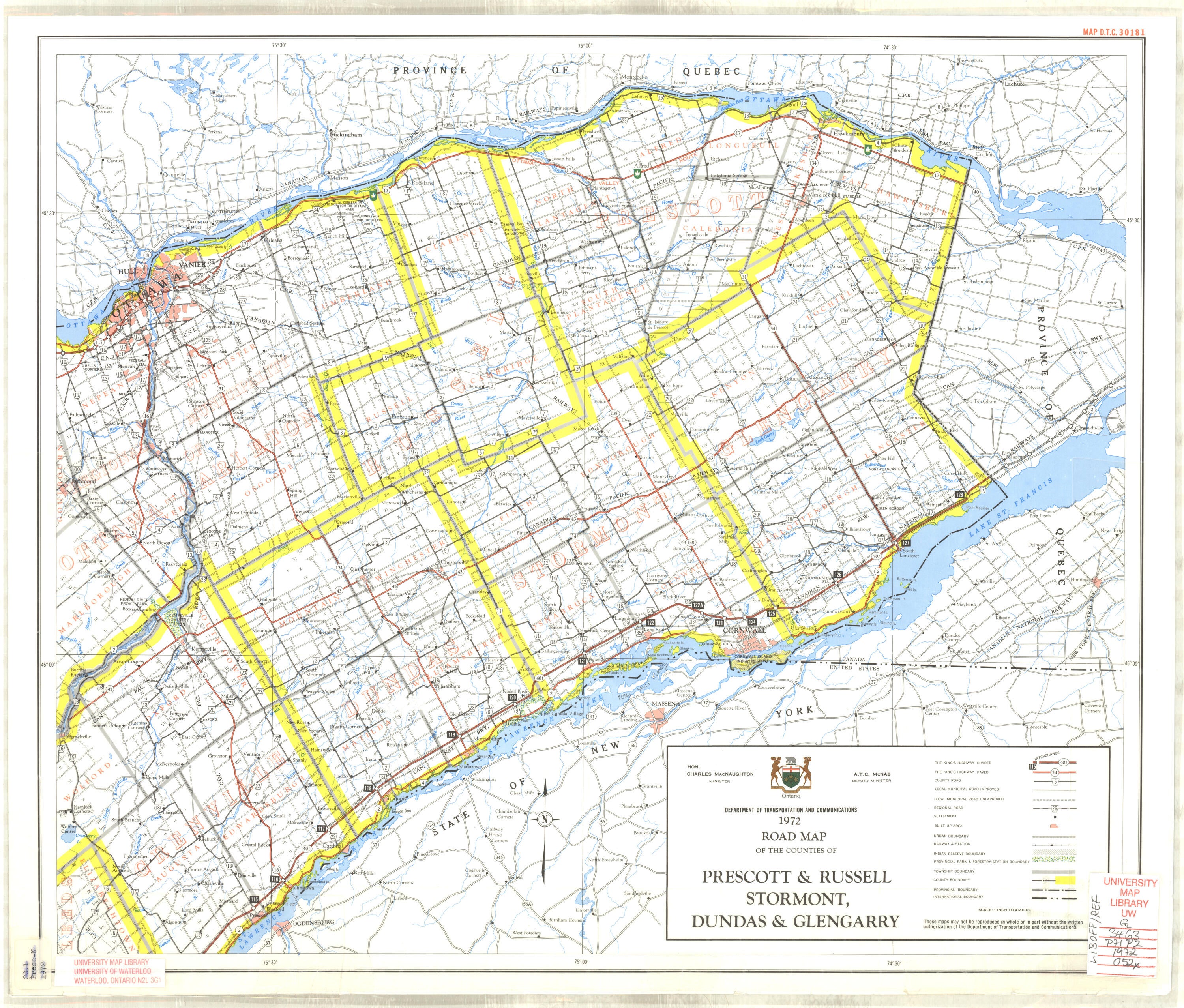
1972 2 copies |
Ontario Dept. of Transportation & Communications |
1”: 4 miles |
|
|
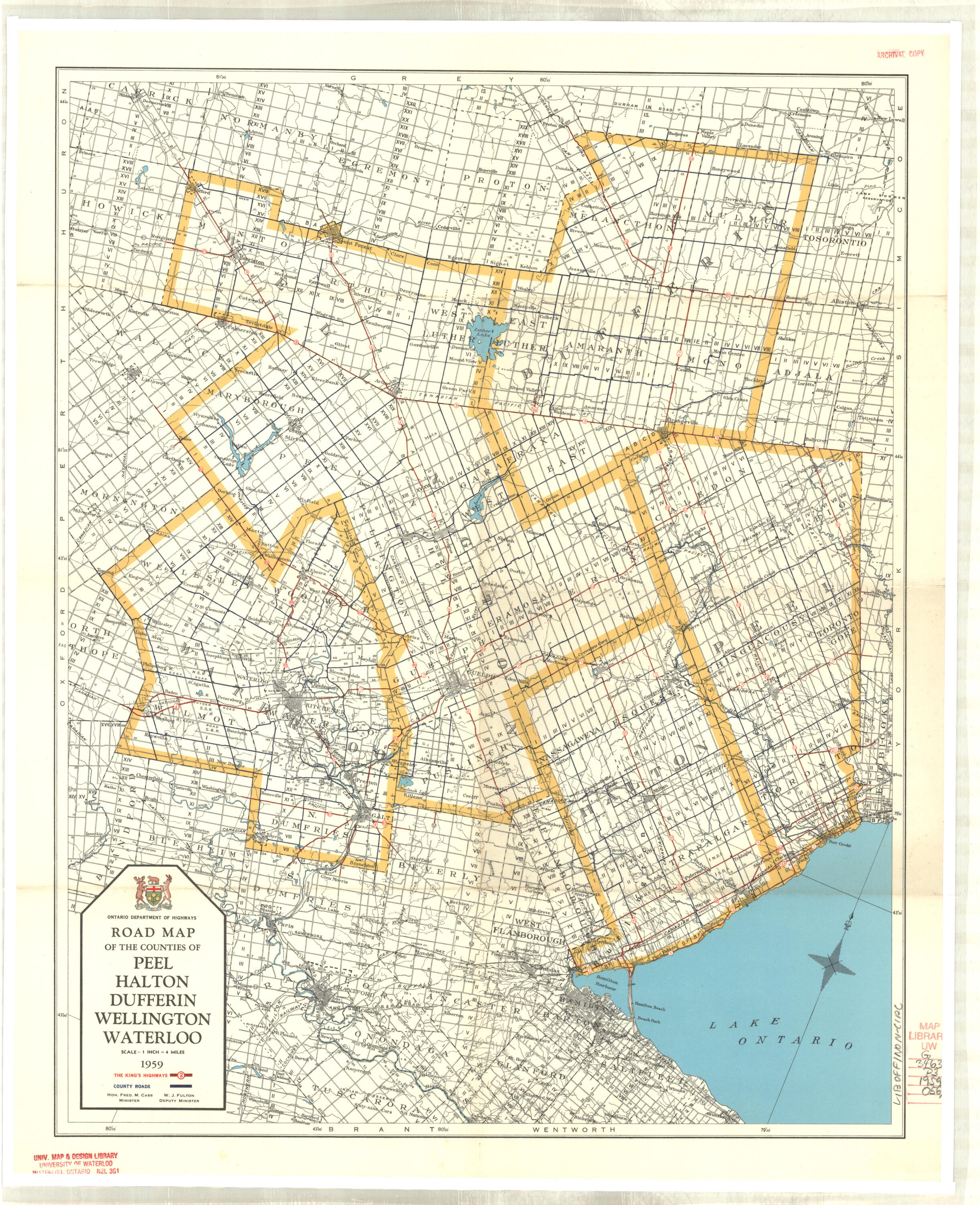
Dufferin SEE ALSO Peel, Halton, Dufferin, Wellington & Waterloo |
|||
|
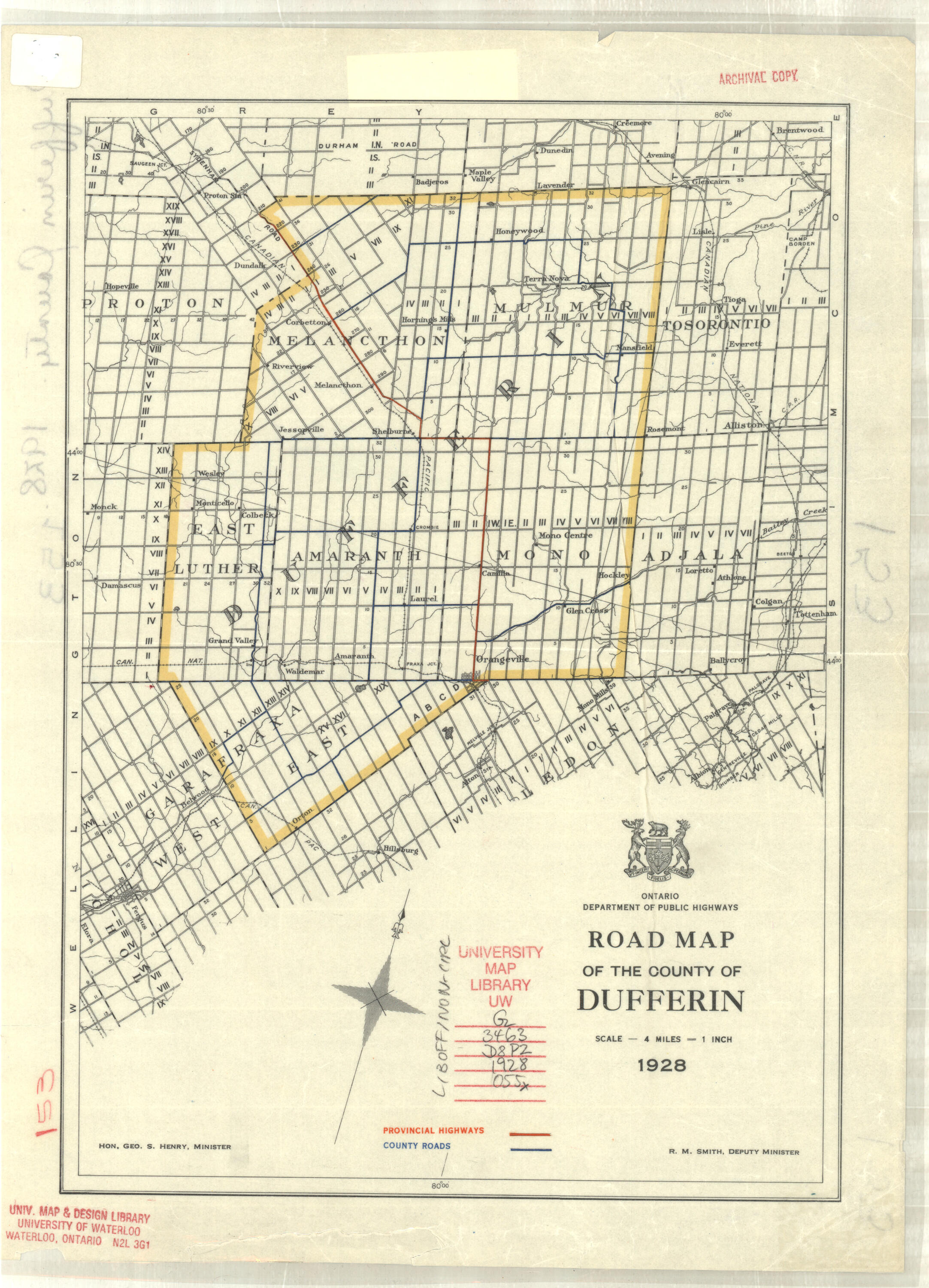
1928 |
Ontario Dept. of Public Highways |
1”: 4 miles |
|
|
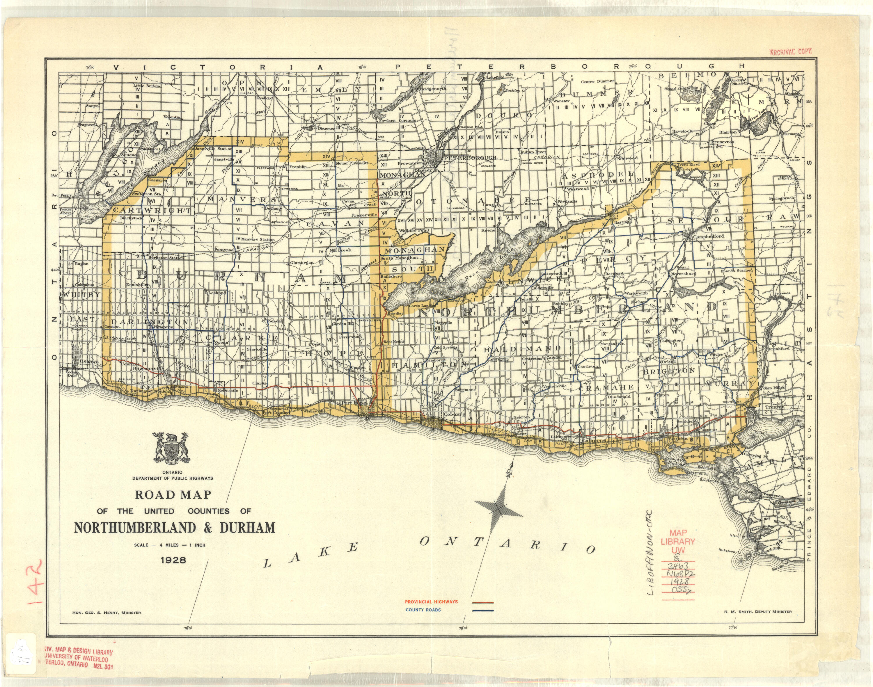
Durham SEE Northumberland, Durham, Peterborough & Victoria |
|||
|
1928 |
Ontario Dept. of Public Highways |
1”: 4 miles |
|
|
Elgin SEE ALSO [Brant, Elgin, Middlesex, Oxford & Norfolk] |
|||
|
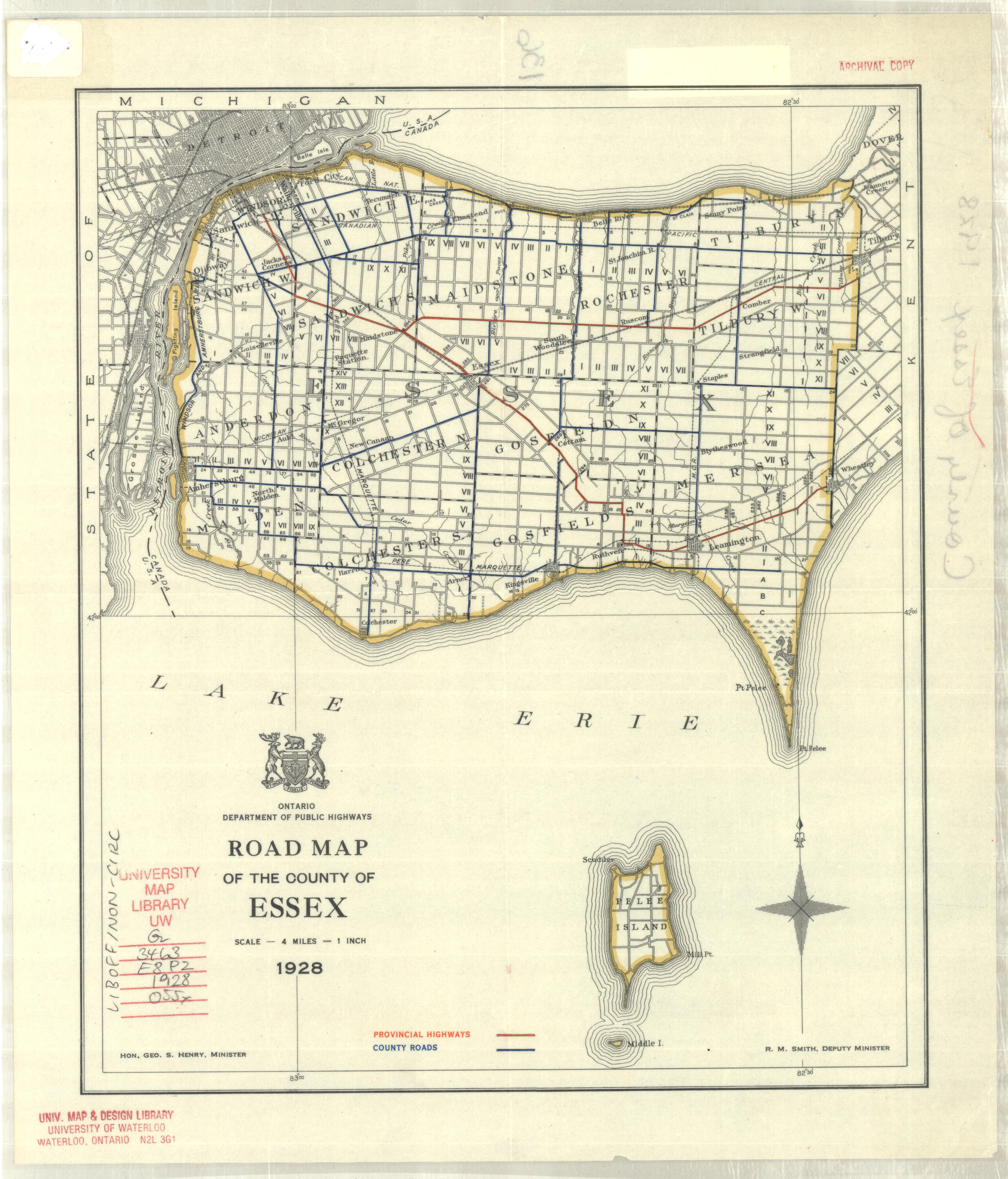
1928 |
Ontario Dept. of Public Highways |
1”: 4 miles |
|
|
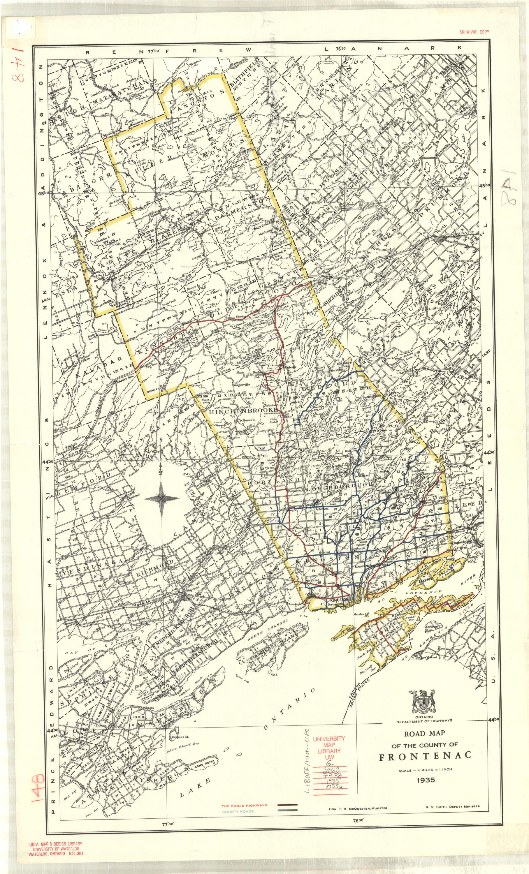
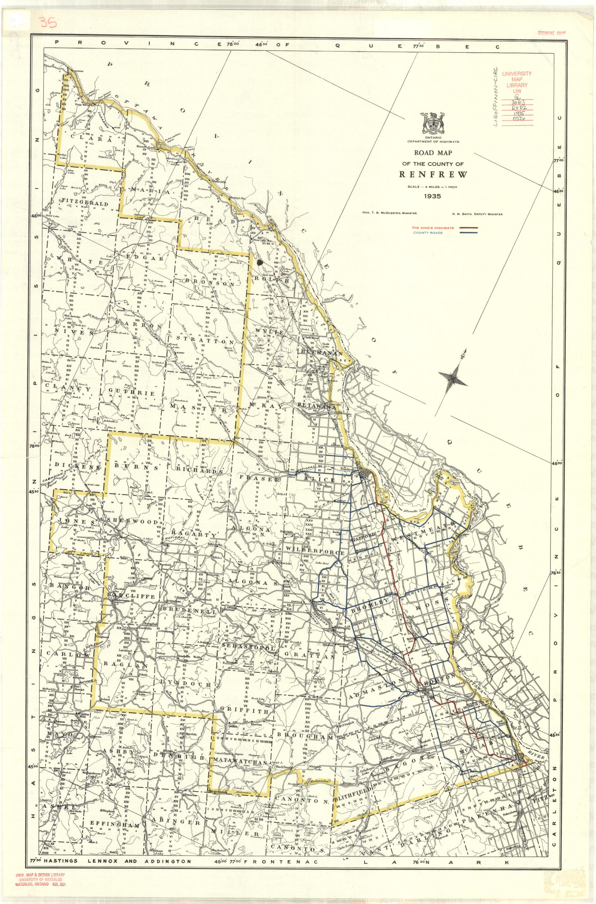
1935 |
Ontario Dept. of Highways |
1”: 4 miles |
|
|
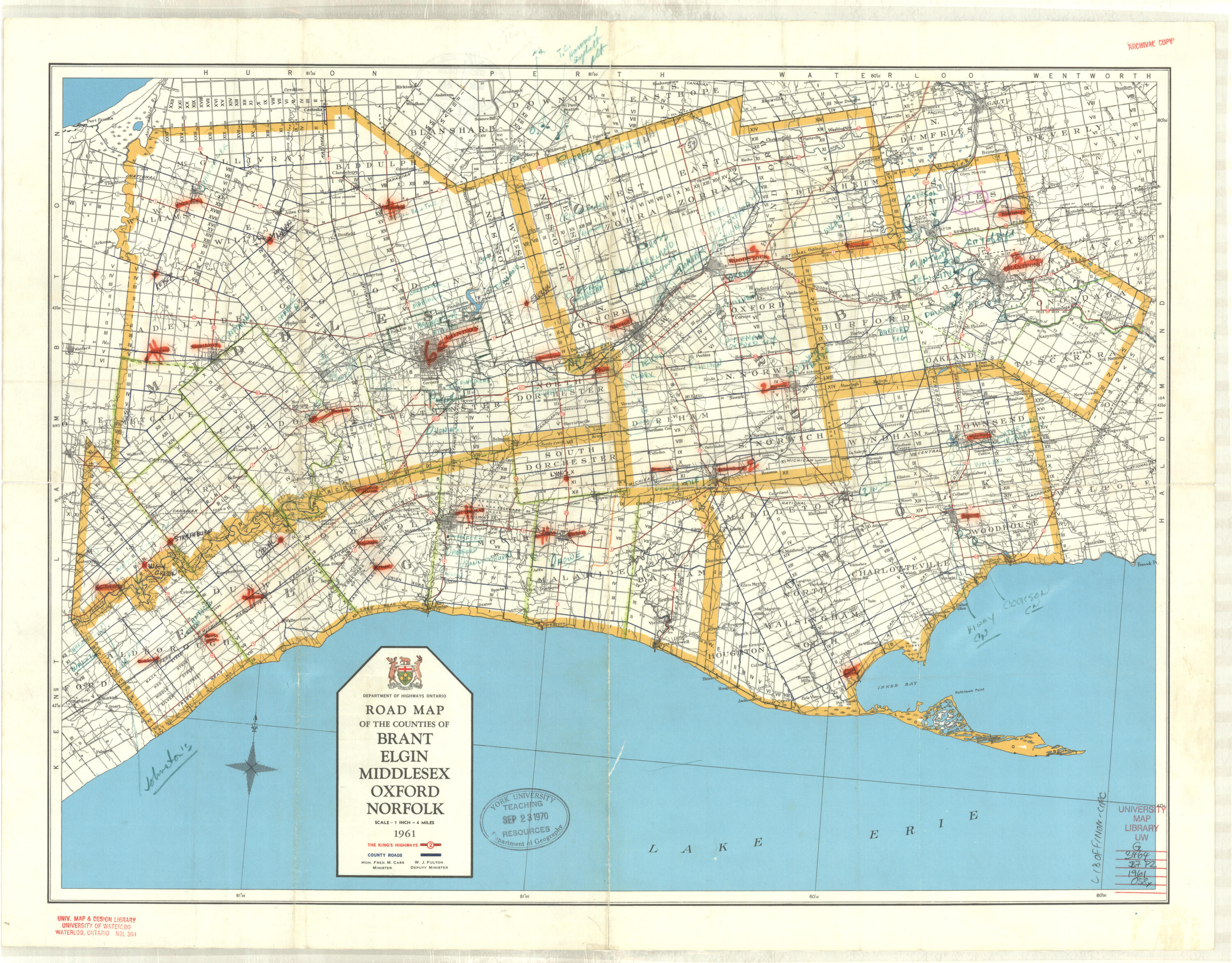
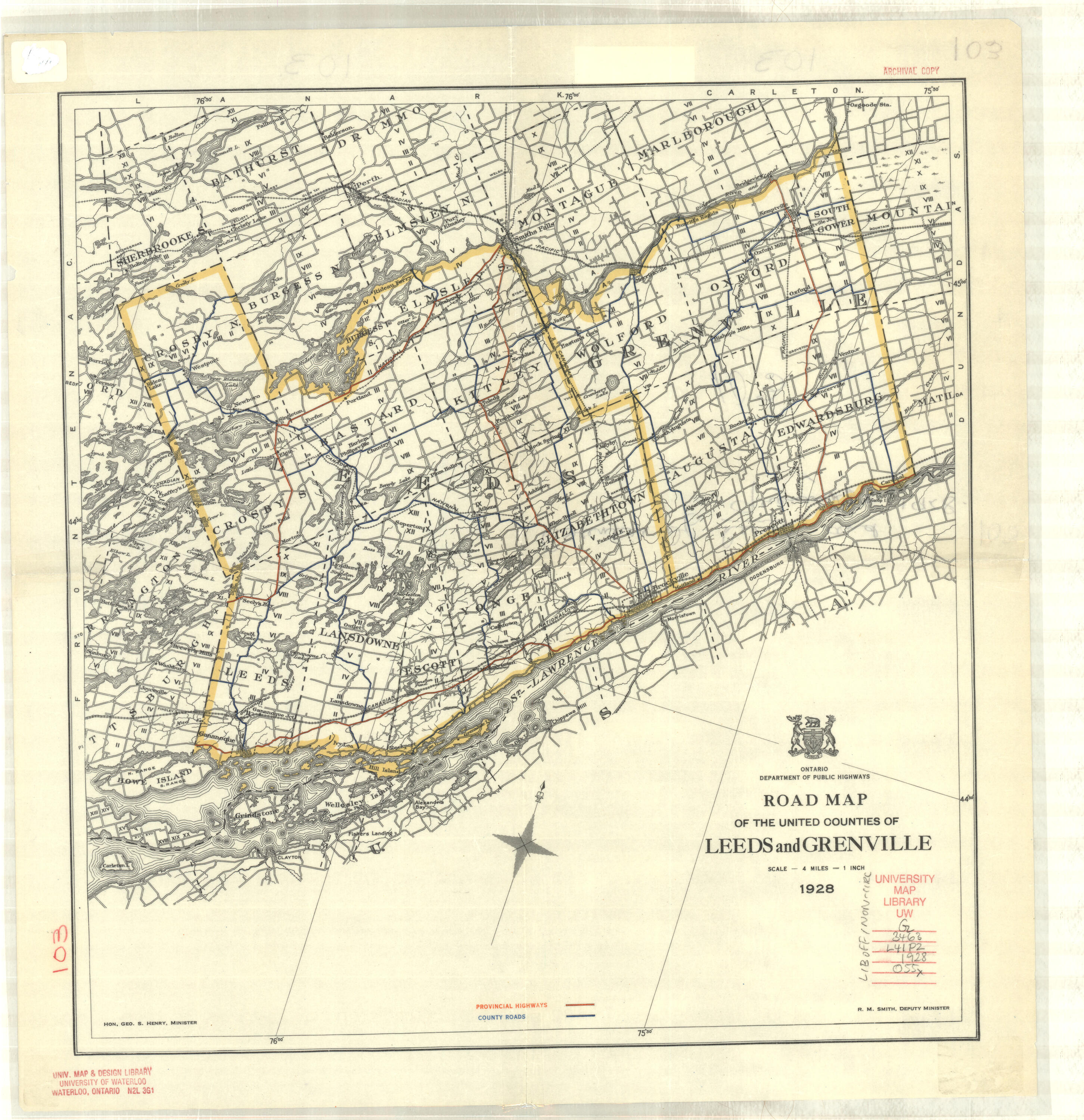
1961 |
Dept. of Highways Ontario |
1”: 4 miles |
Frontenac, Lennox, Addington |
|
Glengarry SEE Dundas, Stormont, Glengarry |
|||
|
Grenville SEE Leeds & Grenville |
|||
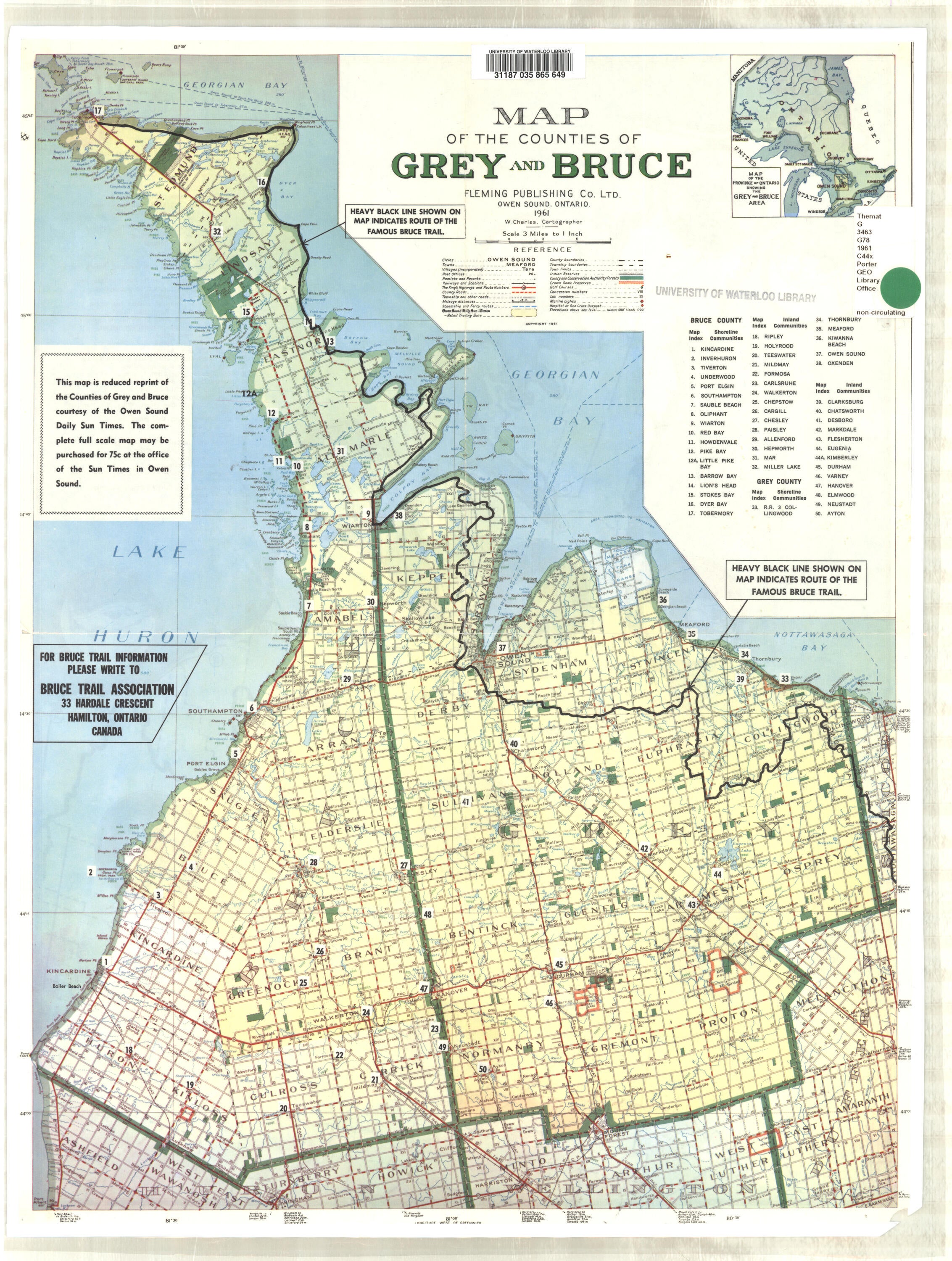
| 1961 | Fleming publishing company limited | 1": 3 miles | Grey and Bruce |
|
1928 |
Ontario Dept. of Public Highways |
1”: 4 miles |
|
|
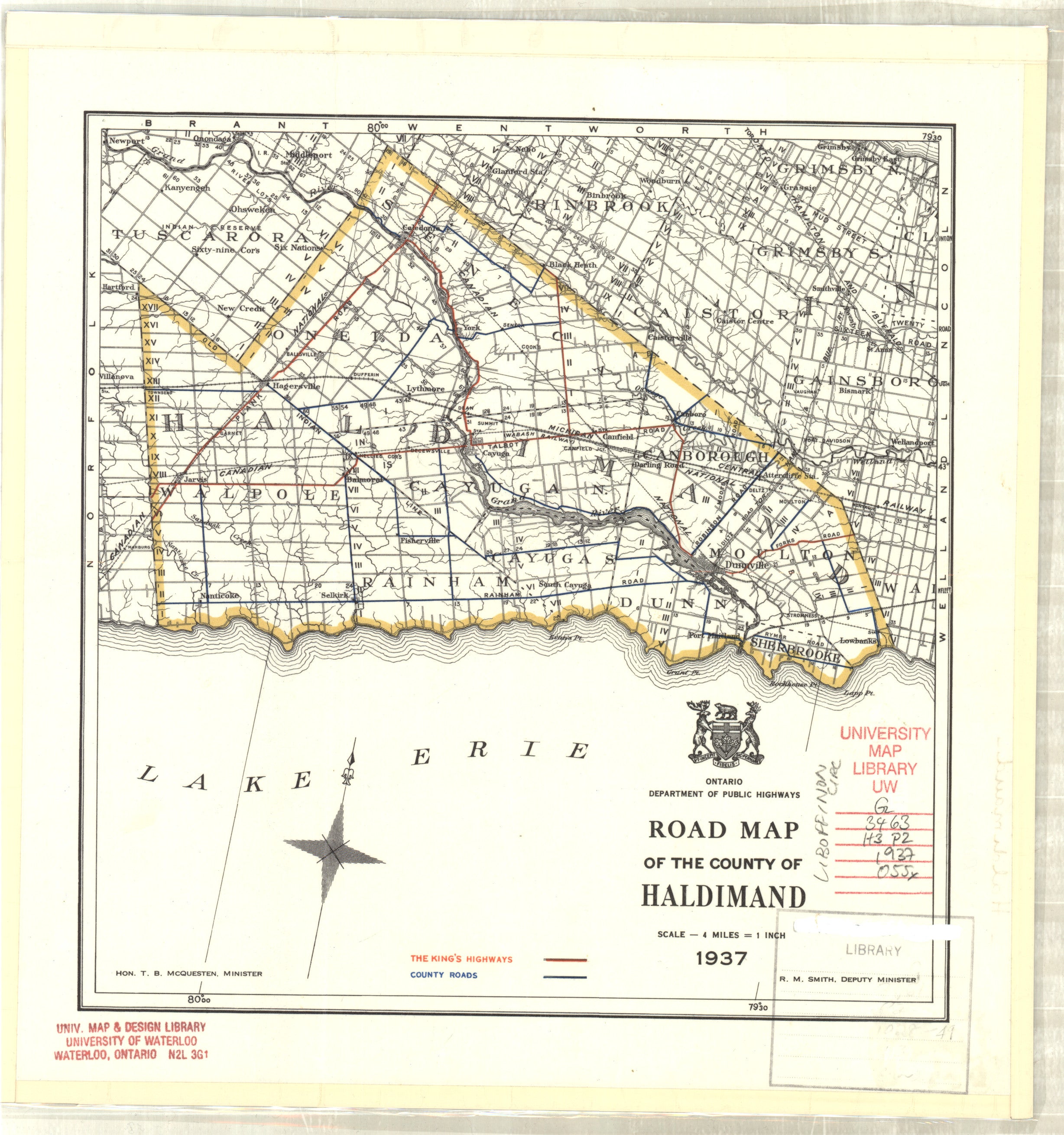
1937 |
Ontario Dept. of Public Highways |
1”: 4 miles |
|
|
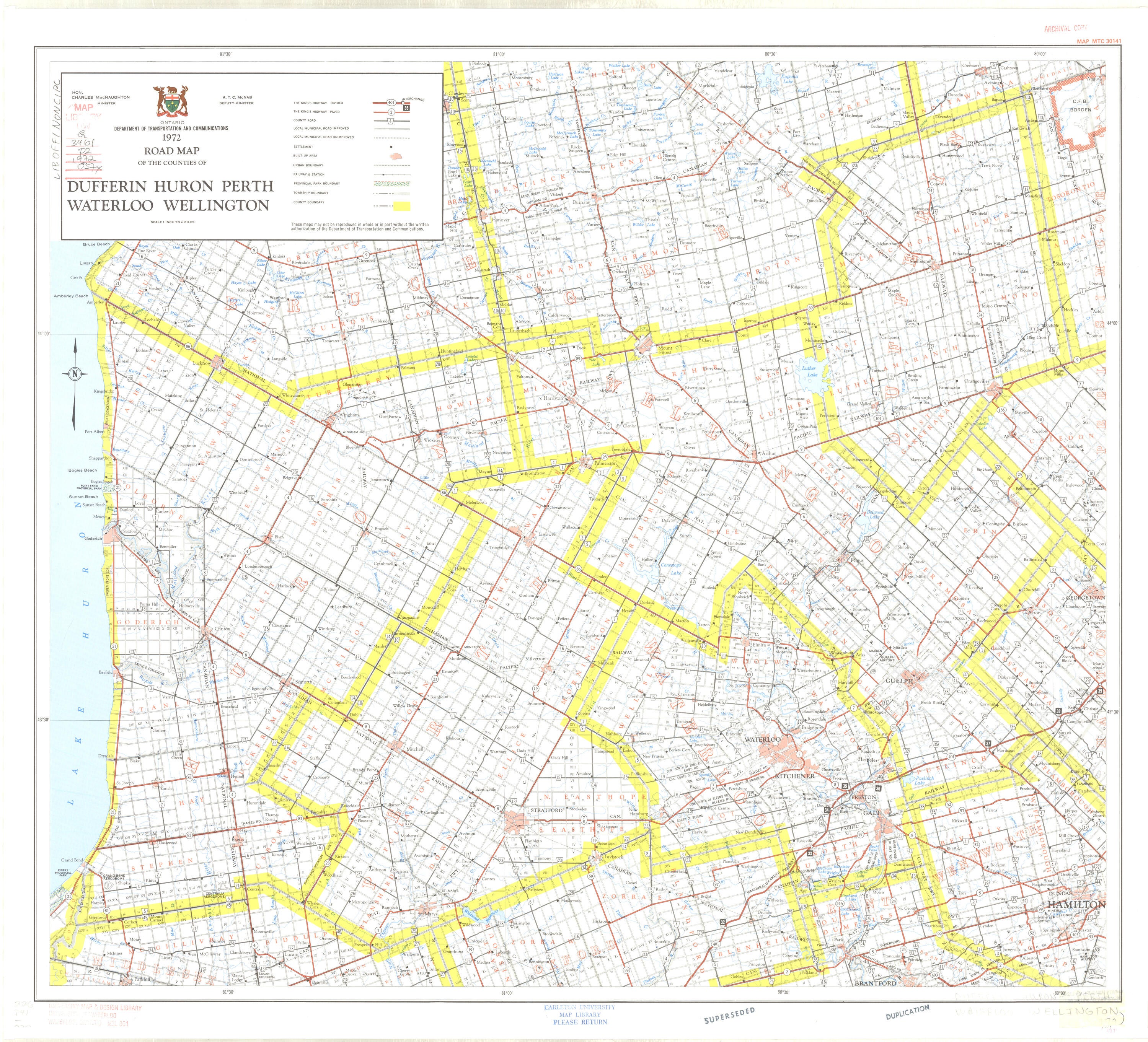
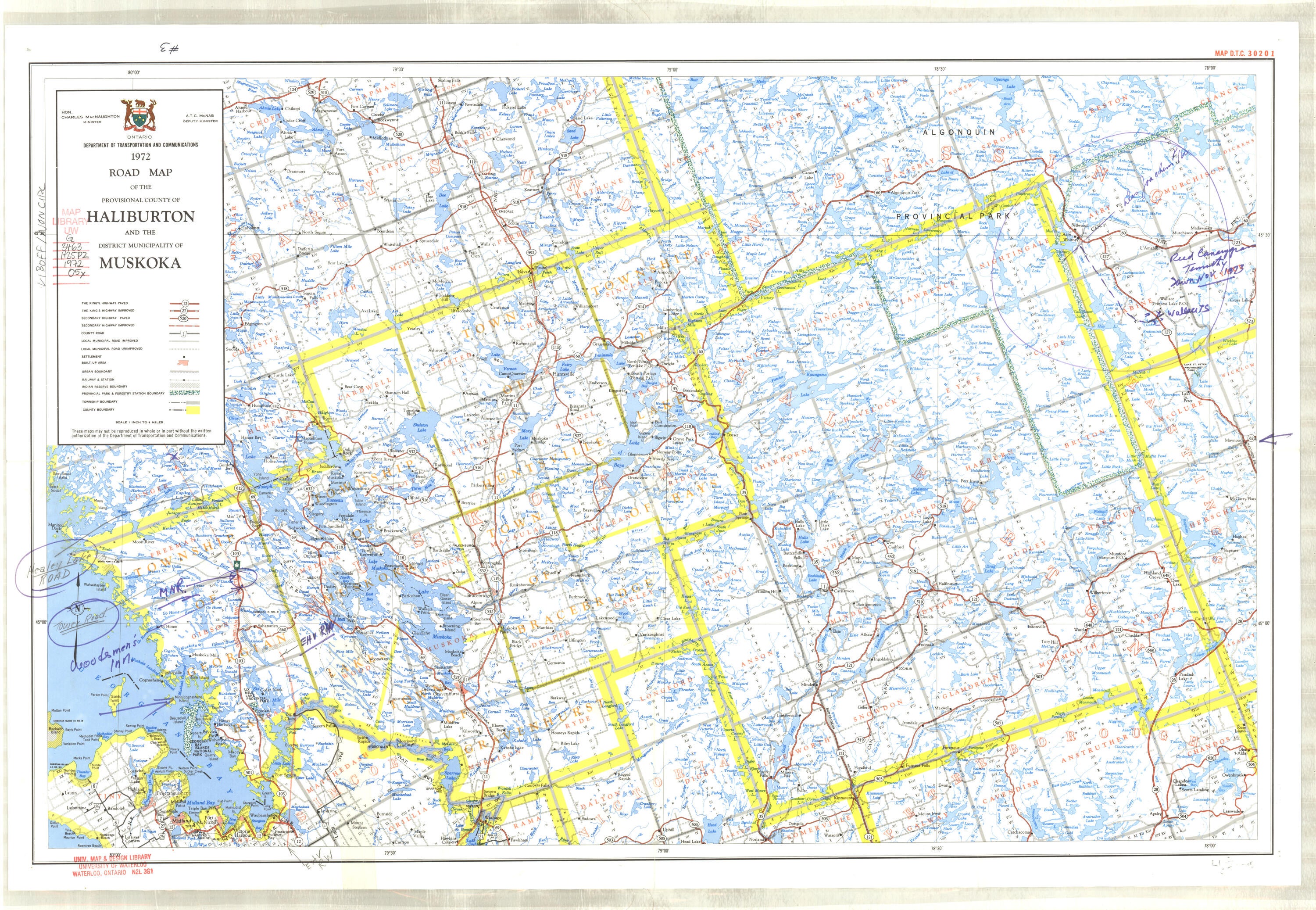
1972
|
Ontario Dept. of Transportation & Communications
|
1": 4 miles
|
Haliburton, District Municipality of Muskoka |
|
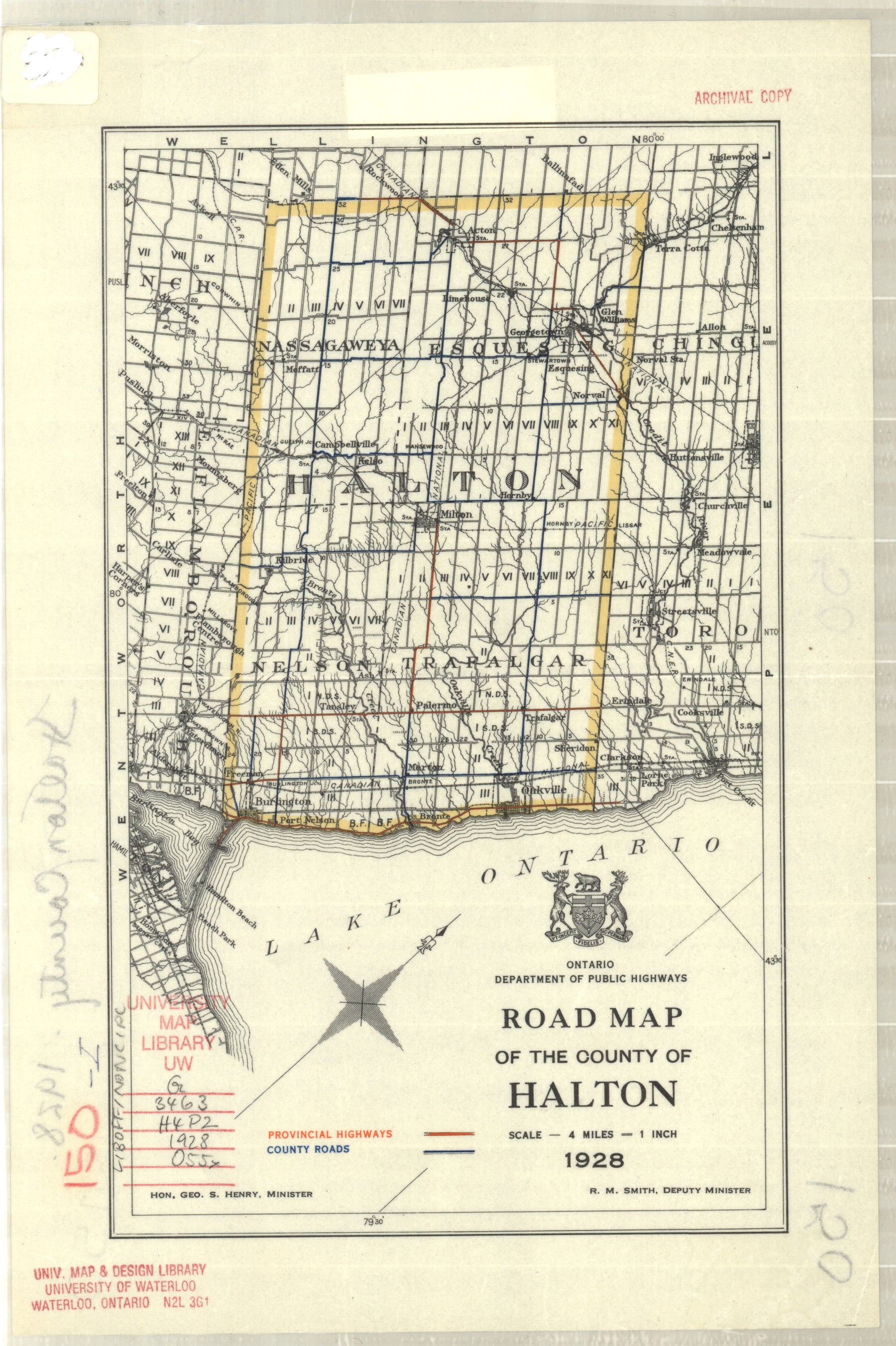
1928 |
Ontario Dept. of Public Highways |
1”: 4 miles |
|
|
Halton SEE ALSO Peel, Halton, Dufferin, Wellington & Waterloo |
|||
|
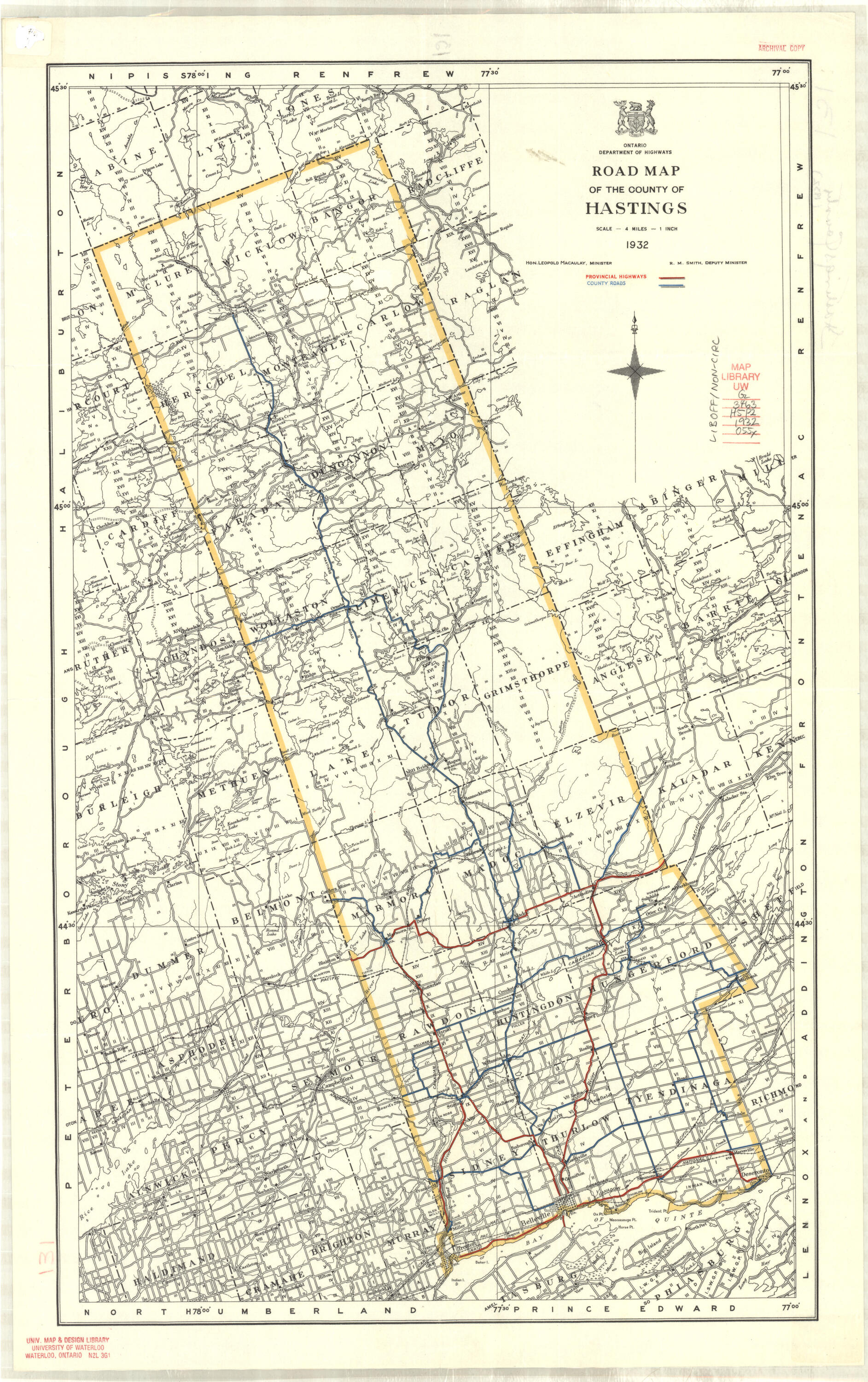
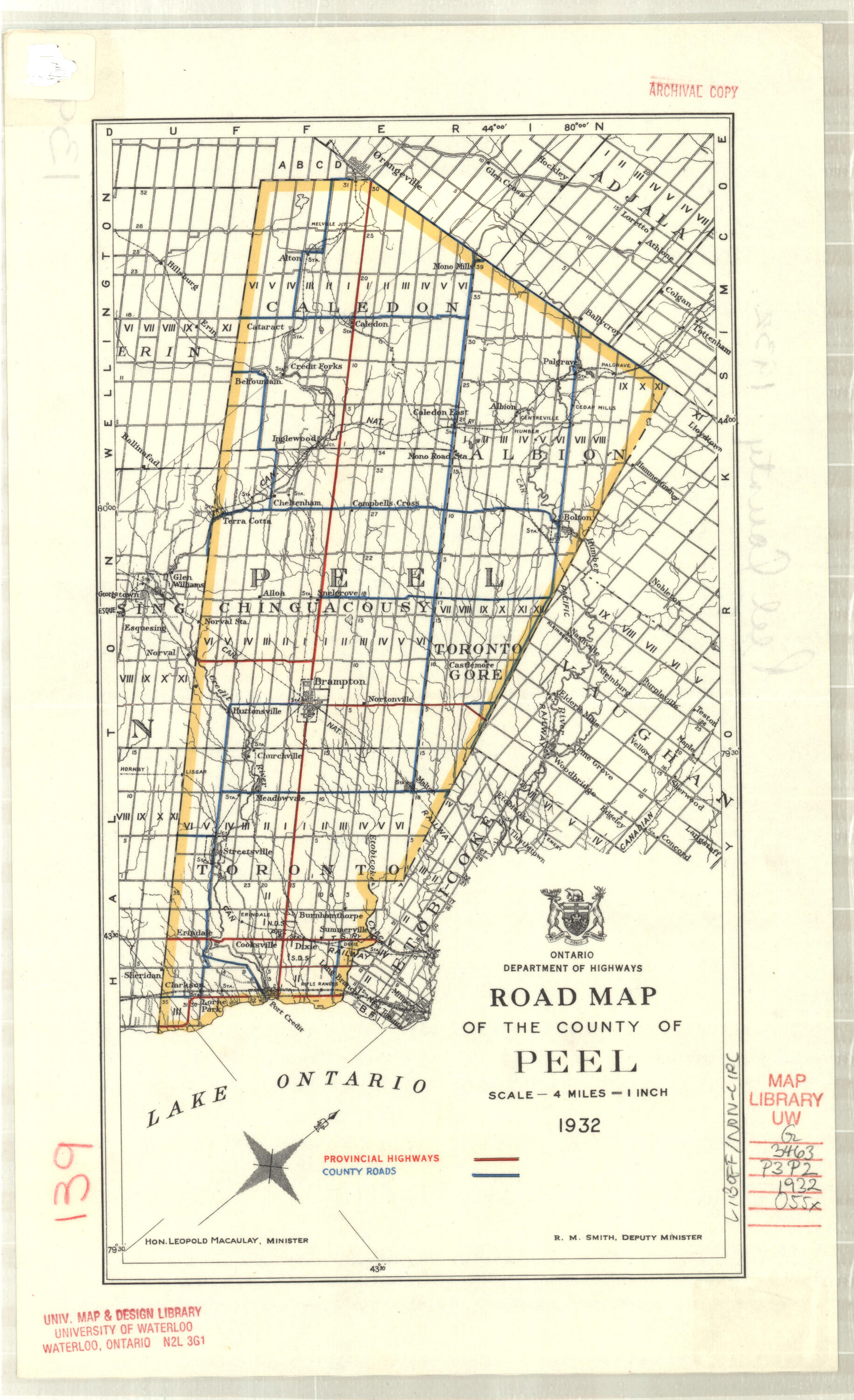
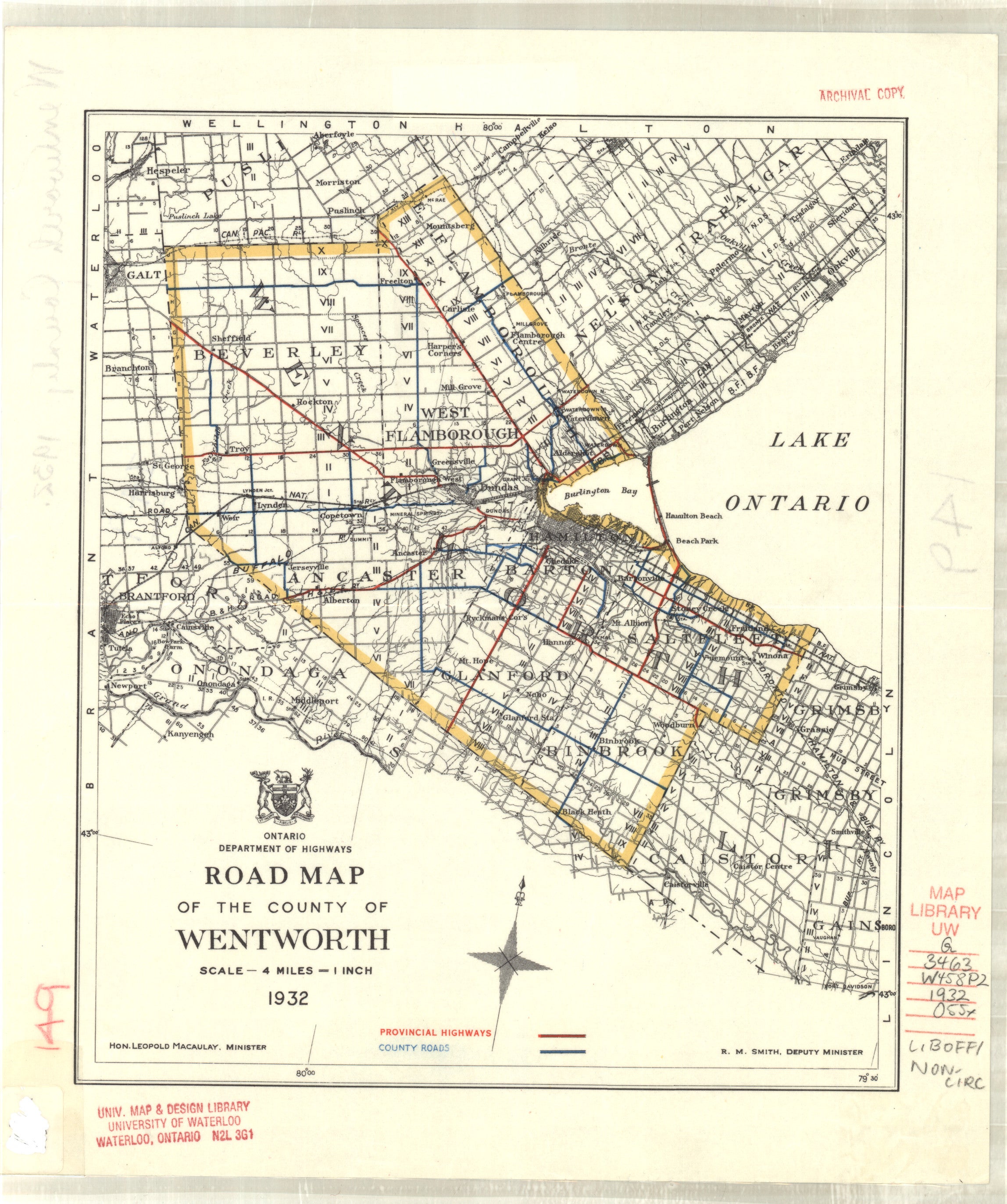
1932 |
Ontario Dept. of Highways |
1”: 4 miles |
|
|
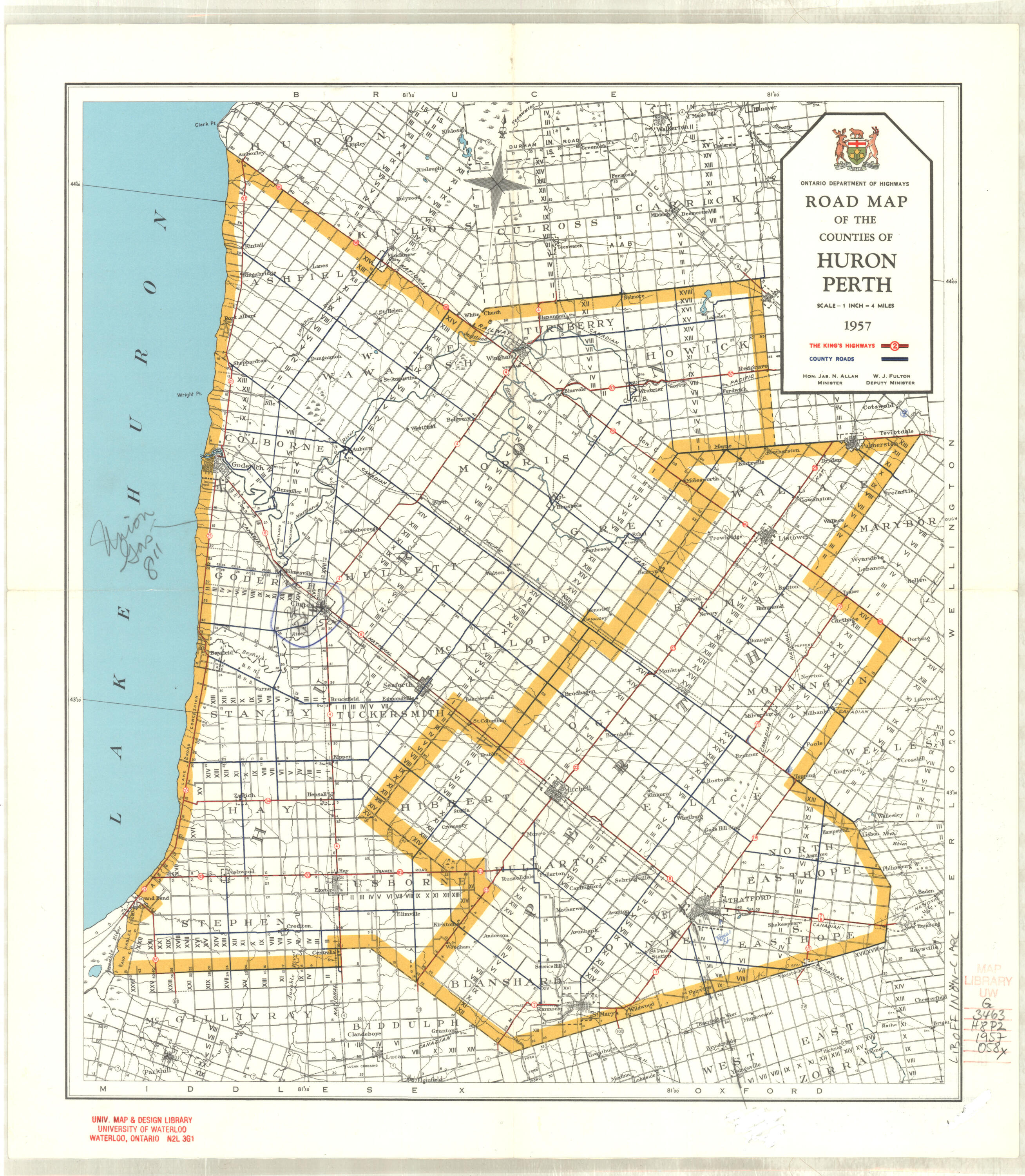
1957
|
Ontario Dep. of Highways
|
1": 4 miles
|
Huron, Perth |
|
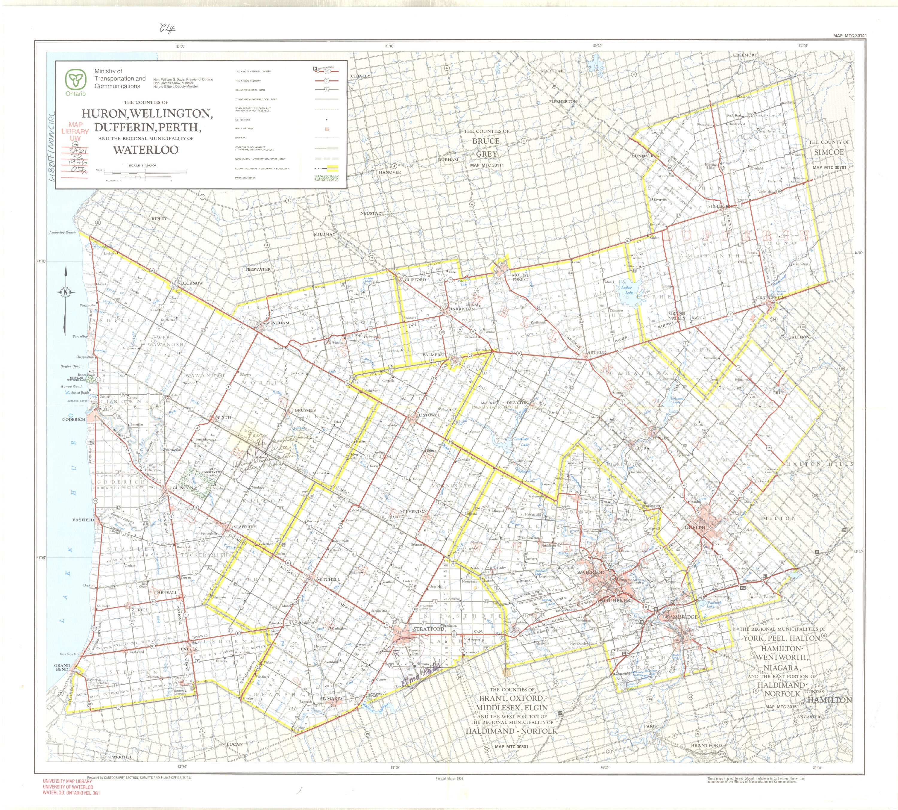
1976 |
Ontario Ministry of Transportation & Communications |
1”: 4 miles |
|
|
Huron SEE ALSO Dufferin, Huron, Perth, Waterloo & Wellington |
|||
|
1928 |
Ontario Dept. of Public Highways |
1”: 4 miles |
|
|
1928 |
Ontario Dept. of Public Highways |
1”: 4 miles |
|
|
1928 |
Ontario Dept. of Public Highways |
1”: 4 miles |
|
|
1928 |
Ontario Dept. of Public Highways |
1”: 4 miles |
|
|
1935 |
Ontario Dept. of Highways |
1”: 4 miles |
|
|
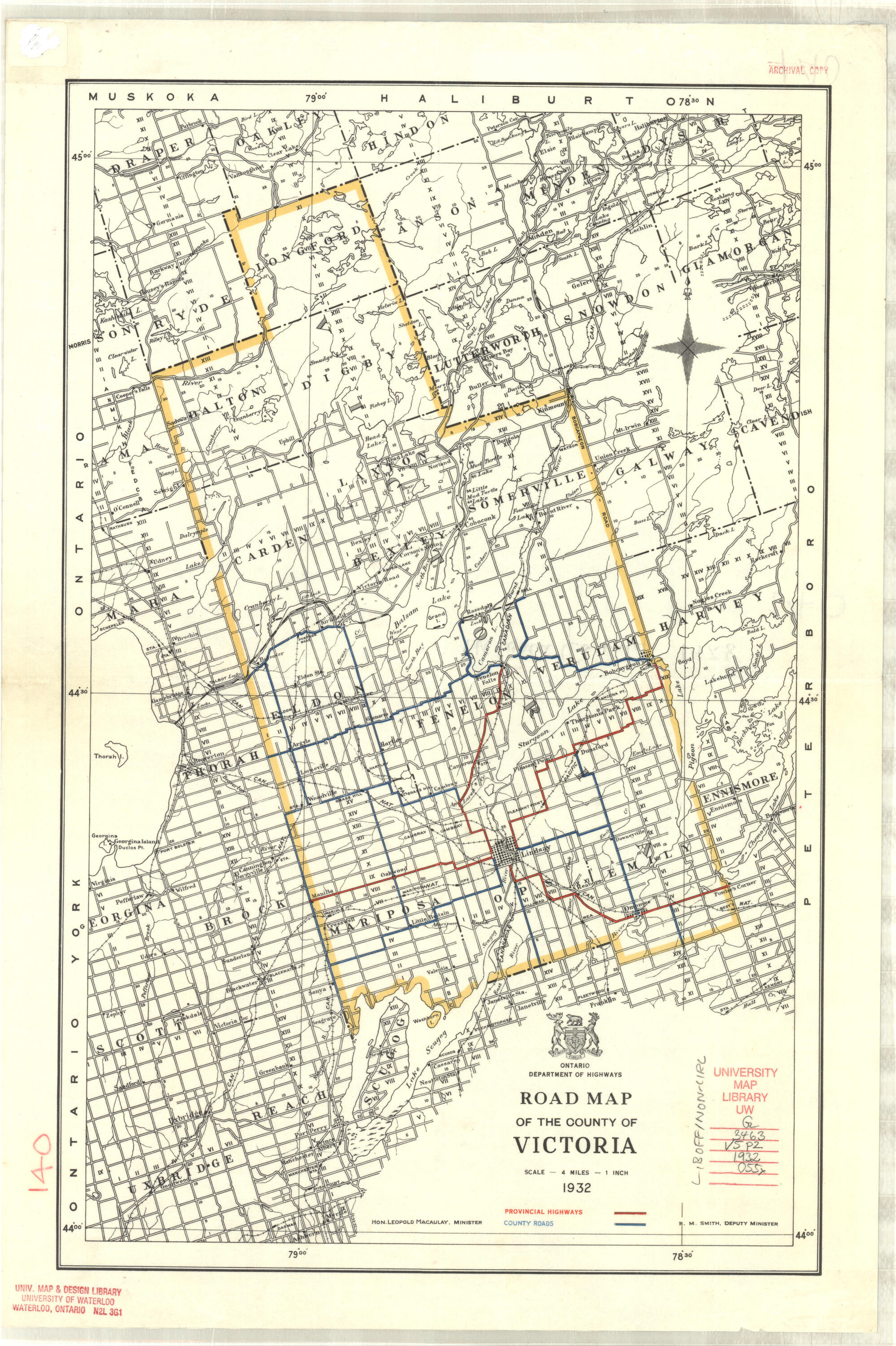
1932 |
Ontario Dept. of Highways |
1”: 4 miles |
|
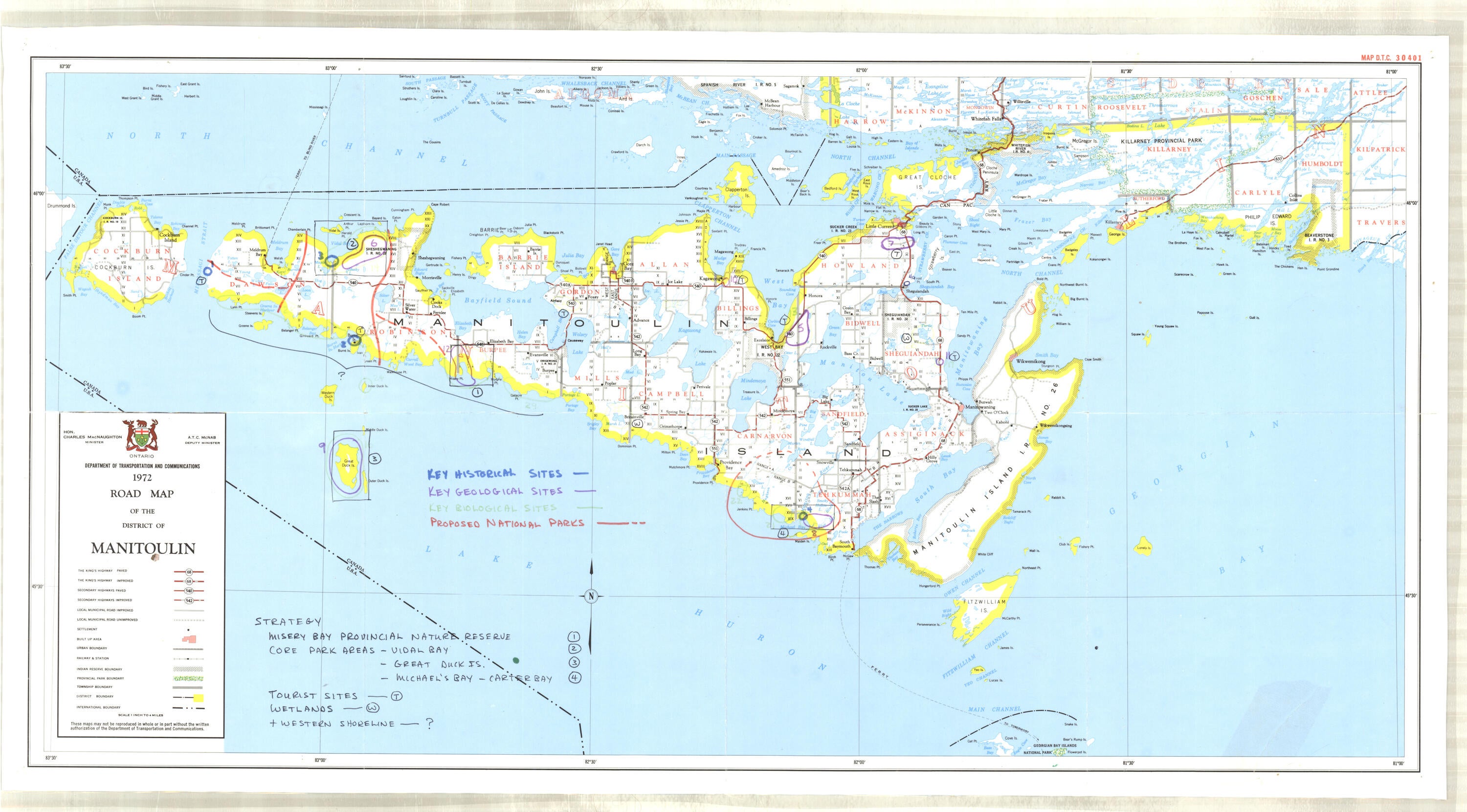
| 1972 | Ontario Dept. of Transportation and Communications | 1": 4 miles | Manitoulin |
|
1928 |
Ontario Dept. of Public Highways |
1”: 4 miles |
|
|
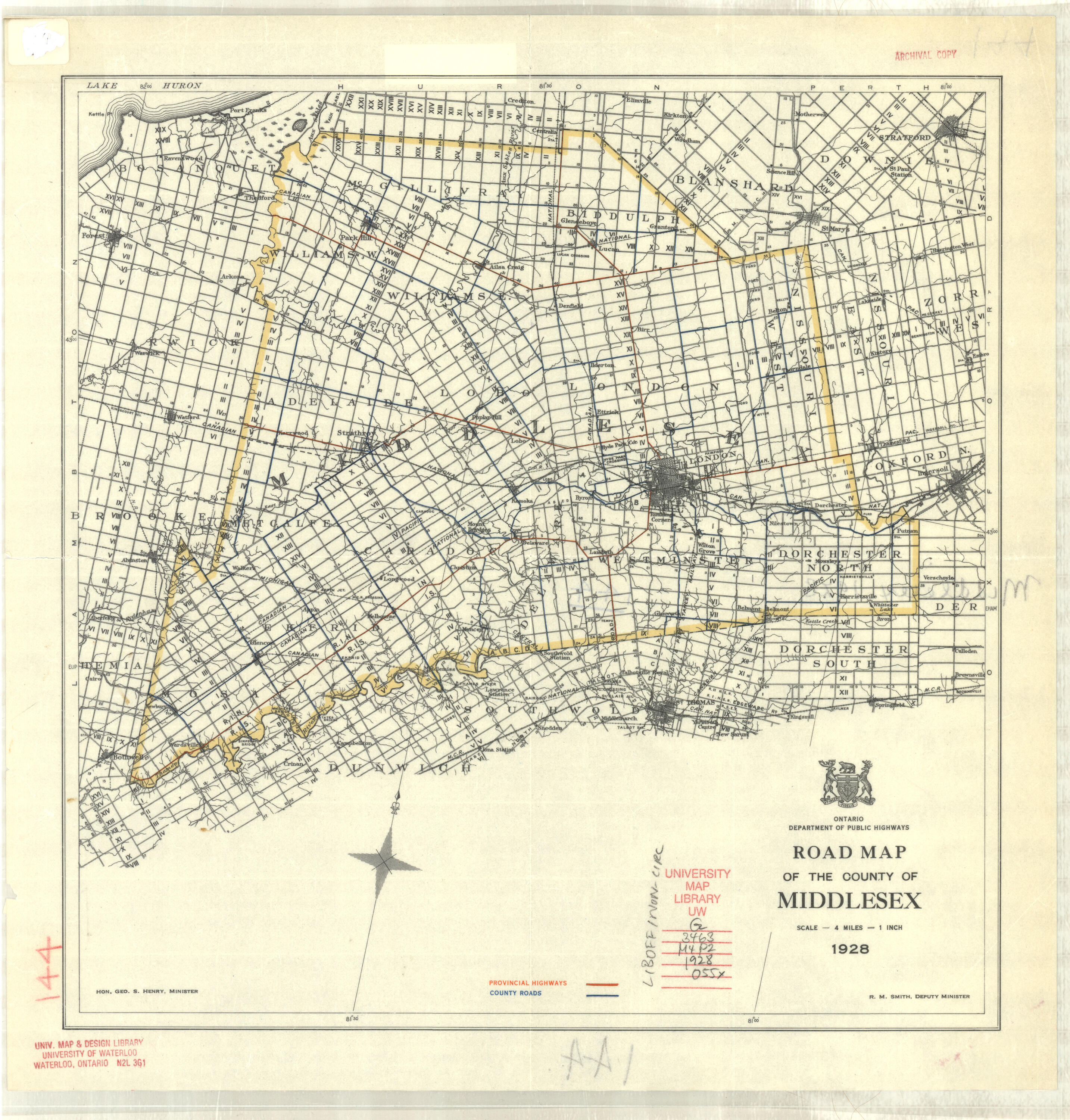
Middlesex SEE ALSO Brant, Elgin, Middlesex, Oxford & Norfolk |
|||
|
1928 |
Ontario Dept. of Public Highways |
1”: 4 miles |
|
|
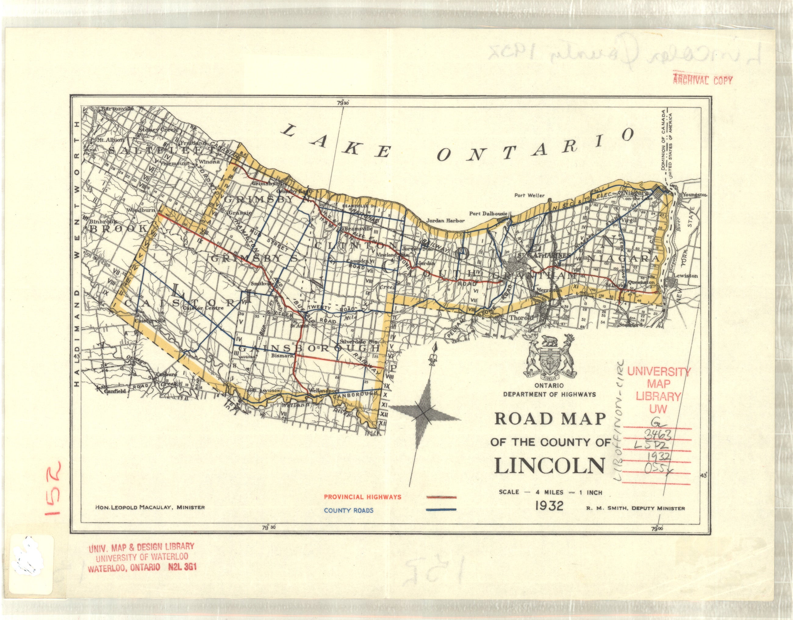
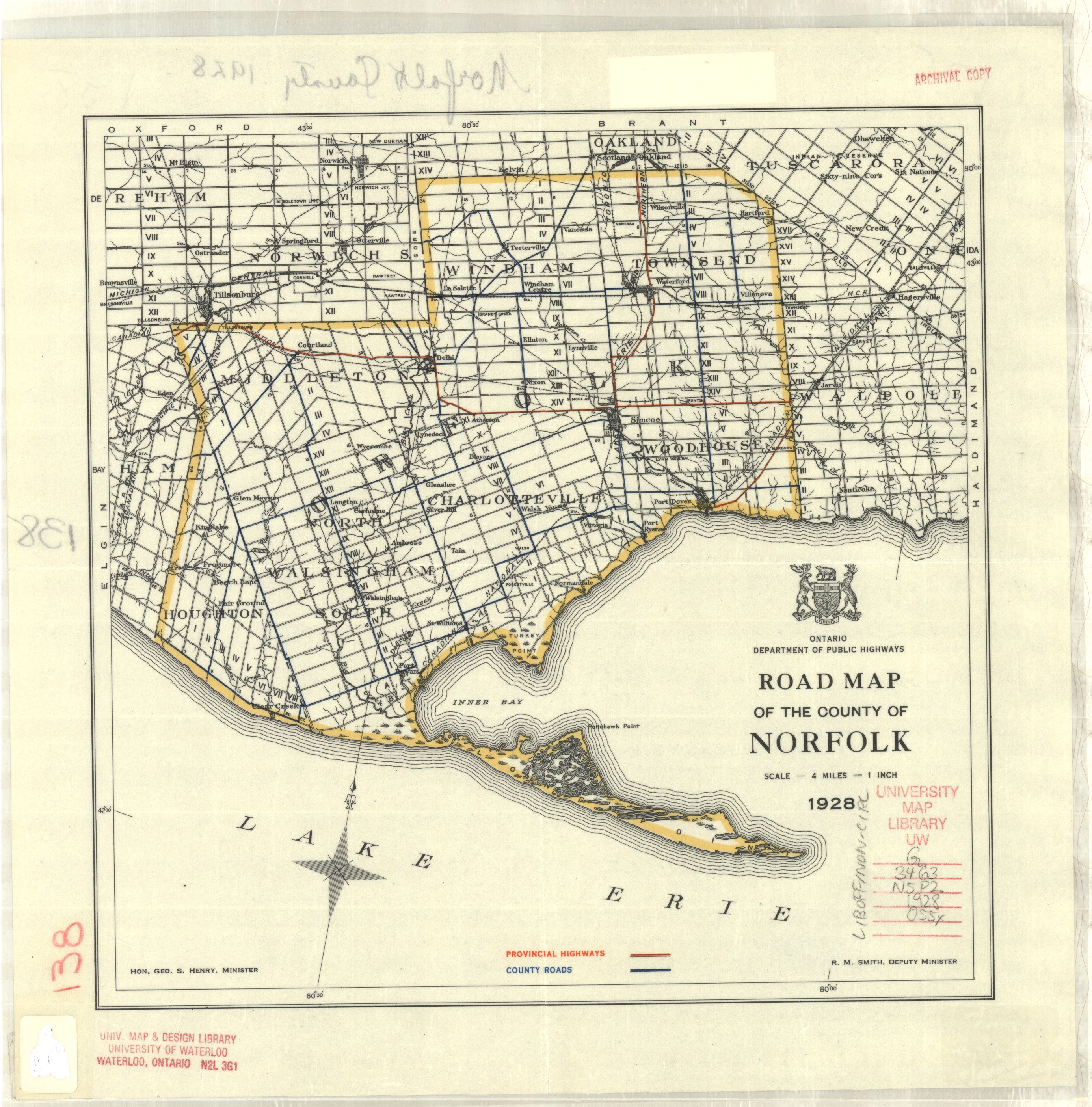
Norfolk SEE ALSO Brant, Elgin, Middlesex, Oxford & Norfolk |
|||
|
1928 |
Ontario Dept. of Public Highways |
1”: 4 miles |
|
|
1961 |
Dept. of Highways Ontario |
1”: 4 miles |
|
|
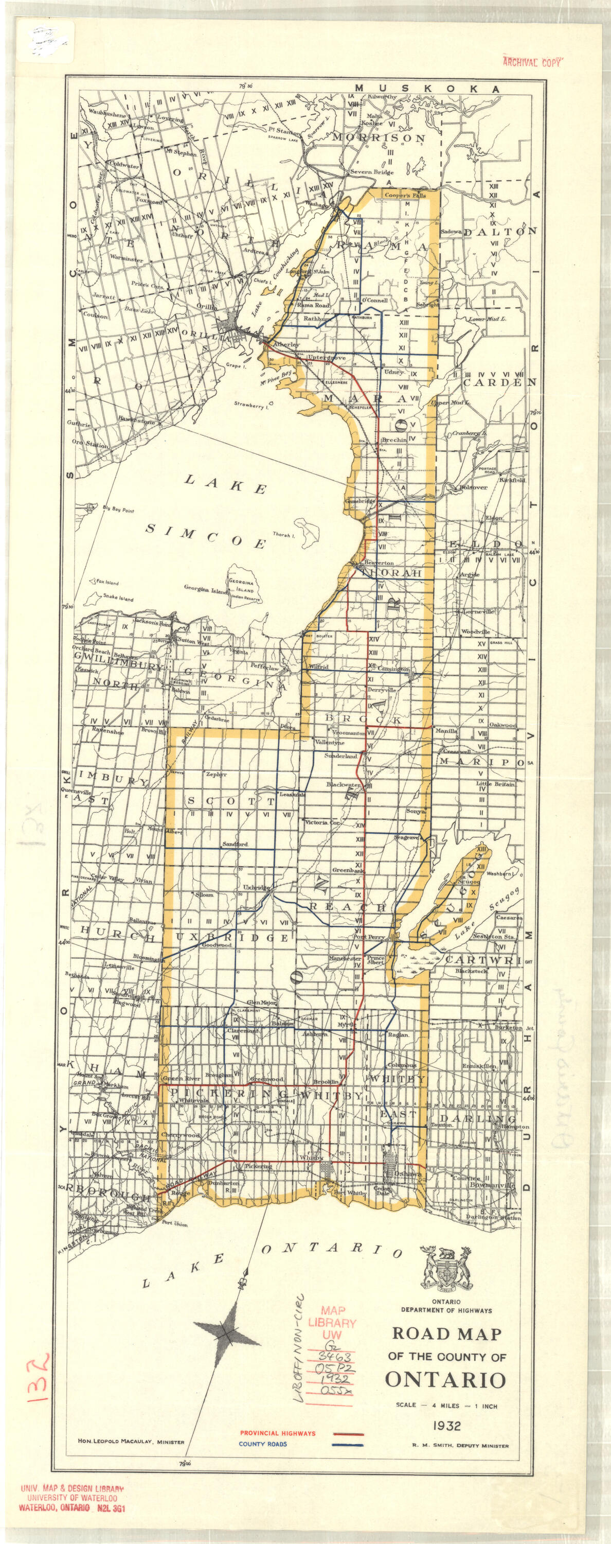
1932 |
Ontario Dept. of Highways |
1”: 4 miles |
|
|
Oxford SEE Brant, Elgin, Middlesex, Oxford & Norfolk |
|||
|
1963 |
Ontario Dept. of Public Highways |
1”: 4 miles |
|
|
1972
|
Ontario Dept. of Transportation and Communication
|
1": 4 miles
|
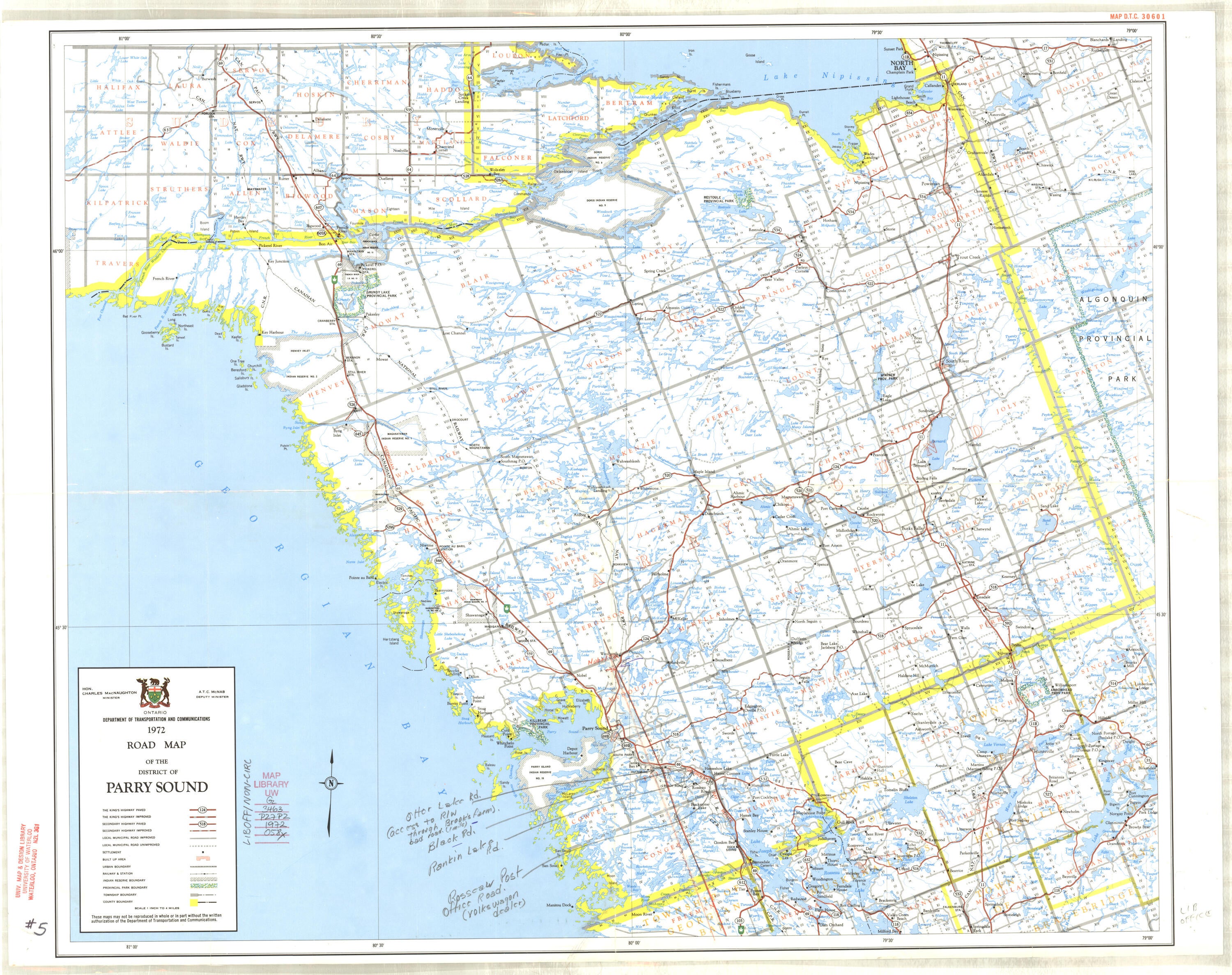
Parry Sound (District) |
|
1932 |
Ontario Dept. of Highways |
1”: 4 miles |
|
|
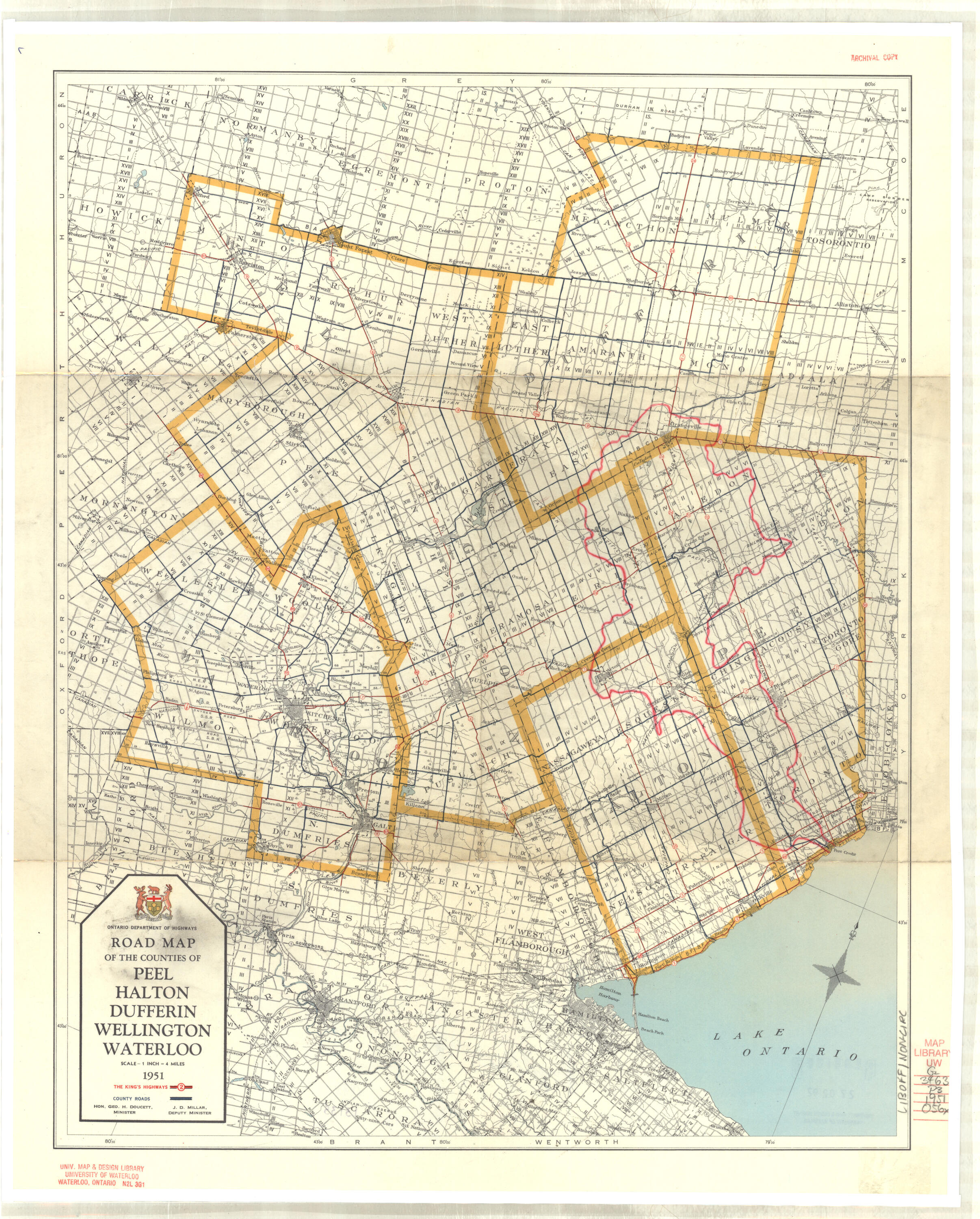
1951 |
Ontario Dept. of Highways |
1”: 4 miles |
|
|
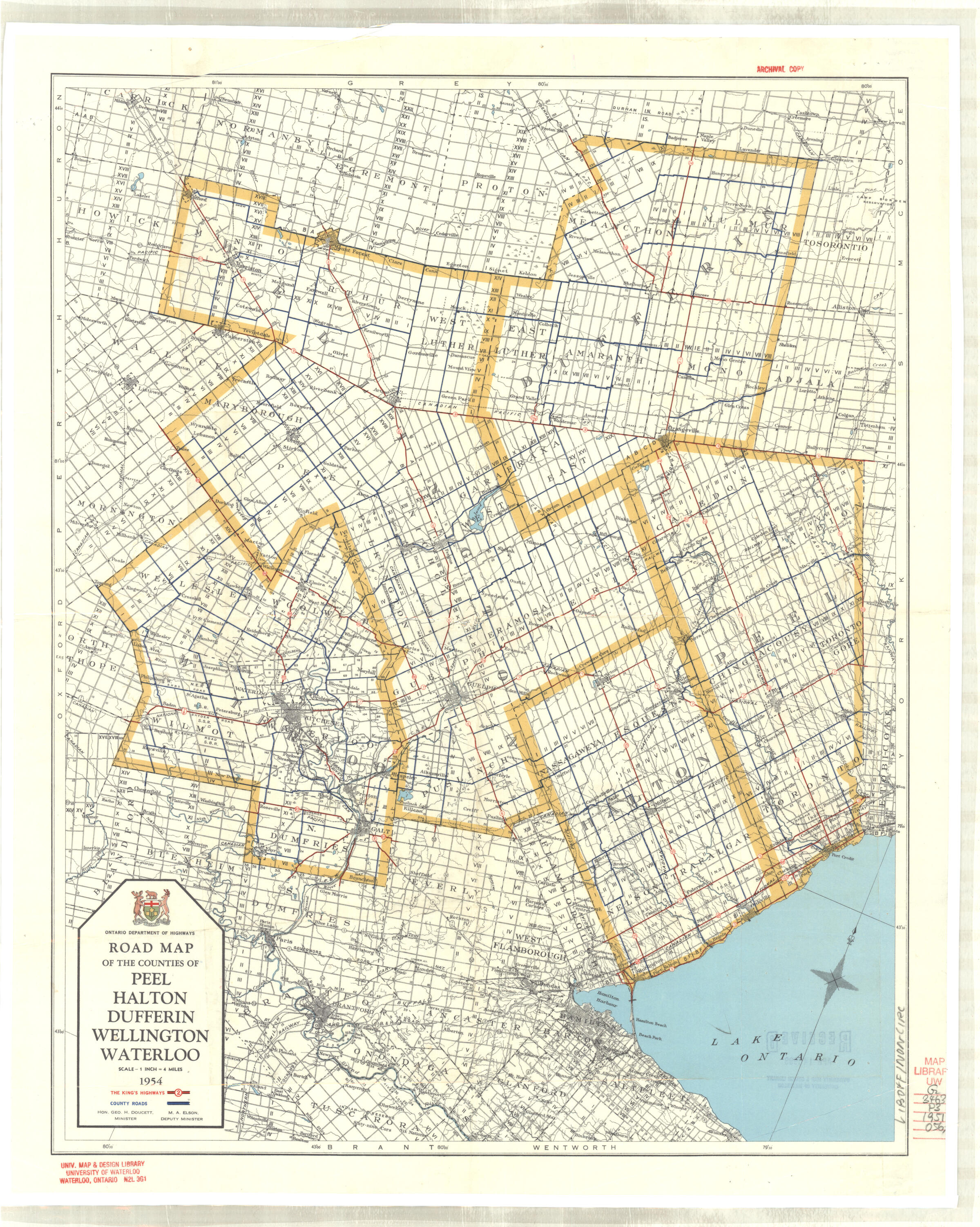
1954 |
Ontario Dept. of Highways |
1”: 4 miles |
|
|
1959 |
Ontario Dept. of Public Highways |
1”: 4 miles |
|
|
Perth SEE Dufferin, Huron, Perth, Waterloo & Wellington |
|||
|
1928 |
Ontario Dept. of Public Highways |
1”: 4 miles |
|
|
1972 (2 copies) |
Ontario Dept. of Transportation & Communications |
1”: 4 miles |
|
|
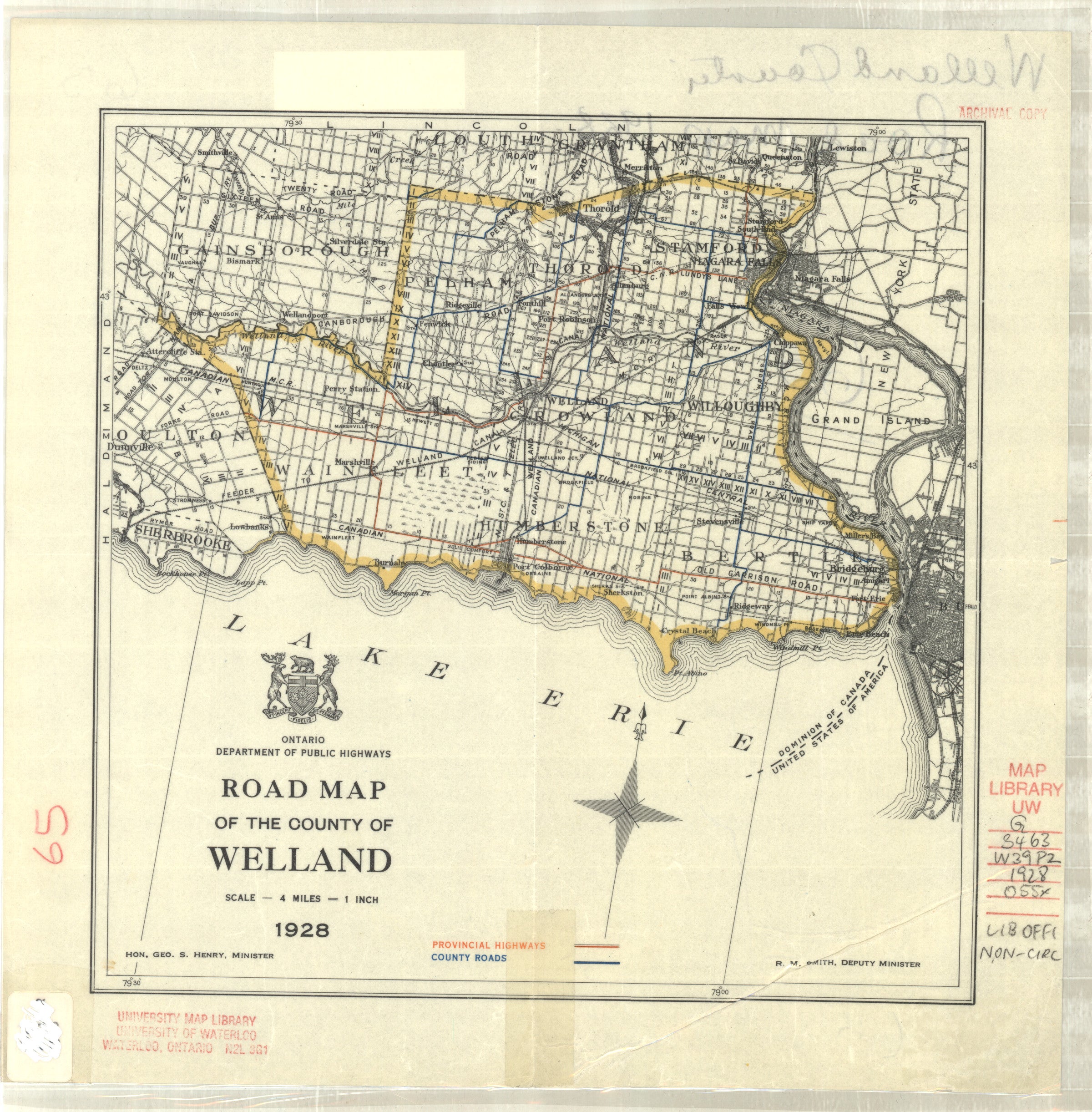
1928 |
Ontario Dept. of Public Highways |
1”: 4 miles |
|
|
1935 |
Ontario Dept. of Highways |
1”: 4 miles |
|
|
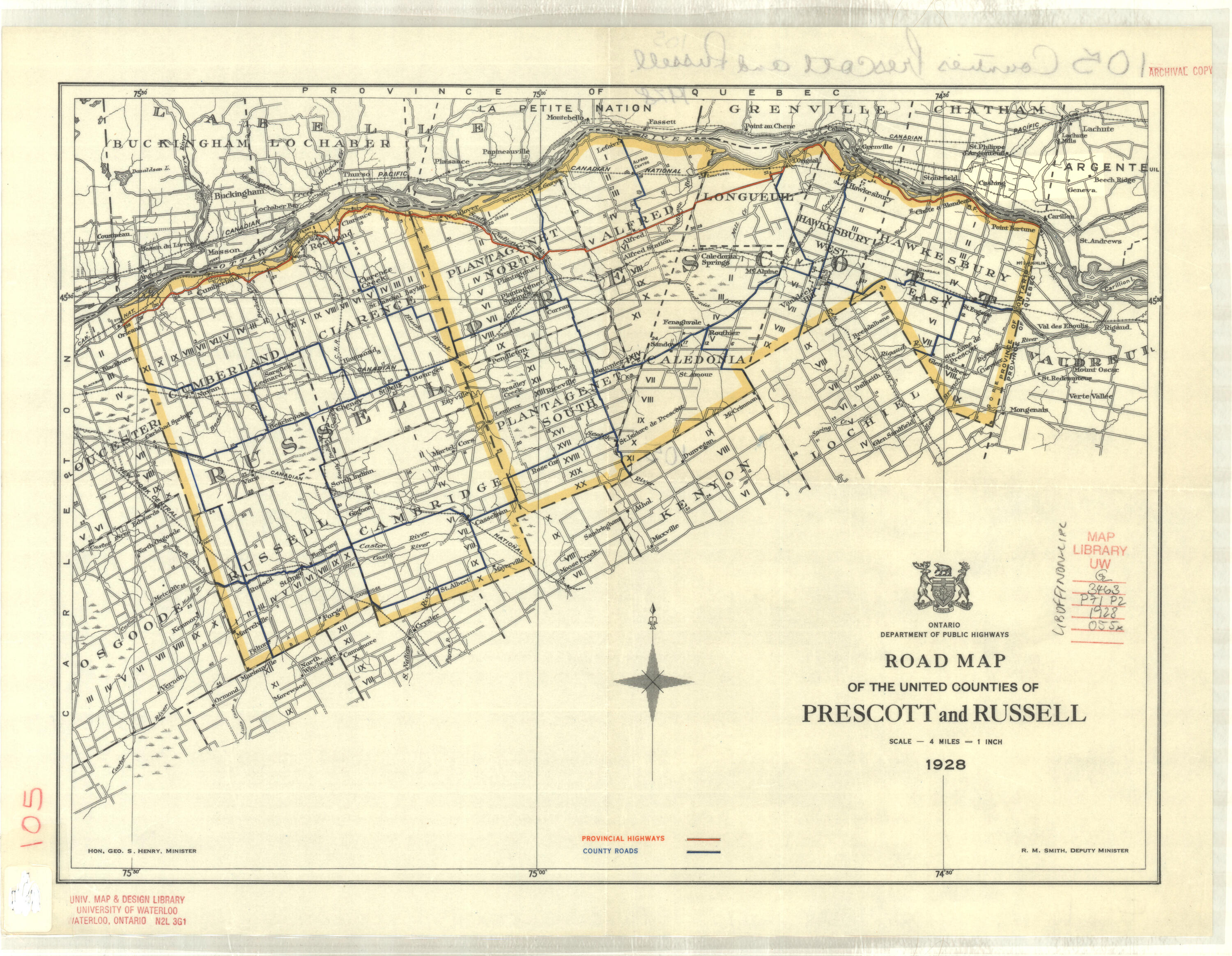
Russell SEE Prescott & Russell |
|||
|
1932 |
Ontario Dept. of Highways |
1”: 4 miles |
|
|
Stormont SEE Dundas, Stormont, Glengarry |
|||
|
1932 |
Ontario Dept. of Highways |
1”: 4 miles |
|
|
1928 |
Ontario Dept. of Public Highways |
1”: 4 miles |
|
|
Waterloo SEE ALSO Dufferin, Huron, Perth, Waterloo & Wellington |
|||
|
Waterloo SEE ALSO Peel, Halton, Dufferin, Wellington & Waterloo |
|||
|
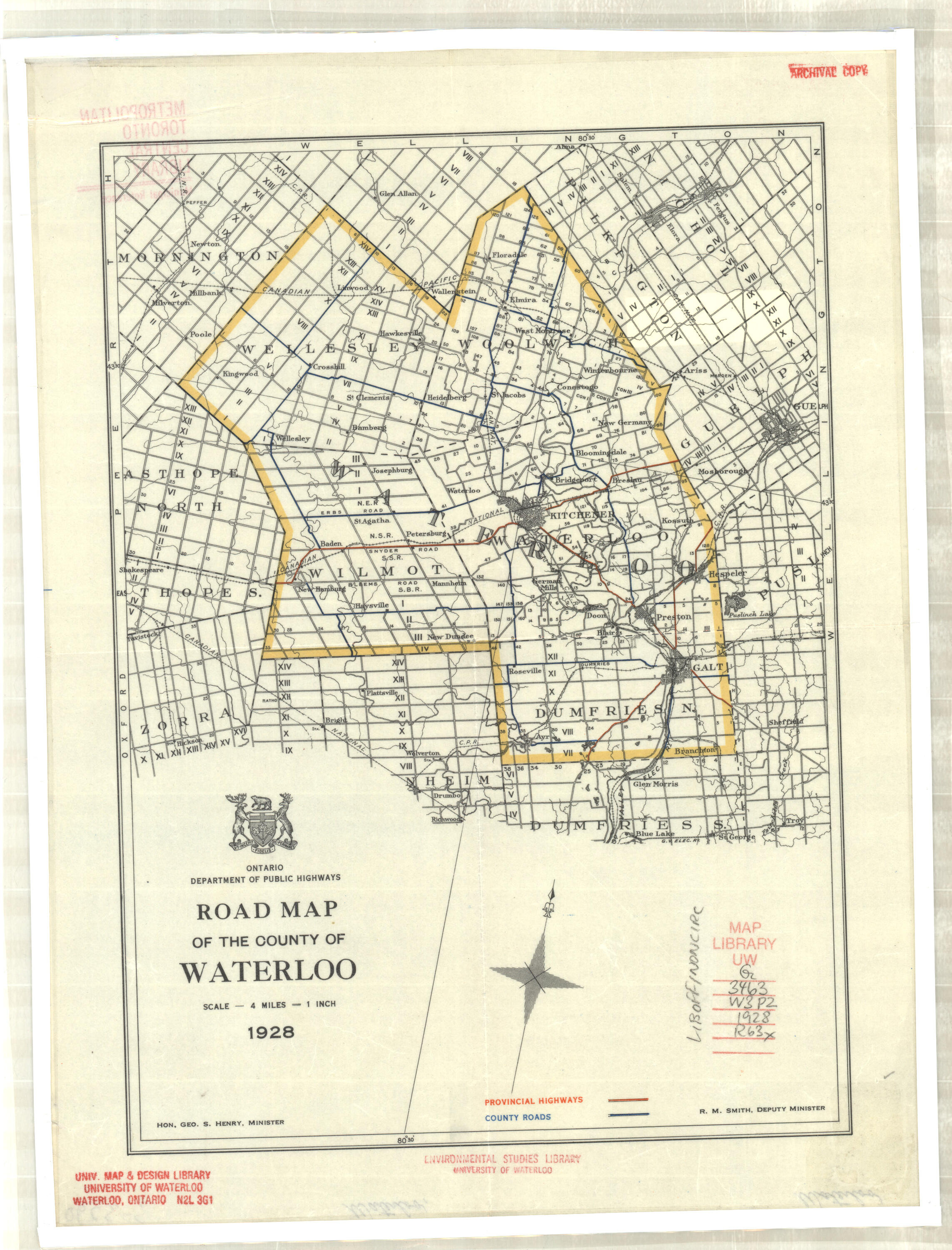
1928 |
Ontario Dept. of Public Highways |
1”: 4 miles |
|
|
Wellington SEE ALSO Dufferin, Huron, Perth, Waterloo & Wellington |
|||
|
Wellington See ALSO Peel, Halton, Dufferin, Wellington & Waterloo |
|||
|
1932 |
Ontario Dept. of Highways |
1”: 4 miles |
|
|
1935 |
Ontario Dept. of Highways |
1”: 4 miles |
|
|
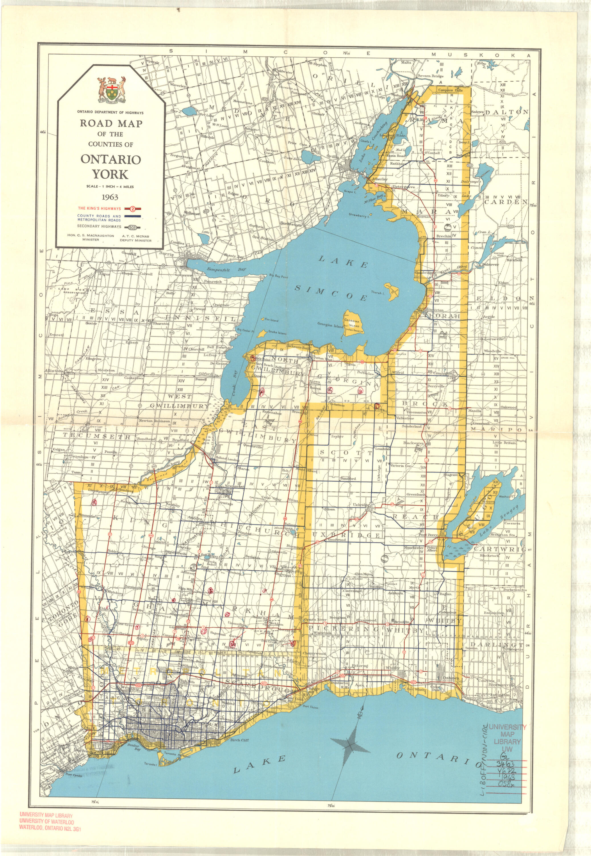
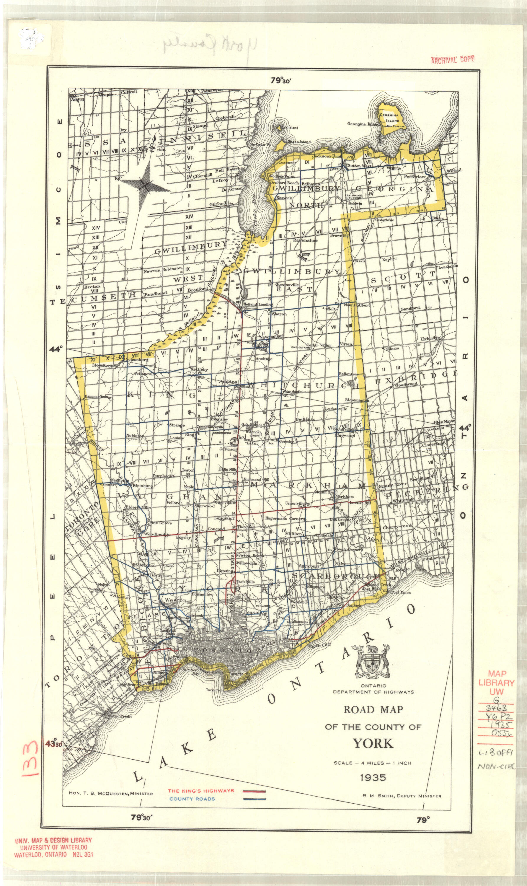
York SEE ALSO Ontario & York |
Small scale maps showing counties - archival
|
Year |
Publisher |
Scale |
Area/Coverage |
|---|---|---|---|
|
1793 |
British Colonial Office, London Reprinted: 1910 |
10 miles to ¾ inch |
Southern Ontario- Counties |
|
1914
|
Rand McNally
|
18 miles to 1 inch
|
Ontario - counties, districts, roads, rail, cities, towns, villages G3461 P2 1914 R36x |
|
1928
|
Canada Dept. of the Interior
|
20 miles to 1 inch
|
Great Lakes Sheet showing Southern and Mid Ontario, Southern Quebec, New York State, West Virginia, Ohio, Indiana, Illinois, Wisconsin - highways, cities, towns, villages |
|
1930
|
Province of Ontario Dept. of Surveyor General |
1: 2,217,600
|
Ontario - counties, townships, roads, rail, 1931 census population for cities, towns, villages G3461 F7 1930.O54x |
|
1944 |
Province of Ontario Dept. of Lands & Forests |
1: 2,217,600 |
Ontario – counties, townships, roads, rail, 1941 census population for cities, towns, villages G3460 1944.O5x |
|
1944 |
Canada Dept. of Mines & Resources |
1: 1,013,760 |
Southern Ontario – counties, townships |
|
1957 |
Province of Ontario Dept. of Lands & Forests |
1: 506,880 |
Southern Ontario – counties, townships, cities, towns, villages |
|
1958 2 copies |
Province of Ontario Dept. of Lands & Forests |
1: 2,027,520 |
Ontario – counties, roads, rail, provincial parks, 1956 census population for cities, towns, villages G3460 1958.O57x |
|
1958 2 copies |
Kitchener-Waterloo Record |
1: 253,440 |
Midwestern Ontario – counties, concessions, townships, roads |
|
1964 |
Province of Ontario Dept. of Lands & Forests |
1: 506,880 |
Southern Ontario – counties, townships, concessions |