| Area | General guide: types of maps | Dates |
|---|---|---|
|
Kitchener |
Land-use maps Street maps Annexation map |
1974 – 1980 1916 – 1982 1980 |
|
Waterloo |
Land-use maps Property boundary maps Zoning maps Street maps |
1965 – 1986 1972 – 1985 1971 – 1985 1913 – 1994 |
|
Cambridge (Galt, Preston, Hespeler) |
Street maps City boundary maps Land-use maps Property boundary maps |
196– 1972 1972 1947 |
|
Kitchener-Waterloo |
Land-use maps Street maps |
1971 – 1979 1923 – 1982 |
|
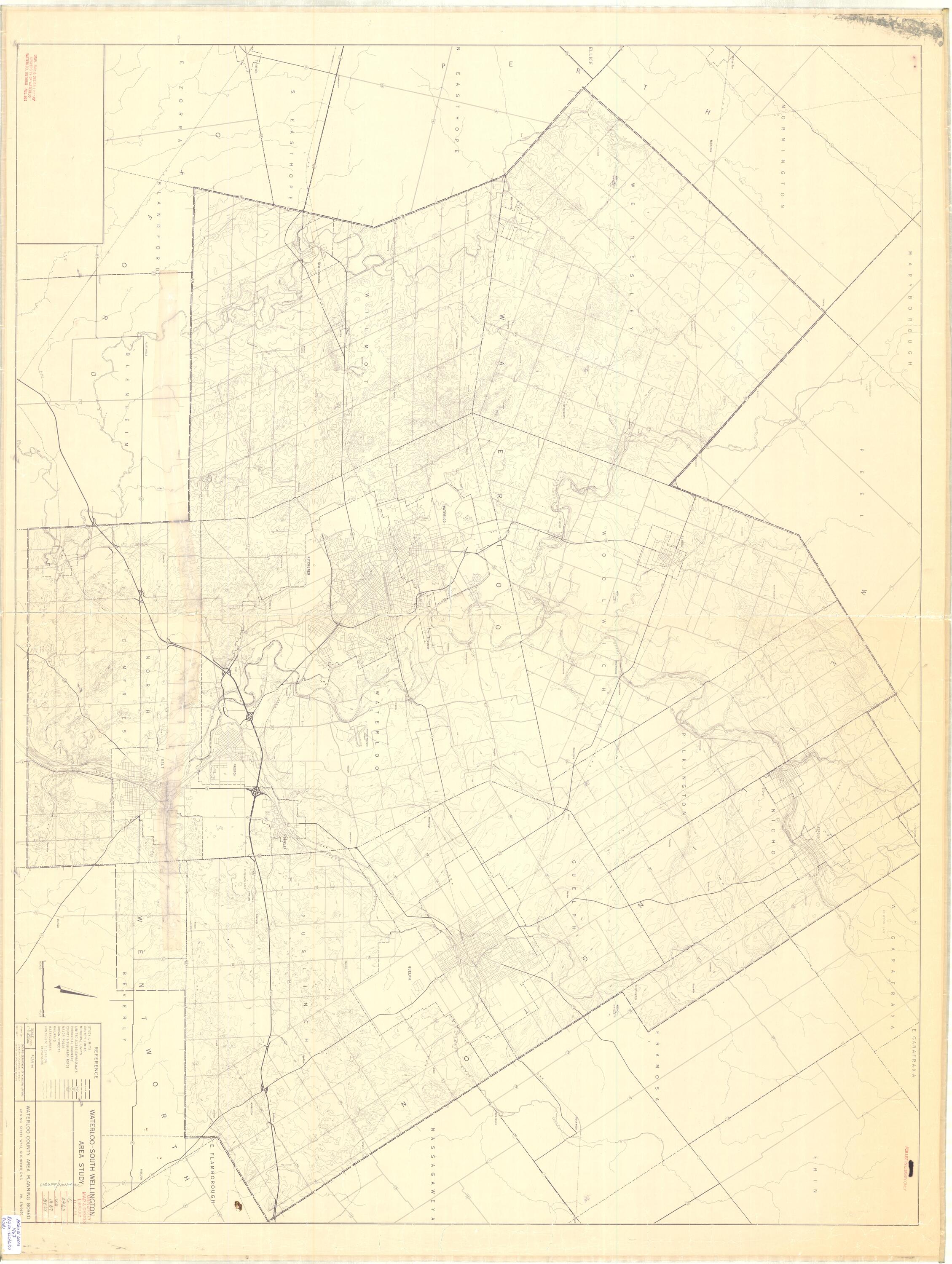
Waterloo-Wellington County |
Street map |
1964 |
|
Regional Municipality of Waterloo |
Road maps |
1881 – 1981 |
Kitchener archival maps
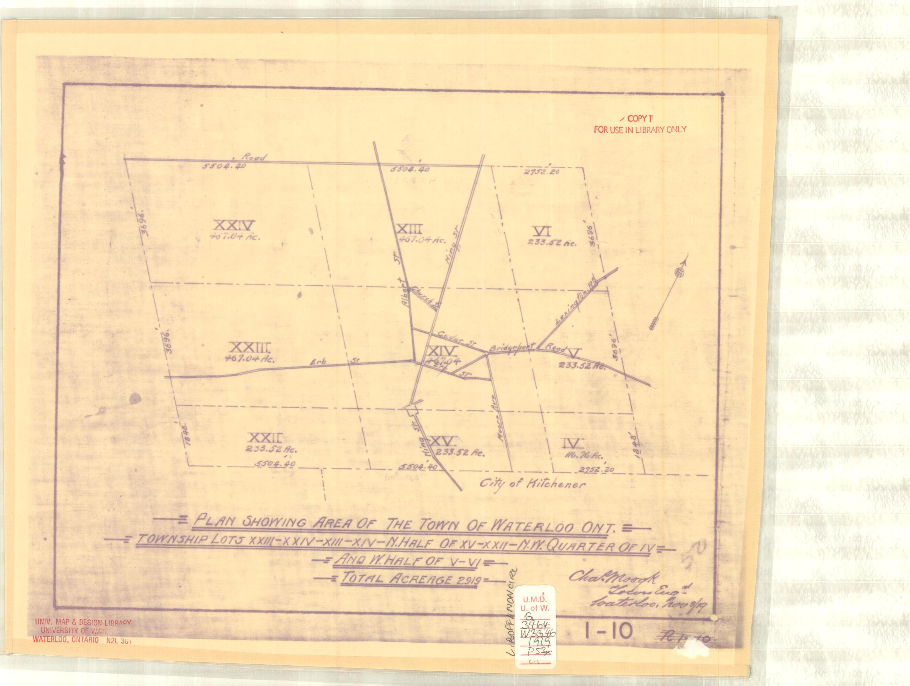
Annexation map
| Date | Scale | Description |
|---|---|---|
|
1980 (Nov) |
1: 2,000 |
Annexation map(History of and Proposed) |
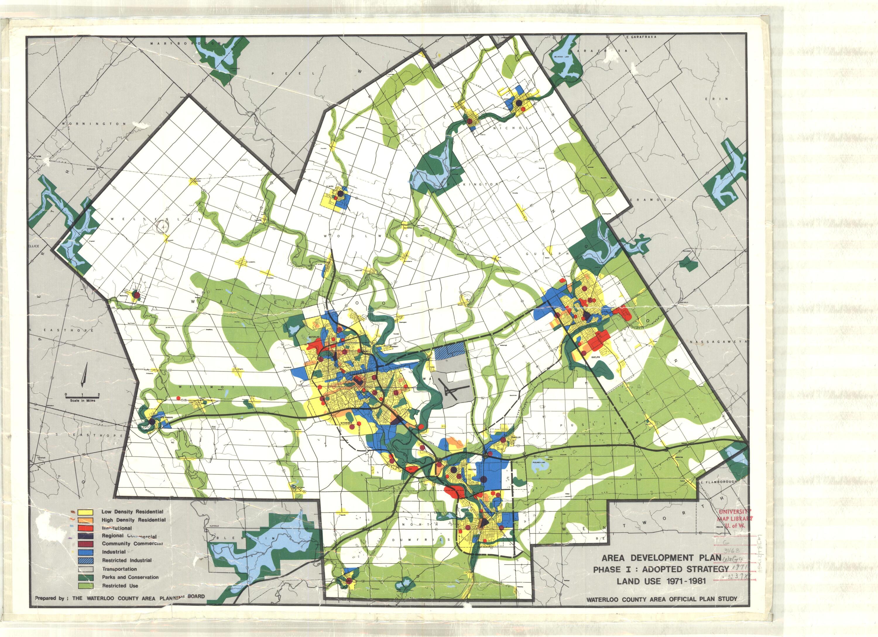
Land use maps
| Date | Scale | Description |
|---|---|---|
|
1974 (Aug) |
1: 24,000 |
Existing land use |
|
1979 (March) |
1: 24,000 |
Land use; Official Plan |
|
1980 |
1:24,000 |
Land use; Official Plan |
Street maps
| Date | Scale | Description |
|---|---|---|
|
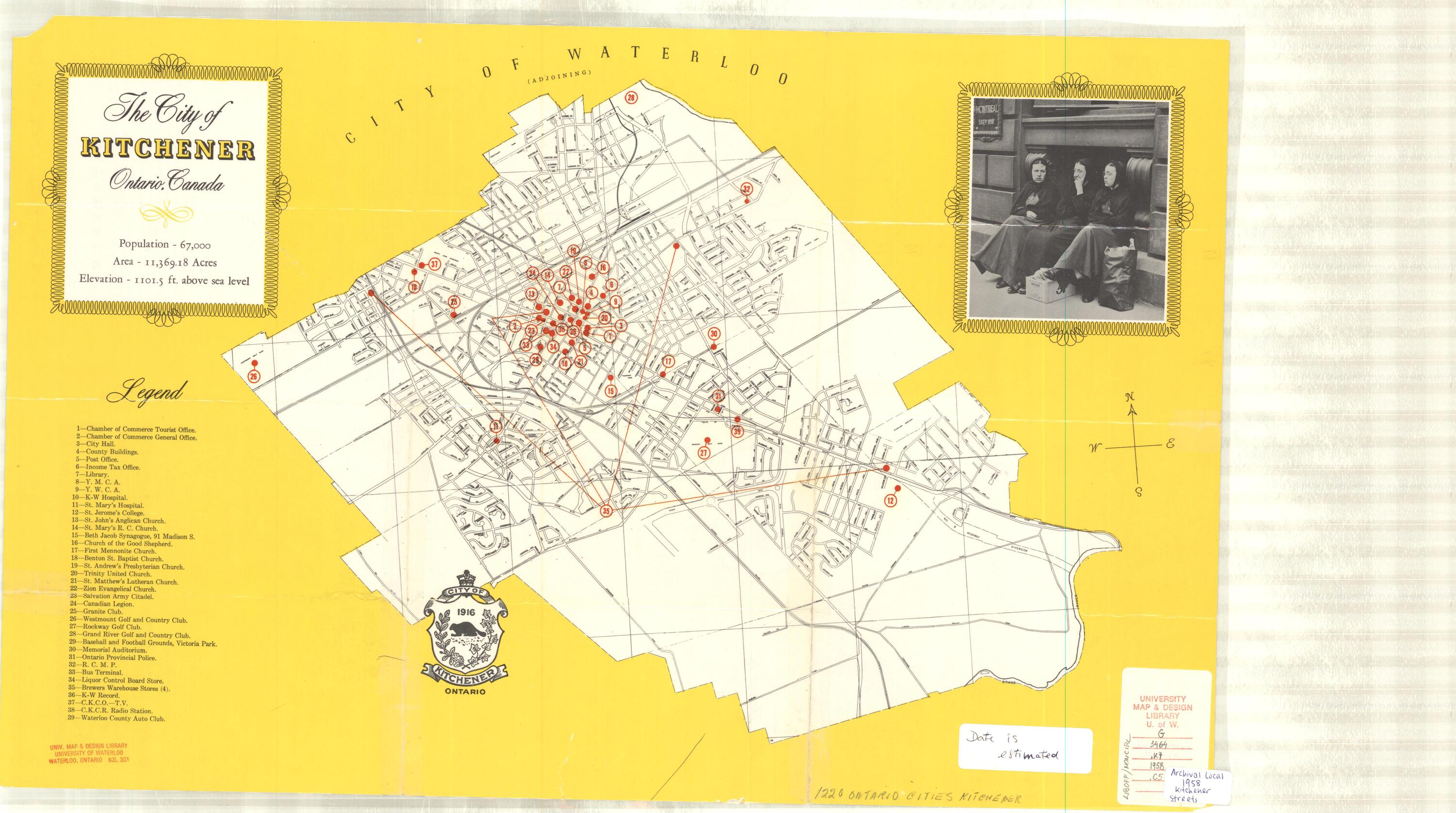
1916 |
No scale |
Population, Area and Elevation included |
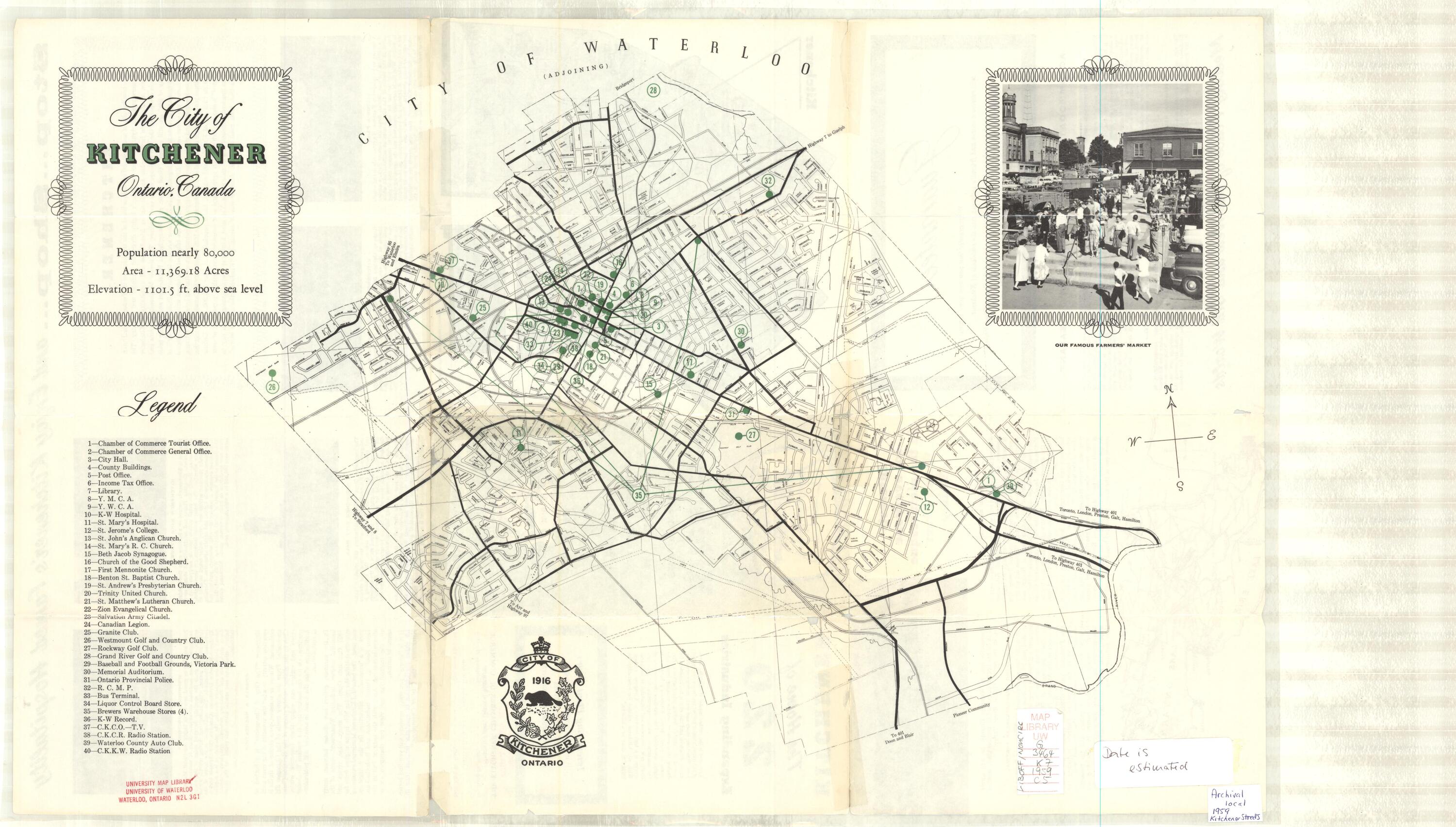
|
No scale No scale |
Population, Area and Elevation included Population, Area and Elevation included |
|
|
1:12,000 |
||
|
1:12,000 |
||
|
1965 (Sept) |
1:24,000 |
|
|
1967 (Aug) |
1:24,000 |
|
|
1968 (April) |
1:24,000 |
|
|
1:24,000 |
||
|
1971 (Aug) |
1:12,000 |
Population of Census Tracts |
|
1:12,000 |
2 sheets |
|
|
1:12,000 |
2 sheets; North & South |
|
|
1:24,000 |
||
| 1981 | ||
|
1:12,000 |
2 sheets |
Waterloo archival maps
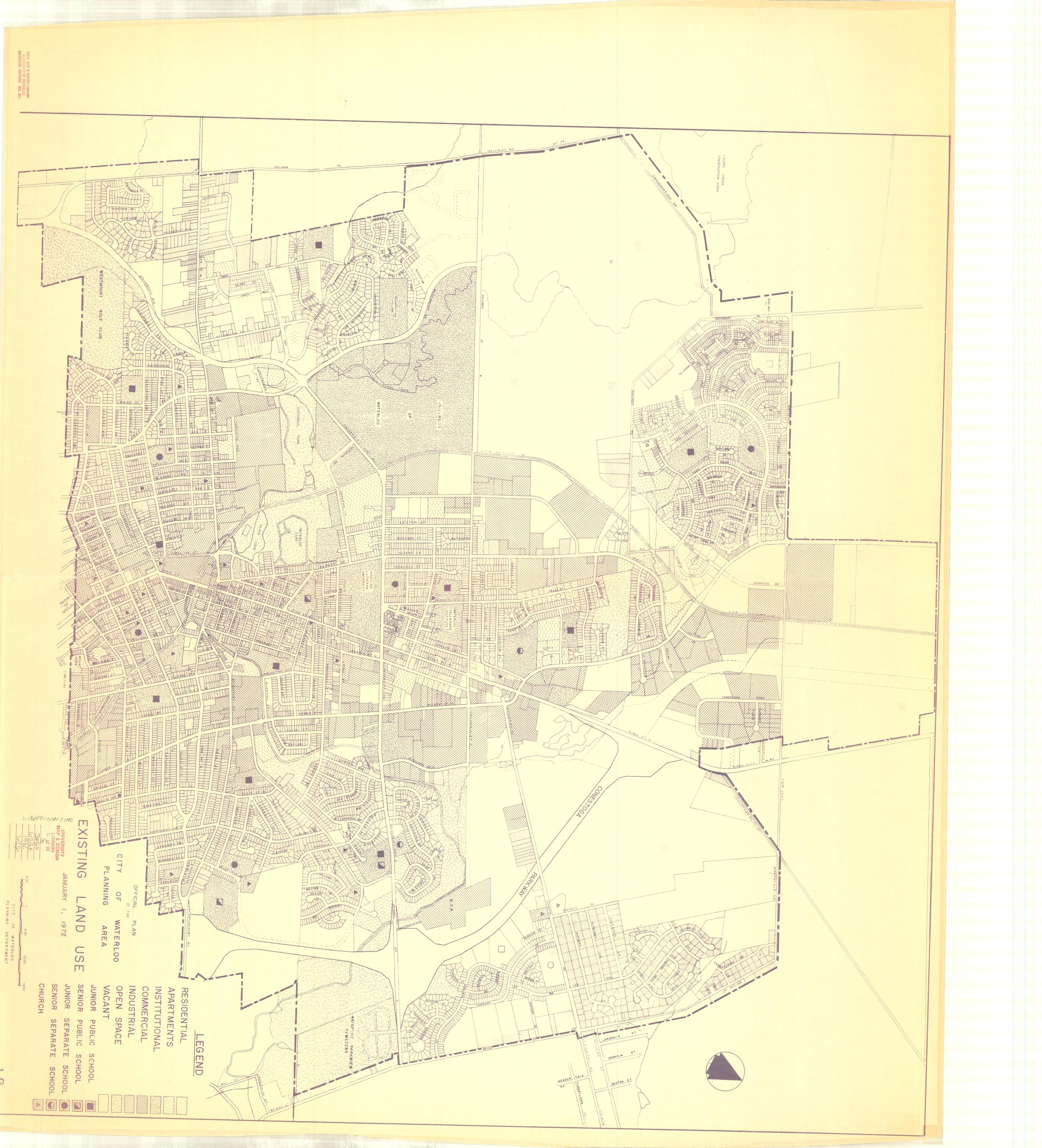
Land use maps
| Date | Scale | Description |
|---|---|---|
|
1965 (Nov) |
1: 6,000 |
Existing land use |
|
1970 |
1: 7,200 |
Existing land use |
|
1: 7,200 |
Existing land use; Official Plan |
|
|
1: 9,600 |
Existing land use |
|
|
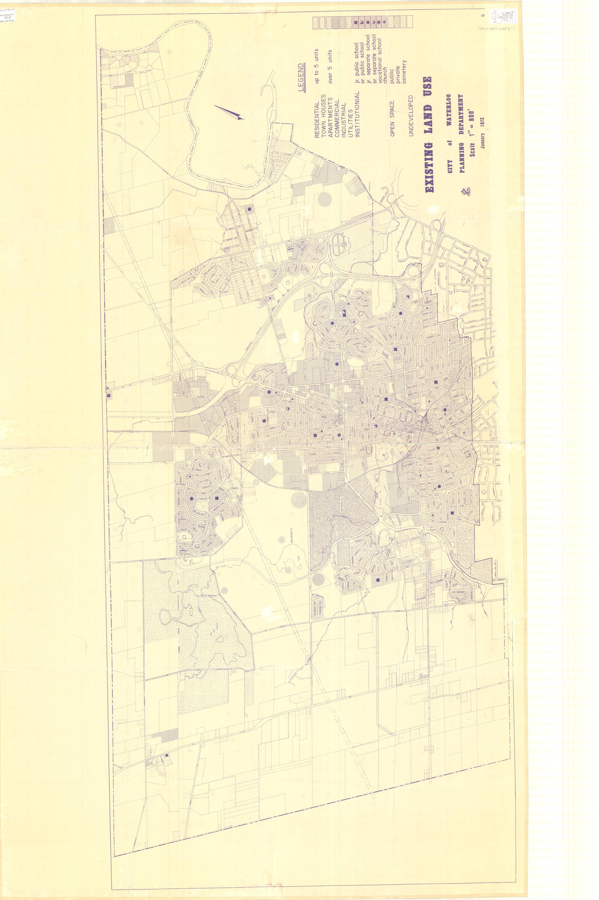
1977 (Oct) |
1: 9,600 |
Existing land use |
|
1980 |
1:24,000 |
Existing land use |
|
1985 (July) |
1: 9,600 |
Land-use plan |
|
1986 (June) |
1: 9,600 |
Land-use plan |
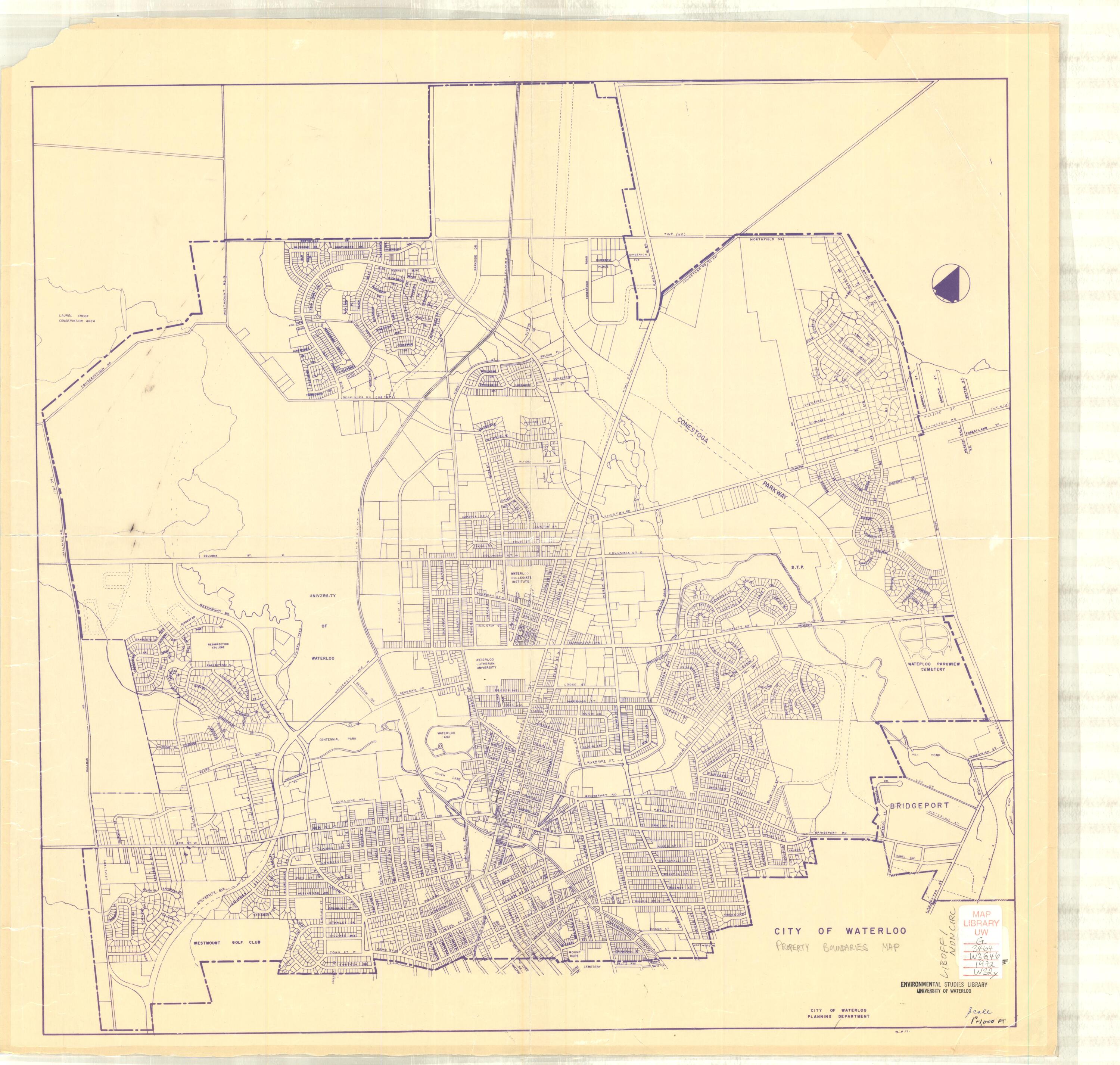
Property boundary maps
| Date | Scale | Description |
|---|---|---|
|
1: 12,000 |
Property boundaries |
|
|
1975 (March) |
1: 9,600 |
Property boundaries |
|
1985 |
1:10,000 |
Property boundaries |
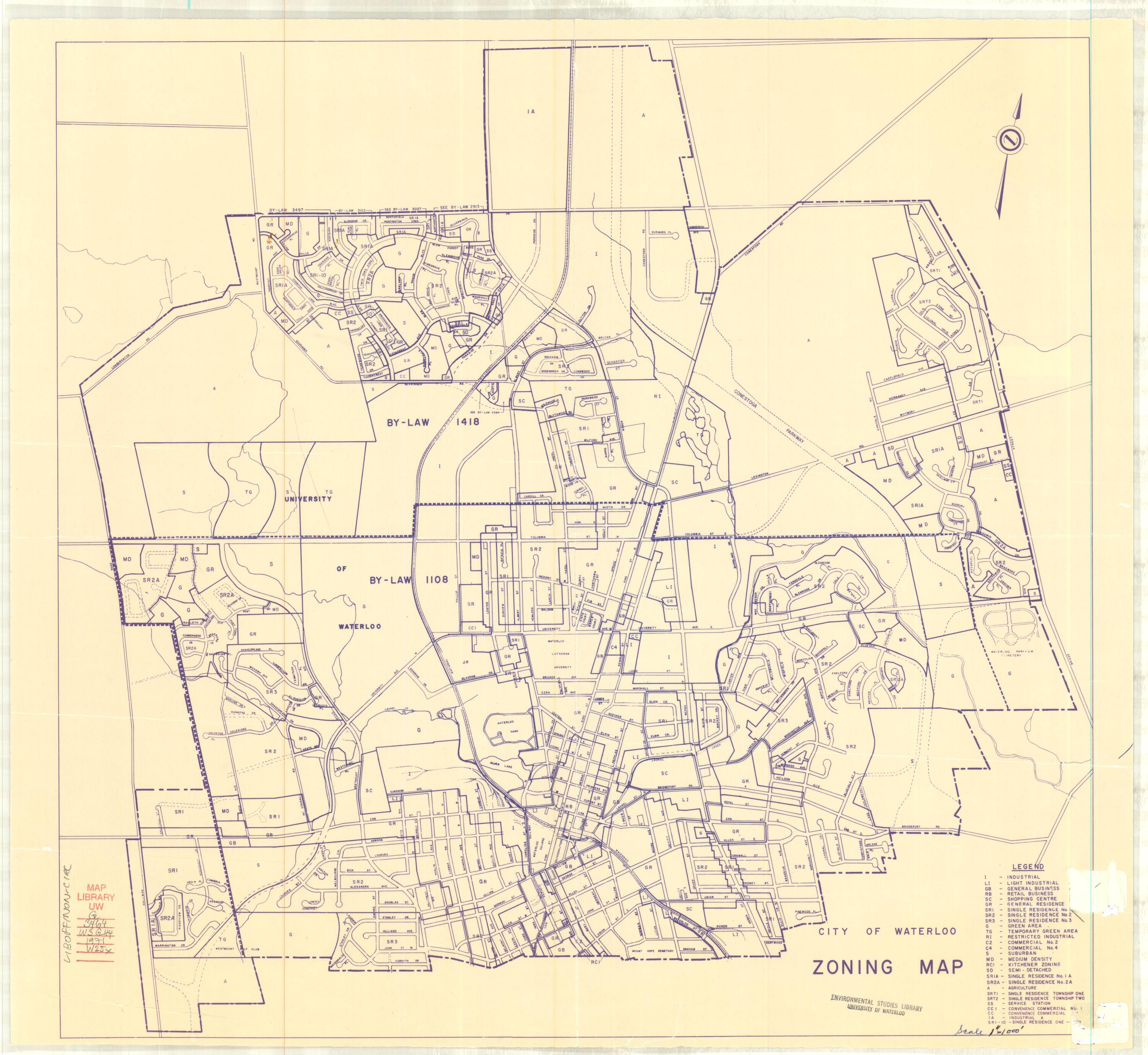
Zoning maps
| Date | Scale | Description |
|---|---|---|
|
1: 12,000 |
Zoning |
|
|
1976 |
1: 9,600 |
Zoning |
|
1985 (July) |
1: 10,000 |
Zoning |
|
1990 |
1:10,000 |
Zoning |
Street maps
| Date | Scale | Description |
|---|---|---|
|
1913 |
1: 4,800 |
Street map; shows hydrants and fire alarm boxes |
|
1918 |
1: 4,800 |
Street map; shows sewer system streets, lots |
|
No scale |
Streets, lots |
|
|
1951 (June) |
1: 7,200 |
Main trunk sewer; shows streets |
|
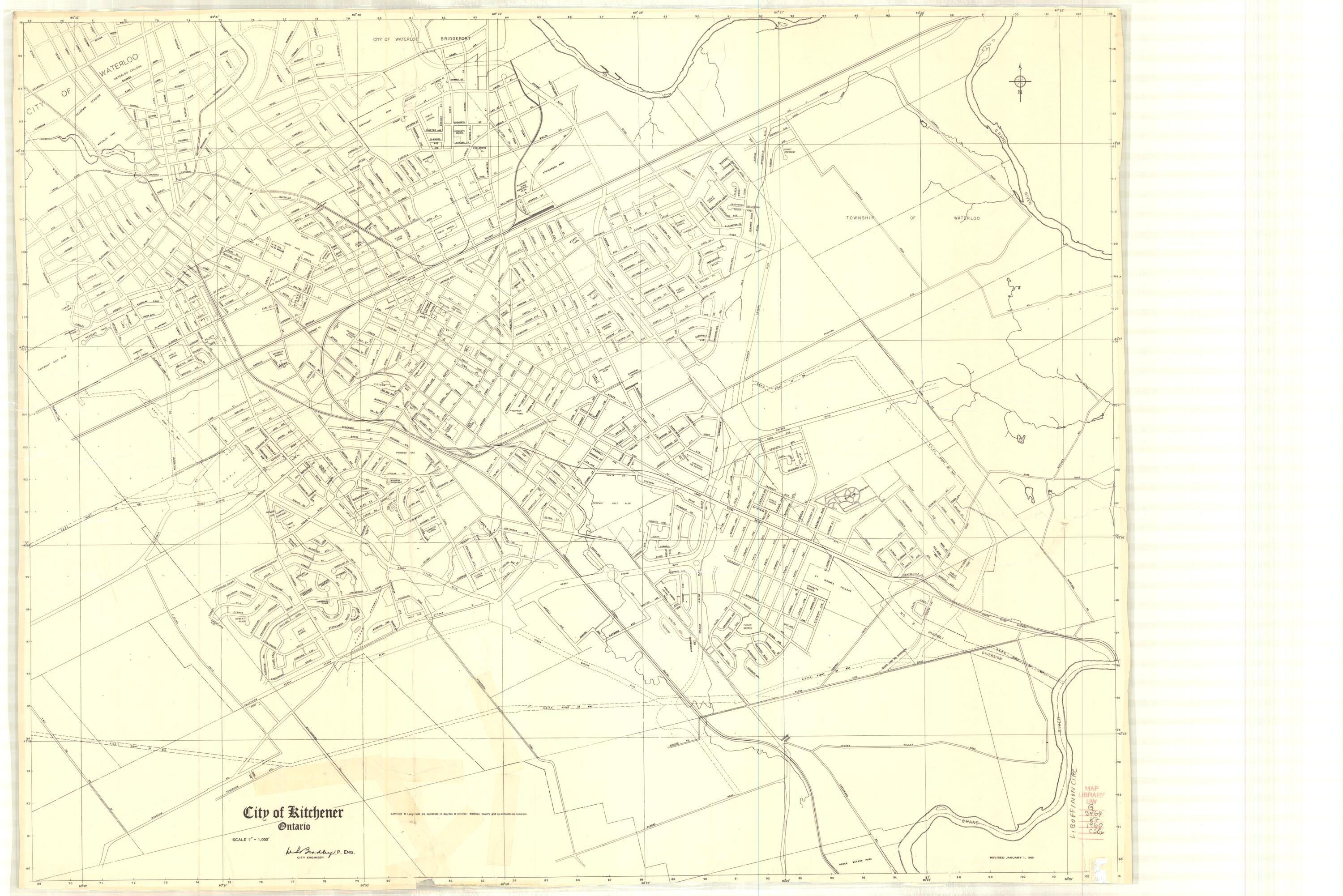
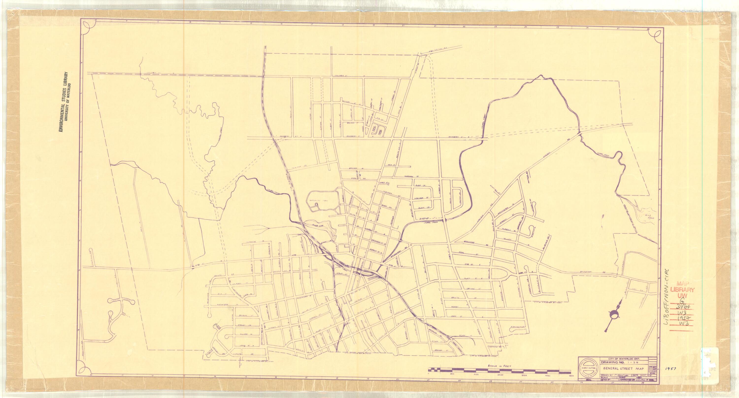
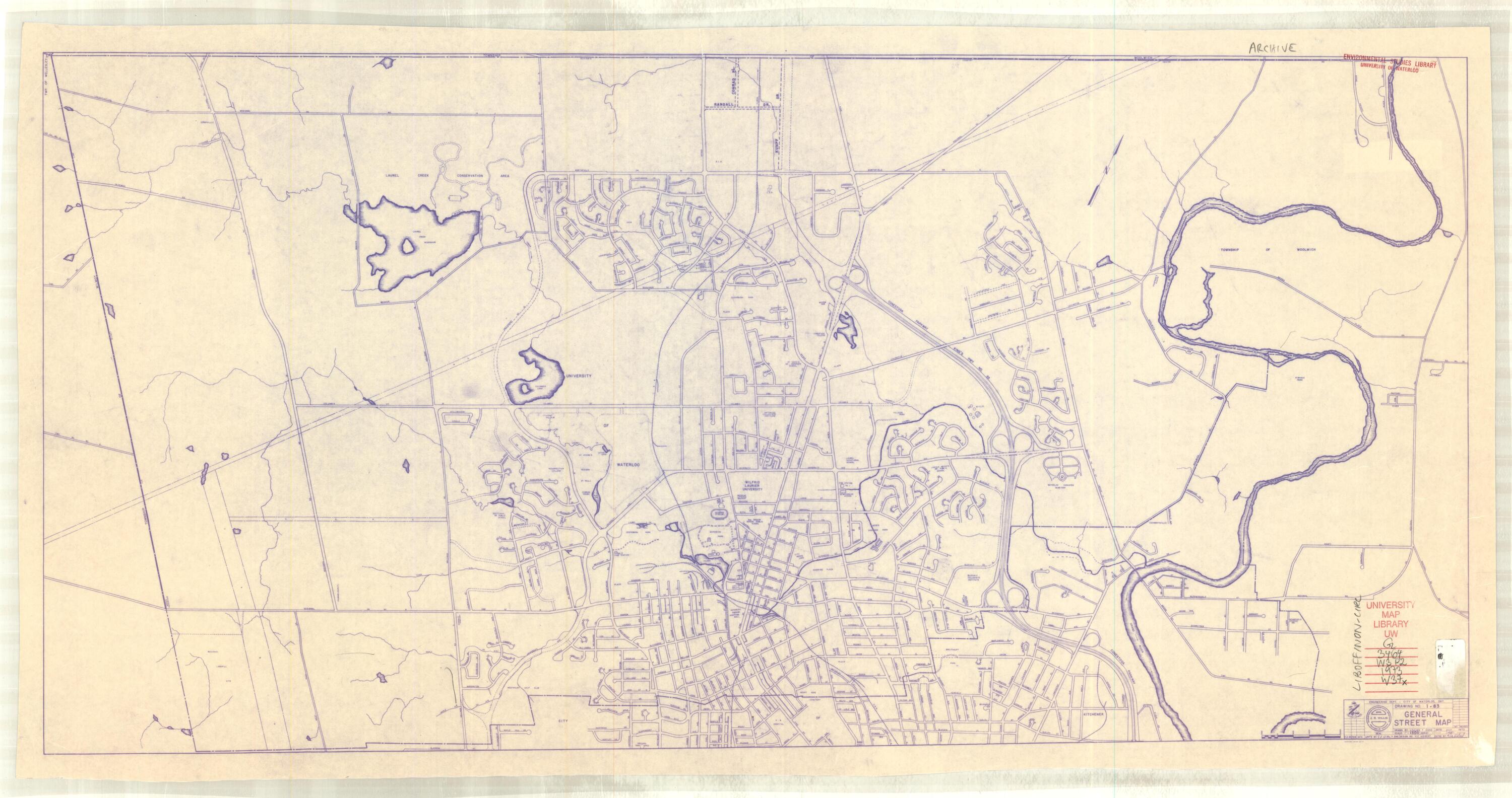
1: 12,167 |
General street map 1-34 |
|
|
1: 10,000 |
General street map I-34 |
|
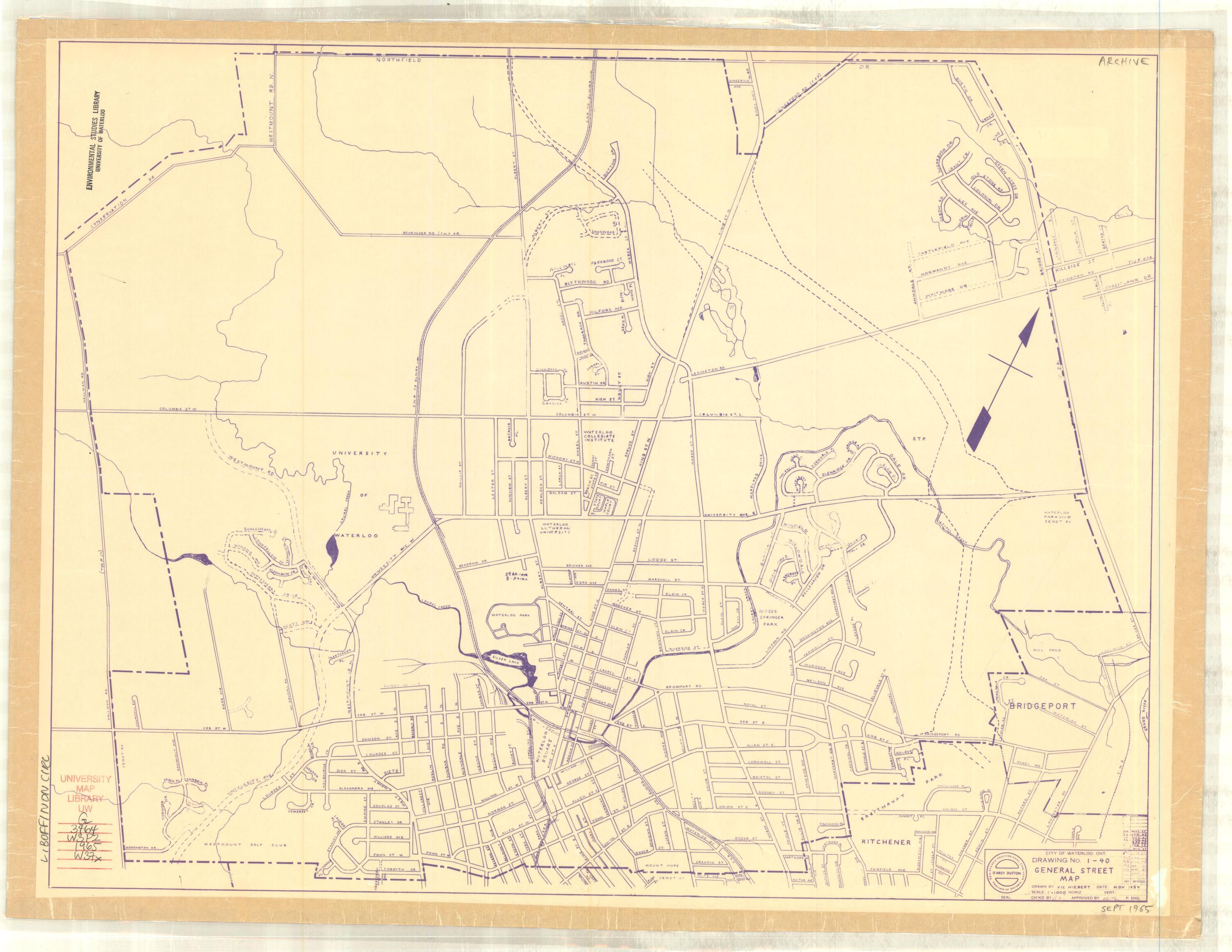
|
1: 12,000 |
General street map I-40 |
|
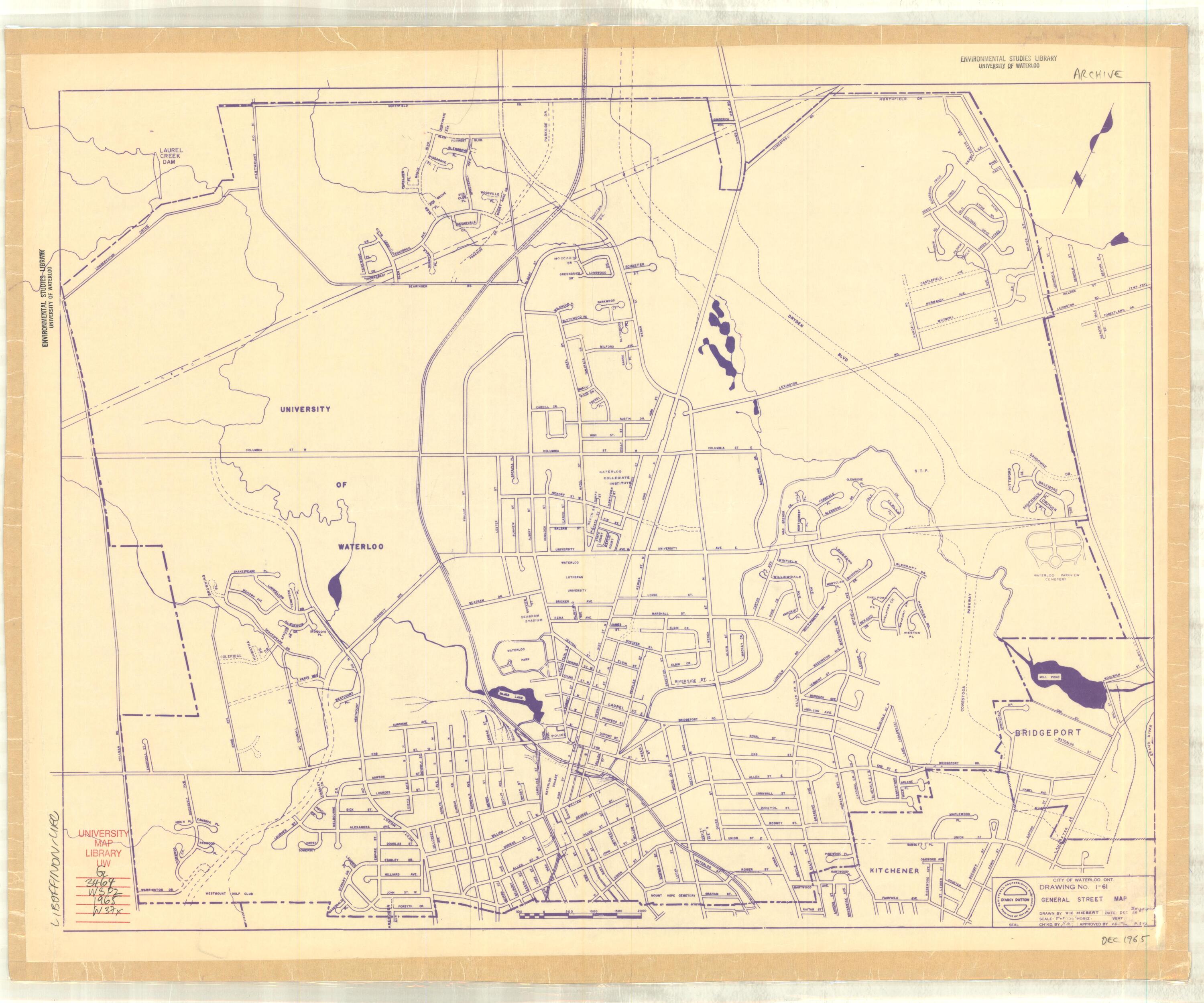
|
1965 (Dec) |
1: 12,000 |
General street map I-61 |
|
1969 (Oct) |
1: 18,000 |
Road plans; Official Plan |
|
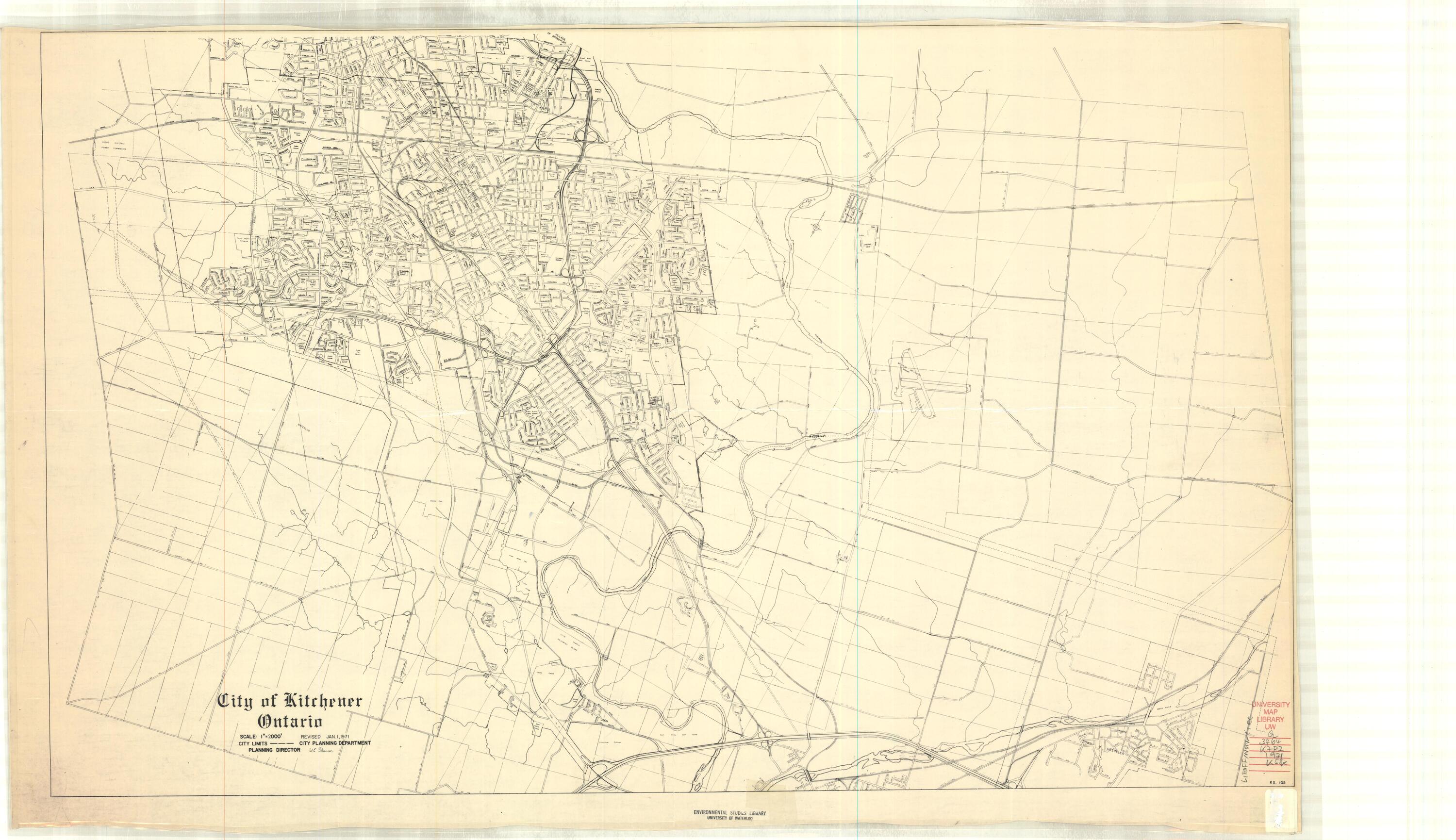
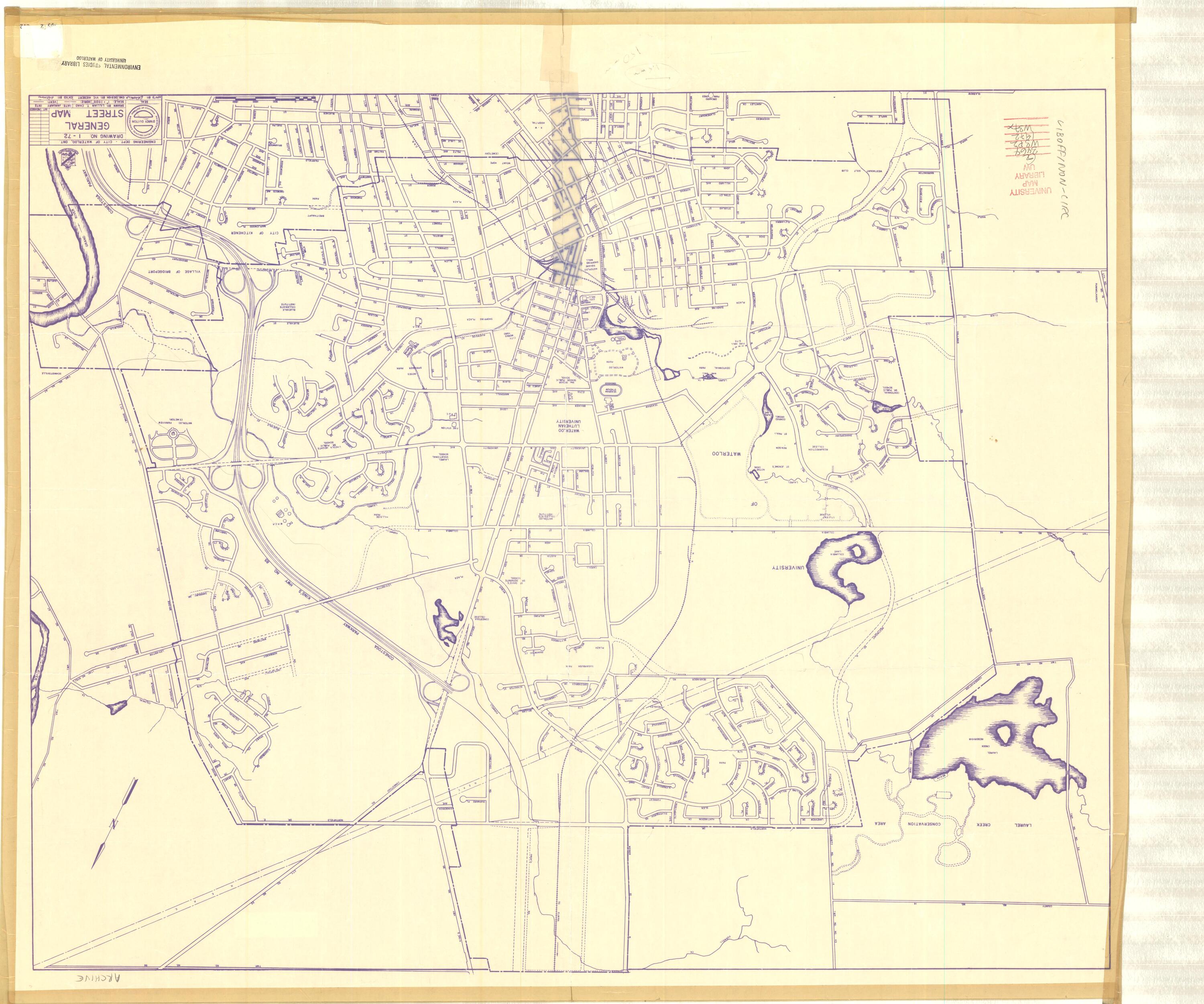
1: 12,000 |
General street map I-72 |
|
|
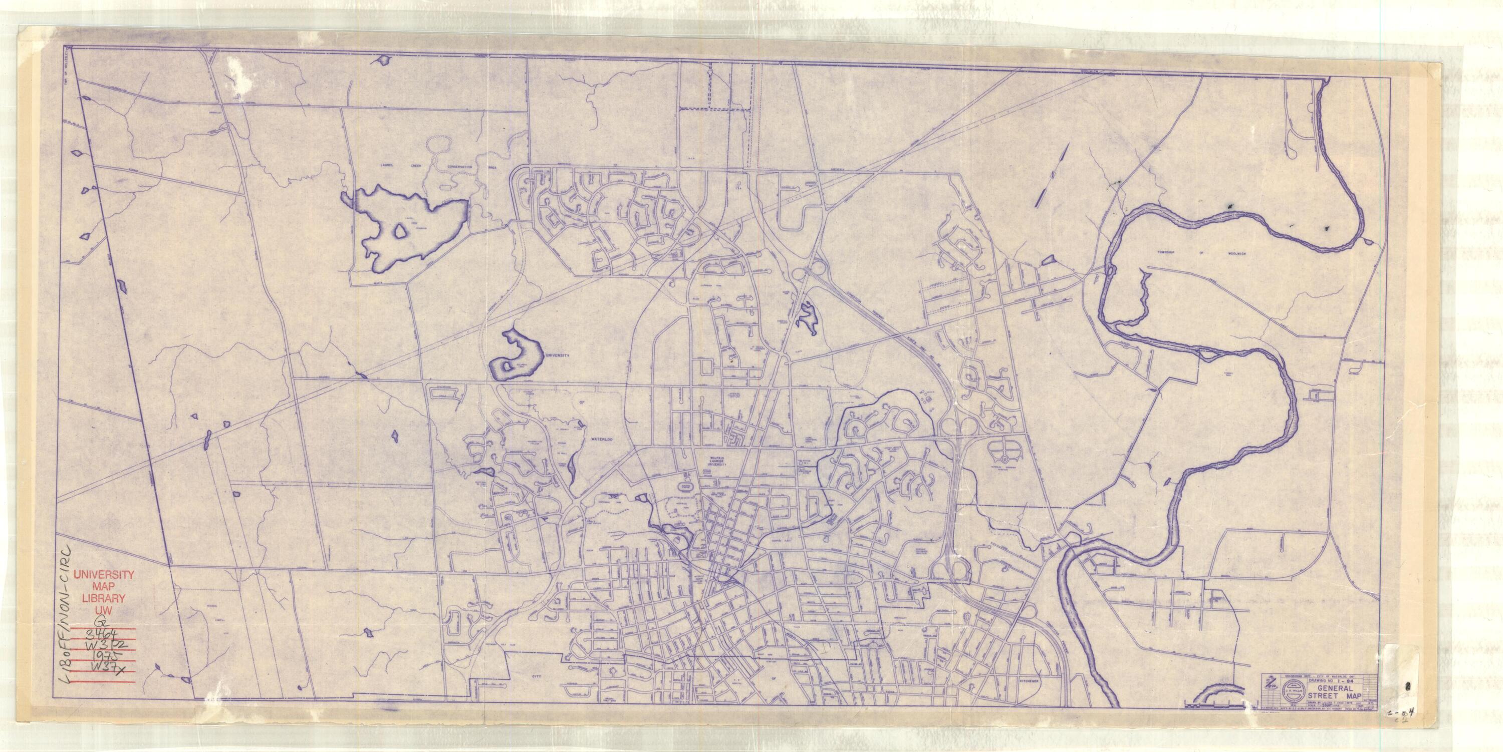
1: 24,000 |
General street map I-84 |
|
|
1: 18,000 |
General street map I-83 |
|
|
1975 (Jan) |
1: 12,000 |
General street map I-82 |
|
1975 (Oct) |
1: 7,500 |
General street map I-86 (2 copies) |
|
1975 (Oct) |
1: 12,000 |
General street map I-82 |
|
1978 (Jan) |
1: 12,000 |
General street map I-93 |
|
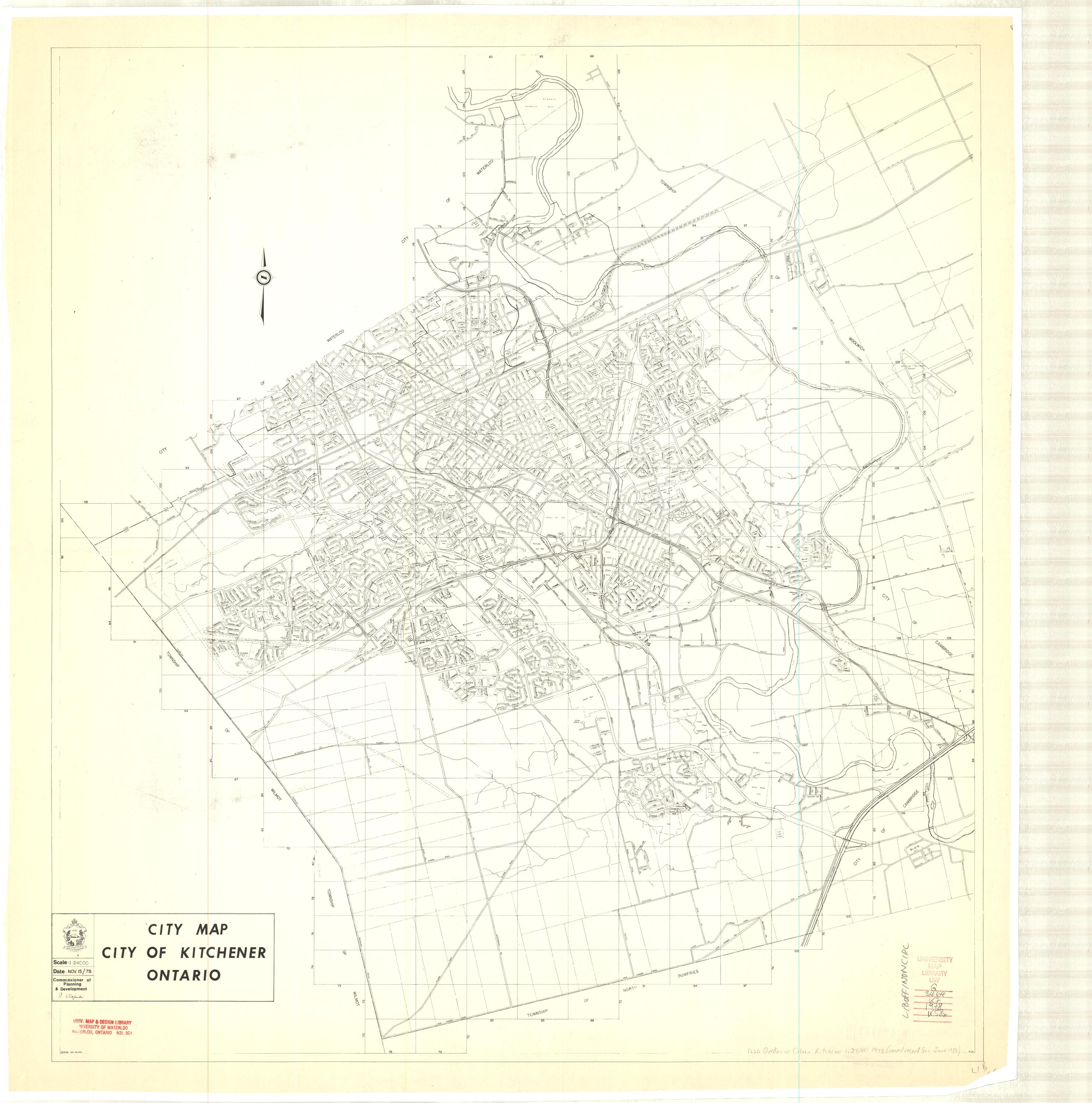
1980 (Dec) |
1: 10,000 |
General street map I-96 |
|
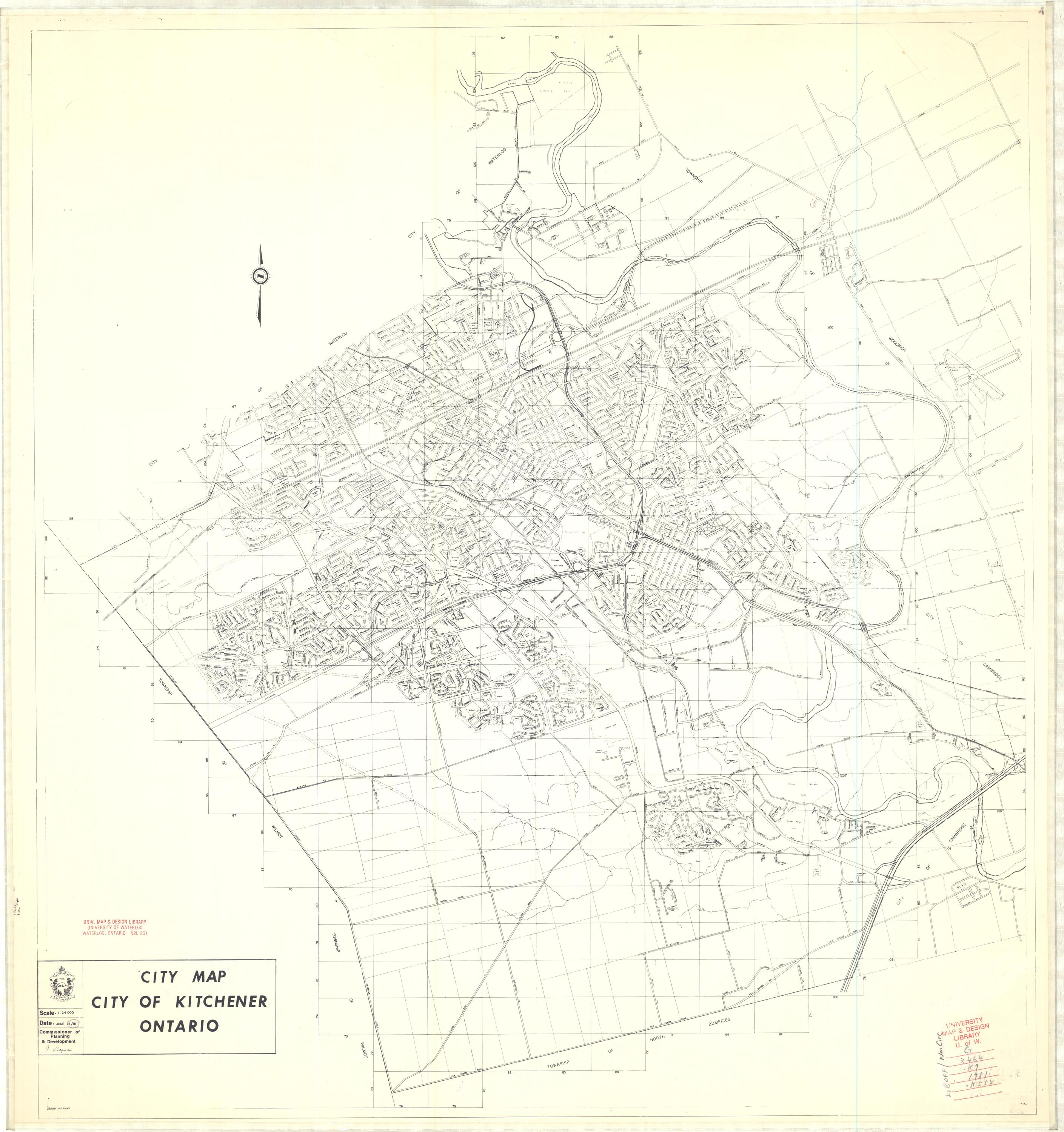
1981 (Dec) |
1: 10,000 |
General street map I-96 |
|
1983 (Aug) |
1: 12,000 |
General street map I-93 |
|
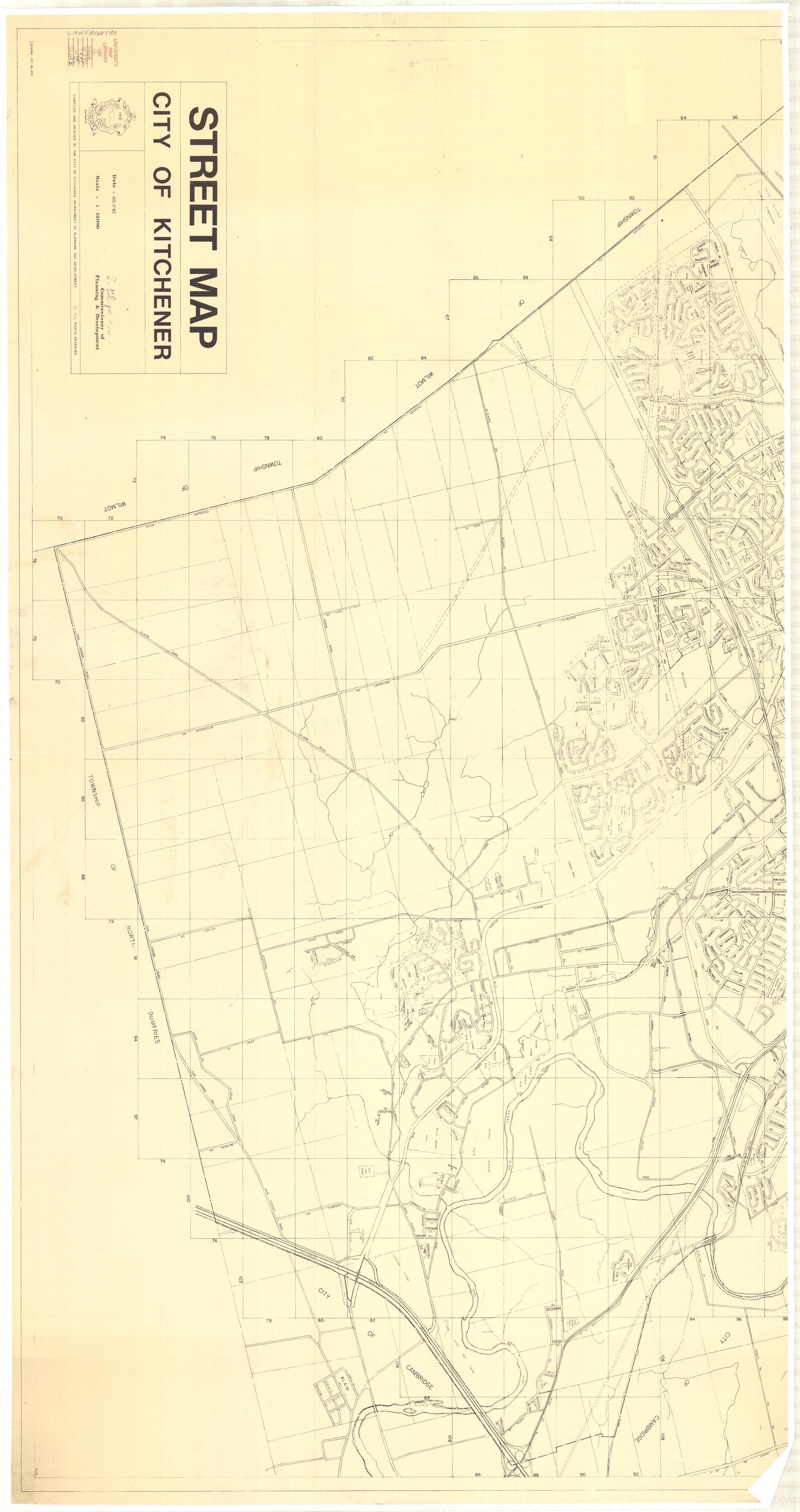
1990 (July) |
1:10.000 |
General street map 1-121 |
|
1994 (June) |
1:15,000 |
General street map 1-171 |
Cambridge archival maps
Property boundary maps
| Date | Scale | Description |
|---|---|---|
|
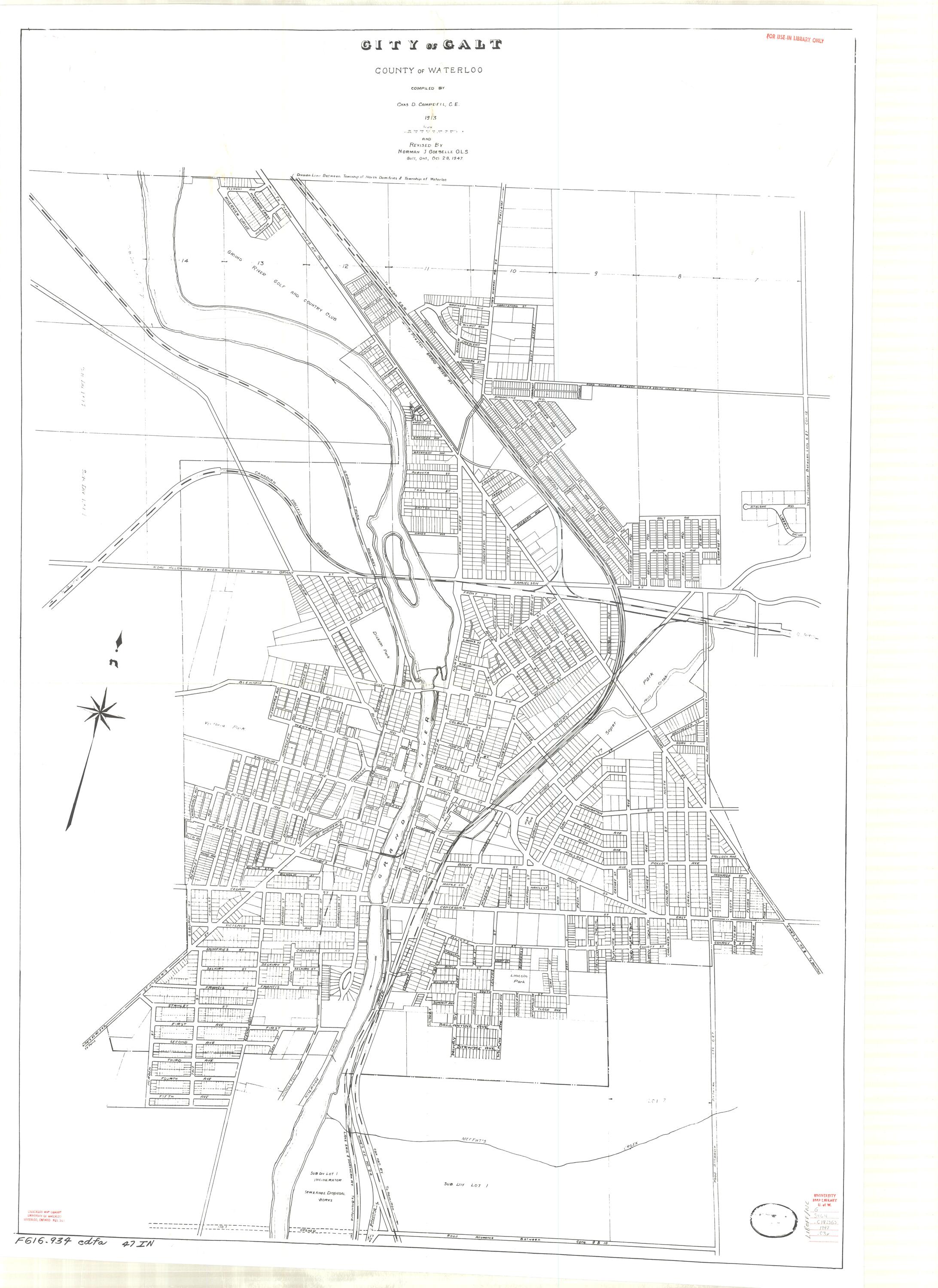
unknown |
City of Galt |
Land use maps
| Date | Scale | Description |
|---|---|---|
|
unknown |
City of Galt |
City boundary maps
| Date | Scale | Description |
|---|---|---|
|
1" = 1600' |
City of Galt |
Street maps
| Date | Scale | Description |
|---|---|---|
|
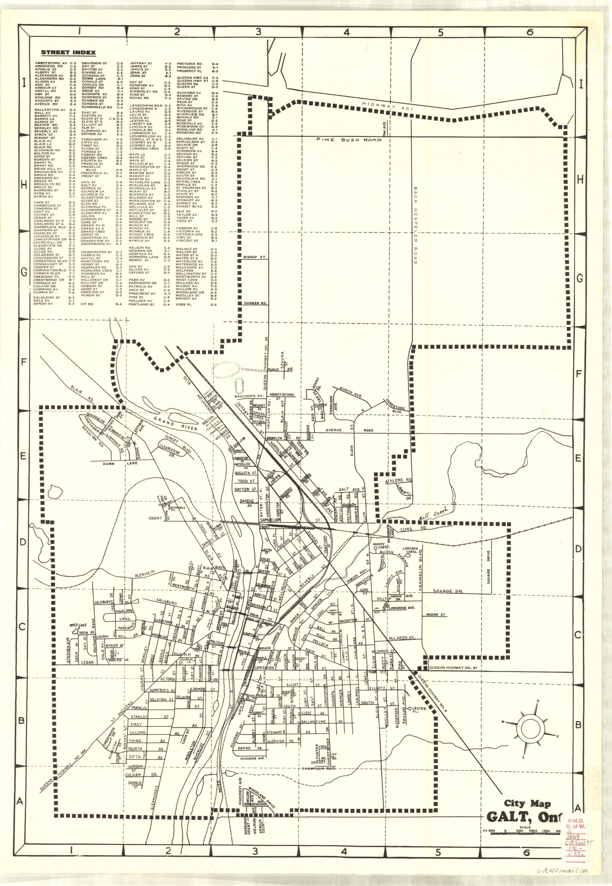
No scale |
Galt street map and index |
|
|
1975 |
1 inch = 1600 feet |
City of Cambridge |
Kitchener-Waterloo archival maps
Land use maps
| Date | Scale | Description |
|---|---|---|
|
1971 (Aug) |
1: 24,000 |
Existing land use; colour map |
|
1974 (Oct) |
1: 24,000 |
Existing land use |
|
1979 (Sept) |
1” = 600m |
Existing land use |
|
1981 |
2cm = 500m |
Existing land use |
Street maps
| Date | Scale | Description |
|---|---|---|
|
1: 26,000 |
Glossy |
|
|
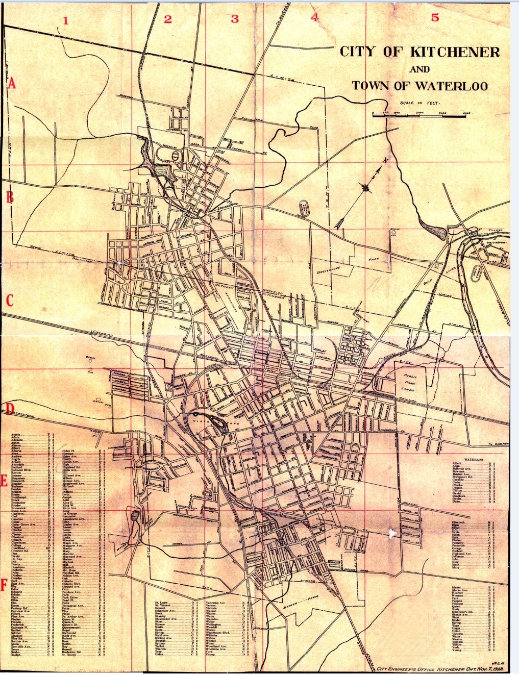
No scale |
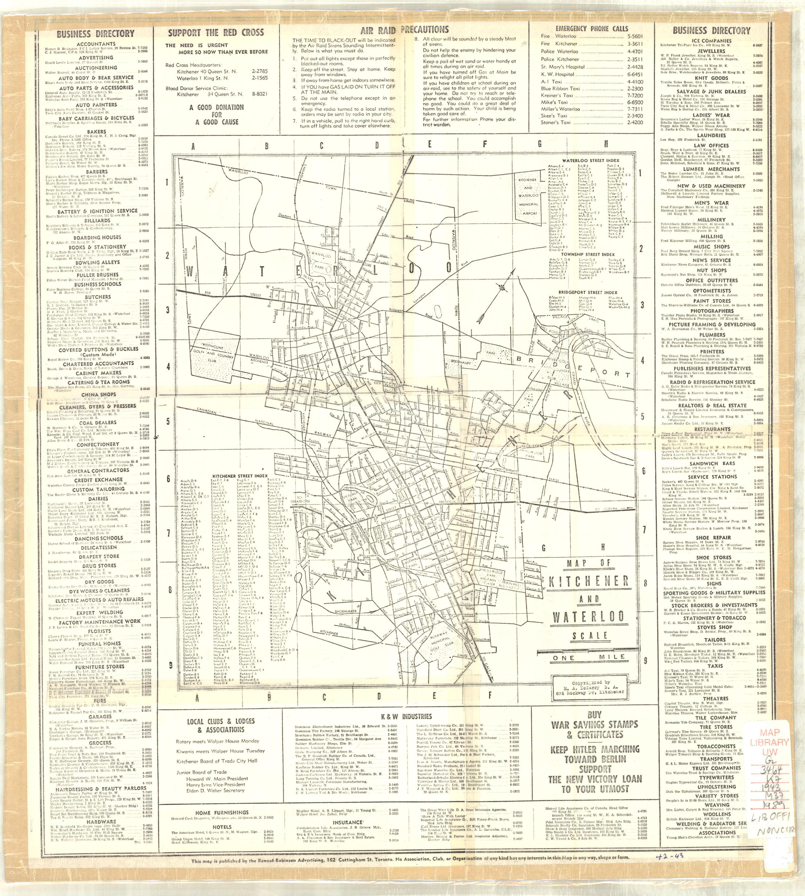
Street map and index; business directory |
|
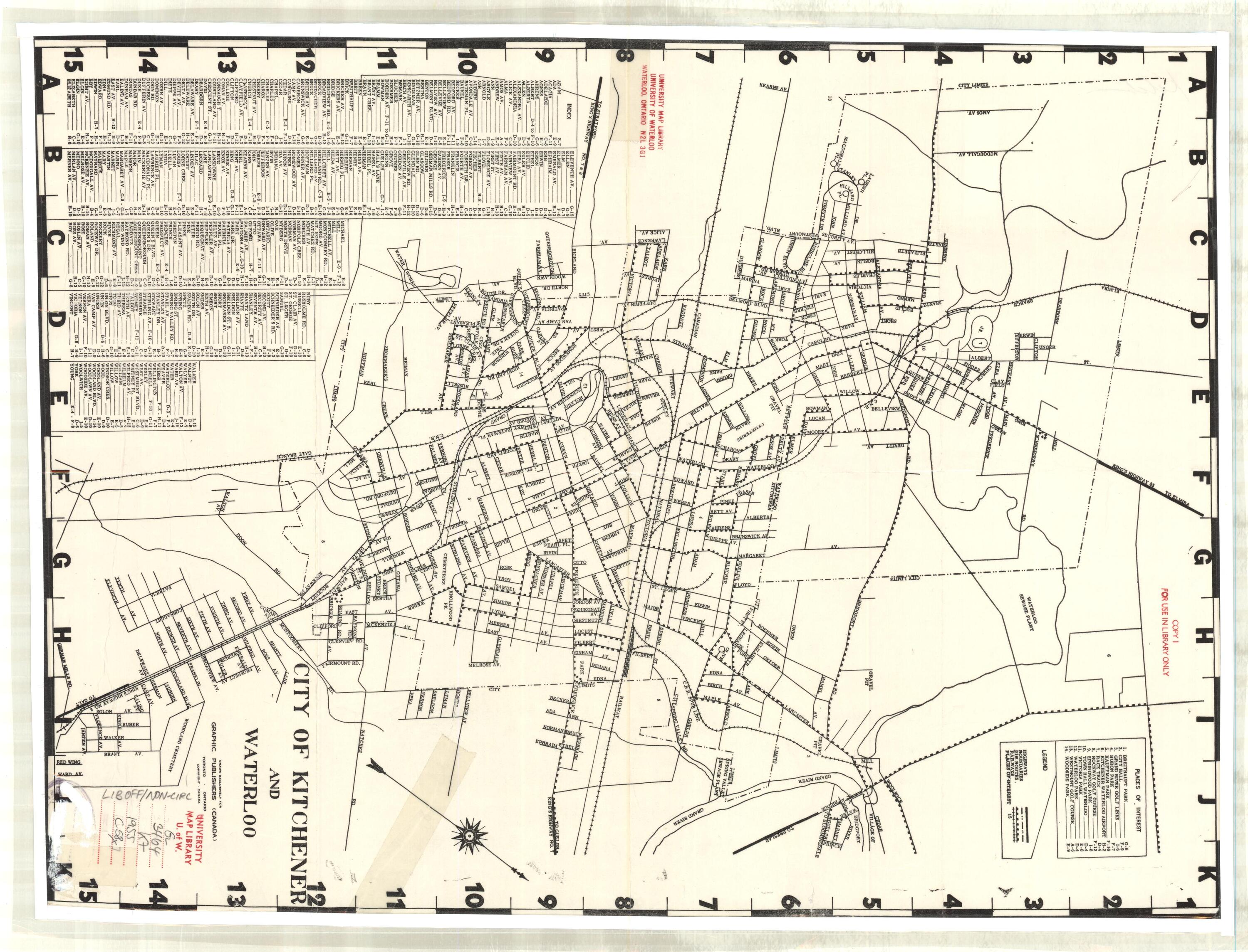
|
No scale |
Street map and index |
|
|
1961 |
Varying scales |
Street map and index; includes village of Bridgeport, Galt, Hespeler, Guelph, Preston |
|
1963 |
1: 24,000 |
Street map and index |
|
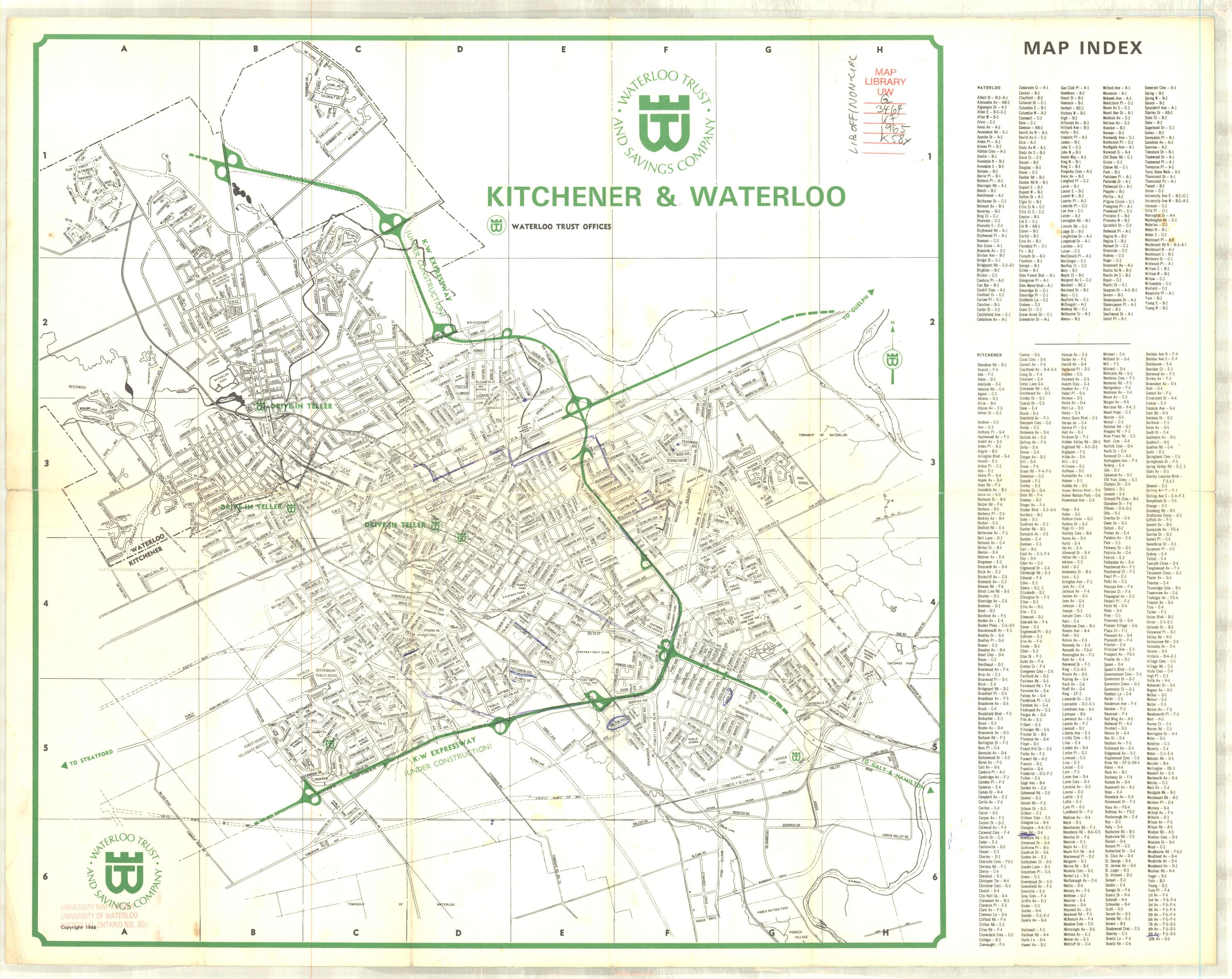
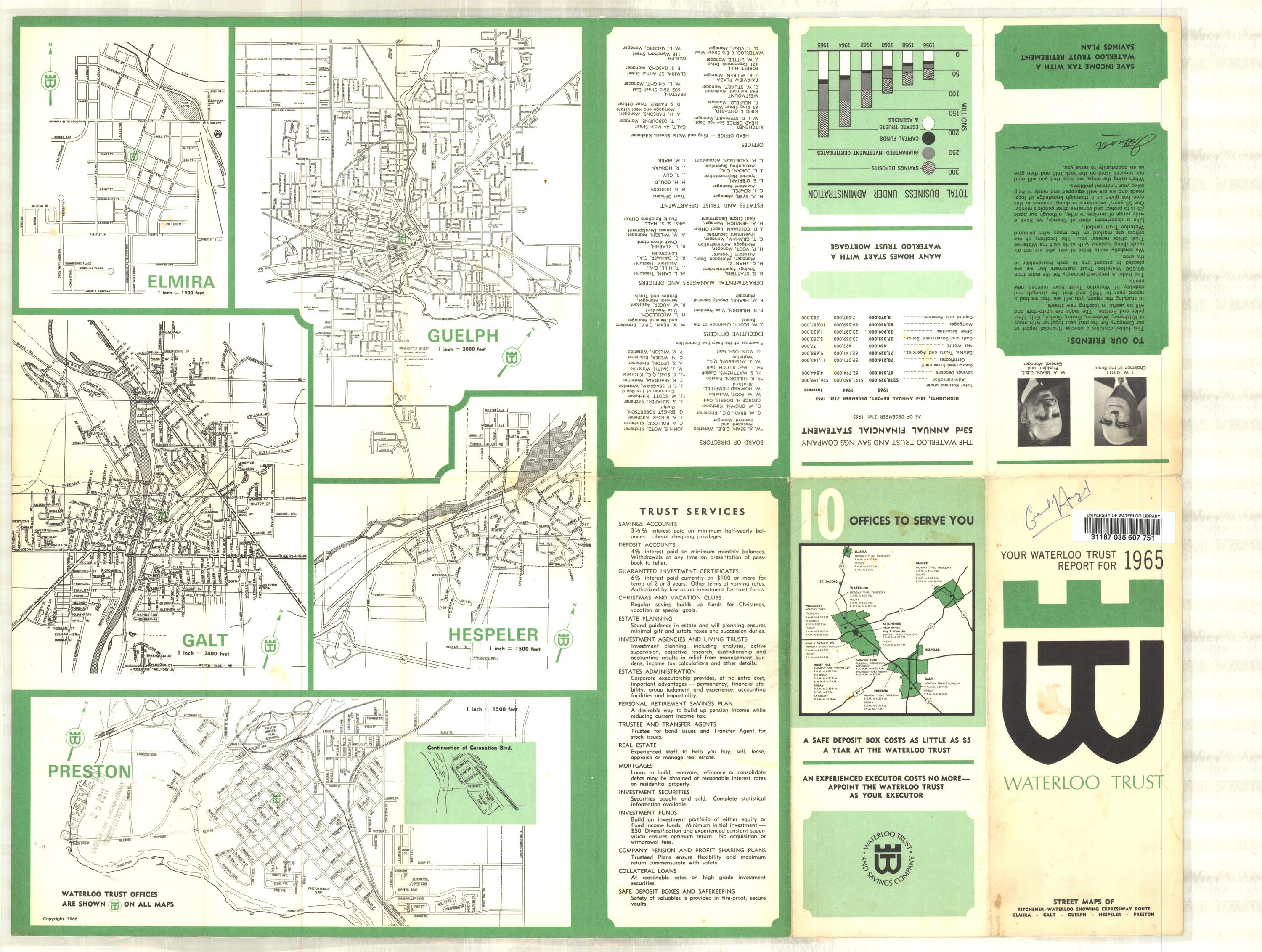
1965 |
Varying scales |
Street map and index; includes Elmira, Guelph, Galt, Hespeler and Preston |
|
1965 |
1: 12,000 |
Includes village of Bridgeport |
|
1968 |
Varying scales |
Street map and index; includes village of Bridgeport, Galt, Hespeler, Guelph, Preston |
|
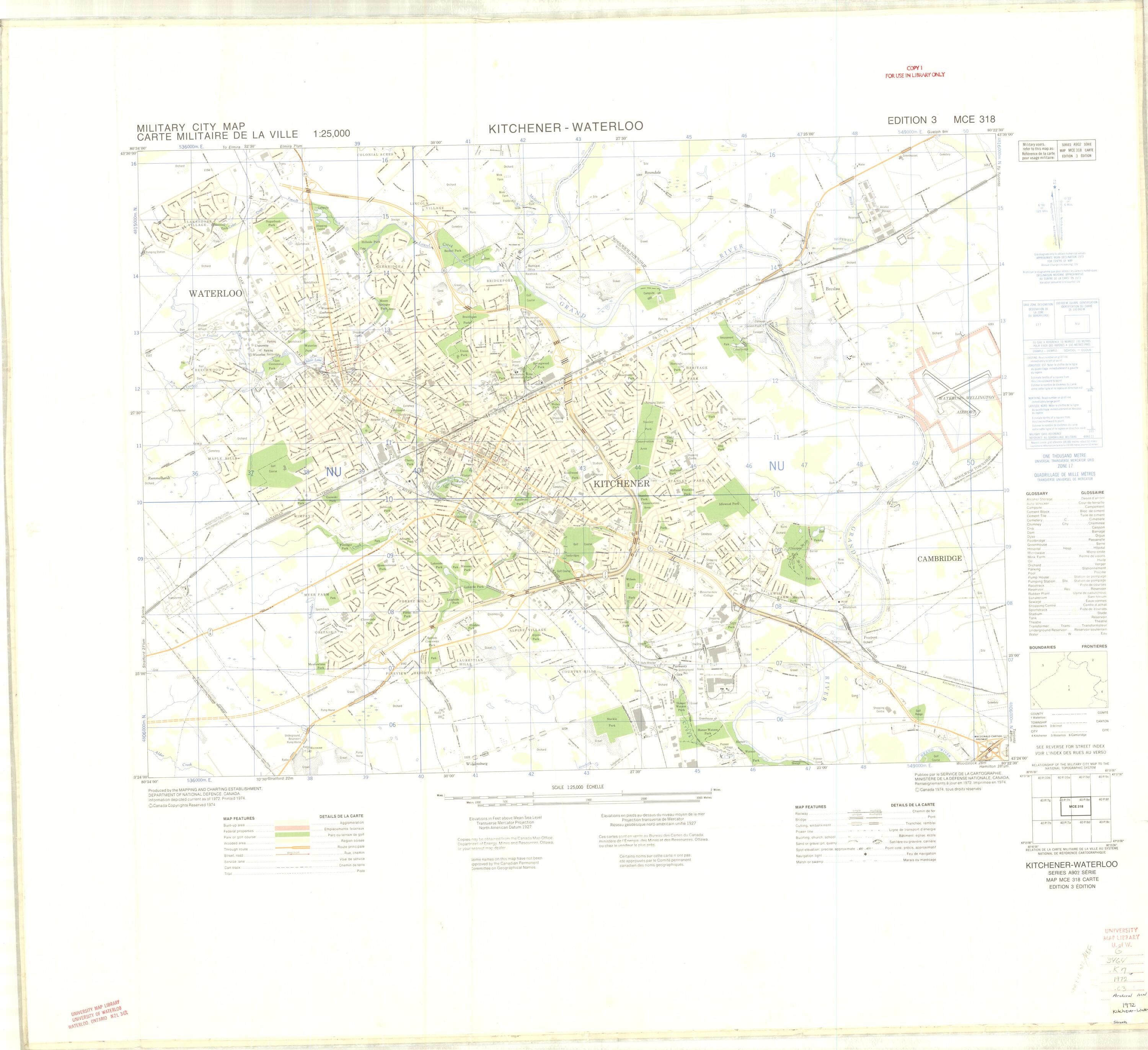
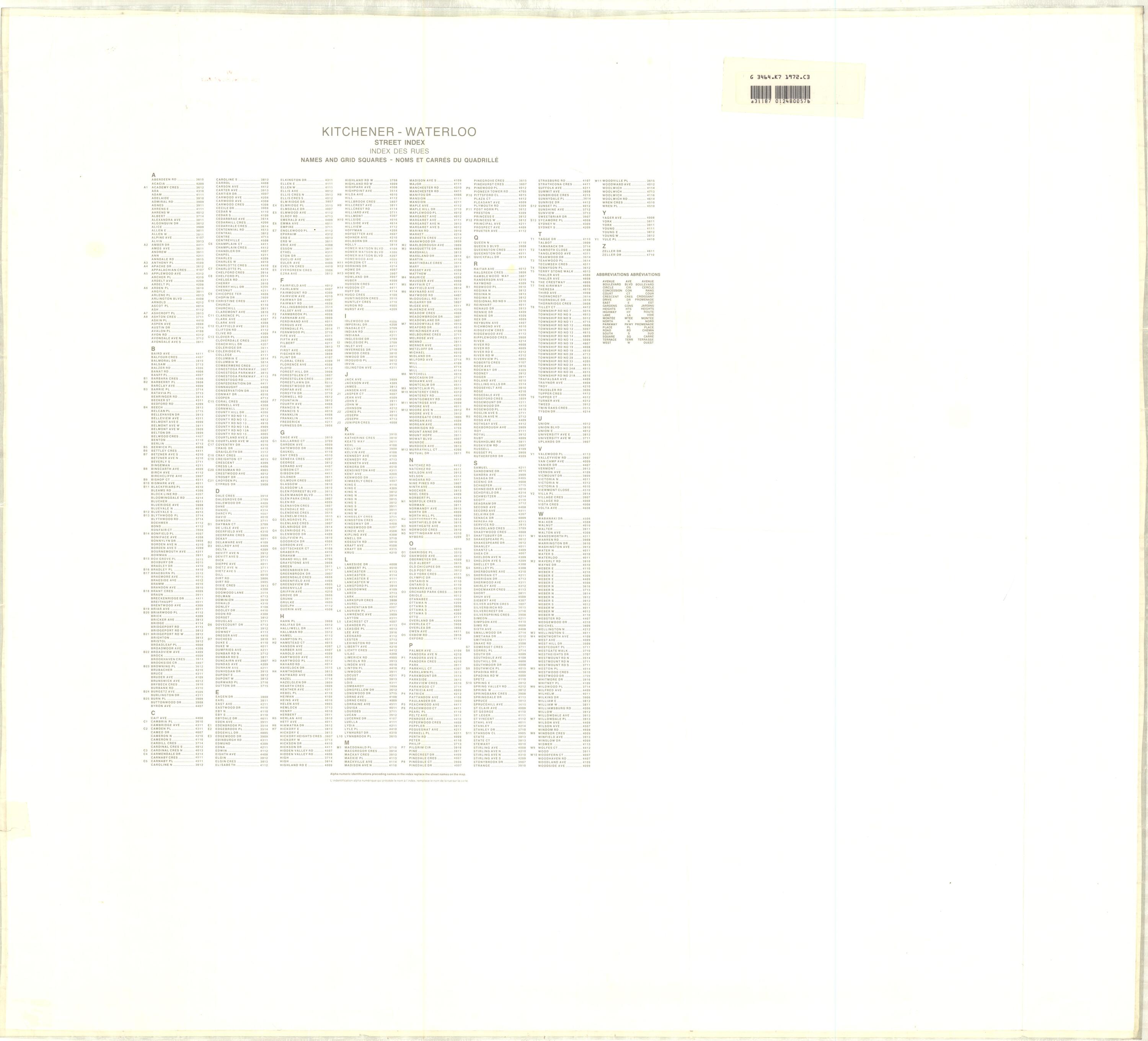
1972 |
1: 25,000 |
Military city map; streets & parks shown (Ed. 3) front, back |
|
1982 |
1: 25,000 |
Military city map; streets & parks shown (Ed. 5) |
Waterloo-Wellington County street maps
| Date | Scale | Description |
|---|---|---|
|
1964 |
1: 88,704 |
Highways, County Roads, Concessions, Lots, Points of Interest |
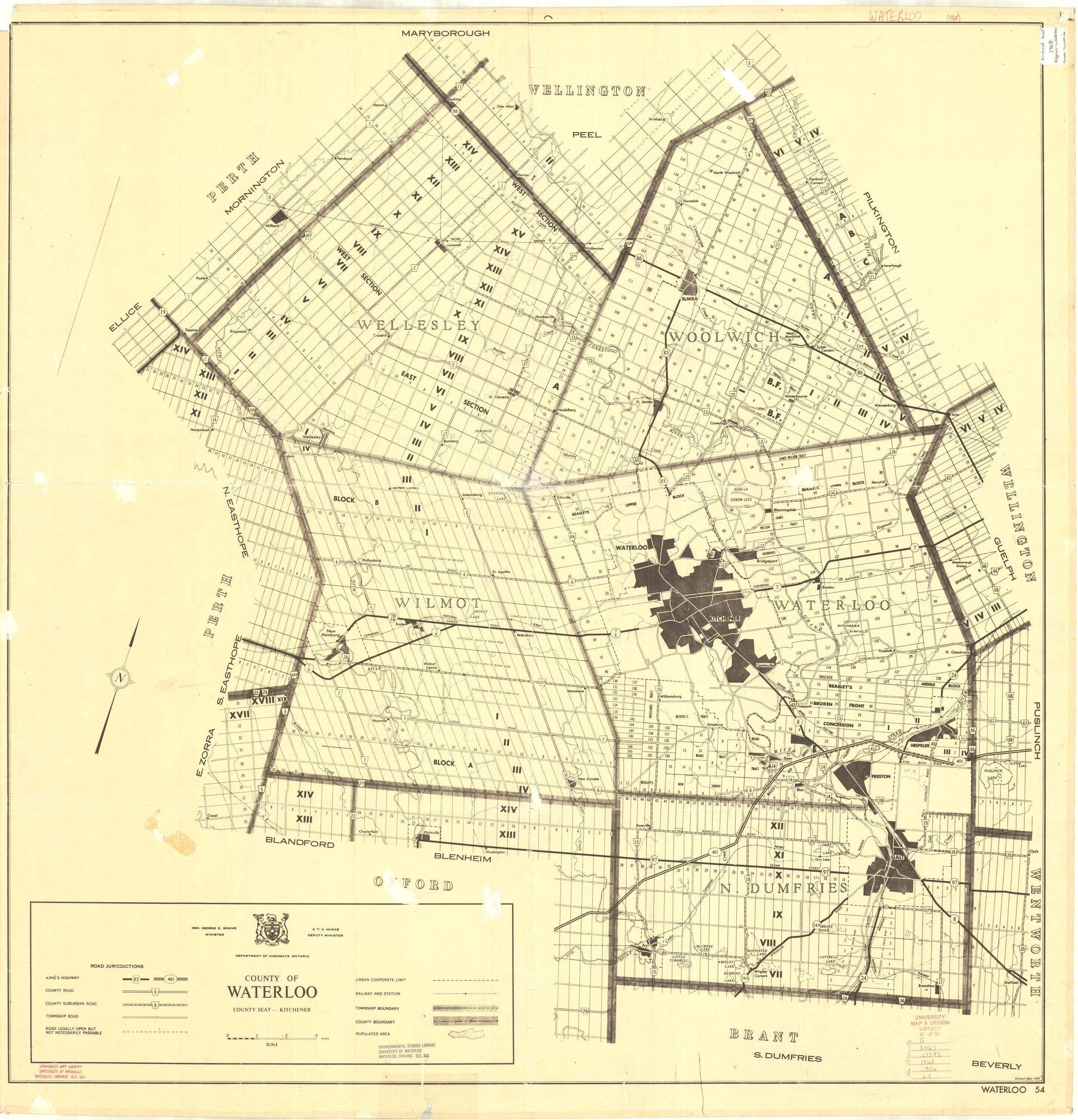
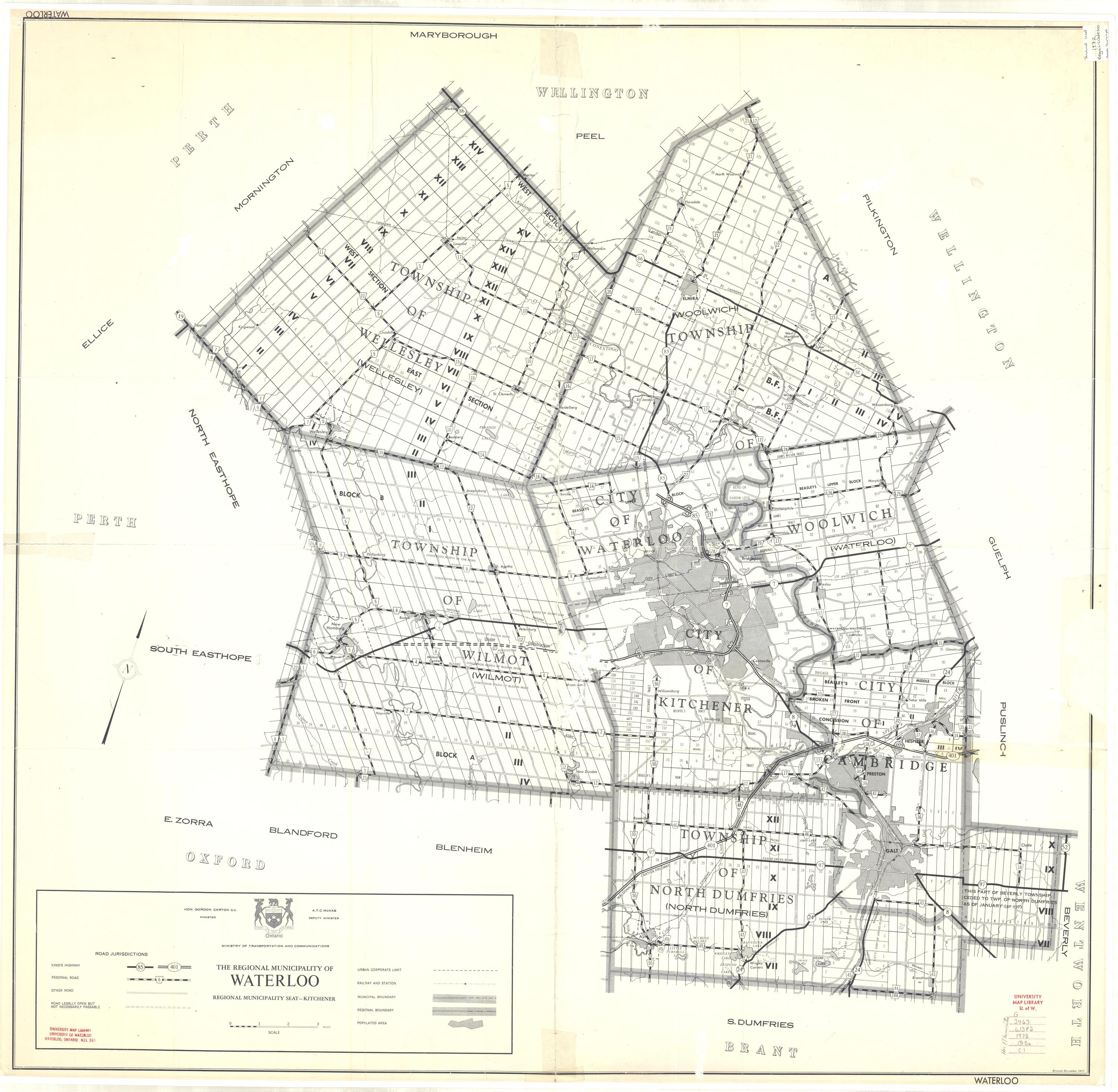
Regional Municipality of Waterloo archival maps
Road maps
| Date | Scale | Description |
|---|---|---|
|
1881 |
1:126,720 |
County of Waterloo; Townships, concessions |
|
1958 (Oct) |
1: 63,360 |
Roads, lots, townships |
|
1967 |
1: 60,000 |
Roads, townships, concessions |
|
1:119,000 |
Roads, townships, concessions |
|
|
1:126,720 |
Roads, townships, towns |
|
|
1:126,720 |
Roads, townships, concessions |
|
|
1972 |
1:190,080 |
Roads, townships, concessions |
|
1975 (Jan) |
1:126,720 |
Roads, townships, concessions |
|
1976 (Jan) |
1:126,720 |
Roads, townships, concessions; includes street plans for Ayr, Wellesley, New Hamburg, Elmira, New Dundee, K-W, Cambridge |
|
1981 (Aug) |
1:126,720 |
Roads, townships, concessions |
Growth maps
| Date | Scale | Description |
|---|---|---|
|
No scale |
Growth |
Boundary maps
| Date | Scale | Description |
|---|---|---|
|
1985 (May) |
No scale |
City of Waterloo, RISC boundaries |
Official policies plan maps
| Date | Scale | Description |
|---|---|---|
|
1975 (Feb) |
1"= 1 mile |
Regional Municipality of Waterloo, proposed environmentally sensitive areas |