Description
This vector data covers the entire City of Vancouver. The data was downloaded from the City of Vancouver's website: http://vancouver.ca/your-government/open-data-catalogue.aspx
The data was compiled by the City of Vancouver between 2002 - 2009; specific collection dates for each file are listed on the City of Vancouver site.
On March 11, 2010, new data was downloaded from the City of Vancouver website including: building footprints, bikeways, city owned properties, lots, heritage sites, traffic signals, web cameras, etc.
The dataset contains the following coverages:
- Bike routes, ways
- Building footprints (city core)
- City owned properties
- Community centres
- Contours (1, 2 and 10 metre)
- Drinking fountains
- Facet grid boundaries
- Fire halls
- Greenways
- Heritage sites
- Land: cadastral (lot boundaries, lot numbers, property parcels)
- Libraries
- Lots
- Olympic related features (no stopping zones, lanes, sites, venues, road closure, parking restrictions, pedestrian corridors, venue closure area)
- Parks
- Rapid transit stations and lines
- Schools
- Sewer network
- Shoreline
- Street lights
- Streets (public and nonpublic)
- Street segments
- Traffic signals
- Truck routes
- Voting division boundaries
- Water network (storm-water main, manhole)
- Web cameras
Spatial reference and data type
This georeferenced data are available in Universal Transverse Mercator (UTM) grid zone 10 coordinates; horizontal datum is North American Datum (NAD) 83.
Data access
In order to access these data sets, please visit the Geospatial Centre reference desk during reference hours. Library reference staff are available to provide further information about these data sets and to deliver data upon request. Under the terms of the library's license agreement, these data sets are for use by students, faculty, and staff at the University of Waterloo only.
Data manipulation and storage
There are public workstations in the Geospatial Centre that provide access to the ArcGIS software program, program extensions and data manipulation utilities. Patrons may use the Geographic Information System (GIS) and image processing software in the library to view and manipulate the data. UWaterloo faculty, students and staff may copy these data to other media (for example: CD, DVD or Zip disc) for use elsewhere.
Data output
These images may be exported from ArcGIS in a choice of bitmapped formats (also known as raster graphics) including JPG, TIFF, GIF, and BMP or in a choice of vector graphics formats including Adobe Illustrator (AI), Encapsulated Postscript (EPS), and Scalable Vector Graphics (SVG). Yet another option is PDF. The user defines the output resolution.
Use restrictions/licensing/copyright
These data are provided for personal use for academic, research, and/or teaching purposes. The City of Vancouver must be acknowledged on any derivative product, whether printed or electronic, including for example, a printed map, a raster or vector graphic, a web-based application, etc. Patrons are advised to fully respect the provisions of Canada's Copyright Act as well as terms and conditions imposed by the data provider.
Citation
City of Vancouver: Municipal 2009 [computer file]. City of Vancouver 2009.
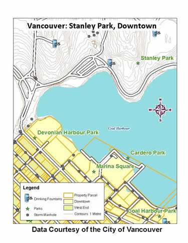
Sample view of the data