Description
GeoGratis is a LANDSAT service provided by Natural Resources Canada. GeoGratis provides free access to its catalogue of LANDSAT 5 and LANDSAT 7 images. LANDSAT 5 imagery dates from 1984-1989, and covers only major urban areas, whereas LANDSAT 7 coverage dates from 2001-present, and covers an ever-increasing area. For more information and to download files, please see the GeoGratis website.
Spatial reference and data type
These data sets are available in Universal Transverse Mercator (UTM) co-ordinates; horizontal datum is North American Datum (NAD) 83. These data are stored as .TIFF images. Other data formats can be accommodated, as the Geospatial Centre has access to a number of conversion utilities.
Data access
These satellite images are available for free download from the GeoGratis website. A search engine is available to help find a specific area of coverage.
Data manipulation
There are public workstations in the Geospatial Centre that provide access to Geographic Information System (GIS) software, program extensions and data manipulation utilities. Patrons may use the GIS software in the library to view and manipulate the data. UWaterloo faculty, students and staff may copy these data to other media (Zip disk or CD-R) for use elsewhere.
Data output
These data may be exported from the GIS software as a bitmapped image (e.g., jpg) or may be printed as a map view using one of the library's colour printers.
Use restrictions/licensing/copyright:
This material is provided for academic, research, teaching, and personal use only. Natural Resources Canada should be acknowledged on any derivative product, such as a map or an image.
Citation
LANDSAT 7 Imagery of Canada [computer file]. Ottawa, Ontario: The Ministry of Natural Resources Canada, [2001].
Sample view of the data
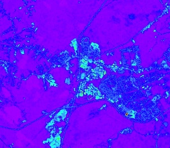
Image courtesy of the Ministry of Natural Resources