Waterloo study links shoreline erosion to nutrient pollution of Lake Erie
A new University of Waterloo study reveals that shoreline erosion plays a far greater role in the health of our Great Lakes than previously understood. Findings for Lake Erie suggest that coastal erosion and the associated input of phosphorus could partially offset the water quality improvements expected from watershed management efforts.
The research team developed a mass balance model for Lake Erie showing that erosion of coastal bluffs along the lake’s central and eastern basins contribute significant amounts of phosphorus to the lake’s littoral zones, the shallow, nearshore areas where land and lake meet. These littoral zones further represent a major pathway for the eastward transport of phosphorus entering Lake Erie, of which around 40 per cent ultimately flows into Lake Ontario via the Niagara River.
“Our research shows that what happens along the shorelines of Lake Erie affects not only Lake Erie itself but also downstream Lake Ontario,” says co-author Serghei Bocaniov, a research associate in the Ecohydrology Research Group. “Coastal erosion generates around 15 per cent of the total phosphorus input to Lake Erie. If we focus only on what flows in from the watershed, we overlook a major part of the story.”
Phosphorus is an essential nutrient in freshwater lakes, but when too much enters a lake, it can fuel toxic and nuisance algal blooms that threaten drinking water, recreation, and aquatic ecosystems. For decades, scientists and governments have focused on reducing the external phosphorus loadings carried by rivers and streams discharging into Lake Erie. But this new model highlights that shoreline erosion and the large-scale circulation patterns of the lake are key to predicting the impact of land-based phosphorus management practices and the potential effects of climate change.
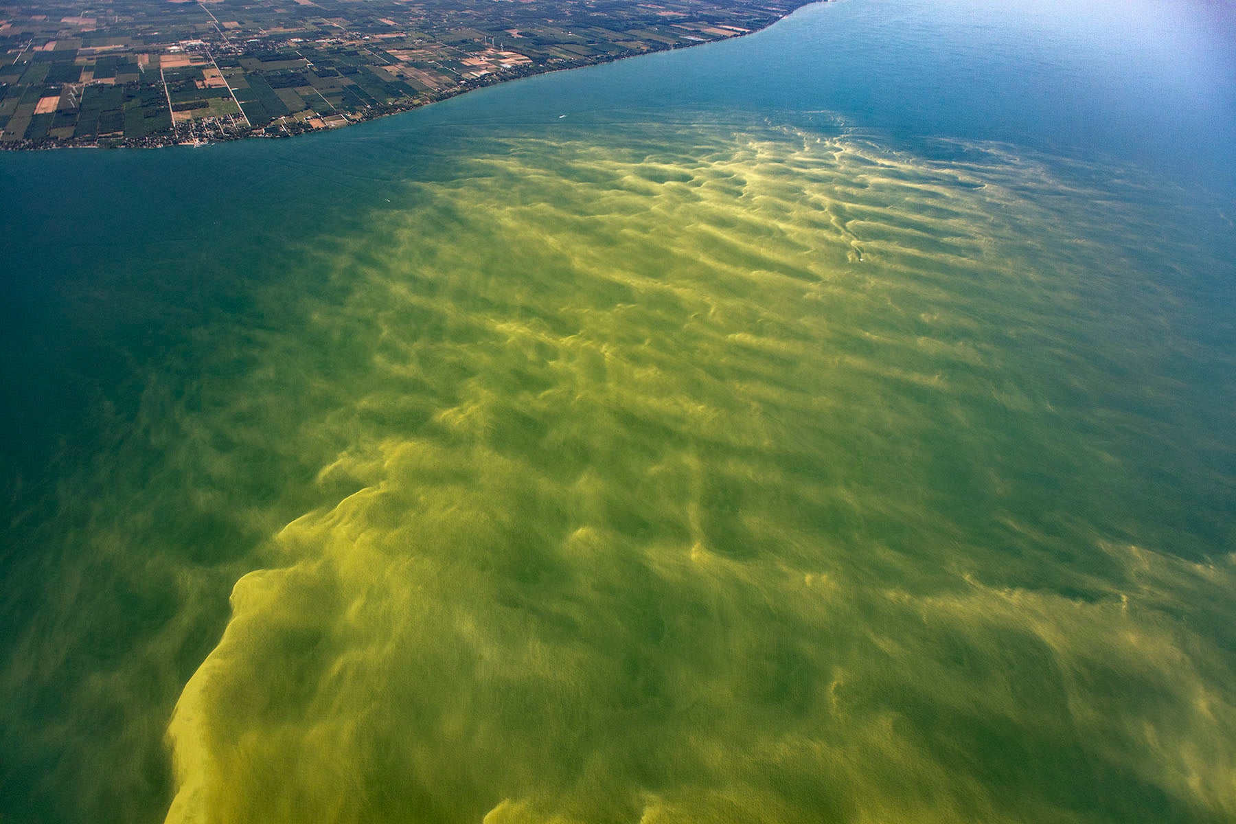
Lake Erie harmful algal blooms (HABs) in Aug 2017. True color photo images of Lake Erie HABs on August 14, 2017 (Photo Credit: Aerial Associates Photography, Inc. by Zachary Haslick) NOAA Great Lakes Environmental Research Laboratory's photo.
The research found that:
- Erosion of coastal bluffs, especially those of the central basin, is a large and thus far overlooked phosphorus source to Lake Erie.
- Nearshore transport parallel to the coastline is a major pathway for moving phosphorus towards the Niagara River and, from there, into Lake Ontario.
- The lake’s circulation patterns control how phosphorus moves between nearshore and offshore waters.
- Climate warming could further worsen nearshore algal blooms in Lake Erie by weakening the transfer of phosphorus to offshore waters.
These results challenge long-standing assumptions about the sources of phosphorus to Lake Erie, and how phosphorus moves through the lake. They also suggest that other pollutants, such as pesticides and microplastics, may behave in similar ways, bypassing sediment burial in Lake Erie and traveling alongshore toward Lake Ontario.
The team’s model, built on data from 2003 to 2016, offers the first comprehensive view of how Lake Erie’s nearshore zones influence the input and fate of phosphorus. Designed to be simple and adaptable, the model can predict how in-lake phosphorus concentrations would respond to changes in watershed phosphorus emissions, coastal erosion, and lake circulation, providing scientists and policymakers with a powerful new tool to help protect Lake Erie and downstream Lake Ontario.
“This work expands our understanding of how the limiting nutrient phosphorus enters and moves through large lake ecosystems,” says Philippe Van Cappellen, Professor and Canada Excellence Research Chair Laureate in Ecohydrology. “By recognizing the pivotal role of littoral dynamics, we can more realistically predict how nutrients and pollutants impact our shared Great Lakes.”
The study, Mass balance modeling highlights the role of the littoral zone in modulating the cycling of phosphorus in a large, multi-basin lake (Lake Erie), was published in the Journal of Great Lakes Research.
Banner Photo: Eroding coastal bluffs in the northern part of Central Lake Erie near Port Burwell taken in July 2024 (Photo courtesy of Serghei A. Bocaniov).