Rural flooding occurs across Canada causing serious impacts on communities and creating the need for expenses to repair damages and to create defenses for future events. Projects and efforts following serious floods in recent years have greatly increased rural communities’ resiliency to flooding. Compared to city centres, rural areas tend to be remote and do not have the same financial or social capital available. As such, methods used in cities to mitigate floods cannot be applied to rural areas as these communities are unique and have their own needs and governance structures. An increase in government presence and support will allow these areas to function to their full capacity.
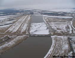
Manitoba has experienced some of the most damaging and costly rural floods in Canadian history. In 1997, the Red River basin saw what was called “the flood of the century” (Rannie, 2016). Saturated grounds and significant precipitation throughout the winter led to favourable flood conditions and resulted in extreme riverine floods with water covering 2,000km2 (Buckland & Rahman, 1999). The damages of the Red River flood led to $500 million in costs. Later in 2011, substantial rain and high soil moisture initiated flooding along the Assiniboine River in Manitoba, which led to $1 billion in damages (Blais, Greshuk, & Stadnyk, 2016). Crops were flooded and hundreds of roads and bridges were washed out as a result. In the province of Québec, rural communities were affected by floods along the Richelieu River during the spring of 2011 (Saad, St-Hilaire, Gachon, & El Adlouni, 2016). This event led to 1,650 evacuations and cost $90 million in damages. With serious damages and significant costs resulting from major floods, mitigation measures are necessary to lessen the impacts on residents and local infrastructure.
To counter the impacts of future floods, provinces and communities across Canada have taken steps to implement both structural and non-structural mitigation measures. Manitoba has a number of built measures including the Red River floodway and Shellmouth Reservoir. In 2018, contracts for flood channels near Lake Manitoba and Lake St. Martin were confirmed (CBC News, 2018). In Nova Scotia, a recent project used LiDAR (light detection and ranging) to create flood-risk maps for the province (Minano, Johnson, & Wandel, 2017). In the communities of Le Goulet and Point-du-Chêne in New Brunswick, provincial and federal government officials were present for multiple presentations and group discussions arranged as part of a study focused on flooding in the communities. In doing so they could hear from community members to gather their input on flood risk and the need for more support (Chouinard, Plante, & Martin, 2008). These interactions are a positive step towards opening the communication channels between rural communities and high levels of government.
Communication is key to successful flood preparation and involves the municipality relaying information to residents about flood planning or news concerning incoming floods. In the municipality of Ritchot, Manitoba, a new platform called “Ritchot Connect” has been created, where community members can sign up for updates on certain warnings or news (Municipality of Ritchot). Online notifications allow municipalities to relay information quickly to their residents, ensuring that they have sufficient time to prepare.
Dialogue with government officials, new structural defenses, and innovative communication platforms have helped to transform the capabilities of rural communities across the country. Add more resources and government funding to this growing network of mitigation measures, and these locations will greatly advance the state of their flood preparedness.
References
Blais, E., Greshuk, J., & Stadnyk, T. (2016). The 2011 flood event in the assiniboine river basin: Causes, assessment and damages. Canadian Water Resources Journal / Revue Canadienne Des Ressources Hydriques, 41(1-2), 74-84. doi:10.1080/07011784.2015.1046139
Buckland, J., & Rahman, M. (1999). Community-based Disaster Management During the 1997 Red River Flood in Canada. Disasters, 23(2), 174-191. doi:10.1111/1467-7717.00112
CBC News. (2018, November 24). Design and construction contracts awarded for flood channels to manage Lake Manitoba, Lake St. Martin | CBC News. Retrieved November 26, 2018, from https://www.cbc.ca/news/canada/manitoba/lake-st-martin-manitoba-outlet-channels-contracts-1.4919790
Chouinard, O., Plante, S., & Martin, G. (2008). The community engagement process: a governance approach in adaptation to coastal erosion and flooding in Atlantic Canada/Le processus d'engagement communautaire : une demarche de gouvernance en adaptation aux problemes d'erosion cotiere et d'inondation au Nouveau Brunswick. Canadian Journal of Regional Science, 31(3), 507+. Retrieved from http://link.galegroup.com/apps/doc/A191475788/AONE?u=uniwater&sid=AONE&xid=96160e7d
Kusch, L. (2009, April 09). Water reaches critical level. Retrieved December 10, 2018, from https://www.winnipegfreepress.com/special/flood/water-reaches-critical-level-42727117.html
Minano, A., Johnson, P. A., & Wandel, J. (2017). Visualizing flood risk, enabling participation and supporting climate change adaptation using the Geoweb: The case of coastal communities in Nova Scotia, Canada. GeoJournal,83(3), 413-425. doi:10.1007/s10708-017-9777-8
Municipality of Ritchot. (n.d.). Ritchot Connect. Retrieved November 19, 2019 from http://www.ritchot.com/p/what-connect-does
Rannie, W. (2016).The 1997 flood event in the red river basin: Causes, assessment, and damages. Canadian Water Resources Journal/Revue Canadienne Des Ressources Hydriques, 41(1-2), 45-55. doi:10.1080/07011784.2015.1004198
Saad, C., St-Hilaire, A., Gachon, P., & El Adlouni, S. (2016). The 2011 flood event in the richelieu river basin: Causes, assessment and damages. Canadian Water Resources Journal / Revue Canadienne Des Ressources Hydriques, 41(1-2), 129-138. doi:10.1080/07011784.2014.999825