P4A produced two reports for Natural Resources Canada (NRCan) that look at the role of flood maps in community engagement and raising risk awareness at the community level. Recommendations from these reports will be incorporated in NRCan’s Federal Floodplain Mapping Guidelines Series in 2018.
Recommendations from “Engaging Community Members in the Floodplain Mapping Process (PDF)”:
- Listen to the needs and wants of each community, as each community is unique.
- Engagement tools are most effective when they are interactive.
- Utilize multiple tools and platforms to optimize engagement efforts.
- Good facilitation is key for conducting effective community engagement.
- Make project information, resources, and deliverables available to the public online.
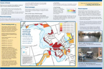
Recommendations from "The Role of Flood Maps in Raising Flood Risk Awareness in Communities (PDF)":
- Tailor maps for specific audience and purpose.
- Pair flood maps with local information that the community can relate to.
- Include information about historical floods.
- Provide flood maps online and promote them regularly as a continuous reminder of flood hazards.
- Use real-time gauge levels.
- Complement flood maps with information about the consequences of flooding and tangible protective actions.