|
Airborne Radar Remote Sensing (CryoSAR system)The CryoSAR instrument is novel dual-frequency Ku and L-band synthetic aperture radar (SAR) system designed for cold season science applications. It is the only system of its kind in Canada. CryoSAR is being used to make backscatter and phase measurements of snow and ice on land, lakes and the ocean. These observations focus on developing the science to estimate the snow total accumulation on land, on freshwater and sea ice, and of water in the soil. CryoSAR builds on recent expertise at UW that focuses on ground-based site-specific experiments in mid-latitude, sub-Arctic and Arctic environments. This expertise has succeeded in characterizing snow and ice properties at small sites.Funding: CFI/Province of Ontario/CSA/ECCC/University of Waterloo |

|
AMSR2 & AMSR3 Snow Depth / SWE Mapping ProjectWe are responsible for JAXA’s standard snow depth product from the Advanced Microwave Scanning Radiometer – 2 (AMSR2) aboard the GCOM-W1 mission, we are involved with estimating snow accumulation from satellite passive microwave observations at regional to global scales. This work builds on NASA research and has developed the Satellite-based Microwave Snow Algorithm.Funding: JAXA/NSERC |
|
|
UWScat: Ground-based Radar Remote SensingKu- and X-Band scatterometer observations of snow. This research is science discovery exploring seasonal radar signatures of snow cover accumulation for potential space-based snow mapping missions designed for unprecedented spatial resolution observations. The project has deployed the system in Churchill Manitoba (2009-2010 and 2010-2011 winter seasons), various Ontario sites (2013-14 and 2014-15 winters), Trail Valley Creek, NWT (2015-16 winter season), Grand Mesa, Colorado (2016-17 winter). The equipment for this project forms part of our Cryospheric Remote Sensing Laboratory which was funded under CFI (with Prof. Claude Duguay).Funding: CFI/ESA/CSA/NASA/NSERC |
|
|
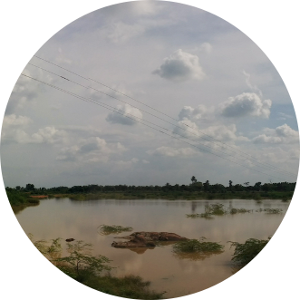
The Rainwater Harvesting ProjectMonitoring monsoon rainwater storage tank environments in S. India using remote sensing is important for feasible and effective water resource management under a changing climate. This work seeks to leverage recent remote sensing and in situ field observations to develop remote sensing methods to track monsoon-fed rainwater tanks in S. India and to map invasive plant species in the tank cascades that have the potential to reduce tan capacities.Funding: NSERC/University of Waterloo |

Contact
Office Hours
By appointment
University of Waterloo
University of Waterloo
43.471468
-80.544205
200 University Avenue West
Waterloo,
ON,
Canada
N2L 3G1

