After the flood: 49 reasons your community may be more vulnerable
Canada’s first comprehensive flood risk model shows which communities are at greater risk of flood devastation over the long term

Canada’s first comprehensive flood risk model shows which communities are at greater risk of flood devastation over the long term
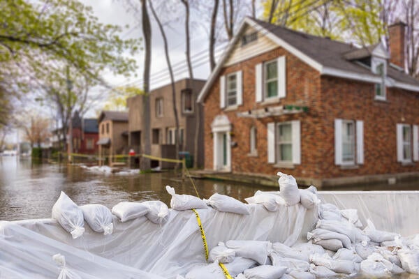
By Heather Bean University RelationsWhen a flood hits a Canadian community and rising waters wash out roads, governments at all levels respond with heroic evacuations of vulnerable residents and emergency food and shelter.

Jason Thistlethwaite
Professor, Faculty of Environment
> JBA Risk Management
> Climate Risk Research Group (CRRG)
But what are the hidden costs to communities when flood waters recede, and why are some left devastated while others rebound?
“We know how much it costs to rebuild a washed-out road. What we don’t consider is the cost of people getting knocked out of the workforce, suffering mental health problems as a result of the shock, and the ripple effect throughout the community. And we know from research that those costs tend to be much higher,” says Jason Thistlethwaite, a professor in the School of Environment, Enterprise and Development and an expert on flood risk.
“The bigger numbers hidden in there are the long-term costs, the social costs, which don’t get captured in the initial disaster appraisal,” he says.
Thistlethwaite wants to help governments make better, long-term plans with better data. He co-leads the Climate Risk Research Group (CRRG) which is developing a tool that pinpoints the areas in Canada where flooding risk overlaps with socioeconomic vulnerability.
To build it, they’ve established the country’s only data-sharing partnership with global flood risk management company JBA Risk Management. That gives CRRG access to Canada’s first comprehensive flood risk model. But a map of flood risk can’t give the full picture. To identify where flooding would be most devastating over the longer term, Thistlethwaite says they have developed what they believe to be the most comprehensive socioeconomic vulnerability index in Canada.”
It was no small feat. Working with grants from the Social Sciences and Humanities Research Council (SSHRCC) and the Marine Environmental Observation Prediction and Response Network (MEOPAR), Thistlethwaite and Ph.D. student Liton Chakraborty spent three years developing and creating visualizations of the index. The team looked at existing best practices for building socioeconomic vulnerability indexes and studied examples from around the world to determine which indicators to include. “We wanted ours to be better,” he explains. The resulting index includes 49 indicators of vulnerability, such as low income, multiple family members, and access to community and emergency services.”
Getting the data from Statistics Canada was a long process. “You have to go through a rigorous process to use that kind of sensitive information.” Then came the testing stage: “Our PhD wanted to make sure we validated our assumptions through econometric and statistical analysis to make sure the results we were coming up with weren’t random.” Finally, the team overlaid their data with JBA’s map of flood risk to reveal Canada’s areas of greatest vulnerability to floods.
The next steps involve getting their information into the right hands. Their research already has strong support from Public Safety Canada and Natural Resources Canada: “We’re making sure that whatever we know, they know as well,” Thistlethwaite says.
Andrea Minano, a PhD Candidate and manager of the Climate Risk Resource Group, is working to develop tools that visualize the teams research, including the use of geographic information systems to help local governments make decisions about where to safely develop land, where to mitigate effects, and when it’s time to start thinking about managed retreat: relocating a community that can’t be protected from cycles of repeated flooding. Thistlethwaite wants to connect with the Canada Mortgage and Housing Commission, as well as municipalities across the country.
Most of all, though, he wants everyday citizens to have access to their flood risk information. “We want to empower Canadians to go down to city council and question the logic of putting a development in a high-risk area, when we have data that in the event of a disaster, the community will be socializing that risk, with no liability for either the municipality or the developer.”
“These are not Acts of God; these are acts of poor governance, and their effects are predictable. The fact that they continue to happen reveals that governments are ignoring science, and it’s time we held them to account for these failings.”

Read more
An ambitious research collaboration with Habitat for Humanity is reimagining home ownership across Waterloo Region and Canada

Read more
Researchers awarded funding to investigate ecology, climate change, repatriation, health and well-being through cultural and historical lens

Read more
Waterloo researchers propose solution to help communities escape the costly cycle of flood damage and rebuilding
The University of Waterloo acknowledges that much of our work takes place on the traditional territory of the Neutral, Anishinaabeg, and Haudenosaunee peoples. Our main campus is situated on the Haldimand Tract, the land granted to the Six Nations that includes six miles on each side of the Grand River. Our active work toward reconciliation takes place across our campuses through research, learning, teaching, and community building, and is co-ordinated within the Office of Indigenous Relations.